 Block
Equality, Kentucky
13 topographic sheets cover this place, the earliest surveyed in 1909 and the latest in 1983. It stands in the Centertown census division. It lies in ZIP code area 42328. It stands on East Fork Williams Creek. The Survey maps it on the Equality quadrangle.
Topographic sheets covering this place
6 surveys from 13 printed sheetsMatched by testing this settlement's coordinate against the published boundary of every sheet in the United States Geological Survey's historical collection. Each opens the scanned sheet at the Survey.
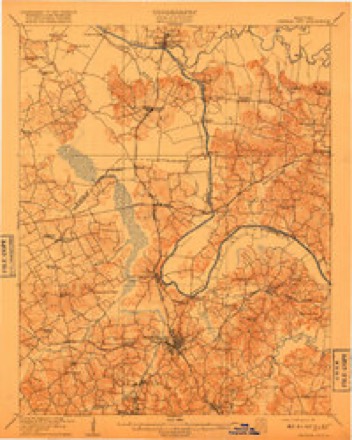
- 1909 USGS Central City quadrangle1:62500, 3 printings
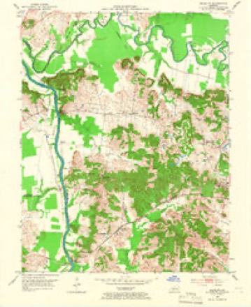
- 1952 USGS Equality quadrangle1:24000, 3 printings
- 1954 USGS Evansville quadrangle1:250000
- 1957 USGS Evansville quadrangle1:250000, 3 printings
- 1961 USGS Evansville quadrangle1:250000, 2 printings
- 1983 USGS Madisonville quadrangle1:100000
Fires near this place
18 since 2000Regional context, not property-specific evidence. The federal wildfire occurrence database lists 18 fires within 5 miles of Equality between 2000 and 2010, burning about 369 acres in total. None started naturally. 3 were recorded as arson. Distance is straight-line from the map coordinates, so a fire counted here may appear on a neighbouring settlement's page as well.
| Reported cause | Fires |
|---|---|
| Recreation and ceremony | 6 |
| Missing data/not specified/undetermined | 5 |
| Debris and open burning | 4 |
| Arson/incendiarism | 3 |
The most recent of them, most recent first, with the day each was reported and the service that recorded it.
| Date | Cause | Size | Reported by | Name on the report |
|---|---|---|---|---|
| 26 September 2008 | Recreation and ceremony | 3.0 acres | Kentucky Division of Forestry | not named |
| 11 September 2002 | Debris and open burning | 5.0 acres | Kentucky Division of Forestry | not named |
| 5 April 2006 | Missing data/not specified/undetermined | under an acre | Kentucky Division of Forestry | not named |
| 4 April 2002 | Recreation and ceremony | 5.0 acres | Kentucky Division of Forestry | not named |
| 28 April 2006 | Missing data/not specified/undetermined | 2.0 acres | Kentucky Division of Forestry | not named |
| 21 April 2007 | Recreation and ceremony | 25 acres | Kentucky Division of Forestry | not named |
| 8 March 2000 | Debris and open burning | under an acre | Kentucky Division of Forestry | not named |
| 8 March 2000 | Debris and open burning | under an acre | Kentucky Division of Forestry | not named |
Settlements close enough to share some of these fires:
Storms near this place
2 since 2018Regional context, not property-specific evidence. The National Weather Service names Equality in 2 storm reports between 2018 and 2021: 1 flash flood, 1 tornado. No death or injury is recorded in these reports. Each account below is quoted exactly as the forecast office filed it, from the NOAA Storm Events Database, and each date opens the federal record of that event.
| When | Event | Place named | Harm | What the report says |
|---|---|---|---|---|
| May 2018 | Flash Flood | Equality | $60,000 | Law enforcement reported State Road 69 was flooded near Matanzas Road. Flood waters entered 4 houses on the 1100 block of State Road 69 just south of Matanzas Road. |
| December 2021 | Tornado (EF3) | Equality | - | This tornado is a continuation of the western Kentucky (Mayfield) tornado and will go down as the longest continuous tornado track on record in the Commonwealth of Kentucky at 163 miles (plus another two miles in Tennessee). This tornado developed in Obion County, Tennessee near Woodland Mills Road before tracking to the northeast through western Kentucky and on into central Kentucky (see Storm Data from the Memphis, Tennessee and the Paducah, Kentucky offices for more information on the beginning portion of this tornado). The tornado finally came to an end in Grayson County, Kentucky at Rough River Dam State Park. This is the first of five segments of this tornado in the Louisville, Kentucky County Warning Area. The tornado was at EF-1 strength when it crossed the Green River from Muhlenberg County into Ohio County. The tornado retained EF-1 strength through an abandoned coal strip mine, snapping hardwood trees, overturning a large section of coal conveyor belt, and downing steel and wood power poles. Rugged terrain seems to have affected the tornado at times as it fluctuated in width and intensity moving across A9 Road, to Matanzas Road, and approaching A5 road. It weakened to around the EF-0/EF-1 threshold and narrowed to 200-300 yards as it crossed A5 Road and A6 Lane, before rapidly intensifying to EF-2 strength over Chandle Loop and Highway 85. Here, a large chicken farm lost 5 out of 7 of its well built chicken houses. The foundations were swept clean. In addition, several homes and barns suffered major damage or total destruction. Hundreds of large hardwoods were snapped and uprooted. One well built house had a large portion of roof removed along with partial wall collapse. Max width in this area was around a quarter mile. The tornado maintained solid EF-1 strength and narrowed to a width around 300 yards as it briefly paralleled Carter Ferry Road, and then approached and crossed A7 Road. From here, a significant topography change occurred as the tornado crossed the Rough River and entered much flatter open farmland. Damage was noted to a grove of snapped hardwood trees near Johnson School and Mud College Roads. Then, several (6 or 7) large steel electrical transmission lines were either broken or bent across a widening half to almost three quarter mile wide width. The tornado had gained significant intensity up to EF-2/EF-3 strength as it slammed into homes and businesses along US 231 only about 1 to 1.5 miles NW of Hartford. On the west side of US 231, two semi tractor trailers were lifted, twisted, and thrown 40 yards from their original position, badly mangling one of the cabs. In addition, a barn was completely demolished. A small, brick office structure was totally destroyed only leaving one half of a wall and a few interior rooms, while completely wiping away the other half of the building. Winds peaked at an estimated 140 mph here. Across the highway a well built, and nearly 100 year old, brick two story home lost its entire roof and collapsed a couple of upstairs walls. Other homes, very large silos, small businesses, and a fertilizer storage facility were heavily damaged in addition to some very large and healthy hardwood trees being snapped, twisted, and snarled. The tornado maintained EF-2/EF-3 intensity as it continued northeastward, crossing the William H Natcher Parkway and approaching Highway 69. Here, more intense damage occurred along 69 between Utley Road and along Morrison Run. At Utley Road, 2 homes and 1 double wide trailer were completely destroyed, and a 4th brick home lost an entire roof and collapsed a couple of walls. Here, an amazing survival story occurred as the residents of the 3 structures that were completely destroyed hunkered in the bathroom of the brick home and rode out the intense tornado. Luckily, no injuries occurred thanks to the great decisions made by the occupants to find a sturdier structure to ride out the storm. A large barn was also heavily damaged here. The next set of homes downstream from Utley Road experienced very intense damage. Here, two anchored mobile homes were completely destroyed as their frames were tossed and bent. One frame ended up 100 yards from its original position. A fifth wheel camper was thrown and landed upside down 30 yards from where it sat. A small farmhouse was also heavily damaged as some walls completely collapsed. Another survival story occurred here as residents made a decision to leave the area to seek better shelter. Many compliments were given to local television media coverage and warning lead time. Two more homes were either heavily damaged or destroyed as the tornado crossed Highway 69. A well built two story home lost half of its upper story, and a small brick home was sheared in half. Damage was observed by NWS surveyors to several hardwood trees along Morrison Run from Cedar Grove Road. However, the most intense tree damage of the Ohio County path occurred along Humble Valley Road where some local terrain influences very likely funneled the tornadic winds into a consolidated area. Here, strong EF-2 to near EF-3 winds snapped thousands of hardwood trees and damaged a few homes, barns, and sheds. It took 2 to 3 days to clear Humble Valley Road for access. A barn was destroyed, along with tree damage, and complete destruction of a home under construction along W Halls Creek Road. As the tornado continued toward the intersection of highways 878 and 919, it crossed Bean Hill doing mainly tree damage. It then did major tree damage, unroofed a home, and destroyed a barn at that intersection. Heavy damage occurred at New Baymus Road where a farm lost three substantial barns, and a deer farm was heavily damaged along with a bunch of equipment. Clinton Lane was the next to be hit as a brand new barn, power poles, and a few structures were damaged or destroyed. The barn was totally destroyed and thrown hundreds of yards downstream, and hundreds of hardwood trees were snapped. One cow was killed by flying debris here. Downwind of that, a trailer was cut in half amongst very heavy tree damage, and the occupants of the mangled half of the trailer had fled to a safer shelter. Hundreds of hardwoods were snapped around Cane Ford Lane along with total destruction of an old trailer. From there, the tornado climbed a ridge and crossed Highway 54, heavily damaging a home and garage, along with continuing to mangle hundreds of hardwood and softwood trees. |
Nearest settlements
The eight closest, with where each one stands in the county. Distances are straight-line, computed from the Geographic Names Information System coordinates.
| Map | Place | Distance | Sheets |
|---|---|---|---|
| Smallhous | 1.8 miles | 13 | |
| Ceralvo | 2.8 miles | 15 | |
| Kirtley | 3.4 miles | 13 | |
| Matanzas | 3.8 miles | 13 | |
| Centertown | 4.0 miles | 11 | |
| Point Pleasant | 4.2 miles | 13 | |
| Coffman | 5.0 miles | 13 | |
| Rockport | 5.7 miles | 12 |
Provenance
This settlement is recorded in the Geographic Names Information System as feature 491806. The sheet list is computed by point-in-boundary test against the United States Geological Survey's historical topographic inventory. Both are works of the United States government and carry no copyright under 17 U.S.C. 105.
Wildfire. Short, Karen C. 2022. Spatial wildfire occurrence data for the United States, 1992-2020 [FPA_FOD_20221014]. 6th Edition. Fort Collins, CO: Forest Service Research Data Archive. https://doi.org/10.2737/RDS-2013-0009.6 Collected with United States Government funding and usable without additional permissions or fees.
Storms. NOAA National Centers for Environmental Information, Storm Events Database https://www.ncei.noaa.gov/stormevents/ A work of the United States government, no copyright under 17 U.S.C. 105. Narratives are quoted verbatim from the National Weather Service report and are not edited or summarised.