 Block
Franklin, Kentucky
13 topographic sheets cover this place, the earliest surveyed in 1942 and the latest in 1985. It stands in the Franklin census division. It lies in ZIP code area 42134. The Survey maps it on the Franklin quadrangle. 10,176 people lived here at the 2020 count. It stands 709 feet above sea level.
Research this city
On record in Franklin
Buildings and businesses the archive holds for this place. Each opens its own page, with the source record it came from.
On the National Register 12 of 14 shown
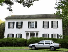 Cedars, Thelisted 1996
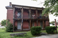 Duncan Houselisted 1982
 Franklin Downtown Commercial Districtlisted 1983
 Franklin Downtown Commercial District (Boundary Increase)listed 1983
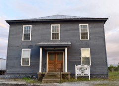 Franklin Grade and High Schoollisted 2010
 Goodnight Houselisted 1977
 Hargis Houselisted 1996
 Randolph Gilbert Moore Houselisted 1996
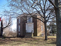 Octagon Halllisted 1980
- Hampton Halllisted 1996
- Harristown Historic Districtlisted 1996
- Simpson County Courthouselisted 1980
Population over time
2 figuresFranklin grew from 8,408 to 10,176 between 2010 and 2020. These are the recorded population figures Wikidata holds for this place, reached through the Geographic Names Information System number this page is keyed on rather than by name, so they belong to this place and not to another of the same name. Most are census counts, but not all are: an early figure may be a founding or settlement estimate, and an estimate published within five years of a census is left out. The change column is computed, and is left blank where more than 20 years separate a figure from the one before it, because a gap that long is not a change between two counts.
| Year | People | Change |
|---|---|---|
| 2010 | 8,408 | |
| 2020 | 10,176 | +1,768 (+21%) |
Topographic sheets covering this place
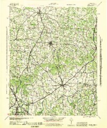
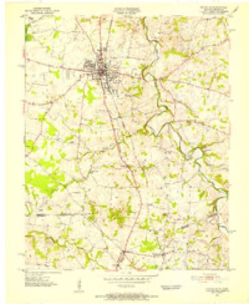
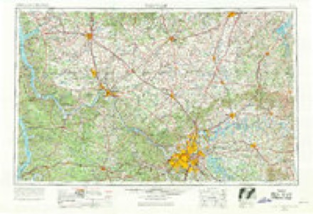
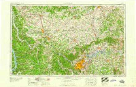
6 surveys from 13 printed sheetsMatched by testing this settlement's coordinate against the published boundary of every sheet in the United States Geological Survey's historical collection. Each opens the scanned sheet at the Survey.
- 1942 USGS Gallatin quadrangle1:100000
- 1951 USGS Franklin quadrangle1:24000, 2 printings
- 1956 USGS Nashville quadrangle1:250000, 2 printings
- 1959 USGS Nashville quadrangle1:250000
- 1968 USGS Franklin quadrangle1:24000, 4 printings
- 1985 USGS Bowling Green quadrangle1:100000, 3 printings
Photographs
8 of 11 photographs shown, 2020Taken for the Office of War Information and the Farm Security Administration, who photographed the country between 1935 and 1944. Works of United States government photographers, with no known restriction on use. Each opens its catalogue record.

Highsmith, Carol M, 2020. Library of Congress

Highsmith, Carol M, 2020. Library of Congress

Highsmith, Carol M, 2020. Library of Congress
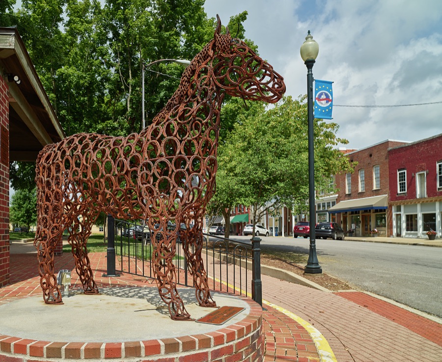
Highsmith, Carol M, 2020. Library of Congress

Highsmith, Carol M, 2020. Library of Congress

Highsmith, Carol M, 2020. Library of Congress
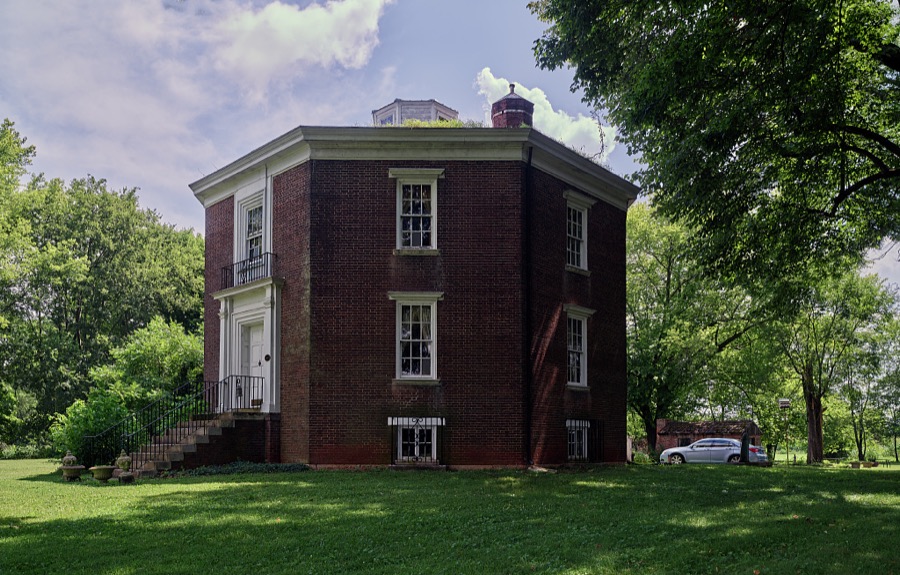
Highsmith, Carol M, 2020. Library of Congress

Highsmith, Carol M, 2020. Library of Congress
Every photograph of Simpson County
Fires near this place
2 since 2005Regional context, not property-specific evidence. The federal wildfire occurrence database lists 2 fires within 5 miles of Franklin between 2005 and 2007, burning about 36 acres in total. None started naturally. None was recorded as arson. Distance is straight-line from the map coordinates, so a fire counted here may appear on a neighbouring settlement's page as well.
| Reported cause | Fires |
|---|---|
| Missing data/not specified/undetermined | 2 |
The most recent of them, most recent first, with the day each was reported and the service that recorded it.
| Date | Cause | Size | Reported by | Name on the report |
|---|---|---|---|---|
| 12 November 2005 | Missing data/not specified/undetermined | 6.0 acres | Kentucky Division of Forestry | not named |
| 13 October 2007 | Missing data/not specified/undetermined | 30 acres | Kentucky Division of Forestry | not named |
Settlements close enough to share some of these fires:
Storms near this place
60 of 94 shownRegional context, not property-specific evidence. The National Weather Service names Franklin in 94 storm reports between 1994 and 2026: 63 thunderstorm wind, 16 flash flood, 12 hail, 2 flood. The reports record 1 death and 11 injuries. Each account below is quoted exactly as the forecast office filed it, from the NOAA Storm Events Database, and each date opens the federal record of that event.
| When | Event | Place named | Harm | What the report says |
|---|---|---|---|---|
| May 2009 | Flood | Franklin | 1 killed | A 49-year old male drove a pickup truck around barriers and attempted to cross Dittmore Ford over Drakes Creek, which was covered by four to five feet of water. He called 911 from his cell phone, but drowned in his vehicle. |
| May 2015 | Thunderstorm Wind | Franklin | 6 hurt, $1,000 | A report was received by the public of a tree down at the Simpson County courthouse during a Relay for Life event. Six people experienced minor injuries and the nearby Kentucky Mesonet site measured a 54 mph wind gust. |
| September 2013 | Lightning | Franklin | 5 hurt, $15,000 | Broadcast media reported 5 injuries from a lightning strike that ended the afternoon racing card at the Kentucky Downs racetrack. Lightning hit a tin pole and traveled down to the ground, shocking 5 people sheltering within a tent. One was transported to a hospital. The racing board was shorted out with racing cancelled for the rest of the afternoon. |
| June 1994 | Thunderstorm Wind | Franklin | $50,000 | Trees and power lines were blown down in Franklin and surrounding area. |
| July 2016 | Thunderstorm Wind | Franklin | $35,000 | State officials reported trees down on a truck and house at 421 Hendricks Street. |
| June 2019 | Thunderstorm Wind | Franklin | $15,000 | Multiple trees and power lines came down around Franklin, KY. |
| March 2019 | Thunderstorm Wind | Franklin | $10,000 | The emergency manager reported siding had been stripped off of a garage and blown in to a nearby field. |
| July 2015 | Flash Flood | Franklin | $10,000 | A law enforcement official reported that a water rescue from a flooded car occurred. |
| November 2000 | Thunderstorm Wind | Franklin | $10,000 | no account filed |
| May 2005 | Thunderstorm Wind | Franklin | $5,000 | There was unspecified structural damage to a mobile home. |
| November 2005 | Thunderstorm Wind | Franklin | $5,000 | A carport was blown down. Trees and power lines were downed. |
| January 1999 | Thunderstorm Wind | Franklin | $3,000 | Porches blown off homes, water tower barn blown down, several trees and power lines down |
| December 2013 | Thunderstorm Wind | Franklin | $2,000 | The Simpson County emergency manager reported several trees down in Franklin, including one that blocked Gold City Road. A storm front window was broken on Main Street. Power outages were reported as well. |
| June 2012 | Thunderstorm Wind | Franklin | $1,000 | The Simpson County emergency manager reported a fallen tree that downed a power line in Franklin on Pepper Street. |
| June 2012 | Thunderstorm Wind | Franklin | $1,000 | Local broadcast media reported two trees down. Some shingles were blown off the roof of a resident near the intersection of Highway 31 and Patton Road. |
| April 2026 | Flash Flood | Franklin | - | North College Street was impassable due to high water. |
| April 2026 | Thunderstorm Wind | Franklin | - | A very large tree was down over the 900 block of Rapids Road. |
| May 2025 | Thunderstorm Wind | Franklin | - | A large tree limb was blown down behind a home in Franklin. |
| February 2025 | Flash Flood | Franklin | - | Flood waters submerged portions of US Route 31W on the north side of Franklin. |
| December 2025 | Thunderstorm Wind | Franklin | - | A tree was blown down onto the road near the intersection of Filter Plant Road and Scottsville Road in Franklin. |
| May 2024 | Thunderstorm Wind | Franklin | - | Trees were downed at the intersection of West Cedar Street and John J Johnson Avenue in Franklin. |
| May 2024 | Thunderstorm Wind | Franklin | - | Trees were downed at the intersection of U.S. Route 31W and Industrial Drive in Franklin. |
| May 2024 | Flash Flood | Franklin | - | Two water rescues had to be performed and multiple roads were closed across Simpson County due to flash flooding. |
| May 2023 | Thunderstorm Wind | Franklin | - | Several trees and power lines were blown down by strong winds in and around Franklin. |
| June 2023 | Thunderstorm Wind | Franklin | - | There were several trees and power lines down on roadways in Franklin. |
| January 2022 | Thunderstorm Wind | Franklin | - | Damage was reported at the intersection of Morgantown Road and Winston Lane. Some trees were uprooted, and large branches were snapped. Area homes had shingle and antenna damage. |
| August 2022 | Thunderstorm Wind | Franklin | - | There were more than 20 trees and power lines down across Jim Roberts Community Park. A barn was destroyed just north of the park along Ditmore Ford Road. |
| September 2022 | Thunderstorm Wind | Franklin | - | Trees were reported down on Gold City Road near Franklin. |
| September 2022 | Flash Flood | Franklin | - | Flooding occurred on North Main Street in Franklin, resulting in the temporary closure of the road. |
| June 2022 | Thunderstorm Wind | Franklin | - | Power lines were down on the 800 block of Blackjack Road. |
| June 2022 | Thunderstorm Wind | Franklin | - | Trees and power lines were down across Simpson County. |
| February 2019 | Flash Flood | Franklin | - | Kentucky 2592 at Highway is impassable due to flooding. Highway 73 is still open. |
| June 2019 | Thunderstorm Wind | Franklin | - | A large tree was down on Main Street and Kentucky Avenue. |
| June 2019 | Thunderstorm Wind | Franklin | - | A tree was on the roadway on the 100 block of Roark Road. |
| June 2019 | Thunderstorm Wind | Franklin | - | A tree was reported down on Gold City Road near Roark Road. |
| April 2018 | Thunderstorm Wind | Franklin | - | Simpson County emergency manager reported a few trees down in the area. |
| May 2018 | Thunderstorm Wind | Franklin | - | There were power lines down in Franklin. |
| September 2017 | Flash Flood | Franklin | - | The Simpson County Emergency Manager reported numerous roads closed with other roads impassable due to high water. The Simpson County Schools were closed due to flooding. |
| April 2016 | Thunderstorm Wind | Franklin | - | The Simpson County emergency manager reported a large tree fell, blocking Morgantown Road just north of Patton Road. |
| June 2016 | Flash Flood | Franklin | - | Local law enforcement reported Roark Road impassable due to high water. |
| June 2016 | Flash Flood | Franklin | - | Local law enforcement reported that Wittland Road was under water and impassable due to high water. |
| June 2016 | Flash Flood | Franklin | - | Local law enforcement reported the 1300 block of East Madison Street was flooded due to high water. |
| June 2016 | Thunderstorm Wind | Franklin | - | The Simpson County emergency manager reported trees and power lines down at Sportsman Lake Road and Akin Avenue. |
| July 2016 | Flash Flood | Franklin | - | Trained spotters reported numerous roads across the county flooded and impassable. |
| July 2016 | Flash Flood | Franklin | - | A trained spotter reported swiftly moving water 3 to 6 inches deep across roadways. |
| July 2016 | Thunderstorm Wind | Franklin | - | Local law enforcement reported trees down in Franklin. |
| July 2016 | Thunderstorm Wind | Franklin | - | Local law enforcement reported trees down across the county including Turnertown Road and Elliott Road. |
| July 2016 | Thunderstorm Wind | Franklin | - | A trained spotter reported several large trees down in and around Franklin. |
| July 2016 | Thunderstorm Wind | Franklin | - | Trained spotters reported large trees down in the area. Also, some county roads were impassable due to high water. |
| July 2016 | Thunderstorm Wind | Franklin | - | State officials reported trees down on Sunset Circle. |
| July 2016 | Thunderstorm Wind | Franklin | - | Trees were reported down on the 100 block of Russell Street. |
| June 2015 | Thunderstorm Wind | Franklin | - | A Kentucky department of highways official reported that a tree was down on Adams Road north of Franklin. |
| July 2015 | Flash Flood | Franklin | - | A law enforcement official reported several roads flooded due to intense rainfall rates and excessive amounts of rain from slow moving thunderstorms. |
| June 2013 | Hail | Franklin | - | A spotter reported that hail up to 2 inches in diameter covered the ground just to the east of Franklin. This hail came from a supercell that earlier had produced an EF-2 tornado well west of Franklin. |
| January 2013 | Flood | Franklin | - | A county official reported that low water crossings along three roads near Franklin were closed due to high water. |
| January 2012 | Thunderstorm Wind | Franklin | - | Local media reported numerous power outages across the county. |
| March 2012 | Hail | Franklin | - | Another report of 1 inch hail came from nearly the same location. |
| August 2012 | Thunderstorm Wind | Franklin | - | A spotter estimated a 60 mph wind gust in Franklin. |
| August 2012 | Thunderstorm Wind | Franklin | - | Simpson County emergency management reported that two trees and some power lines were downed along State Highway 100 just to the west of Franklin. |
| April 2011 | Thunderstorm Wind | Franklin | - | A tree was blown down on Morgantown Rd. |
Nearest settlements
The eight closest, with where each one stands in the county. Distances are straight-line, computed from the Geographic Names Information System coordinates.
| Map | Place | Distance | Sheets |
|---|---|---|---|
| Black Jack Road (historical) | 1.6 miles | 13 | |
| Oak Grove (historical) | 3.0 miles | 13 | |
| Sylvan (historical) | 3.1 miles | 9 | |
| Flat Rock | 3.3 miles | 13 | |
| Lake Spring (historical) | 3.4 miles | 13 | |
| Peden Mill | 3.9 miles | 13 | |
| Salmons | 3.9 miles | 9 | |
| Black Jack | 4.6 miles | 9 |
Elsewhere
Matched on this settlement's Geographic Names Information System number rather than its name, so it cannot be a different place of the same name in another state.
| Wikipedia article on Franklin | An encyclopaedic summary. Its text is share-alike, so it is linked here rather than copied. |
| Wikidata item Q1778943 | The structured record the population and elevation above come from. Public domain (CC0). |
Provenance
This settlement is recorded in the Geographic Names Information System as feature 492443. The sheet list is computed by point-in-boundary test against the United States Geological Survey's historical topographic inventory. Both are works of the United States government and carry no copyright under 17 U.S.C. 105.
Wildfire. Short, Karen C. 2022. Spatial wildfire occurrence data for the United States, 1992-2020 [FPA_FOD_20221014]. 6th Edition. Fort Collins, CO: Forest Service Research Data Archive. https://doi.org/10.2737/RDS-2013-0009.6 Collected with United States Government funding and usable without additional permissions or fees.
Storms. NOAA National Centers for Environmental Information, Storm Events Database https://www.ncei.noaa.gov/stormevents/ A work of the United States government, no copyright under 17 U.S.C. 105. Narratives are quoted verbatim from the National Weather Service report and are not edited or summarised.