 Block
Glasgow, Kentucky
10 topographic sheets cover this place, the earliest surveyed in 1953 and the latest in 1985. It stands in the Glasgow census division. It lies in ZIP code area 42141. The Survey maps it on the Glasgow South quadrangle. 15,014 people lived here at the 2020 count. It stands 755 feet above sea level.
Research this city
On record in Glasgow
Buildings and businesses the archive holds for this place. Each opens its own page, with the source record it came from.
On the National Register 12 of 17 shown
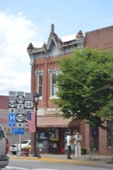 First National Banklisted 1983
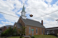 First Presbyterian Churchlisted 1983
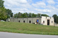 Glasgow OMS #9listed 2002
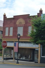 Morris Buildinglisted 1983
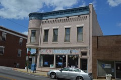 Third National Banklisted 1983
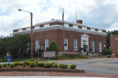 U.S. Post Office/Board of Education Buildinglisted 1983
- Fort Williamslisted 1975
- Glasgow Central Business Districtlisted 1993
- Glasgow Central Business District (Boundary Increase)listed 2004
- Gullian Gerig's Milllisted 1987
- John Mayfield Houselisted 1983
- North Race Street Historic Districtlisted 1983
Population over time
2 figuresGlasgow grew from 14,028 to 15,014 between 2010 and 2020. These are the recorded population figures Wikidata holds for this place, reached through the Geographic Names Information System number this page is keyed on rather than by name, so they belong to this place and not to another of the same name. Most are census counts, but not all are: an early figure may be a founding or settlement estimate, and an estimate published within five years of a census is left out. The change column is computed, and is left blank where more than 20 years separate a figure from the one before it, because a gap that long is not a change between two counts.
| Year | People | Change |
|---|---|---|
| 2010 | 14,028 | |
| 2020 | 15,014 | +986 (+7%) |
Topographic sheets covering this place
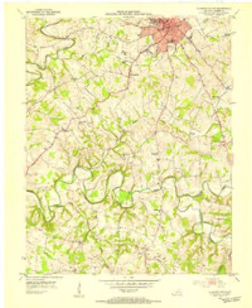
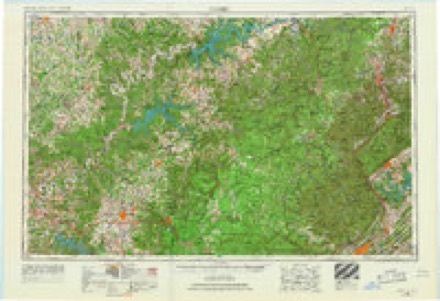
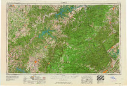
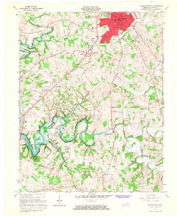
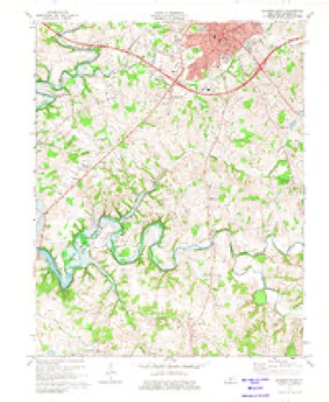
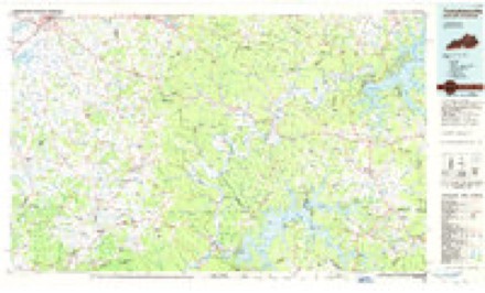
6 surveys from 10 printed sheetsMatched by testing this settlement's coordinate against the published boundary of every sheet in the United States Geological Survey's historical collection. Each opens the scanned sheet at the Survey.
- 1953 USGS Glasgow South quadrangle1:24000
- 1956 USGS Corbin quadrangle1:250000, 3 printings
- 1958 USGS Corbin quadrangle1:250000
- 1965 USGS Glasgow South quadrangle1:24000
- 1973 USGS Glasgow South quadrangle1:24000, 2 printings
- 1985 USGS Tompkinsville quadrangle1:100000, 2 printings
Fires near this place
2 since 1998Regional context, not property-specific evidence. The federal wildfire occurrence database lists 2 fires within 5 miles of Glasgow between 1998 and 1999, burning about 4 acres in total. None started naturally. None was recorded as arson. Distance is straight-line from the map coordinates, so a fire counted here may appear on a neighbouring settlement's page as well.
| Reported cause | Fires |
|---|---|
| Smoking | 1 |
| Debris and open burning | 1 |
The most recent of them, most recent first, with the day each was reported and the service that recorded it.
| Date | Cause | Size | Reported by | Name on the report |
|---|---|---|---|---|
| 9 April 1999 | Debris and open burning | 3.0 acres | Kentucky Division of Forestry | not named |
| 24 November 1998 | Smoking | 1.0 acres | Kentucky Division of Forestry | not named |
Settlements close enough to share some of these fires:
Mines and quarries near this place
2 within 5 milesRegional context, not property-specific evidence. The federal mineral resources record lists 2 workings within 5 miles of Glasgow: 1 producer, 1 past producer. 1 still produces. What was taken out: Stone, Crushed/Broken. Distance is straight-line from the map coordinates, so a quarry counted here may appear on a neighbouring settlement's page as well.
| Where | Site | Commodity | Status | Recorded |
|---|---|---|---|---|
| Barren County Quarry | Stone, Crushed/Broken | Past Producer | ||
| Mc Murtrey Quarry | Stone, Crushed/Broken | Producer |
Storms near this place
60 of 84 shownRegional context, not property-specific evidence. The National Weather Service names Glasgow in 84 storm reports between 1996 and 2026: 52 thunderstorm wind, 14 hail, 9 flash flood, 4 lightning. The reports record 3 deaths and 12 injuries. Each account below is quoted exactly as the forecast office filed it, from the NOAA Storm Events Database, and each date opens the federal record of that event.
| When | Event | Place named | Harm | What the report says |
|---|---|---|---|---|
| April 1998 | Tornado (F3) | Glasgow | 2 killed, 9 hurt, $10,000,000 | no account filed |
| June 2000 | Lightning | Glasgow | 1 killed | A 30 year old male was struck by lightning and killed. The body was found at 0007 EST on June 27. The exact time of death was unknown, but the time of occurrence was earlier during the storms on the evening of June 26. |
| January 1997 | Tornado (F2) | Glasgow | 2 hurt, $1,800,000 | no account filed |
| November 2000 | Thunderstorm Wind | Glasgow | 1 hurt, $1,000 | A male in a vehicle was struck and injured by wind blown debris. |
| May 2012 | Thunderstorm Wind | Glasgow | $200,000 | A survey by a National Weather Service employee found a path of straight line damage associated with a series of microbursts that began just east of Cave City, and ended 5 miles southeast of Glasgow. Numerous trees were downed along a path roughly 14 miles long. A lumber warehouse shed was destroyed by estimated 70 mph winds along State Highway 31E in Glasgow. ||In addition, local media reported several 25 to 30 foot trees downed in the Green Valley subdivision of Glasgow along Burkesville Road. A tree was downed on Rosewood Road. Local emergency management reported at least 75 trees were downed from central Barren County eastwards. A house's siding was damaged nearby on Davis Street just east of Glasgow.||The county emergency manager eventually recorded several dozen damaged barns and homes overall. |
| November 2002 | Thunderstorm Wind | Glasgow | $100,000 | Mobile homes were blown off their foundations. |
| January 2010 | Thunderstorm Wind | Glasgow | $50,000 | Thunderstorm winds blew down trees and blew the shingles off barns and houses. A carport was also blown off the side of a house. |
| July 2016 | Thunderstorm Wind | Glasgow | $45,000 | A trained spotter reported part of a roof blown off a building in Glasgow. |
| July 2018 | Thunderstorm Wind | Glasgow | $25,000 | There was a report of a tree down on a car on East Front Street. |
| April 2017 | Thunderstorm Wind | Glasgow | $25,000 | The public reported a tree on a house. |
| June 2019 | Thunderstorm Wind | Glasgow | $20,000 | Several trees and power lines were down in northern Barren County. |
| March 2016 | Lightning | Glasgow | $15,000 | The Barren County emergency manager reported a transformer blew after a lightning strike at north Race and West Front streets. |
| September 2016 | Lightning | Glasgow | $15,000 | A trained spotter reported that a lightning strike caused a tree to split, and part of it fell onto a house on Cleveland Avenue. |
| July 2022 | Lightning | Glasgow | $10,000 | Lightning knocked down a power pole on West Cherry Street, knocking out power. The cost of damage is unknown. |
| September 2017 | Flash Flood | Glasgow | $10,000 | The Barren County Emergency Manager reported a car was submerged in flood waters on Shamrock Court. |
| September 2017 | Flash Flood | Glasgow | $10,000 | State officials reported that one water rescue was performed along Burkesville Road near Siloam Road. |
| November 2007 | Thunderstorm Wind | Glasgow | $10,000 | Four to 6 large utility poles were downed, and a large pole barn was damaged. |
| April 2005 | Thunderstorm Wind | Glasgow | $10,000 | Thunderstorm winds did roof damage to several buildings. |
| October 2001 | Thunderstorm Wind | Glasgow | $5,000 | Trees were downed and the roof was blown off a barn. |
| June 2015 | Thunderstorm Wind | Glasgow | $3,000 | A Kentucky state official reported multiple trees down in the city along with power lines down on Highland Road. There were also trees down on the east and north side of Glasgow. |
| July 2009 | Thunderstorm Wind | Glasgow | $2,000 | Power was out in Glasgow due to downed trees on power lines. |
| July 2009 | Thunderstorm Wind | Glasgow | $1,000 | Trees were downed in Glasgow. |
| March 2026 | Thunderstorm Wind | Glasgow | - | A tree was blown down blocking the entire road near the intersection of Forrester Road and Cleveland Avenue in Glasgow. |
| April 2025 | Thunderstorm Wind | Glasgow | - | A tree fell on a house in Eastern Valley Estates. |
| July 2024 | Flash Flood | Glasgow | - | A water rescue was needed along Siloam Road near Boyds Creek. |
| June 2023 | Thunderstorm Wind | Glasgow | - | There was shingle damage and several power lines down. |
| June 2023 | Thunderstorm Wind | Glasgow | - | Trees and power lines were down in Glasgow. |
| June 2023 | Thunderstorm Wind | Glasgow | - | There was a tree down on South Green Street. |
| June 2023 | Thunderstorm Wind | Glasgow | - | There were several trees and power lines down across Barren County. |
| January 2021 | Thunderstorm Wind | Glasgow | - | A tree fell on a house near East Main Street. |
| May 2021 | Flash Flood | Glasgow | - | Water was over the Cumberland Parkway eastbound at exit 14. |
| March 2020 | Thunderstorm Wind | Glasgow | - | A large tree and multiple branches were down near The Happy Valley Inn. |
| March 2020 | Flash Flood | Glasgow | - | North Race Street at West Cherry Street were covered with water in Glasgow. |
| January 2020 | Thunderstorm Wind | Glasgow | - | Numerous trees were down across western and central Barren County in Park City and Glasgow. |
| June 2018 | Thunderstorm Wind | Glasgow | - | There were a few trees down in the city of Glasgow. |
| July 2016 | Flash Flood | Glasgow | - | Local law enforcement reported closed streets on Columbia Avenue at Davis Street due to high water from excessive rainfall. |
| July 2016 | Thunderstorm Wind | Glasgow | - | Local law enforcement reported large trees down in the area. |
| June 2015 | Thunderstorm Wind | Glasgow | - | A law enforcement official reported two trees down in Glasgow. |
| April 2015 | Thunderstorm Wind | Glasgow | - | Broadcast media reported several trees down across the county. |
| July 2015 | Flash Flood | Glasgow | - | A public report was received of flash flooding at the intersection of Roseville Rd and Country Barn Rd. |
| July 2015 | Flood | Glasgow | - | A Barren County law enforcement official reported several roads in town were closed due to high water and flash flooding. |
| May 2014 | Flood | Glasgow | - | A few inches of water covered Trojan Trail Road near 31E. |
| January 2013 | Thunderstorm Wind | Glasgow | - | The public reported that a downed telephone pole blocked Highway 1297 just north of Highway 1297 in Glasgow. |
| April 2012 | Thunderstorm Wind | Glasgow | - | The Barren County emergency management reported trees downed across the county. |
| March 2012 | Thunderstorm Wind | Glasgow | - | A trained spotter reported numerous trees and homes damaged. |
| April 2011 | Thunderstorm Wind | Glasgow | - | Multiple trees were blown down in Glasgow. |
| April 2011 | Thunderstorm Wind | Glasgow | - | The AWOS at Glasgow Municipal Airport, Moore Field, measured a wind gust of 69 mph. |
| April 2011 | Thunderstorm Wind | Glasgow | - | Trees an power lines were down countywide. A tree was blocking Cherry St. in the town of Glasgow. |
| June 2011 | Thunderstorm Wind | Glasgow | - | Law enforcement reported several trees down near Glasgow. |
| July 2011 | Flash Flood | Glasgow | - | Intense slow moving thunderstorms brought flash flooding to many streets in Glasgow. Some streets were covered by up to 3 feet of water. A water rescue was required for one flooded home. |
| July 2011 | Flash Flood | Glasgow | - | The Department of Highways reported that road crews had to barricade Siloam Road off of State Highway 90 southeast of Glasgow due to high water. |
| July 2011 | Thunderstorm Wind | Glasgow | - | Local law enforcement reported trees and power lines downed across Glasgow. |
| April 2011 | Thunderstorm Wind | Glasgow | - | Two barns were damaged. One was completely blown over and the other had its roof blown off. |
| May 2010 | Heavy Rain | Glasgow | - | A trained spotter reported a total of 8 inches of rain measures since early May 1. |
| October 2010 | Thunderstorm Wind | Glasgow | - | A Long John Silver sign was blown on top of cars. |
| August 2010 | Thunderstorm Wind | Glasgow | - | Several trees were blown down on New Salem Rd. The time was estimated based on radar. |
| February 2009 | Thunderstorm Wind | Glasgow | - | Media reported that gutters were blown off of a home. |
| June 2009 | Thunderstorm Wind | Glasgow | - | Trees were downed near the high school on the east side of town. |
| October 2009 | Thunderstorm Wind | Glasgow | - | Trees were downed in Glasgow. |
| April 2007 | Thunderstorm Wind | Glasgow | - | Several trees were downed across the county. |
Nearest settlements
The eight closest, with where each one stands in the county. Distances are straight-line, computed from the Geographic Names Information System coordinates.
| Map | Place | Distance | Sheets |
|---|---|---|---|
| Pritchardsville | 2.1 miles | 10 | |
| Lecta | 3.1 miles | 13 | |
| Bristletown | 4.3 miles | 10 | |
| Oil City | 4.6 miles | 13 | |
| Haywood | 4.8 miles | 10 | |
| Coral Hill | 4.8 miles | 13 | |
| Carden | 5.6 miles | 13 | |
| Slick Rock | 6.1 miles | 13 |
Elsewhere
Matched on this settlement's Geographic Names Information System number rather than its name, so it cannot be a different place of the same name in another state.
| Wikipedia article on Glasgow | An encyclopaedic summary. Its text is share-alike, so it is linked here rather than copied. |
| Wikidata item Q1762833 | The structured record the population and elevation above come from. Public domain (CC0). |
Provenance
This settlement is recorded in the Geographic Names Information System as feature 492876. The sheet list is computed by point-in-boundary test against the United States Geological Survey's historical topographic inventory. Both are works of the United States government and carry no copyright under 17 U.S.C. 105.
Wildfire. Short, Karen C. 2022. Spatial wildfire occurrence data for the United States, 1992-2020 [FPA_FOD_20221014]. 6th Edition. Fort Collins, CO: Forest Service Research Data Archive. https://doi.org/10.2737/RDS-2013-0009.6 Collected with United States Government funding and usable without additional permissions or fees.
Mines and quarries. USGS Mineral Resources Data System (MRDS) https://mrdata.usgs.gov/mrds/ A work of the United States government, no copyright under 17 U.S.C. 105.
Storms. NOAA National Centers for Environmental Information, Storm Events Database https://www.ncei.noaa.gov/stormevents/ A work of the United States government, no copyright under 17 U.S.C. 105. Narratives are quoted verbatim from the National Weather Service report and are not edited or summarised.