 Block
Greenbrier, Kentucky
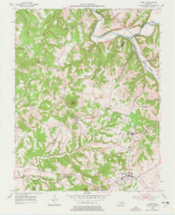
8 topographic sheets cover this place, the earliest surveyed in 1953 and the latest in 1981. It stands in the Bardstown census division. It lies in ZIP code area 40004. It lies near Backbone Ridge. The Survey maps it on the Loretto quadrangle.
Topographic sheets covering this place
4 surveys from 8 printed sheetsMatched by testing this settlement's coordinate against the published boundary of every sheet in the United States Geological Survey's historical collection. Each opens the scanned sheet at the Survey.
- 1953 USGS Loretto quadrangle1:24000, 3 printings
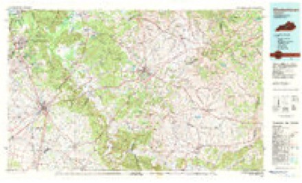
- 1957 USGS Winchester quadrangle1:250000, 3 printings
- 1960 USGS Winchester quadrangle1:250000
- 1981 USGS Elizabethtown quadrangle1:100000


Fires near this place
13 since 1997Regional context, not property-specific evidence. The federal wildfire occurrence database lists 13 fires within 5 miles of Greenbrier between 1997 and 2014, burning about 50 acres in total. None started naturally. None was recorded as arson. Distance is straight-line from the map coordinates, so a fire counted here may appear on a neighbouring settlement's page as well.
| Reported cause | Fires |
|---|---|
| Debris and open burning | 4 |
| Missing data/not specified/undetermined | 4 |
| Recreation and ceremony | 3 |
| Smoking | 2 |
The most recent of them, most recent first, with the day each was reported and the service that recorded it.
| Date | Cause | Size | Reported by | Name on the report |
|---|---|---|---|---|
| 4 April 1997 | Debris and open burning | 1.0 acres | Kentucky Division of Forestry | not named |
| 3 April 2013 | Debris and open burning | 2.5 acres | Kentucky Division of Forestry | BURBA RD. FIRE |
| 24 April 2014 | Smoking | 2.0 acres | Kentucky Division of Forestry | NEWTON |
| 15 April 1997 | Smoking | 8.0 acres | Kentucky Division of Forestry | not named |
| 7 March 2000 | Debris and open burning | 4.0 acres | Kentucky Division of Forestry | not named |
| 24 March 2009 | Recreation and ceremony | 1.0 acres | Kentucky Division of Forestry | not named |
| 18 March 2006 | Missing data/not specified/undetermined | 10 acres | Kentucky Division of Forestry | not named |
| 11 March 2001 | Debris and open burning | 15 acres | Kentucky Division of Forestry | not named |
Settlements close enough to share some of these fires:
Mines and quarries near this place
1 within 5 milesRegional context, not property-specific evidence. The federal mineral resources record lists 1 working within 5 miles of Greenbrier: 1 producer. All of them still produce. What was taken out: Stone, Crushed/Broken. Distance is straight-line from the map coordinates, so a quarry counted here may appear on a neighbouring settlement's page as well.
| Where | Site | Commodity | Status | Recorded |
|---|---|---|---|---|
| Nelson Quarry | Stone, Crushed/Broken | Producer |
Storms near this place
4 since 2012Regional context, not property-specific evidence. The National Weather Service names Greenbrier in 4 storm reports between 2012 and 2025: 2 flash flood, 1 thunderstorm wind, 1 tornado. No death or injury is recorded in these reports. Each account below is quoted exactly as the forecast office filed it, from the NOAA Storm Events Database, and each date opens the federal record of that event.
| When | Event | Place named | Harm | What the report says |
|---|---|---|---|---|
| April 2025 | Tornado (EF1) | Greenbrier | - | An EF1 tornado, with maximum winds of 105 mph, tracked across an almost three mile stretch of eastern Nelson County during the early morning hours on Thursday, April 3rd. The tornado was on the ground for approximately three minutes and had a peak width of approximately 175 yards.||The tornado touched down along Roberts Road and did some damage to a residence and trees down within the Beech Fork basin. The tornado continued across Beech Fork near Turkey Ridge. Damage continued along a hilltop between Beech Fork and Pottershop Road, uprooting several trees. As the tornado approached Pottershop Road, significant damage was done to several barns and outbuildings, and large tree limbs were snapped. The most substantial damage that occurred in this area was to a small |outbuilding, where only one wall was left standing as debris from this building was thrown 100-200 yards downstream. An adjacent house only sustained minor fascia and soffit damage, although brick columns on one side of the house had slightly buckled due to the wind. Wind speeds in this area were estimated at 105 mph.||The tornado then crossed Pottershop Road and moved along Bear Creek Way for approximately three-quarters of a mile. Scattered instances of snapped or uprooted trees were observed along this stretch of the tornado s path, and several homes received minor roof damage. In addition, multiple barns and small outbuildings |received more significant damage, including one well- built barn which had its entire roof collapse. Damage in this area was consistent with EF1 tornado strength, generally between 90 and 100 mph.||The tornado continued to produce isolated to scattered tree damage between the end of Bear Creek Way and Manton Road as it continued to the east-northeast. Just past Manton Road, the tornado damaged multiple older barns, lean-tos and trees. Between |Manton Road and Borders Lane, the tornado lifted and no significant additional damage was found downstream. The damage at the end of the tornado s path was consistent with high-end EF0 and low-end EF1 levels, generally between 85 and 95 mph. |
| April 2025 | Flash Flood | Greenbrier | - | There was flowing water over Loretto Road near Burba Road. |
| April 2025 | Flash Flood | Greenbrier | - | Flowing water made Route 49 completely impassable. |
| July 2012 | Thunderstorm Wind | Greenbrier | - | The Bardstown rescue unit reported several trees downed along Balltown Road 6 miles south of Bardstown. |
Nearest settlements
The eight closest, with where each one stands in the county. Distances are straight-line, computed from the Geographic Names Information System coordinates.
| Map | Place | Distance | Sheets |
|---|---|---|---|
| Balltown | 2.6 miles | 9 | |
| South Bardstown (historical) | 4.0 miles | 9 | |
| Culvertown | 4.2 miles | 9 | |
| Clarktown (historical) | 4.8 miles | 8 | |
| Botland | 4.9 miles | 9 | |
| Needmore (historical) | 5.3 miles | 9 | |
| West Bardstown (historical) | 5.4 miles | 9 | |
| Bardstown | 5.5 miles | 9 |
Provenance
This settlement is recorded in the Geographic Names Information System as feature 508128. The sheet list is computed by point-in-boundary test against the United States Geological Survey's historical topographic inventory. Both are works of the United States government and carry no copyright under 17 U.S.C. 105.
Wildfire. Short, Karen C. 2022. Spatial wildfire occurrence data for the United States, 1992-2020 [FPA_FOD_20221014]. 6th Edition. Fort Collins, CO: Forest Service Research Data Archive. https://doi.org/10.2737/RDS-2013-0009.6 Collected with United States Government funding and usable without additional permissions or fees.
Mines and quarries. USGS Mineral Resources Data System (MRDS) https://mrdata.usgs.gov/mrds/ A work of the United States government, no copyright under 17 U.S.C. 105.
Storms. NOAA National Centers for Environmental Information, Storm Events Database https://www.ncei.noaa.gov/stormevents/ A work of the United States government, no copyright under 17 U.S.C. 105. Narratives are quoted verbatim from the National Weather Service report and are not edited or summarised.