 Block
Hammonville, Kentucky
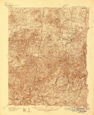
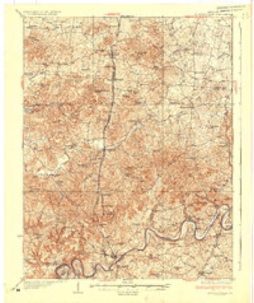
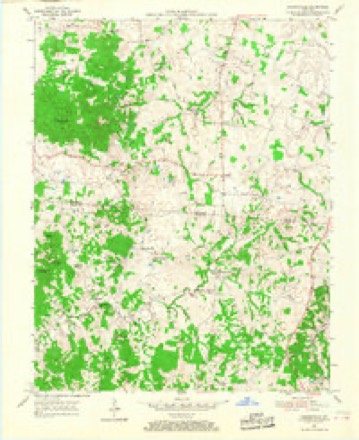
11 topographic sheets cover this place, the earliest surveyed in 1934 and the latest in 1986. It stands in the Hammonville census division. It lies in ZIP code area 42757. It stands on Martis Branch. The Survey maps it on the Hammonville quadrangle.
Topographic sheets covering this place
6 surveys from 11 printed sheetsMatched by testing this settlement's coordinate against the published boundary of every sheet in the United States Geological Survey's historical collection. Each opens the scanned sheet at the Survey.
- 1934 USGS Munfordville quadrangle1:48000
- 1937 USGS Munfordville quadrangle1:62500
- 1954 USGS Hammonville quadrangle1:24000, 3 printings
- 1957 USGS Winchester quadrangle1:250000, 3 printings
- 1960 USGS Winchester quadrangle1:250000
- 1986 USGS Campbellsville quadrangle1:100000, 2 printings


Fires near this place
19 since 1997Regional context, not property-specific evidence. The federal wildfire occurrence database lists 19 fires within 5 miles of Hammonville between 1997 and 2019, burning about 129 acres in total. None started naturally. 1 was recorded as arson. Distance is straight-line from the map coordinates, so a fire counted here may appear on a neighbouring settlement's page as well.
| Reported cause | Fires |
|---|---|
| Missing data/not specified/undetermined | 8 |
| Recreation and ceremony | 5 |
| Debris and open burning | 3 |
| Railroad operations and maintenance | 1 |
| Arson/incendiarism | 1 |
| Smoking | 1 |
The most recent of them, most recent first, with the day each was reported and the service that recorded it.
| Date | Cause | Size | Reported by | Name on the report |
|---|---|---|---|---|
| 7 September 2010 | Recreation and ceremony | 1.0 acres | Kentucky Division of Forestry | WONDERLAND RD. |
| 9 April 1997 | Debris and open burning | 2.0 acres | Kentucky Division of Forestry | not named |
| 3 April 2003 | Missing data/not specified/undetermined | under an acre | Kentucky Division of Forestry | not named |
| 11 April 2010 | Debris and open burning | 2.0 acres | Kentucky Division of Forestry | not named |
| 11 April 2005 | Missing data/not specified/undetermined | 4.0 acres | Kentucky Division of Forestry | not named |
| 8 March 2002 | Recreation and ceremony | 1.0 acres | Kentucky Division of Forestry | not named |
| 7 March 2007 | Recreation and ceremony | 31 acres | Kentucky Division of Forestry | not named |
| 31 March 2015 | Recreation and ceremony | 2.0 acres | Kentucky Division of Forestry | DIE RD. FIRE |
Settlements close enough to share some of these fires:
Storms near this place
7 since 2006Regional context, not property-specific evidence. The National Weather Service names Hammonville in 7 storm reports between 2006 and 2025: 2 hail, 2 thunderstorm wind, 2 flood, 1 tornado. No death or injury is recorded in these reports. Each account below is quoted exactly as the forecast office filed it, from the NOAA Storm Events Database, and each date opens the federal record of that event.
| When | Event | Place named | Harm | What the report says |
|---|---|---|---|---|
| April 2007 | Thunderstorm Wind | Hammonville | $10,000 | Windows were blown out of a building. |
| February 2025 | Tornado (EF0) | Hammonville | - | A National Weather Service storm damage survey confirmed an EF1 tornado briefly touched down in northeastern Hart County, about one mile south of the LaRue County line. The tornado touched down just west of the intersection of US Route 31 E|and Levi Beams Rd. It topped and uprooted trees on a farm about|0.5 miles west of the 11500 block of North Jackson Highway (31E).|The twister then hit a well built house, damaging the southwest|roof, blowing out windows, and taking a bunch of shingles off. ||A large, well built barn had its doors blown out and about a third |of its roof destroyed. There were large sections of the roofing|structure thrown 200 yards. Several large 2 x 10 joists, each|weighing about 100 pounds, were thrown over 150 yards and|embedded in the ground. Portions of the barn's metal sheeting|were thrown about a third of a mile. There were sporadic roofing|impalements downwind facing north northeast to south southeast.|Winds were 95 mph, EF1, with a width of 100 yards. ||On the east side of 31E, along the rear flank downdraft, a resident |reported heavy wind that caused the house to shake and caused their |ears to pop. ||About 50 yards north of that house, there was topping and snapping |of some older trees and a large section of an older barn|had its roof ripped off. Several power poles were leaning along|31E. Winds were 95 mph, EF1, with a width of 100 yards. ||Along Levi Beams Rd, there were dozens of older and newer trees|snapped, topped and uprooted along with a couple of snapped power|poles. The NWS drone found more tree damage about an eighth of a|mile east of the end of Levi Beams Rd. Winds were 90 mph, EF1,|with a width of 80 yards. ||There was a lot of tree damage along Ernest Chaudoin Rd. The most |concentrated tree damage was in a deep forested area on JD Garner |property. Trees were uprooted, twisted, and leaning. Drone |photography was very helpful to see the tree damage in in the trees. |Winds were 90 mph, EF1, with a width of 100 yards. ||There was a lot of tree damage along Mount Zion Church Road (KY 1079). |Trees were uprooted, twisted, and leaning. One well built home |was hit by the tornado with only minor shingle damage. Winds were |90 mph, EF1, with a width of 100 yards.||Pine and cedar trees were snapped along Carl Benningfield Rd. |Maple and locust trees were uprooted and facing from north northeast |to the southeasterly direction. Drone photography found an old barn, |just east of Carl Benningfield Rd with metal sheeting thrown and |wrapped around some trees and fence. That was the last damage point |about 50 yards east of the barn. Winds were 90 mph, EF1, with a width |of 100 yards. |
| February 2019 | Flood | Hammonville | - | Kentucky 2785 was closed due to high water between mile markers 2.5 and 2.6. |
| April 2014 | Flood | Hammonville | - | An employee reported around one foot of water over Hammonsville Road near Laton-Turner road due to an overflowing creek. |
| March 2012 | Thunderstorm Wind | Hammonville | - | Local law enforcement reported trees and power lines down. |
| August 2011 | Hail | Hammonville | - | no account filed |
| April 2006 | Hail | Hammonville | - | no account filed |
Nearest settlements
The eight closest, with where each one stands in the county. Distances are straight-line, computed from the Geographic Names Information System coordinates.
| Map | Place | Distance | Sheets |
|---|---|---|---|
| High Hickory | 1.8 miles | 11 | |
| Jonesville | 2.4 miles | 11 | |
| Wabash | 2.8 miles | 11 | |
| Pike View | 3.4 miles | 11 | |
| Vento | 5.1 miles | 12 | |
| Linwood | 5.6 miles | 12 | |
| Old Linwood (historical) | 5.9 miles | 12 | |
| Bonnieville | 6.1 miles | 12 |
Provenance
This settlement is recorded in the Geographic Names Information System as feature 508169. The sheet list is computed by point-in-boundary test against the United States Geological Survey's historical topographic inventory. Both are works of the United States government and carry no copyright under 17 U.S.C. 105.
Wildfire. Short, Karen C. 2022. Spatial wildfire occurrence data for the United States, 1992-2020 [FPA_FOD_20221014]. 6th Edition. Fort Collins, CO: Forest Service Research Data Archive. https://doi.org/10.2737/RDS-2013-0009.6 Collected with United States Government funding and usable without additional permissions or fees.
Storms. NOAA National Centers for Environmental Information, Storm Events Database https://www.ncei.noaa.gov/stormevents/ A work of the United States government, no copyright under 17 U.S.C. 105. Narratives are quoted verbatim from the National Weather Service report and are not edited or summarised.