 Block
Hickman, Kentucky
17 topographic sheets cover this place, the earliest surveyed in 1939 and the latest in 1985. It stands in the Hickman census division. It lies in ZIP code area 42050. It stands on Bayou de Chien. The Survey maps it on the Hickman quadrangle. 2,365 people lived here at the 2020 count. It stands 469 feet above sea level.
Research this city
On record in Hickman
Buildings and businesses the archive holds for this place. Each opens its own page, with the source record it came from.
On the National Register 6 records
 Carnegie Librarylisted 1990
 Fulton County Courthouselisted 1976
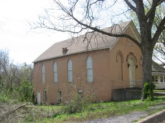 Thomas Chapel C.M.E. Churchlisted 1979
- Buchanan Street Historic Districtlisted 1990
- Confederate Memorial Gateway in Hickmanlisted 1997
- Old Hickman Historic Districtlisted 1990
Surveyed buildings and structures 5 records
- City Barber Shop, 200 Block of Clinton Street, Hickmanfederal building survey, 2 photographs
- Dust & Cobwebs Antiques, 200 Block of Clinton Street, Hickmanfederal building survey, 2 photographs
- Goalder & Goalder Insurance Building, 200 Block of Clinton Street, Hickmanfederal building survey, 2 photographs
- Hickman Outlet Building, 200 Block of Clinton Street, Hickmanfederal building survey, 3 photographs
- Lorene's, 200 Block of Clinton Street, Hickmanfederal building survey, 2 photographs
Population over time
2 figuresHickman fell from 2,395 to 2,365 between 2010 and 2020. These are the recorded population figures Wikidata holds for this place, reached through the Geographic Names Information System number this page is keyed on rather than by name, so they belong to this place and not to another of the same name. Most are census counts, but not all are: an early figure may be a founding or settlement estimate, and an estimate published within five years of a census is left out. The change column is computed, and is left blank where more than 20 years separate a figure from the one before it, because a gap that long is not a change between two counts.
| Year | People | Change |
|---|---|---|
| 2010 | 2,395 | |
| 2020 | 2,365 | -30 (-1%) |
Topographic sheets covering this place
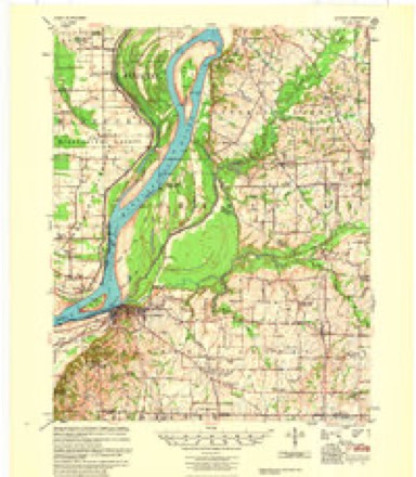
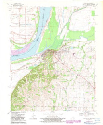
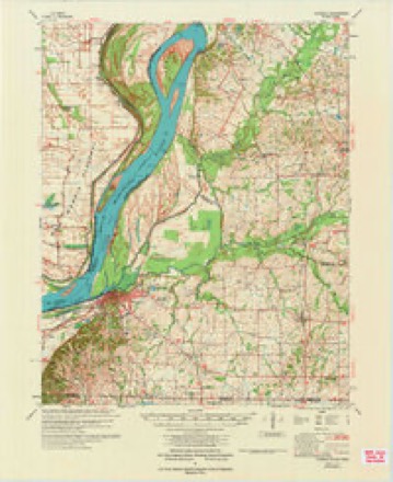
8 surveys from 17 printed sheetsMatched by testing this settlement's coordinate against the published boundary of every sheet in the United States Geological Survey's historical collection. Each opens the scanned sheet at the Survey.
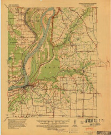
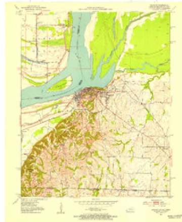
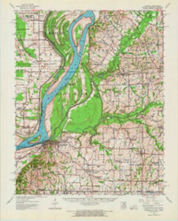
- 1939 USGS Hickman quadrangle1:62500, 4 printings
- 1951 USGS Hickman quadrangle1:24000
- 1954 USGS Hickman quadrangle1:62500
- 1955 USGS Hickman quadrangle1:62500, 2 printings
- 1956 USGS Dyersburg quadrangle1:250000, 4 printings
- 1970 USGS Hickman quadrangle1:24000, 2 printings
- 1972 USGS Hickman quadrangle1:62500
- 1985 USGS Sikeston quadrangle1:100000, 2 printings
Photographs
5 photographs,Taken for the Office of War Information and the Farm Security Administration, who photographed the country between 1935 and 1944. Works of United States government photographers, with no known restriction on use. Each opens its catalogue record.
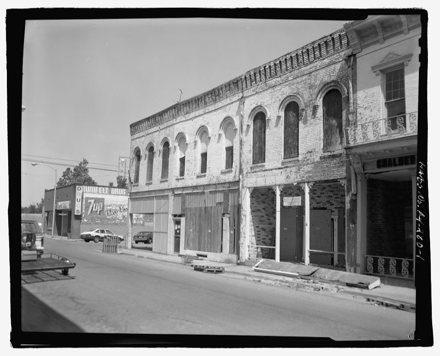
Photographer not recorded. Library of Congress
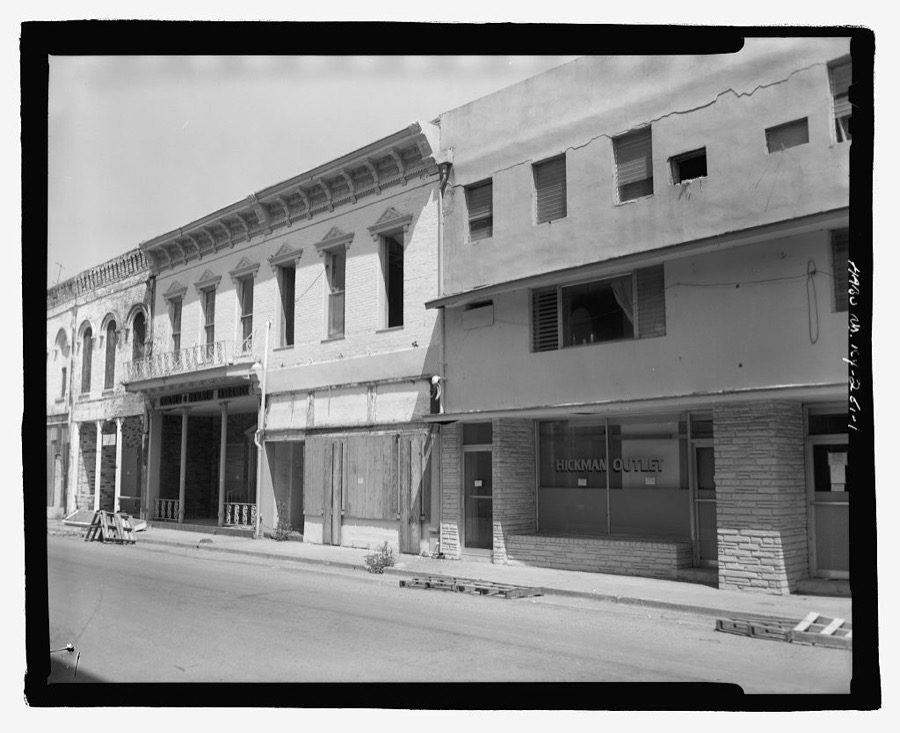
Photographer not recorded. Library of Congress
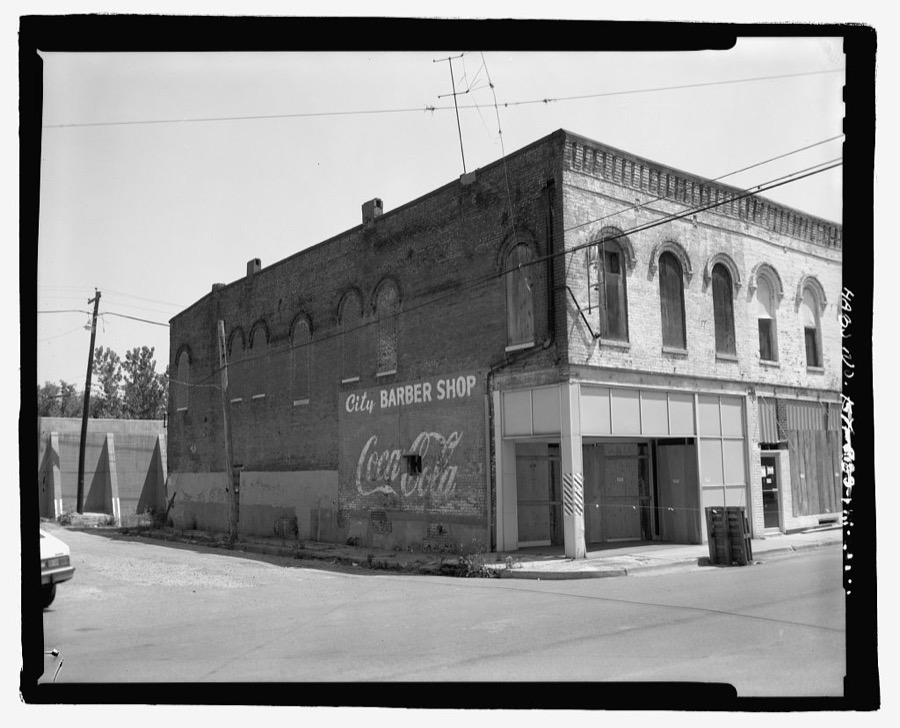
Photographer not recorded. Library of Congress
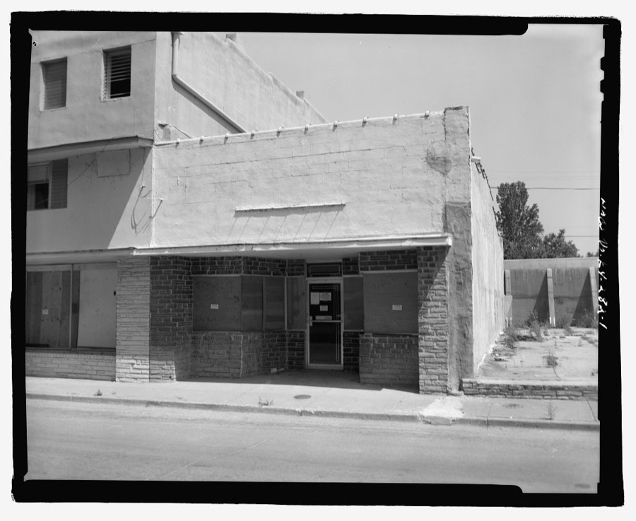
Photographer not recorded. Library of Congress
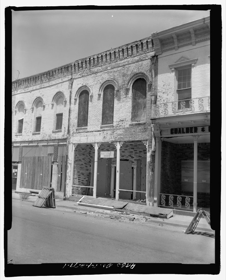
Photographer not recorded. Library of Congress
Fires near this place
22 since 1999Regional context, not property-specific evidence. The federal wildfire occurrence database lists 22 fires within 5 miles of Hickman between 1999 and 2017, burning about 114 acres in total. None started naturally. 1 was recorded as arson. Distance is straight-line from the map coordinates, so a fire counted here may appear on a neighbouring settlement's page as well.
| Reported cause | Fires |
|---|---|
| Missing data/not specified/undetermined | 13 |
| Debris and open burning | 3 |
| Equipment and vehicle use | 2 |
| Arson/incendiarism | 1 |
| Smoking | 1 |
| Recreation and ceremony | 1 |
| Railroad operations and maintenance | 1 |
The most recent of them, most recent first, with the day each was reported and the service that recorded it.
| Date | Cause | Size | Reported by | Name on the report |
|---|---|---|---|---|
| 26 September 2004 | Missing data/not specified/undetermined | 5.0 acres | Kentucky Division of Forestry | not named |
| 24 August 2017 | Missing data/not specified/undetermined | 1.0 acres | Kentucky Division of Forestry | KUDZU |
| 24 August 1999 | Equipment and vehicle use | 50 acres | Kentucky Division of Forestry | not named |
| 10 April 2017 | Arson/incendiarism | 1.0 acres | Kentucky Division of Forestry | BROWNSVILLE |
| 6 March 2010 | Recreation and ceremony | 1.0 acres | Kentucky Division of Forestry | not named |
| 3 March 2010 | Missing data/not specified/undetermined | 2.0 acres | Kentucky Division of Forestry | not named |
| 3 March 2007 | Debris and open burning | 1.0 acres | Kentucky Division of Forestry | not named |
| 28 March 2003 | Missing data/not specified/undetermined | 5.0 acres | Kentucky Division of Forestry | not named |
Settlements close enough to share some of these fires:
Mines and quarries near this place
3 within 5 milesRegional context, not property-specific evidence. The federal mineral resources record lists 3 workings within 5 miles of Hickman: 2 past producers, 1 producer. 1 still produces. What was taken out: Sand and Gravel, Construction, Graphite. Distance is straight-line from the map coordinates, so a quarry counted here may appear on a neighbouring settlement's page as well.
| Where | Site | Commodity | Status | Recorded |
|---|---|---|---|---|
| Carborundum Co/ Hickman, Ky. | Graphite | Producer | ||
| Emma D. Dredge | Sand and Gravel, Construction | Past Producer | ||
| Unk | Sand and Gravel, Construction | Past Producer |
Storms near this place
60 of 72 shownRegional context, not property-specific evidence. The National Weather Service names Hickman in 72 storm reports between 1995 and 2025: 24 thunderstorm wind, 21 hail, 17 flood, 5 flash flood. The reports record 1 death. Each account below is quoted exactly as the forecast office filed it, from the NOAA Storm Events Database, and each date opens the federal record of that event.
| When | Event | Place named | Harm | What the report says |
|---|---|---|---|---|
| March 2018 | Flood | Hickman | 1 killed, $100,000 | Moderate flooding continued on the Mississippi River from late February. At New Madrid, Missouri, the river crested at 41.4 feet on March 5, well above the flood stage of 34 feet. A Hickman city police officer perished after attempting to drive through a flooded area on the night of March 2. The 45-year-old male was seen on the roof of his submerged patrol SUV shortly before being swept away with the vehicle. The victim and his vehicle were recovered from a flooded field early on the morning of March 3. Floodgates were raised at Hickman to protect the city. However, bottomland roads and cropland outside the floodwall were submerged. The cropland was mostly dormant this early in the season. Kentucky Highway 94 was closed in the bottomlands west of Hickman, along with several other state roads. The Dorena, MO to Hickman, KY ferry was closed due to the fast river currents and water over roads. |
| March 2017 | Tornado (EF2) | Hickman | $1,000,000 | A tornado quickly developed over the city of Hickman and moved southeast across Fulton County. This was the second of two tornadoes in Fulton County. In the center of Hickman, the tornado caused significant damage to the county's jail and 911 communications center, which lost parts of the roof and a section of a wall. About 100 inmates were moved to other facilities. Other damage in Hickman included a heavily damaged gas station, numerous downed signs and power poles, and considerable roof damage to a few homes. The tornado damaged or destroyed more than 45 homes and other buildings in the county, as well as several machine sheds, barns, grain bins, and irrigation systems. At least 20 power poles were broken, and numerous trees were uprooted and snapped. The Kentucky Transportation Cabinet Fulton County Highway Maintenance Facility was hit by the tornado. The salt dome, a tractor shed, and several tractors housed in the shed were damaged. The tornado reached its peak intensity just southeast of Hickman along Highway 125, where a frame house had its entire roof structure blown off. The tornado followed Highway 125 from the center of Hickman to the junction of Highway 166, about 4.5 miles southeast of Hickman. Most state highways were closed in and near Hickman, and the Red Cross opened a shelter. Peak winds were estimated near 125 mph. Straight-line winds up to 80 mph occurred mainly southwest of the tornado path. The tornado crossed into Tennessee along State Route 116. |
| May 2011 | Flood | Hickman | $1,000,000 | Record flooding occurred on the Mississippi River. At the New Madrid, Missouri river gage, the flood crest of 48.35 feet on the night of May 5 broke the previous record (set in 1937) by a few inches. Historic flooding of the Mississippi River severely tested the strength of levees and floodwalls protecting Hickman. Numerous sand boils formed, but the levees remain intact. The bottomlands in the Hickman area were evacuated, and Kentucky Highway 94 was closed in many areas. |
| May 2006 | Flash Flood | Hickman | $100,000 | Over an hour of torrential rain in thunderstorms produced widespread flash flooding. Evacuations of five families were conducted in the city of Hickman, and up to three feet of water was over a road. Houses were flooded in the city. Mudslides were reported outside the city. Kentucky 94 was closed between Hickman and the Tennessee state line due to flooding. In Fulton, more than a dozen homes and nine public buildings were damaged. The flooded buildings included an attorney's office and several churches. Between 4 and 6 inches of rain was reported by spotters to the county emergency manager. |
| July 2009 | Thunderstorm Wind | Hickman | $80,000 | A microburst struck the town of Hickman, where the roof was blown off a restaurant. Rainfall then caused extensive damage to parts of the restaurant. Two customers were injured while rushing to escape (indirect injuries). Debris from the restaurant damaged a second home immediately east of the business. A block to the west, a carport roof was blown off. The wall of a small garage was blown inward a couple of feet. Numerous tree limbs were broken off. This microburst contained estimated peak winds of 80 mph. The damage area was about one-quarter mile long and 50 yards wide. Elsewhere in the county, three steel buildings were damaged. There was significant wall damage on one building. Another building had significant damage to the doors. Numerous large limbs were down across the county. There was minor crop damage to area corn fields. |
| February 2011 | Thunderstorm Wind | Hickman | $75,000 | The damage area of this downburst was 150 yards wide and 75 yards long. One grain bin was destroyed, with debris scattered 1000 yards from the foundation. A second grain bin had the roof ripped off and was thrown about 100 yards. A machinery shed was structurally damaged. A carport was peeled back, and a vehicle accessory was damaged. Dozens of large tree limbs were broken. Siding was peeled off a house. |
| August 2023 | Tornado (EF1) | Hickman | $60,000 | This EF-1 tornado began near the center of Hickman, in the Terrace Drive and Sunset Street area. Damage to trees and power lines occurred in this neighborhood. This tornado tracked to the east-southeast, with more tree damage on Bayou Street and Johnson Lane. A large tree fell onto a home on Myron Cory Drive. The tornado crossed Kentucky 125 and proceeded to 7th Street, where the most significant cluster of damage occurred with several trees uprooted, portions of a few trees snapped, and power line damage. One of the trees fell onto a car. The storm was at its peak width around Kentucky 125 and 7th Street. Additional damage to trees occurred on Nelson Street and Harrison Street. The damage path ended at this point, with the tornado lifting after moving into open areas east of Nelson Street. Peak winds were estimated near 105 mph. |
| January 2000 | Hail | Hickman | $50,000 | Wind-driven hail as large as nickels damaged numerous vehicles and windows in Hickman. Quarter size hail fell in Crutchfield. |
| January 2000 | Thunderstorm Wind | Hickman | $50,000 | Thunderstorm winds produced roof damage. Windows were blown out and trees were down. |
| October 2007 | Thunderstorm Wind | Hickman | $35,000 | Numerous trees and power lines were down. One home received damage. |
| February 2011 | Tornado (EF0) | Hickman | $30,000 | This tornado touched down near the intersection of Highways 1099 and 125 and travelled east one mile to the high school. Some windows were blown out of a house. A patio roof was ripped off and thrown 100 yards. Half of a garage roof was blown off. Debris was blown into trees. A mail box was blown over. Some shingles were off of four other homes. A metal dugout was destroyed at the high school. Peak winds were estimated near 80 mph. |
| February 2019 | Flood | Hickman | $20,000 | Moderate flooding of the Mississippi River inundated large areas of agricultural land. The U.S. Army Corps of Engineers assisted with the control of seepage through the levees near Hickman, where sand boils were a concern. Numerous county roads were closed, and about six state roads were closed in the flood plain. Most crops were not planted, so crop losses were small. |
| April 1999 | Thunderstorm Wind | Hickman | $20,000 | Trees were down and a roof was blown off a metal building. |
| May 1997 | Flash Flood | Hickman | $20,000 | Thunderstorms tracked southeast across Fulton County from southeast Missouri, producing copious rainfall amounts. These storms occurred after 2 to 3 inches of rain fell earlier in the day. Storm water pumps were out of service in Hickman, which contributed to significant flooding of streets there. Creeks rose out of their banks near Fulton. |
| April 1996 | Thunderstorm Wind | Hickman | $20,000 | no account filed |
| May 2025 | Thunderstorm Wind | Hickman | $15,000 | A center pivot turned over on Sycamore Rd and a tree was blown down onto a house in Hickman as a surging portion of a thunderstorm line progressed eastward through northwestern Fulton County. |
| February 2019 | Flood | Hickman | $15,000 | A mudslide resulting from heavy rainfall and flooding compromised a building at a church campus in Hickman. One unoccupied building was damaged. The mayor declared a State of Emergency. |
| July 2023 | Thunderstorm Wind | Hickman | $10,000 | Trees and power lines were down near Hickman. |
| August 2023 | Thunderstorm Wind | Hickman | $10,000 | Trees were blocking sections of Highway 125 near and southeast of Hickman. Several trees were down southwest of Cayce. There was minor structural damage in this part of Fulton County, mostly roofs off outbuildings. |
| August 2011 | Thunderstorm Wind | Hickman | $10,000 | Small trees and some large tree limbs were blown down across Fulton County. A flag pole was snapped northeast of Fulton near the Hickman County line. A mesonet site about two miles east of Hickman measured a wind gust to 57 mph. |
| April 1997 | Thunderstorm Wind | Hickman | $10,000 | no account filed |
| May 2007 | Thunderstorm Wind | Hickman | $6,000 | Several trees were blown down. |
| June 1998 | Thunderstorm Wind | Hickman | $5,000 | Dozens of trees were down between Cayce and Hickman. |
| March 2006 | Thunderstorm Wind | Hickman | $4,000 | Several power lines and tree limbs were blown down. |
| February 2025 | Flood | Hickman | - | Minor flooding of low-lying agricultural land occurred near Hickman. Minor flooding continued into early March. |
| May 2024 | Flood | Hickman | - | Minor flooding occurred near Hickman mid-month in low-lying areas. |
| March 2023 | Thunderstorm Wind | Hickman | - | A wind gust to 72 mph was measured at a Kentucky mesonet site. |
| August 2023 | Flash Flood | Hickman | - | Road flooding was reported near the senior center in Hickman. The Kentucky state highway department worked through the morning to remove debris that washed onto roadways. A Kentucky mesonet station near Hickman reported 4.75 inches between midnight and mid-afternoon on the 3rd. |
| February 2022 | Thunderstorm Wind | Hickman | - | A wind gust to 58 mph was measured at a Kentucky mesonet site. |
| March 2019 | Flood | Hickman | - | Moderate flooding of the Mississippi River inundated large areas of agricultural land. The U.S. Army Corps of Engineers assisted with the control of seepage through the levees near Hickman, where sand boils were a concern. Numerous county roads were closed, and about six state roads were closed in the flood plain. Most crops were not planted, so crop losses were small. The prolonged flooding started in February and continued into late March. |
| November 2018 | Flood | Hickman | - | Highway 94 was closed between the 7 and 11 mile markers, which is a flood-prone area just south of Hickman. |
| March 2017 | Thunderstorm Wind | Hickman | - | A wind gust to 63 mph was measured at the Kentucky mesonet site. |
| May 2015 | Heavy Rain | Hickman | - | A Kentucky mesonet site reported 1.65 inches of rain since midnight. |
| April 2014 | Flood | Hickman | - | Kentucky Highway 94 was closed between Kentucky Highways 311 and 1099 near Hickman due to water over the road. High water signs were placed at flooded spots on several other state roads in the county. The flooding was due to thunderstorms the previous night combined with light to moderate rain the next day. |
| May 2011 | Thunderstorm Wind | Hickman | - | A wind gust to 63 mph was measured at a Kentucky mesonet site. |
| April 2011 | Flood | Hickman | - | Historic flooding of the Mississippi River severely tested the strength of levees and floodwalls protecting Hickman. |
| April 2009 | Hail | Hickman | - | The hail lasted about 5 minutes. |
| March 2008 | Flood | Hickman | - | Flooding was reported in Hickman, where a few evacuations were conducted. Several roads were closed by flooding, including parts of Kentucky Highways 1354, 94, 1129, 1907, 137, and 1436. |
| March 2008 | Flood | Hickman | - | Moderate flooding of the Mississippi River occurred. At the New Madrid, MO gage, the river crested at 41.44 feet on March 27. Flood stage there is 34 feet, and moderate flooding begins at 40 feet. Flood gates were installed in the floodwall at Hickman. These flood gates are normally installed when the river reaches 51 feet on the Cairo gage. The ferry from Hickman, KY to Dorena, MO was shut down for over a week due to high water. Kentucky Highway 239 was closed heading toward Clinton. Large areas of agricultural land were flooded. Spring planting was not yet underway, so crop losses were negligible. |
| April 2008 | Flood | Hickman | - | Moderate flooding of the Mississippi River occurred. At the New Madrid, Missouri gage, the river remained above flood stage from mid March through late April. The crest in April was 40.72 feet on the 16th. Flood stage at New Madrid is 34 feet. Ferry service from Hickman, KY to Dorena, MO was suspended due to the high water. Kentucky 1129 and a section of Kentucky 94 was closed. Many low-lying areas were flooded, primarily farm fields. Since planting season was not underway when flooding began, there was little if any crop damage. |
| December 2007 | Flood | Hickman | - | Water was over Highway 94 just west of Hickman and two miles east of Cayce. Authorities expected the road would be closed at those locations. Water was over the roadway on Highway 925 south of Hickman. |
| January 2007 | Flash Flood | Hickman | - | Kentucky Highway 94 was closed by flooding. |
| June 2007 | Heavy Rain | Hickman | - | The state department of highways measured 2.30 inches of rain in 45 to 60 minutes. Some water was reported over roads. |
| May 2006 | Thunderstorm Wind | Hickman | - | Numerous trees were blown down in and around Hickman. |
| July 2006 | Thunderstorm Wind | Hickman | - | Trees were blown down by wind gusts estimated near 60 MPH. |
| July 2003 | Hail | Hickman | - | Vehicles were damaged by hail on Highway 94 west of Hickman. |
| April 2002 | Hail | Hickman | - | Inch-and-a-half diameter hail was reported 3 miles east of Hickman along Highway 58 east. |
| June 1997 | Flash Flood | Hickman | - | Thunderstorms repeatedly moved over the same areas that were drenched with rain earlier in the day. Radar estimated 1 to 2 inches fell within an hour. Numerous streets were flooded. |
| July 2023 | Hail | Hickman | - | no account filed |
| December 2021 | Hail | Hickman | - | no account filed |
| March 2020 | Hail | Hickman | - | no account filed |
| February 2018 | Flood | Hickman | - | no account filed |
| May 2011 | Hail | Hickman | - | no account filed |
| May 2011 | Hail | Hickman | - | no account filed |
| April 2011 | Thunderstorm Wind | Hickman | - | no account filed |
| June 2011 | Flood | Hickman | - | no account filed |
| April 2006 | Hail | Hickman | - | no account filed |
| May 2006 | Hail | Hickman | - | no account filed |
| May 2006 | Hail | Hickman | - | no account filed |
| May 2006 | Hail | Hickman | - | no account filed |
Newspapers printed here
13,315 digitised pages1 paper published in this town, digitised by the Library of Congress and free to read: 2,017 issues, 13,315 pages. Every page is searchable, so a name or a street can be looked for directly in what the town printed about itself at the time.
| Newspaper | Published |
|---|---|
| The Hickman Courier | 1859 to Current |
What the paper printed
23,288 wordsFront pages of the local paper, read from the Library of Congress scans: 6 issues spread across its run from 1868 to 1922, 23,288 words in total. Each is reproduced on its own page, exactly as the recogniser returned it.
These pages read less well than anything else here, and the number is worth stating: about three words in four come through cleanly, against nine in ten for the building records. An 1896 broadsheet sets eight-point type in seven columns on microfilm, which is the hardest thing in this archive to read by machine. We tested our own recognisers against the Library's and they were not better, so the Library's text is what appears, with the wholly unreadable columns removed. Read it as a guide to what the paper covered, and follow the link to the scan before quoting anything.
| Issue | Paper | Length |
|---|---|---|
| 1868-04-18 | The Hickman Courier | 6,244 words |
| 1868-06-06 | The Hickman Courier | 7,239 words |
| 1868-08-08 | The Hickman Courier | 6,217 words |
| 1868-10-31 | The Hickman Courier | 1,536 words |
| 1868-12-19 | The Hickman Courier | 1,025 words |
| 1922-12-21 | The Hickman Courier | 1,027 words |
Nearest settlements
The eight closest, with where each one stands in the county. Distances are straight-line, computed from the Geographic Names Information System coordinates.
| Map | Place | Distance | Sheets |
|---|---|---|---|
| Stubbs | 1.4 miles | 17 | |
| Brownsville | 3.0 miles | 17 | |
| Anna Lynne | 4.0 miles | 13 | |
| Walnut Grove (historical) | 4.7 miles | 18 | |
| Beech Grove (historical) | 4.7 miles | 17 | |
| Blue Pond | 4.8 miles | 13 | |
| Mabel | 4.9 miles | 13 | |
| Ledford | 6.8 miles | 13 |
Elsewhere
Matched on this settlement's Geographic Names Information System number rather than its name, so it cannot be a different place of the same name in another state.
| Wikipedia article on Hickman | An encyclopaedic summary. Its text is share-alike, so it is linked here rather than copied. |
| Wikidata item Q1023019 | The structured record the population and elevation above come from. Public domain (CC0). |
Provenance
This settlement is recorded in the Geographic Names Information System as feature 494109. The sheet list is computed by point-in-boundary test against the United States Geological Survey's historical topographic inventory. Both are works of the United States government and carry no copyright under 17 U.S.C. 105.
Wildfire. Short, Karen C. 2022. Spatial wildfire occurrence data for the United States, 1992-2020 [FPA_FOD_20221014]. 6th Edition. Fort Collins, CO: Forest Service Research Data Archive. https://doi.org/10.2737/RDS-2013-0009.6 Collected with United States Government funding and usable without additional permissions or fees.
Mines and quarries. USGS Mineral Resources Data System (MRDS) https://mrdata.usgs.gov/mrds/ A work of the United States government, no copyright under 17 U.S.C. 105.
Storms. NOAA National Centers for Environmental Information, Storm Events Database https://www.ncei.noaa.gov/stormevents/ A work of the United States government, no copyright under 17 U.S.C. 105. Narratives are quoted verbatim from the National Weather Service report and are not edited or summarised.