 Block
Ingle, Kentucky
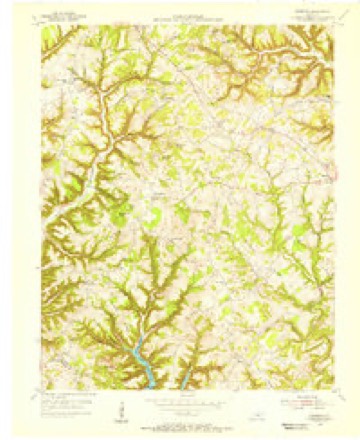
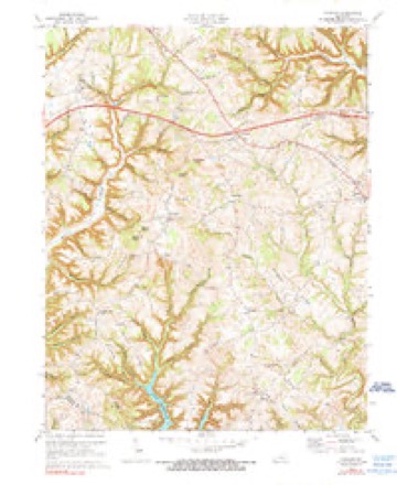
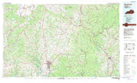
8 topographic sheets cover this place, the earliest surveyed in 1954 and the latest in 1982. It stands in the Nancy census division. It lies in ZIP code area 42544. It stands on Rainwater Branch. The Survey maps it on the Faubush quadrangle.
Topographic sheets covering this place
5 surveys from 8 printed sheetsMatched by testing this settlement's coordinate against the published boundary of every sheet in the United States Geological Survey's historical collection. Each opens the scanned sheet at the Survey.
- 1954 USGS Faubush quadrangle1:24000
- 1957 USGS Winchester quadrangle1:250000, 3 printings
- 1960 USGS Winchester quadrangle1:250000
- 1973 USGS Faubush quadrangle1:24000, 2 printings
- 1982 USGS Somerset quadrangle1:100000


Fires near this place
8 since 2001Regional context, not property-specific evidence. The federal wildfire occurrence database lists 8 fires within 5 miles of Ingle between 2001 and 2016, burning about 256 acres in total. None started naturally. None was recorded as arson. Distance is straight-line from the map coordinates, so a fire counted here may appear on a neighbouring settlement's page as well.
| Reported cause | Fires |
|---|---|
| Debris and open burning | 4 |
| Missing data/not specified/undetermined | 3 |
| Recreation and ceremony | 1 |
The most recent of them, most recent first, with the day each was reported and the service that recorded it.
| Date | Cause | Size | Reported by | Name on the report |
|---|---|---|---|---|
| 3 May 2001 | Debris and open burning | 3.0 acres | Kentucky Division of Forestry | not named |
| 3 April 2016 | Debris and open burning | 2.0 acres | Kentucky Division of Forestry | BROWN RIDGE |
| 17 April 2008 | Missing data/not specified/undetermined | 205 acres | Kentucky Division of Forestry | KING TOWN# 2 |
| 10 April 2007 | Recreation and ceremony | 3.0 acres | Kentucky Division of Forestry | not named |
| 23 March 2004 | Missing data/not specified/undetermined | 3.0 acres | Kentucky Division of Forestry | not named |
| 9 November 2005 | Missing data/not specified/undetermined | 5.0 acres | Kentucky Division of Forestry | not named |
| 2 November 2016 | Debris and open burning | 25 acres | Kentucky Division of Forestry | GREEN RIVER KNOB |
| 12 November 2011 | Debris and open burning | 10 acres | Kentucky Division of Forestry | PARKWAY |
Settlements close enough to share some of these fires:
Storms near this place
3 since 2006Regional context, not property-specific evidence. The National Weather Service names Ingle in 3 storm reports between 2006 and 2025: 2 thunderstorm wind, 1 tornado. The reports record 1 death. Each account below is quoted exactly as the forecast office filed it, from the NOAA Storm Events Database, and each date opens the federal record of that event.
| When | Event | Place named | Harm | What the report says |
|---|---|---|---|---|
| May 2025 | Tornado (EF4) | Ingle | 1 killed | NWS survey teams dispatched on Saturday morning to Russell and |Pulaski Counties, where they were able to confirm a touchdown |along KY-619, about 2.5 miles northeast of Jamestown. Upon |touchdown it caused damage to a garage, two antenna towers, and |several trees. Sporadic damage east of KY-619 seems to suggest |that the tornado may have briefly lifted for a few hundred yards |after its initial touchdown point, before touching back down in a |grove of trees between KY-619 and John Streat Road. EF-1 damage |was observed in this area, with winds estimated between 95 and 100|mph. The tornado caused roofing damage to a house along John |Streat Road as it continued east, also producing a swath of |uprooted trees as it crossed a finger of Lake Cumberland. The |tornado gradually intensified as it crossed Parks Ridge and |continued through the community of Eli and points eastward. The|damage in this area was consistent with high-end EF-1 and EF-2 |winds, between 100 and 130 mph. ||The tornado then continued across the Pulaski County line, where |it caused considerable damage near the Faubush and Nancy |communities, before making it's way to the south side of Somerset.|Here it strengthened as it came down a steep hillside into the |city. Some residences and numerous businesses were affected, with |survey results showing high end EF-2 damage along Parkers Mill |Way and S Hwy 27. On the eastern edge of the city it affected the |South Kentucky RECC, causing catastrophic damage to all buildings,|as well as surrounding businesses. Damage in this region shows a|likely strengthening to low-end EF-3 winds.||The damage path continued on eastward towards the Daniel Boone |National Forest, where additional EF-3 damage was incurred. This|includes the lifting, twisting, and throwing of a high tension |power pole eastward several hundred yards downwind in a nearby |field off of Rush Branch Road, and destroying multiple residences.|High-resolution satellite imagery shows the tornado plowing |through the Daniel Boone Forest, with complete destruction of |trees through the middle of the path. It also reveals a path width|of nearly a mile wide during this time, including the strongest |inflow into the storm. This was also confirmed by the survey crew |on Monday. ||The tornado then exited the forest and moved towards the south|side of London between 11:35 and 11:45 EDT. It is at this point |that it started impacting large residential areas as it set sites |on the London-Corbin Airport. Two teams surveyed the damage in |southern London for several days. The survey results showed that |the tornado continued to strengthen just west of the I-75 |corridor, as it started towards the Sunshine Hills subdivision. It|was here that some of the heaviest damage occurred, with the |tornado taking a direct path through the subdivision. Many homes |were wiped clean from their foundations, with vehicles thrown and |trees debarked with only stubs of the largest limbs left. It is in|this subdivision where the majority of casualties occurred. |Survey teams and subject- matter experts all looked at the damage |that had occurred in this location and agreed that the tornado had|increased again to around 170mph based on the damage, making it |an EF-4 rated tornado. ||After the tornado passed over I-75 around 11:45 EDT, it headed |for the airport, continuing to cause high end EF-3 damage to both |the airport and residential communities adjacent to the west along|the center of it's path. After exiting the airport, it caused |extensive damage at Levi Jackson Park, the Laurel County |Fairgrounds, Crooked Creek Golf Course, and neighboring |subdivisions. The tornado began to lose considerable strength |after this point, with generally EF-0 damage reported as it |neared East Laurel Road (Hwy-80) and Mt. Salem Rd (KY-488). The |tornado appears to have lifted just east of KY-488, based on NWS |ground surveys, satellite, and aerial video. NWS survey teams |followed the circulation path eastward through Clay and Leslie, |but were unable to find any reports that the tornado touched back |down in these counties. ||By the time it lifted, just a few minutes before midnight, the |tornado had carved out a damage path of just shy of 60 miles over|the course of 3 counties. One death was reported in Russell and |another in Pulaski County. Sadly, 17 lives were lost in Laurel |County. |
| June 2023 | Thunderstorm Wind | Ingle | - | The highway department reported a tree blown down onto Roosevelt Vaught Road. |
| October 2006 | Thunderstorm Wind | Ingle | - | Two trees down on Bradley Cemetary Road near Nancy. |
Nearest settlements
The eight closest, with where each one stands in the county. Distances are straight-line, computed from the Geographic Names Information System coordinates.
Provenance
This settlement is recorded in the Geographic Names Information System as feature 508312. The sheet list is computed by point-in-boundary test against the United States Geological Survey's historical topographic inventory. Both are works of the United States government and carry no copyright under 17 U.S.C. 105.
Wildfire. Short, Karen C. 2022. Spatial wildfire occurrence data for the United States, 1992-2020 [FPA_FOD_20221014]. 6th Edition. Fort Collins, CO: Forest Service Research Data Archive. https://doi.org/10.2737/RDS-2013-0009.6 Collected with United States Government funding and usable without additional permissions or fees.
Storms. NOAA National Centers for Environmental Information, Storm Events Database https://www.ncei.noaa.gov/stormevents/ A work of the United States government, no copyright under 17 U.S.C. 105. Narratives are quoted verbatim from the National Weather Service report and are not edited or summarised.