 Block
Keysburg, Kentucky
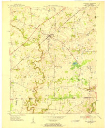
6 topographic sheets cover this place, the earliest surveyed in 1950 and the latest in 1980. It stands in the Adairville census division. It lies in ZIP code area 42204. The Survey maps it on the Allensville quadrangle.
Topographic sheets covering this place
4 surveys from 6 printed sheetsMatched by testing this settlement's coordinate against the published boundary of every sheet in the United States Geological Survey's historical collection. Each opens the scanned sheet at the Survey.
- 1950 USGS Allensville quadrangle1:24000, 2 printings
- 1956 USGS Nashville quadrangle1:250000, 2 printings
- 1959 USGS Nashville quadrangle1:250000
- 1980 USGS Hopkinsville quadrangle1:100000
Fires near this place
1 since 1999Regional context, not property-specific evidence. The federal wildfire occurrence database lists 1 fire within 5 miles of Keysburg in 1999, burning about 15 acres in total. None started naturally. None was recorded as arson. Distance is straight-line from the map coordinates, so a fire counted here may appear on a neighbouring settlement's page as well.
| Reported cause | Fires |
|---|---|
| Equipment and vehicle use | 1 |
The most recent of them, most recent first, with the day each was reported and the service that recorded it.
| Date | Cause | Size | Reported by | Name on the report |
|---|---|---|---|---|
| 15 September 1999 | Equipment and vehicle use | 15 acres | Tennessee Division of Forestry | not named |
Storms near this place
1 since 2018Regional context, not property-specific evidence. The National Weather Service names Keysburg in 1 storm report in 2018: 1 tornado. The reports record 1 death and 1 injury. Each account below is quoted exactly as the forecast office filed it, from the NOAA Storm Events Database, and each date opens the federal record of that event.
| When | Event | Place named | Harm | What the report says |
|---|---|---|---|---|
| February 2018 | Tornado (EF2) | Keysburg | 1 killed, 1 hurt, $800,000 | The National Weather Service conducted a storm damage survey in Logan county Kentucky. The damage moved in from Robertson County Tennessee near the end of McGee Road where two homes received extensive damage. The first home, a well built stone home had significant roof damage and the screened in porch was destroyed. The family pick up truck was tossed around 40 yards to the north. On the family cemetery plot several tombstones were knocked over and one headstone was destroyed. There were several outbuildings and 2 pole Barnes were destroyed on the property as well. ||The second home experienced significant foundation damage and the roof was completely thrown off. The family pick up truck was thrown 250 yards and thrown down into a field. Insulation from the home was thrown down wind over 300 yards. The debris field from the two homes was thrown in a farmers field between 100 yards in a quarter mile down wind with several 2 x 4 and 2 x 10 and bricks being impaled into the ground. Winds were estimated between 120 and 130 mph. ||The tornado then moved through several farmers fields doing extensive tree damage and fence damage. Power lines were down throughout this entire stretch.| |The tornado then hit 901 Dot Road destroying 2 barns, moving heavy farm equipment, blowing out exterior walls and destroying the roof at the property. Tragically, a woman in the home was killed by falling debris. The family pet dog was found alive by rescuers underneath extensive rubble. Debris was thrown up to 500 yards and debris with a width of between 250 and and 300 yards in a farmers field. Winds were estimated to be 135 mph at this location. ||Next, the tornado hit a large family farm at 3604 Schley Road destroying the second story. Three farm silos that were empty or destroyed with the metal sheets being thrown over a quarter mile down wind. The tornado continued through farm fields destroying several trees and uprooting them.||The tornado became more elevated at the intersection of Mortimor Station Road and Mirriaheh Road. In this area trees we snapped, and several homes experienced shingle siding and roof damage. Winds were estimated to be 100 to 110 mph here. ||As the tornado was lifting, it snapped some trees in the Schochoh community. |
Nearest settlements
The eight closest, with where each one stands in the county. Distances are straight-line, computed from the Geographic Names Information System coordinates.
| Map | Place | Distance | Sheets |
|---|---|---|---|
| Mosley Pond | 2.7 miles | 6 | |
| Dot | 3.5 miles | 9 | |
| Oakland (historical) | 4.5 miles | 9 | |
| Schley | 5.3 miles | 9 | |
| Smithgrove (historical) | 5.3 miles | 9 | |
| Ash Spring | 5.4 miles | 6 | |
| Lickskillet | 6.1 miles | 9 | |
| Parson Campground (historical) | 6.1 miles | 9 |
Elsewhere
Matched on this settlement's Geographic Names Information System number rather than its name, so it cannot be a different place of the same name in another state.
| Wikipedia article on Keysburg | An encyclopaedic summary. Its text is share-alike, so it is linked here rather than copied. |
| Wikidata item Q19986693 | The structured record the population and elevation above come from. Public domain (CC0). |
Provenance
This settlement is recorded in the Geographic Names Information System as feature 495711. The sheet list is computed by point-in-boundary test against the United States Geological Survey's historical topographic inventory. Both are works of the United States government and carry no copyright under 17 U.S.C. 105.
Wildfire. Short, Karen C. 2022. Spatial wildfire occurrence data for the United States, 1992-2020 [FPA_FOD_20221014]. 6th Edition. Fort Collins, CO: Forest Service Research Data Archive. https://doi.org/10.2737/RDS-2013-0009.6 Collected with United States Government funding and usable without additional permissions or fees.
Storms. NOAA National Centers for Environmental Information, Storm Events Database https://www.ncei.noaa.gov/stormevents/ A work of the United States government, no copyright under 17 U.S.C. 105. Narratives are quoted verbatim from the National Weather Service report and are not edited or summarised.