 Block
Lancaster, Kentucky
12 topographic sheets cover this place, the earliest surveyed in 1905 and the latest in 1991. It stands in the Lancaster census division. It lies in ZIP code area 40444. The Survey maps it on the Lancaster quadrangle. 3,899 people lived here at the 2020 count. It stands 1,027 feet above sea level.
Research this city
On record in Lancaster
Buildings and businesses the archive holds for this place. Each opens its own page, with the source record it came from.
On the National Register 12 of 52 shown
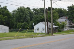 Billy Ball Houselisted 1984
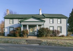 Boyle-Robertson-Letcher Houselisted 1975
 Bryantsville Methodist Churchlisted 1985
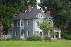 Denny Placelisted 1984
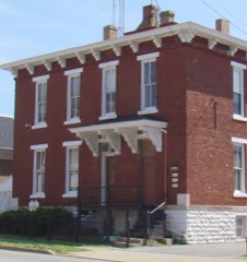 Garrard County Jaillisted 1984
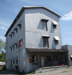 Garrard Millslisted 1984
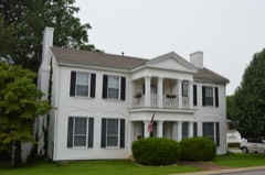 Hamilton Houselisted 1984
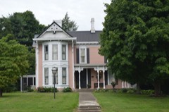 J. C. Hemphill Houselisted 1984
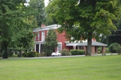 Dr. Oliver Perry Hill Houselisted 1984
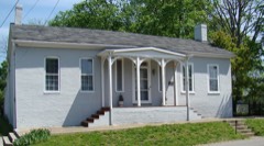 Jennings-Salter Houselisted 1980
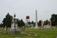 Lancaster Cemeterylisted 1984
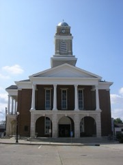 Lancaster Commercial Historic Districtlisted 1984
Population over time
2 figuresLancaster grew from 3,442 to 3,899 between 2010 and 2020. These are the recorded population figures Wikidata holds for this place, reached through the Geographic Names Information System number this page is keyed on rather than by name, so they belong to this place and not to another of the same name. Most are census counts, but not all are: an early figure may be a founding or settlement estimate, and an estimate published within five years of a census is left out. The change column is computed, and is left blank where more than 20 years separate a figure from the one before it, because a gap that long is not a change between two counts.
| Year | People | Change |
|---|---|---|
| 2010 | 3,442 | |
| 2020 | 3,899 | +457 (+13%) |
Topographic sheets covering this place
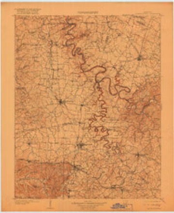
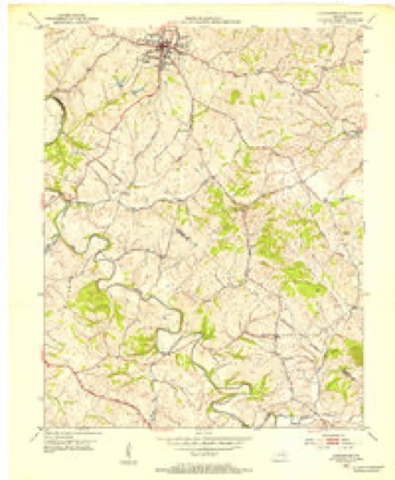
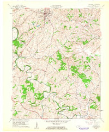
7 surveys from 12 printed sheetsMatched by testing this settlement's coordinate against the published boundary of every sheet in the United States Geological Survey's historical collection. Each opens the scanned sheet at the Survey.
- 1905 USGS Harrodsburg quadrangle1:125000, 3 printings
- 1952 USGS Lancaster quadrangle1:24000
- 1957 USGS Winchester quadrangle1:250000, 3 printings
- 1960 USGS Winchester quadrangle1:250000
- 1961 USGS Lancaster quadrangle1:24000, 2 printings
- 1986 USGS Harrodsburg quadrangle1:100000
- 1991 USGS Harrodsburg quadrangle1:100000


Fires near this place
2 since 2003Regional context, not property-specific evidence. The federal wildfire occurrence database lists 2 fires within 5 miles of Lancaster between 2003 and 2005, burning about 2 acres in total. None started naturally. None was recorded as arson. Distance is straight-line from the map coordinates, so a fire counted here may appear on a neighbouring settlement's page as well.
| Reported cause | Fires |
|---|---|
| Missing data/not specified/undetermined | 2 |
The most recent of them, most recent first, with the day each was reported and the service that recorded it.
| Date | Cause | Size | Reported by | Name on the report |
|---|---|---|---|---|
| 3 April 2003 | Missing data/not specified/undetermined | 1.0 acres | Kentucky Division of Forestry | not named |
| 11 November 2005 | Missing data/not specified/undetermined | 1.0 acres | Kentucky Division of Forestry | not named |
Settlements close enough to share some of these fires:
Mines and quarries near this place
1 within 5 milesRegional context, not property-specific evidence. The federal mineral resources record lists 1 working within 5 miles of Lancaster: 1 occurrence. None of them still produces. What was taken out: Fluorine-Fluorite, Lead, Zinc, Barium-Barite. Distance is straight-line from the map coordinates, so a quarry counted here may appear on a neighbouring settlement's page as well.
| Where | Site | Commodity | Status | Recorded |
|---|---|---|---|---|
| John Burdette Deposit | Fluorine-Fluorite, Lead, Zinc, Barium-Barite | Occurrence |
Storms near this place
45 since 1996Regional context, not property-specific evidence. The National Weather Service names Lancaster in 45 storm reports between 1996 and 2025: 29 thunderstorm wind, 9 flash flood, 5 hail, 2 flood. No death or injury is recorded in these reports. Each account below is quoted exactly as the forecast office filed it, from the NOAA Storm Events Database, and each date opens the federal record of that event.
| When | Event | Place named | Harm | What the report says |
|---|---|---|---|---|
| August 2009 | Thunderstorm Wind | Lancaster | $30,000 | A metal and wooden barn was destroyed along with several greenhouses. Trees and power lines were down near 1295 and Gillespie with damage to a house. |
| August 2013 | Flash Flood | Lancaster | $20,000 | Five hundred feet of Highway 1150 was washed away by flash flooding between mile markers 0 and 1. |
| May 2010 | Flash Flood | Lancaster | $20,000 | There were several houses with water in the basement. Bethel Christian Church had 6 feet of water inside. |
| May 2007 | Flash Flood | Lancaster | $10,000 | A spotter estimated from two and a half to three inches of rain over a 30 minute period. Drakes Creek Road flooded and lost blacktop in two locations. Three people were trapped in a pickup truck. A metal outbuilding was washed away. |
| August 2014 | Thunderstorm Wind | Lancaster | $2,000 | A spotter reported that thunderstorm winds partially removed the roof off of a barn. Many large tree limbs were downed as well. |
| May 2025 | Thunderstorm Wind | Lancaster | - | Trees were blown down across Sugar Creek Road near the intersection of Lexington Road. |
| May 2025 | Thunderstorm Wind | Lancaster | - | A tree was blown down across the 200 block of Lexington Road in Lancaster. |
| December 2025 | Thunderstorm Wind | Lancaster | - | A tree was blown down near the intersection of Kentucky Route 52 and Boones Creek Road. |
| July 2021 | Flash Flood | Lancaster | - | Water was over Crab Orchard Road. |
| December 2021 | Thunderstorm Wind | Lancaster | - | Trees were reported down on Wesley Drive. The area had three rounds of storms from 1 to 7 AM. It is estimated that the last wave of storms caused this damage. |
| July 2020 | Thunderstorm Wind | Lancaster | - | Dispatch reported trees down 2 miles north of Lancaster. |
| November 2019 | Flash Flood | Lancaster | - | Broadcast media and county dispatch reported high water was over county roads. |
| June 2018 | Flood | Lancaster | - | A little water was over Old Danville Road. |
| June 2018 | Thunderstorm Wind | Lancaster | - | Trees down at Richmond Street and South Campbell Street. |
| June 2016 | Thunderstorm Wind | Lancaster | - | The public reported trees down at the local elementary school. |
| May 2016 | Thunderstorm Wind | Lancaster | - | Local law enforcement reported trees down in the area. |
| July 2016 | Thunderstorm Wind | Lancaster | - | State officials reported trees and limbs down on power lines. |
| July 2016 | Flash Flood | Lancaster | - | Local law enforcement reported high water over Richmond Road in Lancaster. |
| July 2016 | Thunderstorm Wind | Lancaster | - | Local law enforcement reported a few trees down in the town of Lancaster due to severe thunderstorm winds. |
| April 2015 | Hail | Lancaster | - | Golf ball size was reported in Lancaster by the public. |
| July 2015 | Thunderstorm Wind | Lancaster | - | A Garrard County law enforcement official reported that numerous trees were down across the county. There were no reports of structural damage. |
| May 2014 | Thunderstorm Wind | Lancaster | - | A bow echo downed multiple trees across the county, including some in Lancaster. |
| May 2013 | Hail | Lancaster | - | Local broadcast media relayed a report of one inch hail in Lancaster. |
| August 2013 | Flash Flood | Lancaster | - | The Lancaster Fire Dept. reported that Crab Orchard Road was briefly closed due to flash flooding. Buckeye Road was also partially impeded by high water. |
| August 2013 | Flood | Lancaster | - | A Garrard County official reported some minor flooding issues across the county, although no roads were closed. |
| August 2013 | Thunderstorm Wind | Lancaster | - | Law enforcement from Lancaster reported a few trees down around the town. |
| July 2012 | Thunderstorm Wind | Lancaster | - | A county official reported trees down near Danville Road, State Highway 52, Polly's Bend Road, and Kennedy Bridge Road. |
| April 2011 | Thunderstorm Wind | Lancaster | - | Trees and power lines were blown down just south of Lancaster. |
| June 2009 | Thunderstorm Wind | Lancaster | - | Trees were downed throughout the county. |
| April 2007 | Thunderstorm Wind | Lancaster | - | Numerous trees were downed county wide. |
| July 2004 | Thunderstorm Wind | Lancaster | - | Trees and power lines were blown down. |
| June 2002 | Thunderstorm Wind | Lancaster | - | Trees and power lines were downed. |
| May 2002 | Flash Flood | Lancaster | - | Water covered Old Danville Road west of Lancaster in several locations. |
| March 2017 | Hail | Lancaster | - | no account filed |
| January 2008 | Hail | Lancaster | - | no account filed |
| October 2007 | Thunderstorm Wind | Lancaster | - | no account filed |
| July 2005 | Thunderstorm Wind | Lancaster | - | no account filed |
| August 2004 | Thunderstorm Wind | Lancaster | - | no account filed |
| May 2003 | Hail | Lancaster | - | no account filed |
| October 2001 | Thunderstorm Wind | Lancaster | - | no account filed |
| September 2000 | Thunderstorm Wind | Lancaster | - | no account filed |
| June 1998 | Thunderstorm Wind | Lancaster | - | no account filed |
| June 1998 | Thunderstorm Wind | Lancaster | - | no account filed |
| May 1996 | Flash Flood | Lancaster | - | no account filed |
| July 1996 | Thunderstorm Wind | Lancaster | - | no account filed |
Newspapers printed here
8,656 digitised pages1 paper published in this town, digitised by the Library of Congress and free to read: 1,292 issues, 8,656 pages. Every page is searchable, so a name or a street can be looked for directly in what the town printed about itself at the time.
| Newspaper | Published |
|---|---|
| The Central Record | 18?? to Current |
What the paper printed
22,290 wordsFront pages of the local paper, read from the Library of Congress scans: 6 issues spread across its run from 1898 to 1922, 22,290 words in total. Each is reproduced on its own page, exactly as the recogniser returned it.
These pages read less well than anything else here, and the number is worth stating: about three words in four come through cleanly, against nine in ten for the building records. An 1896 broadsheet sets eight-point type in seven columns on microfilm, which is the hardest thing in this archive to read by machine. We tested our own recognisers against the Library's and they were not better, so the Library's text is what appears, with the wholly unreadable columns removed. Read it as a guide to what the paper covered, and follow the link to the scan before quoting anything.
| Issue | Paper | Length |
|---|---|---|
| 1898-01-07 | The Central Record | 4,984 words |
| 1898-03-25 | The Central Record | 3,261 words |
| 1898-06-17 | The Central Record | 3,263 words |
| 1898-09-02 | The Central Record | 3,317 words |
| 1898-11-24 | The Central Record | 3,457 words |
| 1922-12-28 | The Central Record | 4,008 words |
Nearest settlements
The eight closest, with where each one stands in the county. Distances are straight-line, computed from the Geographic Names Information System coordinates.
| Map | Place | Distance | Sheets |
|---|---|---|---|
| Hyattsville | 3.1 miles | 12 | |
| Guy (historical) | 3.4 miles | 10 | |
| Judson | 4.6 miles | 10 | |
| Point Leavell | 4.7 miles | 14 | |
| Marksbury | 4.8 miles | 13 | |
| McCreary | 4.9 miles | 10 | |
| Three Forks | 4.9 miles | 10 | |
| Hackley | 5.7 miles | 15 |
Elsewhere
Matched on this settlement's Geographic Names Information System number rather than its name, so it cannot be a different place of the same name in another state.
| Wikipedia article on Lancaster | An encyclopaedic summary. Its text is share-alike, so it is linked here rather than copied. |
| Wikidata item Q2536779 | The structured record the population and elevation above come from. Public domain (CC0). |
Provenance
This settlement is recorded in the Geographic Names Information System as feature 495946. The sheet list is computed by point-in-boundary test against the United States Geological Survey's historical topographic inventory. Both are works of the United States government and carry no copyright under 17 U.S.C. 105.
Wildfire. Short, Karen C. 2022. Spatial wildfire occurrence data for the United States, 1992-2020 [FPA_FOD_20221014]. 6th Edition. Fort Collins, CO: Forest Service Research Data Archive. https://doi.org/10.2737/RDS-2013-0009.6 Collected with United States Government funding and usable without additional permissions or fees.
Mines and quarries. USGS Mineral Resources Data System (MRDS) https://mrdata.usgs.gov/mrds/ A work of the United States government, no copyright under 17 U.S.C. 105.
Storms. NOAA National Centers for Environmental Information, Storm Events Database https://www.ncei.noaa.gov/stormevents/ A work of the United States government, no copyright under 17 U.S.C. 105. Narratives are quoted verbatim from the National Weather Service report and are not edited or summarised.