 Block
Lone Oak, Kentucky
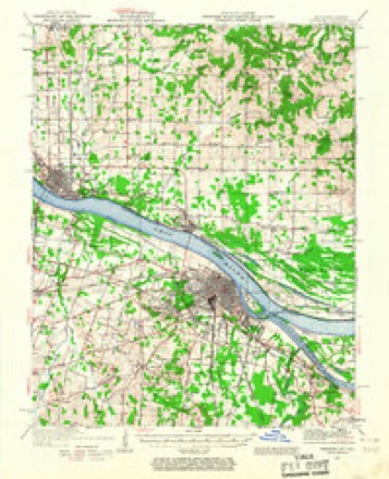
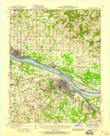
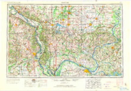
22 topographic sheets cover this place, the earliest surveyed in 1926 and the latest in 1987. It stands in the Paducah census division. It lies in ZIP code area 42003. The Survey maps it on the Paducah West quadrangle. It stands 472 feet above sea level.
Topographic sheets covering this place
14 surveys from 22 printed sheetsMatched by testing this settlement's coordinate against the published boundary of every sheet in the United States Geological Survey's historical collection. Each opens the scanned sheet at the Survey.
- 1926 USGS Paducah quadrangle1:62500
- 1929 USGS Paducah quadrangle1:62500, 4 printings
- 1940 USGS Paducah quadrangle1:62500
- 1949 USGS Paducah quadrangle1:250000, 2 printings
- 1950 USGS Paducah quadrangle1:250000
- 1954 USGS Paducah quadrangle1:250000, 2 printings
- 1954 USGS Paducah West quadrangle1:24000
- 1958 USGS Paducah West quadrangle1:24000, 2 printings
- 1961 USGS Paducah quadrangle1:250000, 2 printings
- 1964 USGS Paducah quadrangle1:250000, 2 printings
- 1982 USGS Paducah West quadrangle1:24000
- 1984 USGS Paducah quadrangle1:100000
- 1986 USGS Paducah quadrangle1:100000
- 1987 USGS Paducah quadrangle1:250000

Fires near this place
28 since 1997Regional context, not property-specific evidence. The federal wildfire occurrence database lists 28 fires within 5 miles of Lone Oak between 1997 and 2017, burning about 145 acres in total. None started naturally. 1 was recorded as arson. Distance is straight-line from the map coordinates, so a fire counted here may appear on a neighbouring settlement's page as well.
| Reported cause | Fires |
|---|---|
| Missing data/not specified/undetermined | 14 |
| Recreation and ceremony | 6 |
| Debris and open burning | 4 |
| Equipment and vehicle use | 1 |
| Railroad operations and maintenance | 1 |
| Smoking | 1 |
| Arson/incendiarism | 1 |
The most recent of them, most recent first, with the day each was reported and the service that recorded it.
| Date | Cause | Size | Reported by | Name on the report |
|---|---|---|---|---|
| 28 September 2004 | Missing data/not specified/undetermined | under an acre | Kentucky Division of Forestry | not named |
| 25 September 1999 | Missing data/not specified/undetermined | 5.0 acres | Kentucky Division of Forestry | not named |
| 23 September 1999 | Smoking | 3.0 acres | Kentucky Division of Forestry | not named |
| 20 September 2004 | Missing data/not specified/undetermined | 10 acres | Kentucky Division of Forestry | not named |
| 17 August 2004 | Missing data/not specified/undetermined | 2.5 acres | Kentucky Division of Forestry | not named |
| 16 August 2012 | Railroad operations and maintenance | 3.0 acres | Kentucky Division of Forestry | SOUTH FRIE |
| 16 August 2004 | Missing data/not specified/undetermined | 2.5 acres | Kentucky Division of Forestry | not named |
| 1 August 2012 | Recreation and ceremony | 2.0 acres | Kentucky Division of Forestry | JOHNY KING |
Settlements close enough to share some of these fires:
Mines and quarries near this place
1 within 5 milesRegional context, not property-specific evidence. The federal mineral resources record lists 1 working within 5 miles of Lone Oak: 1 prospect. None of them still produces. What was taken out: Fire Clay (Refractory). Distance is straight-line from the map coordinates, so a quarry counted here may appear on a neighbouring settlement's page as well.
| Where | Site | Commodity | Status | Recorded |
|---|---|---|---|---|
| Massac Creek Clay Bed | Fire Clay (Refractory) | Prospect |
Storms near this place
54 since 1996Regional context, not property-specific evidence. The National Weather Service names Lone Oak in 54 storm reports between 1996 and 2025: 22 thunderstorm wind, 9 hail, 8 flash flood, 6 heavy rain. No death or injury is recorded in these reports. Each account below is quoted exactly as the forecast office filed it, from the NOAA Storm Events Database, and each date opens the federal record of that event.
| When | Event | Place named | Harm | What the report says |
|---|---|---|---|---|
| June 2013 | Flash Flood | Lone Oak | $1,500,000 | A major flash flood produced millions of dollars in damage in McCracken County. The flooding started out as significant street flooding two to three feet deep in the usual problem spots in the city of Paducah. The railroad underpass at U.S. Highways 62 and 45 in Paducah was closed. The flooding steadily increased to include low-lying sections of numerous roads throughout the county, some of which were impassable. At least three vehicles drove into floodwaters, becoming completely submerged and requiring assistance from rescue boats. Numerous other vehicles stalled out in floodwaters. The swift water rescue team rescued about 30 people from flooded cars and buildings. Creeks and streams rose far outside of their banks, inundating homes and businesses. An apartment complex in Paducah was flooded by up to several feet from Crooked Creek, along with roads and parking lots. Twenty to thirty residents of the apartment complex were evacuated. Perkins Creek flooded the business strip near the Interstate 24 exit to U.S. 60. A couple of hotels were flooded, and restaurants were inaccessible. Seventy units of one hotel were damaged. Water rescue teams evacuated three residences that were surrounded by water, stranding the occupants. Street and road flooding became widespread across the county, making travel very difficult or impossible. Vehicles were flooded in parking lots on the south side of Paducah. Several county roads were washed out or heavily damaged. A rainfall amount of 4.68 inches was measured in just three hours at the National Weather Service office at Barkley Regional Airport. |
| June 2000 | Thunderstorm Wind | Lone Oak | $100,000 | The path of most concentrated damage began near the southwest corner of the county and extended east across Lone Oak and Hendron to the "Littleville" section of Paducah. Dozens of homes were damaged by trees falling on them. The greatest concentration of downed trees appeared to be just south of Paducah, near the Hendron community. A large section of roofing was blown off a building near the south city limit of Paducah. Storm doors and shingles were blown off some buildings. The Paducah Power System reported 1,500 customers without power, but it was restored to nearly all customers within 24 hours. |
| June 2007 | Thunderstorm Wind | Lone Oak | $75,000 | In the community of Hendron, an unoccupied mobile home was rolled over and destroyed. In the same area, a carport was destroyed, and numerous large trees and power lines were blown down. One tree punched a hole in the roof of a mobile home. Other trees were down across roads. The apparent microburst damage was about one-half mile long by 50 yards wide. Spottier damage in the form of isolated downed trees occurred east and west of the microburst. In Lone Oak, a large tree was blown down across a high dollar-value house. The tree came through the roof into the living room. In Woodlawn and Reidland, isolated trees and power lines were down. Tree tops were blown 50 to 75 feet in the Reidland area. |
| July 2023 | Thunderstorm Wind | Lone Oak | $50,000 | A tree fell through the roof of an apartment in Reidland. A tree limb fell on a power line near Hendron. |
| January 2013 | Thunderstorm Wind | Lone Oak | $50,000 | Several large trees up to three feet in diameter were blown down across portions of the south side of Paducah. A tree landed on a day care facility. At least a few homes had some shingles blown off. A couple of miles south of Lone Oak, there was damage at a nursery. Tree limbs were blown down, and a barn and greenhouse were damaged. |
| February 2011 | Thunderstorm Wind | Lone Oak | $45,000 | A carport was blown across U.S. Highway 45 in Lone Oak. Power outages were reported around the area. On the south side of Paducah, a roof was blown off a small building used as an antique and knick-knack store. The owner reported about 40 percent damage to the merchandise inside. On Highway 131 in the Reidland area, a tree fell on a home. |
| December 2021 | Hail | Lone Oak | $20,000 | Hail was reported a few miles northwest through southwest of Lone Oak. Most of the hail was dime sized, but the largest stone was 1.5 inches. Some hail damage was reported to vehicles near Lone Oak. |
| April 2001 | Lightning | Lone Oak | $20,000 | An unoccupied house was destroyed by a fire started by a lightning strike. |
| July 2012 | Thunderstorm Wind | Lone Oak | $10,000 | Several trees and power lines were blown down. |
| July 2011 | Thunderstorm Wind | Lone Oak | $10,000 | A billboard was destroyed on the south side of Paducah. Numerous tree limbs were blown down, some up to three inches in diameter. About one-half to one acre of corn was flattened just west of Paducah. |
| June 2009 | Thunderstorm Wind | Lone Oak | $10,000 | Two empty large swimming pools were blown over. An awning was ripped apart. Several large tree branches were blown down. |
| July 2006 | Thunderstorm Wind | Lone Oak | $10,000 | In Paducah, a carport was blown away. Several trees were blown down from Paducah to the Lone Oak area. The downed trees resulted in power outages for about 4,500 customers. |
| January 2013 | Heavy Rain | Lone Oak | $5,000 | About a foot of water was over Kentucky Highway 994 at Champion Creek, which is a flood-prone location. Floodwaters from Champion Creek entered a garage. A flood-prone railroad underpass on U.S. Highway 45 in Paducah was closed. Water was over a few other streets. |
| June 2007 | Lightning | Lone Oak | $5,000 | Lightning struck a garage and started a fire that damaged the outside of the building. |
| September 2001 | Thunderstorm Wind | Lone Oak | $5,000 | Thunderstorm winds blew about 30 trees down across the county. Some of the trees fell across power lines and roads. |
| June 1998 | Thunderstorm Wind | Lone Oak | $5,000 | Numerous large tree limbs and a few trees were blown down. |
| June 2006 | Thunderstorm Wind | Lone Oak | $4,000 | An off-duty meteorologist estimated winds gusted from 50 to 60 MPH in Lone Oak. Several trees were blown down in the Paducah and Lone Oak areas. Tree limbs fell on power lines, causing some power outages. One tree landed on a house. |
| July 2005 | Hail | Lone Oak | $4,000 | A few vehicles sustained minor damage. |
| April 2017 | Thunderstorm Wind | Lone Oak | $3,000 | In Paducah, shingles were blown off a roof and one-inch tree limbs were broken. A wind gust to 70 mph was estimated by an off-duty weather service employee a couple miles southwest of Lone Oak. |
| February 2000 | Thunderstorm Wind | Lone Oak | $3,000 | A couple of trees and a few power lines were down. |
| June 1999 | Thunderstorm Wind | Lone Oak | $3,000 | A couple of large trees and limbs were down. |
| June 1999 | Flash Flood | Lone Oak | $3,000 | no account filed |
| March 2017 | Thunderstorm Wind | Lone Oak | $2,000 | A couple of large trees were blown down across roadways in the south and southeast part of the county. |
| August 2011 | Thunderstorm Wind | Lone Oak | $2,000 | Large tree limbs were blown down in Lone Oak, blocking part of U.S. Highway 45. Several large branches were blown down in Reidland, blocking the road to a subdivision. |
| April 1996 | Thunderstorm Wind | Lone Oak | $2,000 | no account filed |
| August 2024 | Thunderstorm Wind | Lone Oak | $1,000 | Two large tree limbs were downed near the intersection of Lakeview Dr and Albany Ave. |
| March 2025 | Hail | Lone Oak | - | Quarter size hail occurred just southwest of Paducah in Lone Oak. |
| May 2025 | Funnel Cloud | Lone Oak | - | A picture was submitted of a funnel cloud viewable from Schmidt Road. |
| January 2022 | Flood | Lone Oak | - | A few state roads in typical problem areas were flooded. These roads included Kentucky Routes 1255 and 1014. |
| April 2022 | Flash Flood | Lone Oak | - | Flash flooding of Champion Creek resulted in the closure of Highways 994 and 1014 where they cross the creek. |
| March 2020 | Thunderstorm Wind | Lone Oak | - | A few small tree limbs were broken. |
| November 2018 | Flood | Lone Oak | - | A few state roads were closed around the county. The road closings were along secondary roads in flood-prone areas. In particular, flooding of Champion Creek prompted the closure of a small secondary road. A 24-hour rainfall total of 4.92 inches was measured at the National Weather Service office in Paducah. |
| December 2016 | Hail | Lone Oak | - | The hailstones were covered with icy spikes. The diameters of the largest hailstones were just over two inches from the end of one spike to the other spike. |
| December 2015 | Flash Flood | Lone Oak | - | The intersection of Highways 994 and 1014 was closed due to flash flooding from Champion Creek. |
| September 2014 | Heavy Rain | Lone Oak | - | An off-duty National Weather Service employee measured 2.92 inches of rain in one hour and 15 minutes. There was minor street flooding. |
| April 2014 | Heavy Rain | Lone Oak | - | A trained spotter several miles southwest of Lone Oak measured 3.36 inches of rain in the 12-hour period ending at midnight. A secondary road in a flood-prone area near the Clarks River was closed. Kentucky Highway 131 was flooded near the Graves County line, but the road remained open. |
| November 2013 | Hail | Lone Oak | - | Quarter to half-dollar size hail occurred from Lone Oak to Reidland. |
| October 2009 | Heavy Rain | Lone Oak | - | Water was over the intersection of Highways 994 and 1014. This is a typical problem spot where Clear Creek overflows. Water was over a couple of other roads in flood-prone spots around the county. |
| January 2007 | Flash Flood | Lone Oak | - | Nine inches of water was flowing over a secondary rural road. A state-maintained road was closed due to flooding. A few other roads were partially covered by water. Island Creek flooded a side road in Paducah. |
| May 2006 | Heavy Rain | Lone Oak | - | Slow-moving thunderstorms with heavy rain produced one inch of rain in 25 minutes, as reported by a spotter. |
| February 2005 | Hail | Lone Oak | - | Copious amounts of pea to penny size hail fell across many parts of McCracken County, covering some surfaces briefly. The hailstones were up to the size of pennies in the Lone Oak area. |
| June 2005 | Thunderstorm Wind | Lone Oak | - | A trained spotter measured a wind gust to 58 MPH. The strong winds occurred along a gust front several miles ahead of a line of thunderstorms. |
| February 2003 | Flash Flood | Lone Oak | - | The intersection of Old Mayfield Road and Hauser Road was flooded by Champion Creek. The roads were closed or monitored by emergency personnel until the water subsided. |
| May 2003 | Tornado (F1) | Lone Oak | - | Numerous trees were snapped or uprooted. The tornado began just east of U.S. Highway 45 on the south side of Lone Oak, and moved southeast across Highway 994 (Old Mayfield Road) to about Highway 1954 (Husband Road). Peak winds were estimated near 80 MPH. |
| May 2003 | Flash Flood | Lone Oak | - | Flooding of Champion Creek prompted the closure of Old Mayfield Road after a vehicle became stranded in swiftly moving water. Numerous streets were flooded in eastern McCracken County, including Husband Road just south of Farley. |
| July 2003 | Heavy Rain | Lone Oak | - | Numerous thunderstorms with very heavy rain caused some flooding of creeks and ditches, especially in the Lone Oak area. Champion Creek overflowed onto the intersection of Old Mayfield Road and Houser Road. |
| September 2001 | Flood | Lone Oak | - | Thunderstorms produced around an inch of rain in 15 minutes at the Paducah National Weather Service office. Much of McCracken County received similar rainfall amounts. Some street flooding was reported in Lone Oak. |
| April 1998 | Hail | Lone Oak | - | A supercell thunderstorm tracked from south to north across western portions of the county. A narrow swath of large hail extended from south of Lone Oak along U.S. Highway 45 to Barkley Regional Airport. Golf ball size hail fell along U.S. Highway 45 near the Graves County line, and half-dollar size hail fell at the Paducah National Weather Service office at Barkley Field. |
| July 1997 | Funnel Cloud | Lone Oak | - | A small funnel cloud was sighted over the Lone Oak area. The funnel was observed by employees at the Paducah National Weather Service office. The brief funnel cloud was very small and never extended very far toward the ground. The funnel was associated with a weak thunderstorm. |
| April 2011 | Hail | Lone Oak | - | no account filed |
| October 2004 | Hail | Lone Oak | - | no account filed |
| March 2002 | Flash Flood | Lone Oak | - | no account filed |
| March 1997 | Thunderstorm Wind | Lone Oak | - | no account filed |
| February 1996 | Wildfire | Lone Oak | - | no account filed |
Nearest settlements
The eight closest, with where each one stands in the county. Distances are straight-line, computed from the Geographic Names Information System coordinates.
| Map | Place | Distance | Sheets |
|---|---|---|---|
| Highland Church (historical) | 1.1 miles | 22 | |
| Langs (historical) | 1.2 miles | 22 | |
| Pleasant Grove (historical) | 1.5 miles | 22 | |
| Forest Hill | 1.8 miles | 22 | |
| Hendron | 1.9 miles | 22 | |
| Spring Hill | 2.1 miles | 22 | |
| Avondale Heights | 2.6 miles | 22 | |
| Yopp | 2.9 miles | 12 |
Elsewhere
Matched on this settlement's Geographic Names Information System number rather than its name, so it cannot be a different place of the same name in another state.
| Wikipedia article on Lone Oak | An encyclopaedic summary. Its text is share-alike, so it is linked here rather than copied. |
| Wikidata item Q3240997 | The structured record the population and elevation above come from. Public domain (CC0). |
Provenance
This settlement is recorded in the Geographic Names Information System as feature 496999. The sheet list is computed by point-in-boundary test against the United States Geological Survey's historical topographic inventory. Both are works of the United States government and carry no copyright under 17 U.S.C. 105.
Wildfire. Short, Karen C. 2022. Spatial wildfire occurrence data for the United States, 1992-2020 [FPA_FOD_20221014]. 6th Edition. Fort Collins, CO: Forest Service Research Data Archive. https://doi.org/10.2737/RDS-2013-0009.6 Collected with United States Government funding and usable without additional permissions or fees.
Mines and quarries. USGS Mineral Resources Data System (MRDS) https://mrdata.usgs.gov/mrds/ A work of the United States government, no copyright under 17 U.S.C. 105.
Storms. NOAA National Centers for Environmental Information, Storm Events Database https://www.ncei.noaa.gov/stormevents/ A work of the United States government, no copyright under 17 U.S.C. 105. Narratives are quoted verbatim from the National Weather Service report and are not edited or summarised.