 Block
Lynn Grove, Kentucky
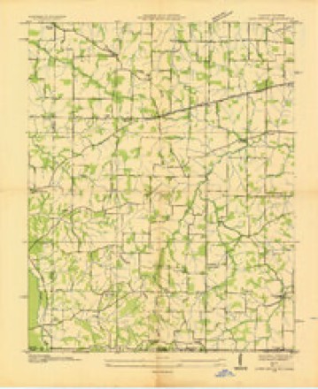
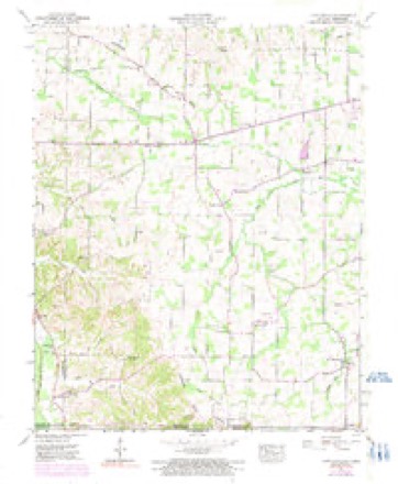
10 topographic sheets cover this place, the earliest surveyed in 1936 and the latest in 1986. It stands in the Hazel-Lynn Grove census division. It lies in ZIP code area 42071. It stands on Williams Creek. The Survey maps it on the Lynn Grove quadrangle. It stands 574 feet above sea level.
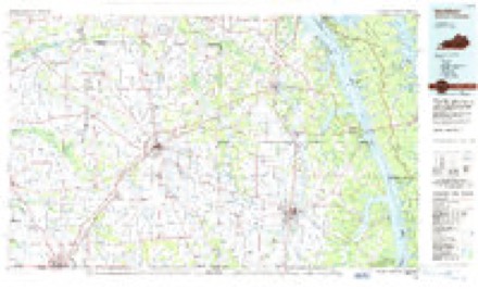
Topographic sheets covering this place
5 surveys from 10 printed sheetsMatched by testing this settlement's coordinate against the published boundary of every sheet in the United States Geological Survey's historical collection. Each opens the scanned sheet at the Survey.
- 1936 USGS Lynn Grove quadrangle1:24000
- 1951 USGS Lynn Grove quadrangle1:24000, 2 printings
- 1951 USGS Murray quadrangle1:62500
- 1956 USGS Dyersburg quadrangle1:250000, 4 printings
- 1986 USGS Murray quadrangle1:100000, 2 printings
Fires near this place
19 since 1997Regional context, not property-specific evidence. The federal wildfire occurrence database lists 19 fires within 5 miles of Lynn Grove between 1997 and 2014, burning about 92 acres in total. None started naturally. None was recorded as arson. Distance is straight-line from the map coordinates, so a fire counted here may appear on a neighbouring settlement's page as well.
| Reported cause | Fires |
|---|---|
| Missing data/not specified/undetermined | 13 |
| Railroad operations and maintenance | 2 |
| Debris and open burning | 2 |
| Recreation and ceremony | 1 |
| Smoking | 1 |
The most recent of them, most recent first, with the day each was reported and the service that recorded it.
| Date | Cause | Size | Reported by | Name on the report |
|---|---|---|---|---|
| 17 September 2008 | Railroad operations and maintenance | 8.0 acres | Kentucky Division of Forestry | not named |
| 11 August 1999 | Debris and open burning | 5.0 acres | Kentucky Division of Forestry | not named |
| 11 April 1998 | Smoking | 1.0 acres | Kentucky Division of Forestry | not named |
| 1 April 2014 | Missing data/not specified/undetermined | 5.0 acres | Kentucky Division of Forestry | HONEY BEE LANE |
| 8 March 2006 | Missing data/not specified/undetermined | 3.0 acres | Kentucky Division of Forestry | not named |
| 3 March 2006 | Missing data/not specified/undetermined | under an acre | Kentucky Division of Forestry | not named |
| 3 March 2006 | Missing data/not specified/undetermined | 4.0 acres | Kentucky Division of Forestry | not named |
| 20 March 2005 | Missing data/not specified/undetermined | under an acre | Kentucky Division of Forestry | not named |
Settlements close enough to share some of these fires:
Mines and quarries near this place
3 within 5 milesRegional context, not property-specific evidence. The federal mineral resources record lists 3 workings within 5 miles of Lynn Grove: 1 producer, 1 prospect, 1 past producer. 1 still produces. What was taken out: Clay, Ball Clay. Distance is straight-line from the map coordinates, so a quarry counted here may appear on a neighbouring settlement's page as well.
| Where | Site | Commodity | Status | Recorded |
|---|---|---|---|---|
| Cooley No. 11 Pit | Ball Clay | Past Producer | ||
| Cook Branch Clay Bed | Clay | Prospect | ||
| Farmington Clay Mine | Clay | Producer |
Storms near this place
26 since 2001Regional context, not property-specific evidence. The National Weather Service names Lynn Grove in 26 storm reports between 2001 and 2025: 12 thunderstorm wind, 7 hail, 4 tornado, 3 flash flood. No death or injury is recorded in these reports. Each account below is quoted exactly as the forecast office filed it, from the NOAA Storm Events Database, and each date opens the federal record of that event.
| When | Event | Place named | Harm | What the report says |
|---|---|---|---|---|
| July 2023 | Flash Flood | Lynn Grove | $500,000 | no account filed |
| April 2011 | Thunderstorm Wind | Lynn Grove | $300,000 | Wind damage occurred across much of Calloway County, mainly across the southern half, including Murray. The county sheriff department estimated 100 trees were down on roads and power lines. At least three houses were damaged by falling trees. A large tree fell on several vehicles near the Murray State University campus, damaging or destroying four of them. On the Murray State University campus, the roof of a paint shop was extensively damaged, numerous tree limbs were down, and a fence was down. A metal roof was blown off a horse barn. The greatest concentration of damage was in the southeast corner of the county. Wind speeds were measured from 60 to 62 mph at three places on the west side of the county. Based on damage reports, even higher wind speeds occurred in the southeast part of the county. |
| December 2021 | Tornado (EF1) | Lynn Grove | $225,000 | The tornado continued into Calloway County from Graves County. Trees were snapped or uprooted. Near the end of the damage track, a tree landed on a house. Many large tree branches were down. Three large pole barns were destroyed, and structural damage occurred to nearby houses, including roof damage. Vehicles were damaged. The tornado track ended only a few miles southwest of Murray. Peak winds in the Calloway County portion of the tornado were estimated near 100 mph. |
| January 2008 | Thunderstorm Wind | Lynn Grove | $100,000 | Numerous trees and large limbs were down near the Murray State University campus. A wind gust to 62 mph was measured at the Calloway County airport. A metal shed was blown over at Dexter. Highway 94 was blocked for three to four hours by trees. One building at a seed company on Highway 299 was destroyed. Numerous trees were blown down in the southeast part of the county. A barn was blown down near Browns Grove. A number of trees and power lines were down across the county. Shingles were blown off buildings. |
| May 2024 | Tornado (EF1) | Lynn Grove | $80,000 | An EF-1 tornado began just west of Lynn Grove near the Graves/Calloway County line. Concentrated tree damage was evident in Lynn Grove. Several buildings sustained minor roof damage from wind and significant damage from falling trees. A very narrow path then continued southeastward between Wiswell Rd and KY-94 into far southern Murray. Damage was more sporadic and minor but grew more intense in south Murray with a few healthy tree trunks snapped. Damage then continued more sporadically just south of KY-121. Several wheat fields showed complicated swirl and straight line wind damage patterns along this path. Damage became more intense once again southwest of New Concord before moving across KY-121 and into the Cypress Springs community where several roads were impassable due to fallen trees. The damage then became inaccessible but may have continued to Kentucky Lake. Peak winds with this tornado were estimated at 105 mph. |
| March 2017 | Thunderstorm Wind | Lynn Grove | $70,000 | Power poles were snapped, power lines were down, and several trees were uprooted. |
| February 2019 | Flash Flood | Lynn Grove | $50,000 | Flash flooding of creeks and roads was reported. The flooding occurred in locations that do not typically flood. Highway 893 was flooded near Lynn Grove. Numerous streets were flooded in and near Murray, especially in the vicinity of Bee Creek. A water rescue was conducted where a vehicle stalled out in floodwater north of Murray State University on North 16th Street. A few inches of water entered a residence. Near Kirksey, water was up to the bridge that crosses the west fork of Rock House Creek on Airport Road just south of Highway 464. In the eastern part of the county just north of Hamlin, one home was evacuated due to floodwaters on Highway 732. About 17 to 18 county roads were under water. The storm total rainfall from the Kentucky mesonet site at Murray was 3.66 inches, of which 2.56 inches fell in four hours. |
| May 2020 | Thunderstorm Wind | Lynn Grove | $30,000 | Damaging thunderstorm winds occurred across western Calloway County, as far east as Murray. Near the Graves County line near Lynn Grove, a tree landed on a residence. A few miles south-southwest of Murray, the roof was peeled back from a horse barn. Several trees were blown down just west of Murray along Routes 94 and 464. A couple of trees were uprooted in Murray. |
| January 2013 | Tornado (EF0) | Lynn Grove | $25,000 | Several outbuildings were damaged or destroyed. A dog kennel was picked up and destroyed. Several shallow-rooted trees were uprooted, and one tree was snapped. A carport was destroyed. There was minor roof damage to some homes, mostly shingles blown off. Porch columns on a home were shifted. There was light damage to a total of nine homes along State Route 94. Two car windows were broken by falling tree limbs. A power pole was snapped at the intersection of Highways 94 and 783. The average path width was 50 yards. Peak winds were estimated near 80 mph. |
| May 2013 | Thunderstorm Wind | Lynn Grove | $18,000 | A tree was on a power line west of U.S. Highway 641. Another tree was blown down across Kentucky 94 west of Murray, causing an accident with injuries. A few other trees were blown across roadways. |
| July 2023 | Thunderstorm Wind | Lynn Grove | $15,000 | A tool shed was damaged. Multiple trees were blown down. There was minor damage to porch decking on a home. A trained spotter estimated winds gusted to 60 mph outside the core of a probable microburst. |
| August 2007 | Thunderstorm Wind | Lynn Grove | $15,000 | A small tobacco barn was blown into the middle of a county road. Part of the roof was blown off a nearby home, allowing water to damage the interior. Several trees were blown down. |
| March 2022 | Thunderstorm Wind | Lynn Grove | $6,000 | Trees were blown down on county roads at least a few times across the county. The locations included the Lynn Grove area, a few miles southeast of Murray, and seven miles northwest of Hamlin. |
| July 2016 | Thunderstorm Wind | Lynn Grove | $5,000 | Large trees were down a few miles east-northeast of Lynn Grove. In Murray, the public estimated the wind gusted to 70 mph. |
| September 2001 | Thunderstorm Wind | Lynn Grove | $4,000 | Trees were downed across 11 county roads in the Lynn Grove area. |
| February 2025 | Flash Flood | Lynn Grove | - | Water covered a portion of Highway 94 between Murray and Lynn Grove. |
| July 2023 | Thunderstorm Wind | Lynn Grove | - | A tree was down on a secondary road. |
| March 2017 | Thunderstorm Wind | Lynn Grove | - | Several large branches were broken along the Graves County line. This damage was associated with the storm that produced the EF-2 tornado near Cuba in Graves County. |
| April 2009 | Hail | Lynn Grove | - | Nickel-size hail fell at Lynn Grove. Penny-size hail fell near Murray State University. |
| August 2003 | Tornado (F0) | Lynn Grove | - | Numerous trees were blown down, including one that fell on a house. |
| April 2020 | Hail | Lynn Grove | - | no account filed |
| May 2012 | Hail | Lynn Grove | - | no account filed |
| January 2012 | Hail | Lynn Grove | - | no account filed |
| February 2008 | Hail | Lynn Grove | - | no account filed |
| May 2007 | Hail | Lynn Grove | - | no account filed |
| March 2002 | Hail | Lynn Grove | - | no account filed |
Nearest settlements
The eight closest, with where each one stands in the county. Distances are straight-line, computed from the Geographic Names Information System coordinates.
| Map | Place | Distance | Sheets |
|---|---|---|---|
| Harris Grove | 1.4 miles | 10 | |
| Wiswell | 2.7 miles | 10 | |
| Protemus | 3.3 miles | 10 | |
| Stella | 4.2 miles | 11 | |
| Coldwater | 4.4 miles | 11 | |
| Bakers Crossroads | 5.0 miles | 13 | |
| West Murray | 5.2 miles | 13 | |
| Penny | 5.7 miles | 12 |
Elsewhere
Matched on this settlement's Geographic Names Information System number rather than its name, so it cannot be a different place of the same name in another state.
| Wikipedia article on Lynn Grove | An encyclopaedic summary. Its text is share-alike, so it is linked here rather than copied. |
| Wikidata item Q16894405 | The structured record the population and elevation above come from. Public domain (CC0). |
Provenance
This settlement is recorded in the Geographic Names Information System as feature 497381. The sheet list is computed by point-in-boundary test against the United States Geological Survey's historical topographic inventory. Both are works of the United States government and carry no copyright under 17 U.S.C. 105.
Wildfire. Short, Karen C. 2022. Spatial wildfire occurrence data for the United States, 1992-2020 [FPA_FOD_20221014]. 6th Edition. Fort Collins, CO: Forest Service Research Data Archive. https://doi.org/10.2737/RDS-2013-0009.6 Collected with United States Government funding and usable without additional permissions or fees.
Mines and quarries. USGS Mineral Resources Data System (MRDS) https://mrdata.usgs.gov/mrds/ A work of the United States government, no copyright under 17 U.S.C. 105.
Storms. NOAA National Centers for Environmental Information, Storm Events Database https://www.ncei.noaa.gov/stormevents/ A work of the United States government, no copyright under 17 U.S.C. 105. Narratives are quoted verbatim from the National Weather Service report and are not edited or summarised.