 Block
From the record
18 National Register listings published here.
Sources: the National Register database, National Park Service
48 topographic sheets and 6 fire insurance atlases across 1 place.
18 National Register listings published here.
Sources: the National Register database, National Park Service
Every property in this county listed on the National Register of Historic Places, with the year it was listed and the federal nomination document.
| Photograph | Property | Type | Listed | Reference |
|---|---|---|---|---|
 | Calloway County Courthouse | building | 1986 | 86000287 |
| Central Hazel Historic District | district | 2024 | 100007810 | |
| Confederate Monument in Murray | object | 1997 | 97000711 | |
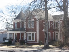 | Edwin S. Diuguid House | building | 1976 | 76000855 |
 | First Baptist Church | building | 1986 | 86000289 |
 | First Christian Church | building | 1986 | 86000292 |
| Fort Heiman Site | site | 1976 | 76000856 | |
 | Will Linn House | building | 1980 | 80001491 |
| Main Street Historic District | district | 1986 | 86000294 | |
| Murray Commercial Historic District | district | 2003 | 02001464 | |
| Murray State University Historic Buildings | district | 1978 | 78001307 | |
| Murray State University Historic Buildings, Addition: Main Library | building | 1983 | 83002593 | |
 | Murray Woman's Club Clubhouse, The | building | 2011 | 11000792 |
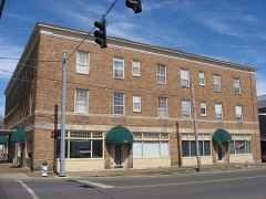 | National Hotel | building | 1986 | 86000298 |
 | Old Normal School Building | building | 1975 | 75000740 |
| Seclusaval | building | 1975 | 75000741 | |
| W.G. Swann Tobacco Company | building | 2015 | 15000647 | |
 | US Post Office-Murray | building | 1986 | 86000296 |
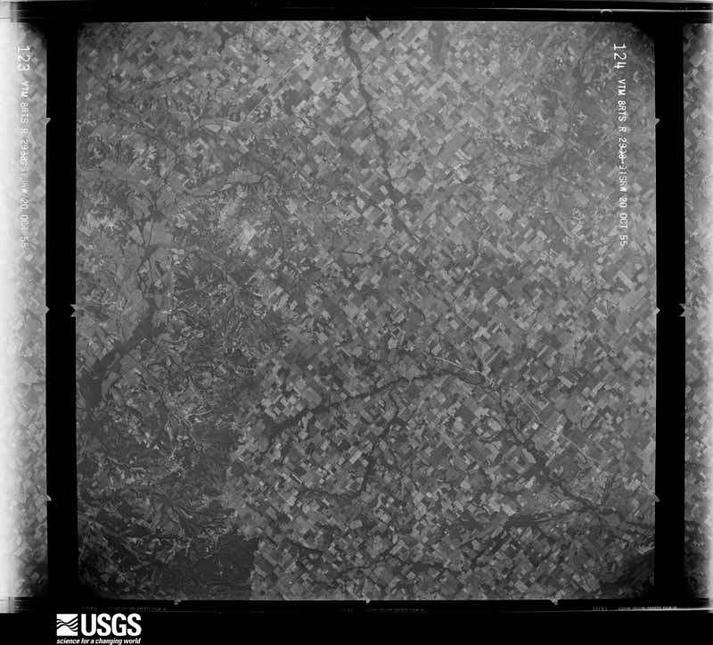
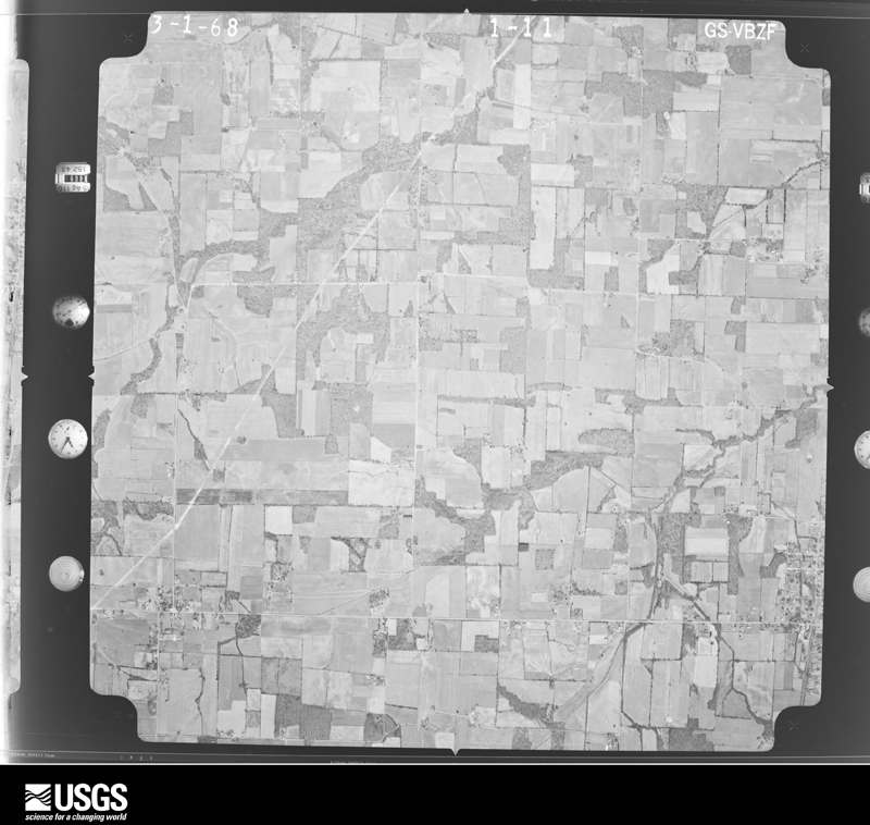
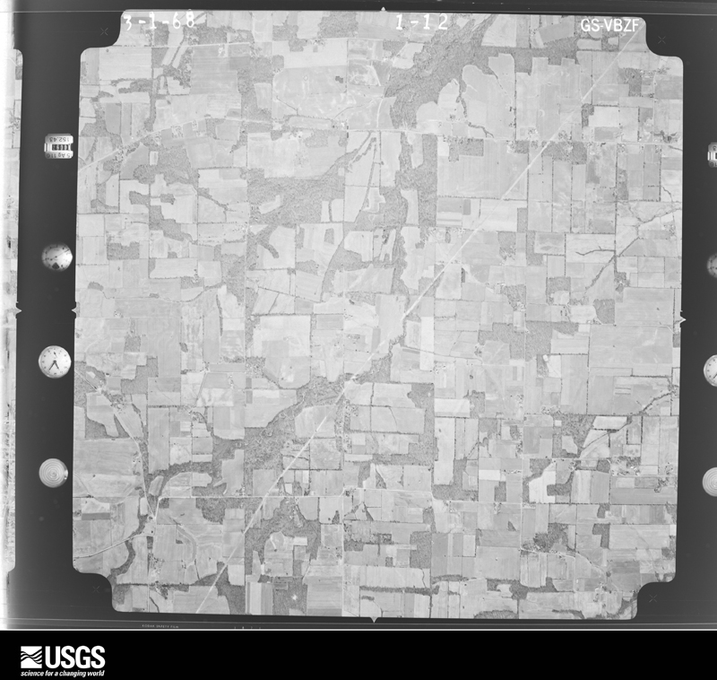
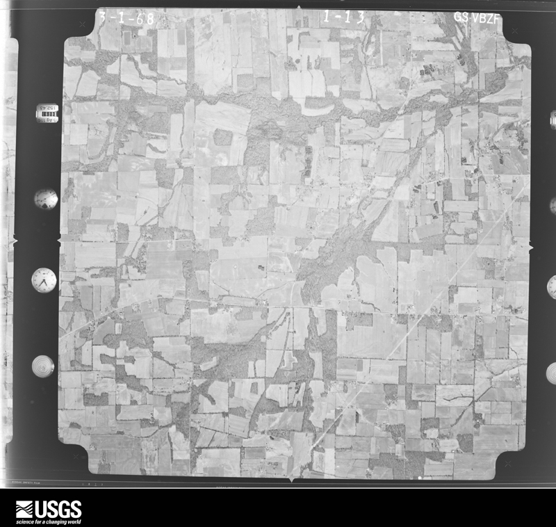
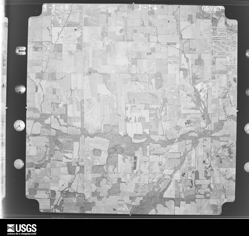
Flown by the U.S. Geological Survey between 1937 and 1989, the Aerial Photo Single Frames collection is the definitive mid-century view of the land: fields, roads and rivers as the camera saw them. The Survey holds 196 frames inside the rectangle that bounds this county; the 14 frames below were taken over the county itself, chosen across the decades of flights (at most four a year from that rectangle), so one flight cannot crowd out the rest. The full set is free to browse and download at EarthExplorer under the dataset Aerial Photo Single Frames.









The thermometers that kept this county's weather, and the gages that measured the flow of its streams, as the federal records hold them. The extremes below are measured values from those records, not estimates.
Who lived here in 1950, one enumeration district at a time, as the Census Bureau described each district. Each row opens its official National Archives result, with Population Schedules and ED Maps available there.
Every wildfire the federal occurrence database records inside this county: 136 of them, burning about 674 acres. 1 started naturally and none was recorded as arson. Each settlement page carries the fires within five miles of it.
| Reported cause | Fires |
|---|---|
| Missing data/not specified/undetermined | 68 |
| Recreation and ceremony | 33 |
| Debris and open burning | 11 |
| Smoking | 10 |
| Railroad operations and maintenance | 9 |
| Misuse of fire by a minor | 3 |
| Natural | 1 |
| Equipment and vehicle use | 1 |
The five largest, by the area the report gives. None of them was recorded as arson.
| Date | Cause | Size | Reported by | Name on the report |
|---|---|---|---|---|
| 12 April 1998 | Debris and open burning | 100 acres | Kentucky Division of Forestry | not named |
| 4 August 2007 | Railroad operations and maintenance | 70 acres | Kentucky Division of Forestry | not named |
| 23 January 2009 | Recreation and ceremony | 25 acres | Kentucky Division of Forestry | not named |
| 30 October 1999 | Smoking | 25 acres | Kentucky Division of Forestry | not named |
| 26 February 2005 | Missing data/not specified/undetermined | 23 acres | Kentucky Division of Forestry | not named |
| 24 January 2005 | Missing data/not specified/undetermined | 20 acres | Kentucky Division of Forestry | not named |
| 22 February 2002 | Recreation and ceremony | 15 acres | Kentucky Division of Forestry | not named |
| 2 November 2003 | Missing data/not specified/undetermined | 15 acres | Kentucky Division of Forestry | not named |
Every settlement page carries the fires within five miles of it - see the settlement index below.
The NOAA Storm Events Database holds 464 reports for this county, causing 2 deaths, 42 injuries and about $18,474,500 in recorded property damage. Each settlement page carries the reports that name it.
| Kind of event | Reports |
|---|---|
| Thunderstorm Wind | 191 |
| Hail | 106 |
| Flash Flood | 61 |
| Tornado | 43 |
| Flood | 27 |
| Heavy Rain | 24 |
| Funnel Cloud | 7 |
| Lightning | 5 |
The most serious of them, by death, then injury, then recorded damage. The accounts are quoted exactly as the forecast office filed them.
| When | Event | Place named | Harm | What the report says |
|---|---|---|---|---|
| April 1968 | Tornado (F4) | not stated | 1 killed, 15 hurt, $2,500,000 | no account filed |
| June 2019 | Lightning | Murray | 1 killed | Eyewitnesses observed lightning strike next to a woman on the campus of Murray State University. The 50-year-old woman immediately collapsed. CPR was administered, and she died shortly thereafter at a Tennessee hospital. |
| March 1964 | Tornado (F4) | not stated | 8 hurt, $250,000 | no account filed |
| November 2001 | Tornado (F2) | Hazel | 4 hurt, $750,000 | A total of 45 to 50 structures were damaged or destroyed. The tornado, which tore through rural farm country, first touched down about one quarter mile inside the Tennessee state line. It moved north-northeast, directly impacting the small community of Harris Grove. The damage path ended 2 miles east of Stella, just after the tornado crossed Kentucky Highway 121. Maximum winds in the tornado were estimated at 130 MPH. The breakdown of structural damage included: Two destroyed houses, two destroyed mobile homes, two destroyed car garages, ten destroyed barns, twelve damaged homes, seven damaged mobile homes, and fourteen damaged barns. A tobacco barn, still containing its crop, was blown onto Kentucky Highway 94 west of Murray. Two of the most seriously injured, who required hospitalization for cuts and bruises, were in mobile homes. The other two injured persons were treated and released. Four mobile home residents were trapped by fallen trees and were rescued by emergency personnel. |
| May 2000 | Tornado (F2) | Midway | 4 hurt, $250,000 | The peak intensity of the tornado was rated F-2, with estimated maximum winds near 125 MPH. Although the tornado was only on the ground for a mile or two, it struck the small community of Midway directly, causing extensive damage. Two mobile homes housing migrant workers were destroyed. One of the persons in a mobile home was seriously injured. Three others sustained relatively minor injuries. A used car dealership and a grocery store sustained major damage to roofs and walls. Several additional homes, mobile homes, and barns received moderate to major damage. Numerous trees in the area were downed or uprooted. U.S. Highway 641 was closed for about 18 hours south of Murray due to debris and power lines across the road. The owner of the grocery and an attached home estimated his losses at just under 100,000 dollars. |
| December 2007 | Flood | Copeland | 4 hurt, $10,000 | Rescue personnel were called to assist an SUV that was trapped in floodwaters at the Clarks River bridge on Martins Chapel Road. As the rescue personnel arrived in their own SUV, their own vehicle was swept down the river and overturned. Everybody was eventually rescued without any serious injuries. The four occupants of both vehicles were taken to a local hospital for treatment. Elsewhere in the county, water was over a few roads. |
| March 1979 | Tornado (F1) | not stated | 2 hurt, $250,000 | no account filed |
| November 1973 | Tornado (F1) | not stated | 2 hurt, $250,000 | no account filed |
| March 2008 | Flood | Almo | 1 hurt, $20,000 | Due to flooding of the Clarks River, several roads were underwater. A car drove into the floodwaters near Almo. The vehicle stalled and then floated about 100 yards before stopping in a ditch. The woman driver was rescued from her vehicle by a state trooper, who found her waist deep in water. She was clinging to the top of her car door with her feet dangling. The water was several feet deep. The trooper was just tall enough to wade through the water, then help her to safety. The woman was treated for hypothermia at a local hospital. Another water rescue occurred shortly afterward, when teenagers tried to cross a flooded section of highway in another area of the county. |
| June 2018 | Thunderstorm Wind | Murray | 1 hurt, $16,000 | A few miles northwest of Murray, one person was injured when a tree fell on a moving car. A tree was down across a secondary road west of Murray. |
| May 2024 | Thunderstorm Wind | Van Cleave | 1 hurt, $15,000 | A man was injured when thunderstorm winds caused a tree to fall on his vehicle on Rockwood Rd. |
| February 2021 | Flash Flood | Pottertown | $2,900,000 | Considerable flash flooding occurred in Murray and the nearby surrounding area. Numerous roads were flooded, including main thoroughfares such as U.S. Highway 641 and Highway 80. Water entered homes and businesses. Creeks such as Ledbetter Creek were well out of their banks. Brookfield Lane in Murray was completely submerged, with deep water in some areas. Some cars were halfway submerged on the Kentucky 121 bypass close to the CSFB Center. Part of Baily Road was washed away. Many roads were still flooded in the evening due to the ongoing rain. Storm total rainfall was 5.05 inches at Murray. Specific damage figures for the City of Murray include: 2 locations with road or culvert damage and at least 6 businesses flooded. There were some flooded homes but none that were evacuated by emergency services. The figures for Calloway County outside Murray include: at least 91 locations with road or culvert damage and an unspecified number of flooded residences. No evacuations were conducted by emergency services. |
| April 2011 | Thunderstorm Wind | Murray | $2,000,000 | A Kentucky mesonet site measured a wind gust to 101 mph. A number of buildings were damaged, and an industrial warehouse was destroyed. Half the roof was torn off an auto parts store. There was extensive damage to trees and power lines in the city of Murray. Some trees were down on houses. Power poles were down. Roads were blocked. An eight-foot section of siding was blown off a manufacturing plant on the north side of Murray. Two rooftop air conditioning units were blown over. Two barns were blown down. City and county schools and Murray State University were cancelled the following day due to widespread power outages and blocked roads. The county emergency operations center was set up for the first time since the January, 2009 ice storm. Veteran utility workers declared that damage exceeded that from the 2009 ice storm. |
| February 2018 | Tornado (EF1) | Murray | $550,000 | This EF-1 tornado crossed the southern part of the city of Murray, damaging about 40 homes. The tornado touched down several blocks west of Highway 641 and lifted on the east edge of the city at the Clarks River floodplain. Most of the damage consisted of roof damage, mainly shingle loss. Two homes were a total loss, with roof decking removed, windows blown out, and part of an exterior wall caved in due to projectile impacts. At least four businesses were damaged, with the majority of the roof removed from one. Dozens of trees were uprooted or broken. The mayor of Murray declared a state of emergency. Peak winds were estimated near 105 mph. |
| June 2009 | Thunderstorm Wind | Murray | $500,000 | An intense microburst carved a damage swath from northwest to southeast across the city of Murray. The damage path was about 3.5 miles long and three-quarters of a mile wide. The damage began on the northwest side of town and ended near Highway 121 just southeast of town. Significant structural damage occurred as a result of peak winds estimated up to 105 mph in a very small area. The vast majority of the damage was from winds of 60 to 80 mph. Damage at Murray State University included a damaged dorm wall and many trees down. Windows were blown out on campus. Debris was blown onto cars in the campus parking lots, damaging vehicles. A batting cage at the college was blown several hundred yards into the parking lot of a bank. An Office Depot store on the north side of town along U.S. Highway 641 sustained minor to moderate roof damage. The roofs of several other buildings, including a Dollar General store, were damaged at a shopping plaza on Highway 641 in town. Much of the roof damage was minor, consisting of cosmetic materials. Debris from stores in the plaza damaged cars in a nearby parking lot. The most significant structural damage occurred to a couple of storage buildings, where roofs were blown off. The door was blown off a movie theater. Numerous trees were blown down in the city, including some that landed on houses. Downed trees and power poles blocked streets, including some major ones. In city parks, batting cages and a baseball dugout were damaged or destroyed. Power lines were down. A couple of empty 15,000-pound semi trailers were overturned. |
| July 2023 | Flash Flood | Lynn Grove | $500,000 | no account filed |
| February 2018 | Tornado (EF1) | Taylors Store | $350,000 | This EF-1 tornado moved from Graves County into Calloway County near State Route 97. The tornado tracked across mainly rural farm country before lifting a few miles southwest of Murray. Most of the path and associated damage was in Calloway County. More than a half dozen barns were damaged or destroyed. A newly built, well-constructed barn was completely destroyed, and debris was strewn hundreds of yards. Two empty grain bins were blown over. Several homes were damaged, mainly due to fallen trees and blowing debris. Two semi trailers were overturned. Two mobile homes were blown from their foundations. Many dozens of trees, some very large, were snapped or uprooted. At least one eyewitness observed the tornado. Peak winds were estimated near 100 mph. |
| May 2003 | Tornado (F2) | Murray | $350,000 | The tornado began along Highway 732 about one quarter mile east of Highway 94. It then moved northeast, roughly parallel to Highway 94, for almost two miles. Six homes received minor to moderate damage. Numerous trees were down, two barns were destroyed, and several others were damaged. Peak winds were estimated near 120 MPH. |
| April 2011 | Thunderstorm Wind | Lynn Grove | $300,000 | Wind damage occurred across much of Calloway County, mainly across the southern half, including Murray. The county sheriff department estimated 100 trees were down on roads and power lines. At least three houses were damaged by falling trees. A large tree fell on several vehicles near the Murray State University campus, damaging or destroying four of them. On the Murray State University campus, the roof of a paint shop was extensively damaged, numerous tree limbs were down, and a fence was down. A metal roof was blown off a horse barn. The greatest concentration of damage was in the southeast corner of the county. Wind speeds were measured from 60 to 62 mph at three places on the west side of the county. Based on damage reports, even higher wind speeds occurred in the southeast part of the county. |
| October 2013 | Thunderstorm Wind | Faxon | $250,000 | A large boat dock, two fishing boats, and two pontoon boats were lifted and flipped upside down into the lake. |
| April 2009 | Thunderstorm Wind | Almo | $250,000 | This microburst was about 100 yards wide. Dozens of houses sustained shingle and minor siding damage. An uninhabited mobile home was blown over and destroyed. The mobile home was strapped down securely. Half a dozen barns sustained roof damage. A propane tank was moved. A few trees and power lines were blown down. An EF0 tornado occurred in the vicinity of this microburst. |
| March 2005 | Thunderstorm Wind | New Concord | $250,000 | Extensive wind damage occurred at three resorts near the shore of Kentucky Lake in extreme southeast Calloway County. The resorts were mainly recreational vehicle trailer parks. At one resort containing about 100 trailers, about 25 trailers were damaged. The damage was primarily due to falling trees. Some damage was due to carports and tool sheds striking trailers. Two trailers were knocked off their block foundations. At a second resort, dock roofs were blown a distance of about 100 yards. Three boats were adrift. A marine anemometer recorded a wind gust to 80 MPH. Amateur radio operators reported a gust to 60 MPH at nearby Fort Heiman and a gust to 65 MPH at Hamlin. Trees and power lines were blown down. At least two dozen trees blocked roads. |
| April 1982 | Tornado (F1) | not stated | $250,000 | no account filed |
| February 1979 | Tornado (F1) | not stated | $250,000 | no account filed |
| December 2021 | Tornado (EF1) | Lynn Grove | $225,000 | The tornado continued into Calloway County from Graves County. Trees were snapped or uprooted. Near the end of the damage track, a tree landed on a house. Many large tree branches were down. Three large pole barns were destroyed, and structural damage occurred to nearby houses, including roof damage. Vehicles were damaged. The tornado track ended only a few miles southwest of Murray. Peak winds in the Calloway County portion of the tornado were estimated near 100 mph. |
| April 2009 | Tornado (EF0) | Almo | $200,000 | Shingles and siding were blown off several homes. There was light structural damage. Several storage buildings were destroyed. Dozens of trees were uprooted or snapped. At least two witnesses reported seeing a funnel cloud briefly dip to the ground and lift back up. Peak winds were estimated near 85 mph. |
| April 2023 | Tornado (EF0) | Stella | $100,000 | Several homes sustained shingle damage. One garage slid off its foundation. Several trees were snapped or uprooted. There was roof damage and windows were blown in at a commercial site. The most significant damage occurred along Poor Farm Road. Peak winds were estimated near 85 mph. |
| June 2021 | Flash Flood | Dexter | $100,000 | Numerous rural county roads were either flooded or completely washed out from near Almo to Dexter and surrounding areas. |
| June 2017 | Flash Flood | Coldwater | $100,000 | Several roads across the northwest part of the county were flooded and closed, including Kentucky Highway 299. Kentucky Highway 783 was closed due to a washout. Flash flooding of the north fork of Duncan Creek impacted a residence just east of Kentucky Highway 299. Floodwaters rose rapidly toward the residence, prompting a response from the emergency management agency. A barn was submerged in three feet of water from the creek. A high water rescue was conducted on a county road west of U.S. Highway 641 due to a vehicle that was driven into floodwaters. A couple miles northwest of Almo, multiple people were trapped in a vehicle caught in a flooded creek. A water rescue was conducted. A trained spotter a few miles southwest of Hardin measured 4.75 inches of rain. |
| June 2014 | Thunderstorm Wind | Murray | $100,000 | The macroburst containing winds estimated near 95 mph continued east-southeast across the Murray area, passing mainly north and east of the city. The three-mile wide damage area in eastern parts of the county was mainly along and just south of Highway 94. Numerous large trees were snapped and uprooted, causing widespread power outages lasting 6 to 12 hours on average. Numerous roads were blocked by downed trees. At least one house was damaged by a falling tree. A resident of the house was trapped for a short time. Two houses appeared to be uninhabitable based on emergency management reports. Several barns and a garage were destroyed. A porch was ripped off a home. Scores of homes received minor roof damage. Siding was damaged on at least one house. The damage area appeared to end in eastern Calloway County, about five miles north of New Concord. |
| June 2014 | Thunderstorm Wind | Coldwater | $100,000 | A macroburst containing winds estimated near 95 mph entered western Calloway County from Graves County. The three-mile wide damage area was roughly parallel to Highway 80. A camper was flipped over. Many homes and a tobacco barn sustained minor roof damage. Hundreds of trees were uprooted, including several along Highway 121 near Coldwater. Widespread power outages lasted for 6 to 12 hours on average. The underpinning of a mobile home was damaged. Much of the damage was along and just south of a line from Kirksey to Almo, including the airport area. The damage area continued east-southeast across the city of Murray. |
| July 2013 | Thunderstorm Wind | Kirksey | $100,000 | A microburst centered in the southwest part of Kirksey affected an area about 1.5 miles wide. About two dozen structures were damaged, and about 50 trees were blown down. Trees landed across roads and houses. Small sections of roof decking were blown off a few structures. At least two windows were blown out. Estimated peak winds based on damage photos were 95 mph. |
| January 2008 | Thunderstorm Wind | Lynn Grove | $100,000 | Numerous trees and large limbs were down near the Murray State University campus. A wind gust to 62 mph was measured at the Calloway County airport. A metal shed was blown over at Dexter. Highway 94 was blocked for three to four hours by trees. One building at a seed company on Highway 299 was destroyed. Numerous trees were blown down in the southeast part of the county. A barn was blown down near Browns Grove. A number of trees and power lines were down across the county. Shingles were blown off buildings. |
| July 1999 | Tornado (F1) | Murray | $100,000 | The tornado formed along U.S. Highway 641 about 5 miles south of Murray and tracked east into the New Concord area. The tornado was rated F-1 intensity with top winds near 110 MPH. Numerous trees were uprooted or snapped off along the path of the tornado. Some of the trees fell on utility lines, vehicles, and buildings. The area was sparsely populated, so damage was relatively light considering the path length and width. At least a dozen or so homes received some damage, mostly light roof or siding damage. There was moderate damage to at least a couple homes. Several barns were damaged. At one residence, a porch was damaged, along with other items such as a television antenna, fence, and swimming pool. Sheet metal from a barn was blown into treetops. |
| May 1995 | Hail | SE Murray | $100,000 | Windows were broken and cars were dented by hail slightly larger than golf balls. |
| March 1997 | Flash Flood | Murray | $100,000 | no account filed |
| May 2011 | Thunderstorm Wind | Stella | $90,000 | Hundreds of trees and limbs were blown down, mostly uprooted. Some trees were snapped ten feet off the ground. A portion of Highway 121 was impassable for several hours due to downed limbs and power poles. Some power lines were down across a semi on the road. A tree landed on a mobile home, destroying it. Large shop doors were caved in near Penny. |
| May 2024 | Tornado (EF1) | Lynn Grove | $80,000 | An EF-1 tornado began just west of Lynn Grove near the Graves/Calloway County line. Concentrated tree damage was evident in Lynn Grove. Several buildings sustained minor roof damage from wind and significant damage from falling trees. A very narrow path then continued southeastward between Wiswell Rd and KY-94 into far southern Murray. Damage was more sporadic and minor but grew more intense in south Murray with a few healthy tree trunks snapped. Damage then continued more sporadically just south of KY-121. Several wheat fields showed complicated swirl and straight line wind damage patterns along this path. Damage became more intense once again southwest of New Concord before moving across KY-121 and into the Cypress Springs community where several roads were impassable due to fallen trees. The damage then became inaccessible but may have continued to Kentucky Lake. Peak winds with this tornado were estimated at 105 mph. |
| April 2011 | Tornado (EF0) | Wadesboro | $80,000 | A brief touchdown occurred, with numerous trees snapped or uprooted. There were varying degrees of roof damage to a few buildings. One metal-framed building was crushed. Peak winds were estimated near 70 mph. The average path width was 150 yards. |
| September 1998 | Flash Flood | Murray | $80,000 | Slow-moving thunderstorms dumped around 4 inches of rain in a couple hours at Murray. Street and low-lying flooding was widespread. Cars were stranded in flooded intersections, and several homes were flooded. |
| May 1995 | Thunderstorm Wind | Murray | $80,000 | A roof was blown off a house, and a mobile home was heavily damaged. A sign and window were blown out of a supermarket. Numerous trees and power lines were blown down. |
| May 2025 | Thunderstorm Wind | Murray | $75,000 | A tree was uprooted and fell onto a manufactured home at Pine Street and 1st Street in Murray. At the time, flood waters were 8 inches deep in the main floor of the home. The saturated soil likely made it easier for the tree to be uprooted. The home was essentially destroyed. |
| August 2021 | Flash Flood | Midway | $75,000 | Highway 121 south of New Concord was closed due to flooding. In the New Concord area, a bridge on Highway 280 at Panther Creek was closed due to pavement washed away. Rainfall reports of up to 7 inches were received from this event in Calloway County. A co-operative observer in Murray measured a storm total rainfall of 3.45 inches over the past 24 hours. |
| March 2017 | Tornado (EF1) | Murray | $75,000 | Peak winds were estimated near 95 mph. The path began in the southwest part of Murray and followed Highway 121 to about four miles southeast of Murray. Dugout roofs at the city high school ballfield in Murray were blown across the street into a home and car. Numerous very large trees were snapped and uprooted. About three miles outside the city limits of Murray, barns and outbuildings were heavily damaged. Most of the path was high-end EF-0 strength. Near the end of the path, the tornado intensified to EF-1. This is the area where a large section of roof and some trusses were blown off a well-built metal barn, and plastic projectiles were hurled through a garage wall. A building was destroyed by uprooted trees that fell on top of it. |
| January 2008 | Thunderstorm Wind | Coldwater | $75,000 | Significant damage occurred to a few houses in a small subdivision along Kentucky 121 near the Graves County line. Windows were blown in, and a set of stairs was blown onto a porch. A nearby shop of block construction on Route 121 was blown down. The roof was blown into the yard, and a nearby vehicle was heavily damaged. The roof was slightly displaced from a nearby house. A barn was destroyed, and trees were uprooted and snapped. |
| July 2001 | Flash Flood | Countywide | $75,000 | no account filed |
| March 2017 | Thunderstorm Wind | Lynn Grove | $70,000 | Power poles were snapped, power lines were down, and several trees were uprooted. |
| July 2009 | Thunderstorm Wind | Stella | $70,000 | A swath of downed tree limbs extended from about 5 miles west of Murray into the city of Murray. Many large limbs were down on Highway 783 just south of Stella, and aluminum trim was blown off a house. Six-inch diameter tree limbs were down a mile west of Murray, and a large tree was down across power lines. Wind gusts were measured up to 70 mph in Murray, where a roof was blown off a building. A number of trees were down in Murray. There were over 30 reports of trees landing across roads in Calloway County. |
| July 1997 | Thunderstorm Wind | Almo | $70,000 | Trees and power lines were down across the north part of the county. Trees up to 4 feet in diameter were down in Murray, blocking several city streeets. High winds caused damage to several businesses along U.S. Highway 641. Three vehicles were heavily damaged by a falling tree on the campus of Murray State University. A few windows were broken and a roof was slightly damaged on the college campus. |
| July 2024 | Thunderstorm Wind | Wadesboro | $65,000 | As a thunderstorm drifted northward in Calloway County, a roof was completely blown off of a concrete building on Ingram Lane. A residence on Crestview Ln had substantial tree damage. A pole barn was destroyed west of Dexter. A utility company reported several trees down across central and northern Calloway County with over 1,200 without power. |
| May 2021 | Thunderstorm Wind | Hazel | $60,000 | A microburst over five miles long and about one mile wide caused extensive damage along the Tennessee border near Hazel. Peak winds were estimated near 95 mph. Numerous trees were blown down, including at least two trees that landed on houses. Several trees were down on U.S. Highway 641. |
| October 2007 | Tornado (EF1) | Murray | $60,000 | Hundreds of trees were snapped and uprooted. One home received major roof damage, primarily from falling trees. Roads were blocked by downed trees. The average path width was 150 yards. Peak winds were estimated near 95 mph. The tornado path ended at the shore of Kentucky Lake. |
| February 2019 | Flash Flood | Lynn Grove | $50,000 | Flash flooding of creeks and roads was reported. The flooding occurred in locations that do not typically flood. Highway 893 was flooded near Lynn Grove. Numerous streets were flooded in and near Murray, especially in the vicinity of Bee Creek. A water rescue was conducted where a vehicle stalled out in floodwater north of Murray State University on North 16th Street. A few inches of water entered a residence. Near Kirksey, water was up to the bridge that crosses the west fork of Rock House Creek on Airport Road just south of Highway 464. In the eastern part of the county just north of Hamlin, one home was evacuated due to floodwaters on Highway 732. About 17 to 18 county roads were under water. The storm total rainfall from the Kentucky mesonet site at Murray was 3.66 inches, of which 2.56 inches fell in four hours. |
| December 2013 | Thunderstorm Wind | Almo | $50,000 | Several trees were blown down and power poles were snapped. The area of spotty damage extended from U.S. Highway 641 north of Murray to Highway 783 west-southwest of Murray. On U.S. Highway 641 a few miles north of Murray, a trampoline was blown into the middle of the road. Construction barrels were blown over. The peak wind gust at the Murray/Calloway County airport was 67 mph. |
| January 2012 | Tornado (EF1) | Hazel | $50,000 | Peak winds were estimated near 95 mph. Hundreds of trees were uprooted or snapped. Windows were blown out of a house, and shingles were damaged. Shutters were ripped off the house. Three barns were destroyed. Two garages were levelled. A section of roof was peeled off another garage. The porch roof of a business in Hazel was destroyed. A large tree fell across a truck. |
| May 2011 | Tornado (EF0) | New Concord | $50,000 | About a dozen trees and several tree tops were snapped. One car was completely destroyed by a large fallen tree. Mostly minor damage occurred to a couple of homes or garages. At least one power line was downed. Peak wind speeds were estimated near 85 mph. |
| January 2006 | Thunderstorm Wind | Murray | $50,000 | Severe thunderstorm winds downed tree limbs, demolished outbuildings and a well house, and overturned a trailer. Shingles were ripped off the roof of a house. A small boat was damaged. |
| May 2006 | Flash Flood | Dexter | $50,000 | Flash flooding prompted the evacuations of at least two families. A house trailer was flooded on Kentucky 1483 just northeast of Murray. Another house was flooded up to the front door. Several roads were under water. A few motorists were swept into ditches. The county rescue squad received at least 15 requests for assistance from people stranded in their homes or vehicles. Water was over the road in several locations along Highway 280 east of Murray. The flooding forced the closure of parts of Kentucky 280 between Highway 94 and Panorama Shores. Flooded vehicles and homes were reported along Kentucky 280. Two to three inches of flowing water was across roads near Dexter. Some private lanes were washed out in the same area. An unofficial rainfall measurement of four inches was reported by a member of the county fire and rescue squad. |
| August 2005 | Thunderstorm Wind | Murray | $50,000 | The most concentrated damage was along and a couple miles either side of Highway 121, where trees were blown down onto houses and power lines. Some houses received shingle and vinyl damage. Debris and tree limbs were blown across Highway 121. The section of Highway 121 most affected was between the community of Stella and Highway 783. As far north as the Kirksey area, some tree and power line damage occurred. One uprooted tree was blown about 25 feet onto a roadway. A field of corn and beans was layed down. Along U.S. Highway 641 several miles north of Murray, several trees were blown down. |
| May 2000 | Tornado (F1) | Almo | $50,000 | A relatively weak F-1 tornado with maximum wind speeds near 80 MPH moved southeast across the "Almo Heights" area. Three houses sustained roof damage, mainly due to trees falling on them. The storm that spawned the tornado displayed excellent supercellular characteristics on radar throughout its path across Calloway County. Videotape of the storm's funnel cloud was shown on local media outlets. The funnel again briefly touched down in eastern Calloway County. |
The Survey's mineral resources record lists 6 workings inside this county. 1 still produces and 5 are closed or unrecorded. Each settlement page carries the workings within five miles of it.
| Commodity | Workings |
|---|---|
| Clay | 5 |
| Sand and Gravel, Construction | 1 |
The least common of them first, because a county's hundredth gravel pit says nothing its first ten did not.
| Where | Site | Commodity | Status | Recorded |
|---|---|---|---|---|
| Murray Mine | Sand and Gravel, Construction | Producer | ||
| Backusburg Clay | Clay | Prospect | ||
| Burton Shale | Clay | Prospect | ||
| Cook Branch Clay Bed | Clay | Prospect | ||
| Kirk Ridge Clay Exposure | Clay | Prospect | ||
| Sugar Creek Clay | Clay | Prospect |
Named settlements recorded in the Geographic Names Information System, each with the topographic sheets covering it. Villages, hamlets and abandoned places alike. Each is shown with the nearest named watercourse or landform and the survey quadrangle it falls on. The 1 place that was also surveyed for fire insurance comes first, with the number of atlases and photographs held for them.
Murray census division · 42071 · On Clayton Creek · Murray quadrangle
13 sheets, 1936 to 1986
Fire insurance: 6 atlases
Kirksey census division · 42020 · On East Fork Rockhouse Creek · Dexter quadrangle
12 sheets, 1936 to 1986
Kirksey census division · 42054 · On Watson Creek · Kirksey quadrangle
11 sheets, 1936 to 1986
Hazel-Lynn Grove census division · 42049 · On Pleasant Grove Creek · Murray quadrangle
13 sheets, 1936 to 1986
Shiloh census division · 42071 · On Bee Creek · Dexter quadrangle
12 sheets, 1936 to 1986
No longer a settlement
Kirksey census division · 42071 · On Muck Branch · Dexter quadrangle
12 sheets, 1936 to 1986
No longer a settlement
Shiloh census division · 42071 · On Little Sugar Creek · Rushing Bay quadrangle
13 sheets, 1936 to 1986
Shiloh census division · 42071 · On Lick Branch · Rushing Bay quadrangle
13 sheets, 1936 to 1986
No longer a settlement
New Concord census division · 42071 · New Concord quadrangle
13 sheets, 1936 to 1986
No longer a settlement
Kirksey census division · 42054 · Kirksey quadrangle
11 sheets, 1936 to 1986
No longer a settlement
Hazel-Lynn Grove census division · 42071 · On Cook Branch · Kirksey quadrangle
11 sheets, 1936 to 1986
New Concord census division · 42049 · Murray quadrangle
13 sheets, 1936 to 1986
No longer a settlement
Kirksey census division · 42036 · On Rockhouse Creek · Dexter quadrangle
12 sheets, 1936 to 1986
Murray census division · 42071 · On Clayton Creek · Murray quadrangle
13 sheets, 1936 to 1986
No longer a settlement
Kirksey census division · 42071 · On East Fork Rockhouse Creek · Dexter quadrangle
12 sheets, 1936 to 1986
No longer a settlement
New Concord census division · 42076 · On Shannon Creek · Hamlin quadrangle
11 sheets, 1936 to 1986
Murray census division · 42071 · On Farley Branch · Murray quadrangle
13 sheets, 1936 to 1986
No longer a settlement
New Concord census division · 42076 · On Boyds Branch · Hamlin quadrangle
11 sheets, 1936 to 1986
Hazel-Lynn Grove census division · 42071 · Lynn Grove quadrangle
10 sheets, 1936 to 1986
Hazel-Lynn Grove census division · 42049 · On Dry Creek · Murray quadrangle
13 sheets, 1936 to 1986
New Concord census division · 42071 · Murray quadrangle
13 sheets, 1936 to 1986
No longer a settlement
Shiloh census division · 42036 · Hico quadrangle
13 sheets, 1936 to 1986
No longer a settlement
Shiloh census division · 42071 · On Little Sugar Creek · Hico quadrangle
13 sheets, 1936 to 1986
Shiloh census division · 42071 · Hico quadrangle
13 sheets, 1936 to 1986
No longer a settlement
Murray census division · 42071 · On Green Creek · Murray quadrangle
13 sheets, 1936 to 1986
No longer a settlement
Shiloh census division · 42071 · On Snipe Creek · Rushing Bay quadrangle
13 sheets, 1936 to 1986
No longer a settlement
Hazel-Lynn Grove census division · 42071 · On Williams Creek · Lynn Grove quadrangle
10 sheets, 1936 to 1986
New Concord census division · 42049 · On Bullfrog Branch · New Concord quadrangle
13 sheets, 1936 to 1986
No longer a settlement
New Concord census division · 42071 · Near Culpepper Hollow · New Concord quadrangle
13 sheets, 1936 to 1986
No longer a settlement
Hazel-Lynn Grove census division · 42049 · On White Oak Creek · Murray quadrangle
13 sheets, 1936 to 1986
New Concord census division · 42076 · Near Egypt Hollow · Hamlin quadrangle
11 sheets, 1936 to 1986
No longer a settlement
New Concord census division · 42076 · By Devils Pulpit · New Concord quadrangle
13 sheets, 1936 to 1986
Murray census division · 42071 · On East Fork Clayton Creek · Murray quadrangle
13 sheets, 1936 to 1986
No longer a settlement
Murray census division · 42071 · On East Fork Clayton Creek · Murray quadrangle
13 sheets, 1936 to 1986
No longer a settlement
Shiloh census division · 42036 · On Burr Branch · Hico quadrangle
13 sheets, 1936 to 1986
No longer a settlement
Kirksey census division · 42020 · On East Fork Rockhouse Creek · Dexter quadrangle
12 sheets, 1936 to 1986
Shiloh census division · 42071 · New Concord quadrangle
13 sheets, 1936 to 1986
No longer a settlement
Shiloh census division · 42071 · On Little Sugar Creek · Hico quadrangle
13 sheets, 1936 to 1986
No longer a settlement
Murray census division · 42071 · On East Fork Clarks River · Murray quadrangle
13 sheets, 1936 to 1986
New Concord census division · 42071 · On Green Creek · Murray quadrangle
13 sheets, 1936 to 1986
No longer a settlement
New Concord census division · 42071 · Murray quadrangle
13 sheets, 1936 to 1986
No longer a settlement
Shiloh census division · 42071 · Near Buzzard Roost · Hico quadrangle
13 sheets, 1936 to 1986
No longer a settlement
Shiloh census division · 42036 · Dexter quadrangle
12 sheets, 1936 to 1986
No longer a settlement
Murray census division · 42071 · Dexter quadrangle
12 sheets, 1936 to 1986
No longer a settlement
Kirksey census division · 42036 · On Muck Branch · Dexter quadrangle
12 sheets, 1936 to 1986
Murray census division · 42071 · On Farley Branch · Murray quadrangle
13 sheets, 1936 to 1986
Hazel-Lynn Grove census division · 42071 · On Jackson Creek · Lynn Grove quadrangle
10 sheets, 1936 to 1986
The vanished settlements of Calloway County: the places named above that are no longer on the map.
13 topographic sheets and 6 fire insurance atlases, 1897 to 1942