 Block
Merrittstown, Kentucky
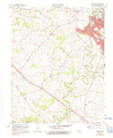
9 topographic sheets cover this place, the earliest surveyed in 1951 and the latest in 1980. It stands in the Hopkinsville census division. It lies in ZIP code area 42240. The Survey maps it on the Church Hill quadrangle.
On record in Merrittstown
Buildings and businesses the archive holds for this place. Each opens its own page, with the source record it came from.
On the National Register within a mile 1 record
The National Register names another town for these. They stand within one mile of this settlement's coordinate.
- Campbell Houselisted 1979 · 0.9 miles away
Topographic sheets covering this place
6 surveys from 9 printed sheetsMatched by testing this settlement's coordinate against the published boundary of every sheet in the United States Geological Survey's historical collection. Each opens the scanned sheet at the Survey.
- 1951 USGS Church Hill quadrangle1:24000
- 1956 USGS Church Hill quadrangle1:24000, 2 printings
- 1956 USGS Nashville quadrangle1:250000, 2 printings
- 1959 USGS Nashville quadrangle1:250000
- 1978 USGS Church Hill quadrangle1:24000, 2 printings
- 1980 USGS Hopkinsville quadrangle1:100000
Fires near this place
4 since 2004Regional context, not property-specific evidence. The federal wildfire occurrence database lists 4 fires within 5 miles of Merrittstown between 2004 and 2010, burning about 85 acres in total. None started naturally. None was recorded as arson. Distance is straight-line from the map coordinates, so a fire counted here may appear on a neighbouring settlement's page as well.
| Reported cause | Fires |
|---|---|
| Recreation and ceremony | 2 |
| Railroad operations and maintenance | 1 |
| Missing data/not specified/undetermined | 1 |
The most recent of them, most recent first, with the day each was reported and the service that recorded it.
| Date | Cause | Size | Reported by | Name on the report |
|---|---|---|---|---|
| 22 September 2004 | Missing data/not specified/undetermined | 5.0 acres | Kentucky Division of Forestry | not named |
| 21 September 2010 | Recreation and ceremony | 45 acres | Kentucky Division of Forestry | QUAIL |
| 24 August 2007 | Railroad operations and maintenance | 10 acres | Kentucky Division of Forestry | not named |
| 16 August 2007 | Recreation and ceremony | 25 acres | Kentucky Division of Forestry | not named |
Settlements close enough to share some of these fires:
Mines and quarries near this place
1 within 5 milesRegional context, not property-specific evidence. The federal mineral resources record lists 1 working within 5 miles of Merrittstown: 1 unknown. None of them still produces. What was taken out: Graphite. Distance is straight-line from the map coordinates, so a quarry counted here may appear on a neighbouring settlement's page as well.
| Where | Site | Commodity | Status | Recorded |
|---|---|---|---|---|
| Superior Graphite/Hopkinsville, Ky. | Graphite | Unknown |
Storms near this place
11 since 2009Regional context, not property-specific evidence. The National Weather Service names Merrittstown in 11 storm reports between 2009 and 2025: 4 thunderstorm wind, 3 tornado, 2 hail, 1 flash flood. No death or injury is recorded in these reports. Each account below is quoted exactly as the forecast office filed it, from the NOAA Storm Events Database, and each date opens the federal record of that event.
| When | Event | Place named | Harm | What the report says |
|---|---|---|---|---|
| October 2010 | Tornado (EF1) | Merrittstown | $100,000 | The tornado touched down west of Hopkinsville along Highway 272, where a metal building was damaged and a couple of small trees were down. In a subdivision on the north side of Highway 272, there were several homes with partial removal of roof shingles. There was damage to gutters and flashing. Numerous trees were uprooted, mainly small trees. Numerous large tree limbs were broken. One house roof was damaged by a falling tree limb. The tornado was videotaped by storm spotters as it moved through the west side of Hopkinsville. A storage warehouse sustained roof damage. A warehouse side structure was ripped away from a building in Hopkinsville. Peak winds were estimated near 85 mph. The average path width was 70 yards. |
| May 2025 | Thunderstorm Wind | Merrittstown | $35,000 | Straight-line winds on the north side of a tornado track blew trees onto multiple homes along Glass Ln. |
| October 2014 | Tornado (EF1) | Merrittstown | $35,000 | This tornado moved east-northeast, roughly paralleling Kentucky Highway 272 on the north side of the highway. The tornado removed half of the roof of a tobacco barn, including some rafters. The only other structure damaged was a volunteer fire station, which had a large portion of its roof blown off. Several large trees were blown down. The damage path was mostly through farm fields. The average path width was 100 yards. Peak winds were estimated near 90 mph. |
| January 2023 | Tornado (EF0) | Merrittstown | $30,000 | A brief weak tornado with estimated peak winds of 85 mph struck the southwest side of Hopkinsville. Most of the damage was in the form of several large, snapped trees. A cinder block garage attached to a home lost its roof. A portion of an adjacent house lost some roofing. A large carport was tossed at least 25 yards into a wooded area. The path of the tornado roughly paralleled Kentucky Route 695 from the U.S. 68 bypass northeast to a residential area neighboring the Hopkinsville high school. |
| July 2012 | Thunderstorm Wind | Merrittstown | $20,000 | About midway between Gracey and Hopkinsville off U.S. Highway 68, two old wooden barns were destroyed. One barn was flattened, and the other barn was pushed over. About ten trees were damaged. The damage was caused by downburst winds from a weakening thunderstorm. |
| March 2025 | Thunderstorm Wind | Merrittstown | $5,000 | A 65 mph gust was measured on the west side of Hopkinsville. A few trees were blown down in Hopkinsville. |
| May 2017 | Thunderstorm Wind | Merrittstown | $1,000 | A few miles west of Hopkinsville, a downed tree blocked Highway 272 near Highway 164. |
| June 2013 | Hail | Merrittstown | - | Dime-size hail was reported on U.S. Highway 68 west of Hopkinsville. |
| March 2012 | Heavy Rain | Merrittstown | - | Rainfall of 2.10 inches caused flooding of low lying areas. |
| May 2009 | Flash Flood | Merrittstown | - | Flooding was reported in several places in Hopkinsville, including spots on Canton Pike, Fort Campbell Boulevard, and West Seventh Street. Water was over at least a few other roads, including one lane of Highway 68/80 East at Western State Hospital. The 24-hour rainfall total from a spotter on the northeast side of Hopkinsville was 3.40 inches. A co-operative observer near Fort Campbell reported 3.82 inches over the same time period. |
| March 2012 | Hail | Merrittstown | - | no account filed |
Nearest settlements
The eight closest, with where each one stands in the county. Distances are straight-line, computed from the Geographic Names Information System coordinates.
| Map | Place | Distance | Sheets |
|---|---|---|---|
| Walnut Grove | 0.7 miles | 9 | |
| Belleview (historical) | 1.6 miles | 9 | |
| Canton Pike | 1.6 miles | 9 | |
| Cox Mill (historical) | 2.3 miles | 9 | |
| Church Hill | 3.0 miles | 9 | |
| Julien | 3.7 miles | 8 | |
| West Brook | 4.3 miles | 9 | |
| Newstead | 4.5 miles | 8 |
Provenance
This settlement is recorded in the Geographic Names Information System as feature 498078. The sheet list is computed by point-in-boundary test against the United States Geological Survey's historical topographic inventory. Both are works of the United States government and carry no copyright under 17 U.S.C. 105.
Wildfire. Short, Karen C. 2022. Spatial wildfire occurrence data for the United States, 1992-2020 [FPA_FOD_20221014]. 6th Edition. Fort Collins, CO: Forest Service Research Data Archive. https://doi.org/10.2737/RDS-2013-0009.6 Collected with United States Government funding and usable without additional permissions or fees.
Mines and quarries. USGS Mineral Resources Data System (MRDS) https://mrdata.usgs.gov/mrds/ A work of the United States government, no copyright under 17 U.S.C. 105.
Storms. NOAA National Centers for Environmental Information, Storm Events Database https://www.ncei.noaa.gov/stormevents/ A work of the United States government, no copyright under 17 U.S.C. 105. Narratives are quoted verbatim from the National Weather Service report and are not edited or summarised.