 Block
Murray, Kentucky
13 topographic sheets cover this place, the earliest surveyed in 1936 and the latest in 1986. It stands in the Murray census division. It lies in ZIP code area 42071. It stands on Clayton Creek. The Survey maps it on the Murray quadrangle. 17,307 people lived here at the 2020 count. It stands 535 feet above sea level.
Research this city
On record in Murray
Buildings and businesses the archive holds for this place. Each opens its own page, with the source record it came from.
On the National Register 12 of 16 shown
 Calloway County Courthouselisted 1986
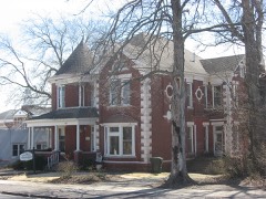 Edwin S. Diuguid Houselisted 1976
 First Baptist Churchlisted 1986
 First Christian Churchlisted 1986
 Will Linn Houselisted 1980
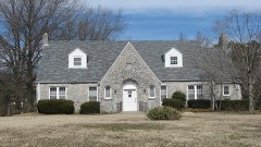 Murray Woman's Club Clubhouse, Thelisted 2011
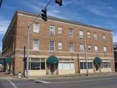 National Hotellisted 1986
 Old Normal School Buildinglisted 1975
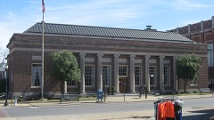 US Post Office-Murraylisted 1986
- Confederate Monument in Murraylisted 1997
- Main Street Historic Districtlisted 1986
- Murray Commercial Historic Districtlisted 2003
Population over time
3 figuresMurray grew from 218 to 17,307 between 1860 and 2020. These are the recorded population figures Wikidata holds for this place, reached through the Geographic Names Information System number this page is keyed on rather than by name, so they belong to this place and not to another of the same name. Most are census counts, but not all are: an early figure may be a founding or settlement estimate, and an estimate published within five years of a census is left out. The change column is computed, and is left blank where more than 20 years separate a figure from the one before it, because a gap that long is not a change between two counts.
| Year | People | Change |
|---|---|---|
| 1860 | 218 | |
| 2010 | 17,741 | |
| 2020 | 17,307 | -434 (-2%) |
Topographic sheets covering this place
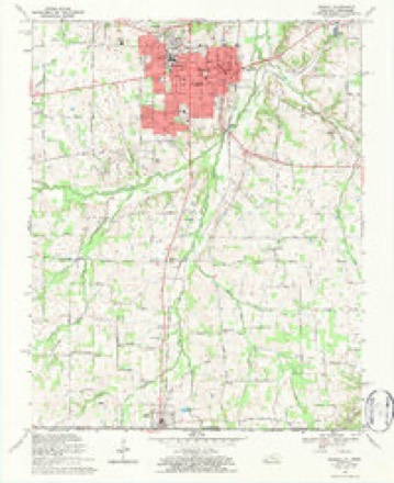
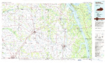
6 surveys from 13 printed sheetsMatched by testing this settlement's coordinate against the published boundary of every sheet in the United States Geological Survey's historical collection. Each opens the scanned sheet at the Survey.
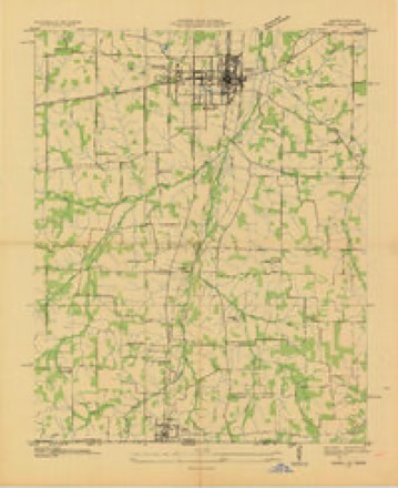
- 1936 USGS Hazel quadrangle1:24000
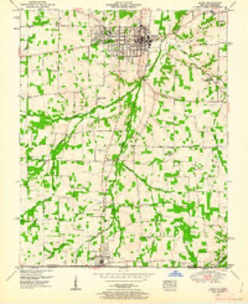
- 1951 USGS Hazel quadrangle1:24000, 2 printings
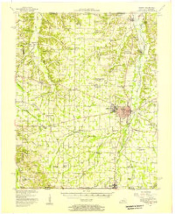
- 1951 USGS Murray quadrangle1:62500
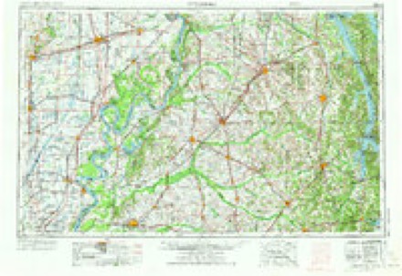
- 1956 USGS Dyersburg quadrangle1:250000, 4 printings
- 1969 USGS Murray quadrangle1:24000, 3 printings
- 1986 USGS Murray quadrangle1:100000, 2 printings
Fires near this place
21 since 1998Regional context, not property-specific evidence. The federal wildfire occurrence database lists 21 fires within 5 miles of Murray between 1998 and 2012, burning about 54 acres in total. 1 started naturally. None was recorded as arson. Distance is straight-line from the map coordinates, so a fire counted here may appear on a neighbouring settlement's page as well.
| Reported cause | Fires |
|---|---|
| Missing data/not specified/undetermined | 11 |
| Recreation and ceremony | 6 |
| Misuse of fire by a minor | 1 |
| Natural | 1 |
| Smoking | 1 |
| Railroad operations and maintenance | 1 |
The most recent of them, most recent first, with the day each was reported and the service that recorded it.
| Date | Cause | Size | Reported by | Name on the report |
|---|---|---|---|---|
| 7 September 2012 | Natural | 1.0 acres | Kentucky Division of Forestry | TAYLOR TRA |
| 26 June 2012 | Missing data/not specified/undetermined | 5.0 acres | Kentucky Division of Forestry | BETHEL RO |
| 11 April 1998 | Smoking | 1.0 acres | Kentucky Division of Forestry | not named |
| 6 March 2010 | Recreation and ceremony | 3.0 acres | Kentucky Division of Forestry | not named |
| 4 March 2006 | Missing data/not specified/undetermined | under an acre | Kentucky Division of Forestry | not named |
| 28 March 2004 | Missing data/not specified/undetermined | under an acre | Kentucky Division of Forestry | not named |
| 24 March 2009 | Recreation and ceremony | 3.0 acres | Kentucky Division of Forestry | not named |
| 21 March 2007 | Recreation and ceremony | 1.0 acres | Kentucky Division of Forestry | not named |
Settlements close enough to share some of these fires:
Mines and quarries near this place
2 within 5 milesRegional context, not property-specific evidence. The federal mineral resources record lists 2 workings within 5 miles of Murray: 1 prospect, 1 producer. 1 still produces. What was taken out: Ball Clay, Sand and Gravel, Construction. Distance is straight-line from the map coordinates, so a quarry counted here may appear on a neighbouring settlement's page as well.
| Where | Site | Commodity | Status | Recorded |
|---|---|---|---|---|
| Murray Mine | Sand and Gravel, Construction | Producer | ||
| R.L. Wiggs Farm Pit | Ball Clay | Prospect |
Storms near this place
60 of 170 shownRegional context, not property-specific evidence. The National Weather Service names Murray in 170 storm reports between 1995 and 2025: 70 thunderstorm wind, 50 hail, 21 flash flood, 13 heavy rain. The reports record 1 death and 1 injury. Each account below is quoted exactly as the forecast office filed it, from the NOAA Storm Events Database, and each date opens the federal record of that event.
| When | Event | Place named | Harm | What the report says |
|---|---|---|---|---|
| June 2019 | Lightning | Murray | 1 killed | Eyewitnesses observed lightning strike next to a woman on the campus of Murray State University. The 50-year-old woman immediately collapsed. CPR was administered, and she died shortly thereafter at a Tennessee hospital. |
| June 2018 | Thunderstorm Wind | Murray | 1 hurt, $16,000 | A few miles northwest of Murray, one person was injured when a tree fell on a moving car. A tree was down across a secondary road west of Murray. |
| April 2011 | Thunderstorm Wind | Murray | $2,000,000 | A Kentucky mesonet site measured a wind gust to 101 mph. A number of buildings were damaged, and an industrial warehouse was destroyed. Half the roof was torn off an auto parts store. There was extensive damage to trees and power lines in the city of Murray. Some trees were down on houses. Power poles were down. Roads were blocked. An eight-foot section of siding was blown off a manufacturing plant on the north side of Murray. Two rooftop air conditioning units were blown over. Two barns were blown down. City and county schools and Murray State University were cancelled the following day due to widespread power outages and blocked roads. The county emergency operations center was set up for the first time since the January, 2009 ice storm. Veteran utility workers declared that damage exceeded that from the 2009 ice storm. |
| February 2018 | Tornado (EF1) | Murray | $550,000 | This EF-1 tornado crossed the southern part of the city of Murray, damaging about 40 homes. The tornado touched down several blocks west of Highway 641 and lifted on the east edge of the city at the Clarks River floodplain. Most of the damage consisted of roof damage, mainly shingle loss. Two homes were a total loss, with roof decking removed, windows blown out, and part of an exterior wall caved in due to projectile impacts. At least four businesses were damaged, with the majority of the roof removed from one. Dozens of trees were uprooted or broken. The mayor of Murray declared a state of emergency. Peak winds were estimated near 105 mph. |
| June 2009 | Thunderstorm Wind | Murray | $500,000 | An intense microburst carved a damage swath from northwest to southeast across the city of Murray. The damage path was about 3.5 miles long and three-quarters of a mile wide. The damage began on the northwest side of town and ended near Highway 121 just southeast of town. Significant structural damage occurred as a result of peak winds estimated up to 105 mph in a very small area. The vast majority of the damage was from winds of 60 to 80 mph. Damage at Murray State University included a damaged dorm wall and many trees down. Windows were blown out on campus. Debris was blown onto cars in the campus parking lots, damaging vehicles. A batting cage at the college was blown several hundred yards into the parking lot of a bank. An Office Depot store on the north side of town along U.S. Highway 641 sustained minor to moderate roof damage. The roofs of several other buildings, including a Dollar General store, were damaged at a shopping plaza on Highway 641 in town. Much of the roof damage was minor, consisting of cosmetic materials. Debris from stores in the plaza damaged cars in a nearby parking lot. The most significant structural damage occurred to a couple of storage buildings, where roofs were blown off. The door was blown off a movie theater. Numerous trees were blown down in the city, including some that landed on houses. Downed trees and power poles blocked streets, including some major ones. In city parks, batting cages and a baseball dugout were damaged or destroyed. Power lines were down. A couple of empty 15,000-pound semi trailers were overturned. |
| May 2003 | Tornado (F2) | Murray | $350,000 | The tornado began along Highway 732 about one quarter mile east of Highway 94. It then moved northeast, roughly parallel to Highway 94, for almost two miles. Six homes received minor to moderate damage. Numerous trees were down, two barns were destroyed, and several others were damaged. Peak winds were estimated near 120 MPH. |
| June 2014 | Thunderstorm Wind | Murray | $100,000 | The macroburst containing winds estimated near 95 mph continued east-southeast across the Murray area, passing mainly north and east of the city. The three-mile wide damage area in eastern parts of the county was mainly along and just south of Highway 94. Numerous large trees were snapped and uprooted, causing widespread power outages lasting 6 to 12 hours on average. Numerous roads were blocked by downed trees. At least one house was damaged by a falling tree. A resident of the house was trapped for a short time. Two houses appeared to be uninhabitable based on emergency management reports. Several barns and a garage were destroyed. A porch was ripped off a home. Scores of homes received minor roof damage. Siding was damaged on at least one house. The damage area appeared to end in eastern Calloway County, about five miles north of New Concord. |
| July 1999 | Tornado (F1) | Murray | $100,000 | The tornado formed along U.S. Highway 641 about 5 miles south of Murray and tracked east into the New Concord area. The tornado was rated F-1 intensity with top winds near 110 MPH. Numerous trees were uprooted or snapped off along the path of the tornado. Some of the trees fell on utility lines, vehicles, and buildings. The area was sparsely populated, so damage was relatively light considering the path length and width. At least a dozen or so homes received some damage, mostly light roof or siding damage. There was moderate damage to at least a couple homes. Several barns were damaged. At one residence, a porch was damaged, along with other items such as a television antenna, fence, and swimming pool. Sheet metal from a barn was blown into treetops. |
| March 1997 | Flash Flood | Murray | $100,000 | no account filed |
| September 1998 | Flash Flood | Murray | $80,000 | Slow-moving thunderstorms dumped around 4 inches of rain in a couple hours at Murray. Street and low-lying flooding was widespread. Cars were stranded in flooded intersections, and several homes were flooded. |
| May 1995 | Thunderstorm Wind | Murray | $80,000 | A roof was blown off a house, and a mobile home was heavily damaged. A sign and window were blown out of a supermarket. Numerous trees and power lines were blown down. |
| May 2025 | Thunderstorm Wind | Murray | $75,000 | A tree was uprooted and fell onto a manufactured home at Pine Street and 1st Street in Murray. At the time, flood waters were 8 inches deep in the main floor of the home. The saturated soil likely made it easier for the tree to be uprooted. The home was essentially destroyed. |
| March 2017 | Tornado (EF1) | Murray | $75,000 | Peak winds were estimated near 95 mph. The path began in the southwest part of Murray and followed Highway 121 to about four miles southeast of Murray. Dugout roofs at the city high school ballfield in Murray were blown across the street into a home and car. Numerous very large trees were snapped and uprooted. About three miles outside the city limits of Murray, barns and outbuildings were heavily damaged. Most of the path was high-end EF-0 strength. Near the end of the path, the tornado intensified to EF-1. This is the area where a large section of roof and some trusses were blown off a well-built metal barn, and plastic projectiles were hurled through a garage wall. A building was destroyed by uprooted trees that fell on top of it. |
| October 2007 | Tornado (EF1) | Murray | $60,000 | Hundreds of trees were snapped and uprooted. One home received major roof damage, primarily from falling trees. Roads were blocked by downed trees. The average path width was 150 yards. Peak winds were estimated near 95 mph. The tornado path ended at the shore of Kentucky Lake. |
| January 2006 | Thunderstorm Wind | Murray | $50,000 | Severe thunderstorm winds downed tree limbs, demolished outbuildings and a well house, and overturned a trailer. Shingles were ripped off the roof of a house. A small boat was damaged. |
| August 2005 | Thunderstorm Wind | Murray | $50,000 | The most concentrated damage was along and a couple miles either side of Highway 121, where trees were blown down onto houses and power lines. Some houses received shingle and vinyl damage. Debris and tree limbs were blown across Highway 121. The section of Highway 121 most affected was between the community of Stella and Highway 783. As far north as the Kirksey area, some tree and power line damage occurred. One uprooted tree was blown about 25 feet onto a roadway. A field of corn and beans was layed down. Along U.S. Highway 641 several miles north of Murray, several trees were blown down. |
| February 1997 | Flash Flood | Murray | $50,000 | no account filed |
| February 2008 | Thunderstorm Wind | Murray | $45,000 | Several trees were down in and around the south part of town. Street signs and power lines were down. A house was damaged and windows were blown out. |
| March 2023 | Thunderstorm Wind | Murray | $40,000 | Multiple power lines and poles were down in the city. A wind gust to 63 mph was measured on a personal weather station. |
| June 2018 | Thunderstorm Wind | Murray | $40,000 | East and northeast of Murray, numerous trees were snapped or down. Some trees fell on outbuildings. A tree fell across a road and onto a car. Trees were down along portions of Highway 94 northeast of Murray. A metal shed was blown down and pushed 100 yards. Large tree limbs were broken. |
| July 2017 | Thunderstorm Wind | Murray | $40,000 | East of Murray, a significant area of wind damage extended from Kentucky Highway 94 south to Kentucky Highway 121. Power poles were broken and trees were down along Kentucky Highway 94 between Highways 280 and 732. To the south of this damage, trees were blown down on Kentucky Highway 121. The underpinning of a trailer was blown off and the front door was blown in. Numerous trees were blown down between Kentucky Highways 94 and 121. |
| May 2025 | Thunderstorm Wind | Murray | $35,000 | A partial fence was blown down at Murray State University as a line of thunderstorms moved across the city. Numerous large limbs were downed in the City of Murray. Doors were blown in at Marshall's department store. Cheri Theatres had their business sign destroyed by winds with downed tree limbs on the south side of Chestnut St. |
| May 2020 | Thunderstorm Wind | Murray | $35,000 | A steeple was blown off a church. A tree was blown onto a home, causing roof damage. Power lines were down and a couple large trees were down across Highway 121. |
| April 2016 | Thunderstorm Wind | Murray | $35,000 | Just south of Murray along U.S. Highway 641, a large tree was uprooted and two telephone poles were down. Just north of New Providence, two open barns were destroyed. Southeast of Murray, several trees were damaged or blown down, and a tin roof was blown off a house. Just northeast of New Concord, a tree fell on power lines, starting a small fire. |
| July 2020 | Flash Flood | Murray | $30,000 | Numerous city streets and county roads were flooded, with estimated water depths from six inches to one foot. State Highway 121 was flooded south of New Concord. Creeks were out of their banks. At the Kentucky mesonet site near downtown Murray, 2.06 inches fell in 35 minutes. A water rescue was conducted west of Hazel along the state line, where a vehicle drove into floodwaters and stalled. Near Midway off U.S. Highway 641, two homes were evacuated due to flooding. Water was 4 to 8 inches deep in the homes. Some roads remained barricaded shut due to flooding well into the night. |
| July 2016 | Flash Flood | Murray | $30,000 | Several city streets in Murray were flooded with two feet of water. Floodwaters entered some homes in Murray, prompting the evacuation of a few homes. A trained spotter in Murray measured 6.01 inches of rain in 24 hours. At a resort on the eastern edge of the county, emergency responders were requested to help at a flooded cabin. |
| September 2009 | Flash Flood | Murray | $30,000 | Two persons were evacuated from a residence off Kentucky 94 east of Murray. That residence and another at that location were deemed uninhabitable due to flooding. Red Cross was aiding the victims. Residences on an adjacent street had flooding that stopped just short of the houses but submerged lawn mowers in the yard. The mesonet system west of Murray measured 1 inch of rain in less than an hour. From observer reports, the rain east and south of Murray was heavier. |
| June 2018 | Thunderstorm Wind | Murray | $25,000 | Scattered wind damage occurred around the county. A large maple tree was blown onto a power line on the south side of Murray. Much of the community of Hazel was without power. Some trees landed across roads, mainly south of Murray. |
| August 2005 | Thunderstorm Wind | Murray | $25,000 | A tree fell on a home, punching a hole in the roof and breaking out several windows. Another tree fell through power lines and onto a road. At least six homes received minor roof damage, including a few with large sections of shingles missing. Siding was blown off at least one house. Several soybean fields were layed over. A wind gust to 60 MPH was estimated at Murray High School. Multiple large trees were blown down on roads, mainly north and northwest of the city. The damage area, which was about one mile wide, primarily affected rural areas north and northwest of Murray. The significant damage was north of Highway 121. |
| March 2023 | Flash Flood | Murray | $20,000 | Cars were stranded in floodwaters on North 16th Street near Highway 121 in Murray. |
| July 2022 | Thunderstorm Wind | Murray | $20,000 | Numerous trees were down. About 1300 customers were without power in the county. |
| December 2021 | Thunderstorm Wind | Murray | $20,000 | Significant tree and power line damage was reported along and near Highway 280. |
| August 2020 | Thunderstorm Wind | Murray | $20,000 | Power poles were snapped, resulting in several road closures. Trees were down. |
| November 2020 | Thunderstorm Wind | Murray | $20,000 | In the city of Murray, a power pole was knocked down, two trees were uprooted, and a house roof was damaged. |
| May 2007 | Thunderstorm Wind | Murray | $20,000 | Numerous trees were down in northern parts of the county. A few trees were down in Murray. Near downtown Murray, a large tree fell on a car and destroyed the vehicle. |
| May 1999 | Thunderstorm Wind | Murray | $20,000 | A barn was blown onto Kentucky Route 94 a few miles west of Murray. Trees were down on Kentucky Routes 121 and 497. The front door was blown off a restaurant in Murray. |
| July 2016 | Thunderstorm Wind | Murray | $18,000 | Utility poles were snapped, and power lines were down in an industrial park. Metal roofing was blown off. |
| May 2025 | Thunderstorm Wind | Murray | $15,000 | Thunderstorm wind gusts caused power outages and blew down trees in and around Murray. |
| July 2024 | Thunderstorm Wind | Murray | $15,000 | A tree was blown down onto a car with a person inside on Robertson Rd in Murray. |
| June 2019 | Thunderstorm Wind | Murray | $15,000 | Strong damaging winds from 60 to 70 mph continued southeast across central and southern Calloway County. An off-duty NWS employee two miles southwest of Murray estimated winds gusted from 60 to 65 mph. Tree limbs were down. Power lines were down in Murray. Multiple trees were blown down in Hazel. |
| February 2017 | Thunderstorm Wind | Murray | $15,000 | A power pole was down on a building on the west side of Murray. There was also minor roof damage to a structure. |
| November 2017 | Thunderstorm Wind | Murray | $15,000 | Multiple trees were reported down around the county. A few dozen utility customers were without power. |
| September 2012 | Thunderstorm Wind | Murray | $15,000 | A tree and power line was blown down in the southwest part of the county. A car ran into a downed tree just northwest of Murray. |
| May 2024 | Flash Flood | Murray | $10,000 | Widespread flash flooding occurred in Murray. In a later update, emergency management reported that N 16th St remained closed well into the afternoon. Radar estimated rainfall amounts in Murray were 2-3 inches through the morning hours. |
| March 2016 | Lightning | Murray | $10,000 | Lightning struck a substation in Murray, knocking out power to all of the city and a substantial part of east Calloway County. The total number of affected customers was about 14,000. |
| June 2015 | Thunderstorm Wind | Murray | $10,000 | Downed trees were reported along Highway 94 East. Trees were damaged on the northwest side of Murray. Isolated power outages were reported in rural areas of the county. |
| June 1999 | Thunderstorm Wind | Murray | $10,000 | Propane cylinders and signs were blown over. |
| May 2025 | Thunderstorm Wind | Murray | $8,000 | A few trees were downed on the north side of Murray, including a tree at Riviera Court. |
| May 2017 | Thunderstorm Wind | Murray | $8,000 | Pockets of damaging winds occurred in the county. Just west of Murray, trees were down at the intersection of Highway 94 and Kentucky Highway 1660. Several trees were blown down along Kentucky Highway 121 near New Concord. |
| June 2016 | Thunderstorm Wind | Murray | $8,000 | Just east of Midway, part of a metal roof was blown off a barn. A few trees were blown down in the Murray area, including one in the city of Murray and another two miles east of town. |
| July 2016 | Thunderstorm Wind | Murray | $8,000 | A house roof was damaged by winds estimated up to 60 mph. Two trees were down in the city. |
| May 2014 | Heavy Rain | Murray | $8,000 | From four to five inches of rain fell in the Murray area. Water was over roadways. One resident reported basement flooding. A rain gage along the Clarks River maintained by the U.S. Geological Survey measured 5.12 inches in about three hours. One inch fell in 15 minutes. |
| January 2000 | Thunderstorm Wind | Murray | $8,000 | Tree limbs and power lines were down. Minor roof damage was reported. |
| May 2017 | Thunderstorm Wind | Murray | $7,000 | Trees were blown down, blocking Highway 94 a few miles east of Murray. Three miles northeast of Murray, a downed tree blocked a secondary road. |
| May 2021 | Thunderstorm Wind | Murray | $6,000 | A tree landed on a mobile home. A tree landed on a power line in northern Murray. Forty customers were without power in Murray. |
| July 2025 | Thunderstorm Wind | Murray | $5,000 | Large portions of a large tree were downed by straight-line thunderstorm winds, with one section falling onto power lines on 6th St in Murray. |
| July 2024 | Flash Flood | Murray | $5,000 | Flash flooding occurred in Murray with a water rescue for one person trapped in a vehicle on N 16th St. Radar estimated rainfall totals were 1.5-2.5 inches, most of which fell between 1945-2030CST. |
| June 2023 | Thunderstorm Wind | Murray | $5,000 | Strong thunderstorm winds carved a path across southern Calloway County. A few trees were down along Highway 121. A power line was down across a road. A trained spotter on the southwest side of Murray reported a 60 mph wind gust. |
| July 2023 | Thunderstorm Wind | Murray | $5,000 | Some minor roofing damage was reported on a building. |
| June 2019 | Thunderstorm Wind | Murray | $5,000 | Several trees were blown down. |
Nearest settlements
The eight closest, with where each one stands in the county. Distances are straight-line, computed from the Geographic Names Information System coordinates.
| Map | Place | Distance | Sheets |
|---|---|---|---|
| Five Points | 0.9 miles | 13 | |
| North Murray | 1.6 miles | 13 | |
| West Murray | 1.7 miles | 13 | |
| South Murray | 1.8 miles | 13 | |
| East Murray (historical) | 1.8 miles | 13 | |
| Utterback (historical) | 2.0 miles | 12 | |
| Outland (historical) | 3.1 miles | 13 | |
| Halfway (historical) | 3.2 miles | 13 |
Elsewhere
Matched on this settlement's Geographic Names Information System number rather than its name, so it cannot be a different place of the same name in another state.
| Wikipedia article on Murray | An encyclopaedic summary. Its text is share-alike, so it is linked here rather than copied. |
| Wikidata item Q984364 | The structured record the population and elevation above come from. Public domain (CC0). |
Provenance
This settlement is recorded in the Geographic Names Information System as feature 499118. The sheet list is computed by point-in-boundary test against the United States Geological Survey's historical topographic inventory. Both are works of the United States government and carry no copyright under 17 U.S.C. 105.
Wildfire. Short, Karen C. 2022. Spatial wildfire occurrence data for the United States, 1992-2020 [FPA_FOD_20221014]. 6th Edition. Fort Collins, CO: Forest Service Research Data Archive. https://doi.org/10.2737/RDS-2013-0009.6 Collected with United States Government funding and usable without additional permissions or fees.
Mines and quarries. USGS Mineral Resources Data System (MRDS) https://mrdata.usgs.gov/mrds/ A work of the United States government, no copyright under 17 U.S.C. 105.
Storms. NOAA National Centers for Environmental Information, Storm Events Database https://www.ncei.noaa.gov/stormevents/ A work of the United States government, no copyright under 17 U.S.C. 105. Narratives are quoted verbatim from the National Weather Service report and are not edited or summarised.