 Block
Olmstead, Kentucky
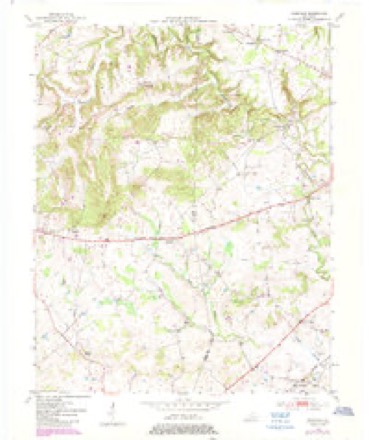
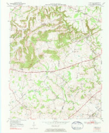
8 topographic sheets cover this place, the earliest surveyed in 1950 and the latest in 1980. It stands in the Russellville census division. It lies in ZIP code area 42265. It stands on Vicks Branch. The Survey maps it on the Olmstead quadrangle. It stands 581 feet above sea level.
On record in Olmstead
Buildings and businesses the archive holds for this place. Each opens its own page, with the source record it came from.
On the National Register 1 record
- Cedar Grove Rosenwald Schoollisted 2002
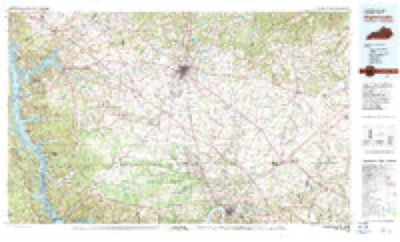
Topographic sheets covering this place
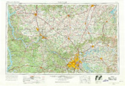
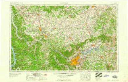
5 surveys from 8 printed sheetsMatched by testing this settlement's coordinate against the published boundary of every sheet in the United States Geological Survey's historical collection. Each opens the scanned sheet at the Survey.
- 1950 USGS Olmstead quadrangle1:24000
- 1951 USGS Olmstead quadrangle1:24000, 3 printings
- 1956 USGS Nashville quadrangle1:250000, 2 printings
- 1959 USGS Nashville quadrangle1:250000
- 1980 USGS Hopkinsville quadrangle1:100000
Fires near this place
4 since 2000Regional context, not property-specific evidence. The federal wildfire occurrence database lists 4 fires within 5 miles of Olmstead between 2000 and 2007, burning about 234 acres in total. None started naturally. 3 were recorded as arson. Distance is straight-line from the map coordinates, so a fire counted here may appear on a neighbouring settlement's page as well.
| Reported cause | Fires |
|---|---|
| Arson/incendiarism | 3 |
| Debris and open burning | 1 |
The most recent of them, most recent first, with the day each was reported and the service that recorded it.
| Date | Cause | Size | Reported by | Name on the report |
|---|---|---|---|---|
| 10 August 2007 | Arson/incendiarism | 1.0 acres | Kentucky Division of Forestry | not named |
| 10 August 2007 | Arson/incendiarism | 2.0 acres | Kentucky Division of Forestry | not named |
| 10 August 2007 | Arson/incendiarism | 230 acres | Kentucky Division of Forestry | not named |
| 23 February 2000 | Debris and open burning | under an acre | Kentucky Division of Forestry | not named |
Settlements close enough to share some of these fires:
Storms near this place
19 since 2000Regional context, not property-specific evidence. The National Weather Service names Olmstead in 19 storm reports between 2000 and 2023: 11 thunderstorm wind, 4 flash flood, 2 hail, 2 tornado. No death or injury is recorded in these reports. Each account below is quoted exactly as the forecast office filed it, from the NOAA Storm Events Database, and each date opens the federal record of that event.
| When | Event | Place named | Harm | What the report says |
|---|---|---|---|---|
| May 2003 | Thunderstorm Wind | Olmstead | $30,000 | The top was blown off a building. Trees were uprooted. |
| August 2011 | Thunderstorm Wind | Olmstead | $15,000 | Thunderstorm winds downed several trees and damaged a barn. The local emergency manager reported that several vehicles were damaged by falling limbs. Minor damage was reported to several homes. |
| May 2016 | Flash Flood | Olmstead | $5,000 | Logan County officials reported a man stranded in a vehicle on Joe Gill Road due to high water. |
| November 2007 | Thunderstorm Wind | Olmstead | $5,000 | Power lines were downed on top of a house. |
| May 2023 | Thunderstorm Wind | Olmstead | - | A tree was blown down along Paul Hines Road. |
| December 2023 | Tornado (EF2) | Olmstead | - | The National Weather Service in Louisville conducted a storm damage assessment survey in Logan County, Kentucky from the storms on Saturday, December 9th. The survey was conducted in very cold conditions with temperatures in the mid to upper 30s with storm damage over 22 miles. ||This storm damage survey is only for the Logan County and Simpson County, Kentucky, portion of a long-track EF3 tornado that touched down on Fort Campbell in Montgomery County, Tennessee. The tornado tracked east northeast across the southern part of Todd County, Kentucky. The tornado continued eastward from Todd County, Kentucky, dropping debris from Allensville into farmers fields between the county line and Gossett Hines Road. The tornado sucked up leftover corn and beans from the fields, throwing them in all directions and covering portions of the roadway. It also knocked some power lines down in this area with wind speeds estimated at 95 mph (EF1) and a path width of 125 yards.||The tornado continued east northeastward, topping some trees near the intersection of Paul Young Road as well as doing significant structural roof damage to a barn. Wind speeds were estimated at 90 mph (EF1), with a path width of 100 yards. ||The tornado increased in width and intensity as it approached Lickskillet. A series of small vortices inside the tornado increased the width to 250 yards, with wind speeds estimated at 115 mph (EF2) in a small area off of Lickskillet Road. A well-built two-story house sustained extensive roof damage, had its foundation shifted, windows blown out, 3 vehicles thrown and severely damaged, and 2 barns destroyed with impalement of barn boards. Debris was thrown several hundred yards from the north to |the east southeasterly direction. NWS drone footage clearly showed a large forested area had trees snapped, uprooted, twisted and facing numerous directions. The drone footage also showed debris deposited up to 500 yards to the east northeast. ||Several barns and outbuildings were destroyed along Lickskillet Road, with barn metal sheeting wrapped around trees and insulation on the front and back sides of homes. The survey team once again observed leftover corn and beans from harvested crops thrown all over the place. Wind speeds in this area ranged from 95 to 105 mph (EF1) with a damage width of 250 yards. ||Witness testimony and video clearly showed several small vortices mainly rain wrapped in this area. Numerous people heard the strong wind and roar and felt a severe pressure drop in their eardrums. ||The tornado next hit a couple of homes on Watermelon Road (Hwy 1041). Significant roof damage occurred, including major loss of shingles, loss of gutters and large sections of the roof ripped off and mangled. There were several uprooted trees, and 2 outbuildings were destroyed. Some damage was thrown 400 yards to the east northeast. Wind speeds in this area ranged from 95 to 105 mph (EF1) with a width of 250 yards.||The next concentrated damage area was near the intersection of Johnson Young Road (Highway 739) and McIntosh Road. Several greenhouses had their roofing material ripped apart and bent, and two outbuildings and one barn were destroyed. Several witnesses had video of the tornado, which showed several small vortices. This was extremely helpful to determine why some areas had almost no damage, while other areas had substantial damage. Dozens of large trees were uprooted and snapped on the west side of McIntosh Road behind the greenhouses. Wind speeds in this area were between 100 and 105 mph (EF1) with a width of 250 yards.||The tornado significantly damaged roofing structures of two homes on Orndorff Mill Road (Highway 96). One middle section of the home on the west side of Hwy 96 was completely destroyed, and the home on the east side of Hwy 96 had most of its roof ripped off. There were some structural flaws to these homes and pine trees next to the home were not significantly affected. Thus, wind speeds were kept at 95 mph (EF1). Two barns were destroyed at this location as well. ||Along Nashville Road (Highway 431), there was some metal uplift of some barns and one outbuilding, while no foundation support was destroyed. Wind speeds were between 80 and 85 mph (EF0) with a width of 175 yards.||Along Franklin Road (Highway 100), there were several power poles snapped or knocked down, and some shingle, gutter, and soffit damage to one home. Wind speeds were 90 mph (EF1) with a width of 175 yards.||Along Dennis Corinth Road (Highway 2369), there was a partial uplift of an old barn. The debris from the barn was thrown to the north and east directions. The eastern debris struck a single- family residence, doing roof, gutter, and broken glass damage. Wind speeds were between 80 and 85 mph (EF0) with a width of 100 yards.||The last observed damage from the December 10th survey was roof damage to a barn on Carter Road with debris thrown into a farmer's field, stopping before Montgomery Road. Wind speeds were 85 mph (EF0) with a width of 60 yards. ||Upon further investigation by emergency personnel on December 18th, the tornado was found to have crossed Montgomery Road across mostly rural locations before more damage was observed at Matlock Road and Pamela Lane. Roof damage to barns and outbuildings were found to be at EF0 strength at 80 mph. The tornado then continued across Friendship Road and did damage along Harris Road where a barn under construction was leveled. Winds in excess of 90 mph were determined to occur here at EF1 strength.||The tornado continued across Logan Middleton Road where EF0 damage occurred to a home and barns just to the east of the highway. At this point, the tornado crossed just into Simpson county along Clifford Peart and J Wilson Road where additional barn damage occurred. No additional damage was observed from the tornado beyond |Clifford Peart Road. In total, the damage track was extended an additional 4.59 miles for a total of 22.82 miles in the NWS Louisville warning area, and a total of 47.75 miles from the origination point of Montgomery County TN. |
| January 2022 | Tornado (EF0) | Olmstead | - | This confirmed tornado was a continuation of a tornadic storm that crossed from Todd County Kentucky to Logan County Kentucky. The tornado first crossed the Todd/Logan county line about a mile south of Allensville around 12:19 PM EST. Small tree limbs were broken along Keysburg Road (KY Route 102). The tornado continued across mostly rural fields before striking a barn along Joe Riley road where major roof damage was observed as well as moderate tree damage. Near this location is where the max wind speeds were observed at 85 mph, or high end EF-0. This rating was changed from a previously reported EF-1 rating due to the nature of surrounding damage observed.||The tornado continued along rural open farm fields before damaging a mix of hard and softwood trees. Some trees had large limbs downed, while others had snapped trunks along Kenny Stratton Road west of Lickskillet. The tornado ended at around 12:22 PM EST along with no further damage observed past Olmstead Road. |
| July 2022 | Thunderstorm Wind | Olmstead | - | A tree was down on Olmstead Road off of Clarksville Road. |
| May 2016 | Flash Flood | Olmstead | - | Kentucky state officials reported high water over roadways in Olmstead. |
| May 2016 | Flash Flood | Olmstead | - | The Department of Highways reported high water flowing over the road in several places on Highway 79 south. There was also standing water on parts of Highway 431 south and several secondary roads in the county. |
| June 2015 | Thunderstorm Wind | Olmstead | - | A Kentucky state official reported that thees were down along Highway 775. |
| April 2011 | Thunderstorm Wind | Olmstead | - | A barn was blown on to the railroad tracks. Several trees were also blown down. |
| June 2011 | Thunderstorm Wind | Olmstead | - | Several trees were downed by thunderstorm winds in the small town of Olmstead. |
| April 2011 | Thunderstorm Wind | Olmstead | - | An NWS storm survey confirmed straight line wind damage from Olmstead to Chandlers Chapel. Several small outbuildings including a carport and a barn were severely damaged. Numerous trees were snapped. Winds were estimated to be up to 100 mph. |
| May 2010 | Thunderstorm Wind | Olmstead | - | Several barns and sheds received structural damage. A mobile home was also moved off its foundation. Several trees were also blown down. |
| July 2002 | Thunderstorm Wind | Olmstead | - | Trees and power lines were downed. |
| May 2000 | Flash Flood | Olmstead | - | Low lying roads in southwest Logan County were covered by 8 to 10 inches of water. |
| April 2006 | Hail | Olmstead | - | no account filed |
| May 2005 | Hail | Olmstead | - | no account filed |
Nearest settlements
The eight closest, with where each one stands in the county. Distances are straight-line, computed from the Geographic Names Information System coordinates.
| Map | Place | Distance | Sheets |
|---|---|---|---|
| Old Volney | 1.5 miles | 8 | |
| Lickskillet | 1.7 miles | 9 | |
| Ash Spring | 1.8 miles | 6 | |
| Dripping Spring (historical) | 2.3 miles | 9 | |
| Johnstown (historical) | 2.5 miles | 8 | |
| Ferguson | 2.7 miles | 9 | |
| Whippoorwill | 4.5 miles | 8 | |
| Mosley Pond | 4.6 miles | 6 |
Elsewhere
Matched on this settlement's Geographic Names Information System number rather than its name, so it cannot be a different place of the same name in another state.
| Wikipedia article on Olmstead | An encyclopaedic summary. Its text is share-alike, so it is linked here rather than copied. |
| Wikidata item Q7088425 | The structured record the population and elevation above come from. Public domain (CC0). |
Provenance
This settlement is recorded in the Geographic Names Information System as feature 499937. The sheet list is computed by point-in-boundary test against the United States Geological Survey's historical topographic inventory. Both are works of the United States government and carry no copyright under 17 U.S.C. 105.
Wildfire. Short, Karen C. 2022. Spatial wildfire occurrence data for the United States, 1992-2020 [FPA_FOD_20221014]. 6th Edition. Fort Collins, CO: Forest Service Research Data Archive. https://doi.org/10.2737/RDS-2013-0009.6 Collected with United States Government funding and usable without additional permissions or fees.
Storms. NOAA National Centers for Environmental Information, Storm Events Database https://www.ncei.noaa.gov/stormevents/ A work of the United States government, no copyright under 17 U.S.C. 105. Narratives are quoted verbatim from the National Weather Service report and are not edited or summarised.