 Block
Peach Grove, Kentucky
10 topographic sheets cover this place, the earliest surveyed in 1929 and the latest in 1986. It stands in the Butler census division. It lies in ZIP code area 41006. It stands on Deer Lick. The Survey maps it on the Butler quadrangle. It stands 889 feet above sea level.
On record in Peach Grove
Buildings and businesses the archive holds for this place. Each opens its own page, with the source record it came from.
On the National Register 1 record
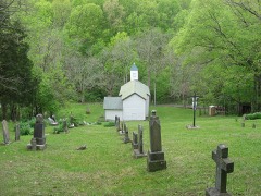
Topographic sheets covering this place
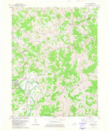
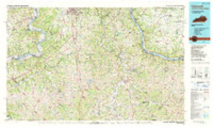
7 surveys from 10 printed sheetsMatched by testing this settlement's coordinate against the published boundary of every sheet in the United States Geological Survey's historical collection. Each opens the scanned sheet at the Survey.
- 1929 USGS Alexandria quadrangle1:48000
- 1936 USGS Alexandria quadrangle1:62500, 2 printings
- 1953 USGS Butler quadrangle1:24000
- 1956 USGS Louisville quadrangle1:250000, 2 printings
- 1964 USGS Louisville quadrangle1:250000
- 1981 USGS Butler quadrangle1:24000
- 1986 USGS Falmouth quadrangle1:100000, 2 printings


Mines and quarries near this place
4 within 5 milesRegional context, not property-specific evidence. The federal mineral resources record lists 4 workings within 5 miles of Peach Grove: 3 producers, 1 plant. All of them still produce. What was taken out: Stone, Crushed/Broken, Stone, Crushed/Broken, Calcium, Sand and Gravel, Construction. Distance is straight-line from the map coordinates, so a quarry counted here may appear on a neighbouring settlement's page as well.
| Where | Site | Commodity | Status | Recorded |
|---|---|---|---|---|
| Black River Mining Limekiln | Stone, Crushed/Broken, Calcium | Plant | ||
| Franklin Stone Pit | Sand and Gravel, Construction | Producer | ||
| Butler Quarry | Stone, Crushed/Broken | Producer | ||
| Pendleton County Underground | Stone, Crushed/Broken | Producer |
Storms near this place
10 since 2000Regional context, not property-specific evidence. The National Weather Service names Peach Grove in 10 storm reports between 2000 and 2024: 5 thunderstorm wind, 2 hail, 2 tornado, 1 lightning. The reports record 1 death. Each account below is quoted exactly as the forecast office filed it, from the NOAA Storm Events Database, and each date opens the federal record of that event.
| When | Event | Place named | Harm | What the report says |
|---|---|---|---|---|
| June 2005 | Lightning | Peach Grove | 1 killed | A man was struck by lightning as he walked along State Route 154 in Peach Grove. He later died at the hospital. |
| March 2012 | Tornado (EF3) | Peach Grove | $2,000,000 | The tornado initially touched down in south central Campbell County at 1639 EST near Peach Grove Road and crossed Fisher Road northwest of Peach Grove. The tornado then crossed into Pendleton County at 1641 EST after producing high end EF3 damage along Reid Ridge Road near the Campbell and Pendleton County line. The tornado then moved across Mays Road producing significant and widespread EF2 to low end EF3 damage. The tornado then crossed AA highway and eventually the Ohio River, after crossing Kentucky Highway 8. Based on the damage surveyed, the maximum wind speed of the tornado was estimated to be 160 miles per hour in Campbell County and 140 miles per hour in Pendleton County. The tornado traveled a total of 2.68 miles in Campbell County, and 4 miles in Pendleton County. The tornado moved into Clermont County Ohio at 1646 EST, where it hit the town of Moscow, causing EF3 damage. The tornado continued on the ground across Clermont County, crossing into Brown County at 1658 EST. The tornado then lifted south of Hamersville in western Brown County at 1702 EST. This tornado caused extensive damage to structures and trees along its entire path on both sides of the Ohio River. Numerous homes were very heavily damaged or destroyed. Many homes lost their roofs, having complete exterior wall failure. Some modular homes were completely removed from their foundations, lifted, and thrown in excess of 100 yards where they were destroyed. The damage in Ohio from this tornado was consistent with maximum winds estimated at 160 miles per hour in Clermont County, and 100 miles per hour in Brown County. The tornado traveled a total of 11.04 miles in Clermont County, and 2.69 miles in Brown County. |
| June 2008 | Tornado (EF0) | Peach Grove | $60,000 | Just north of Peach Grove, a tornado touched down on the west side of State Route 10, ripping the siding off portions of a house and damaging a garage door. On the other side of State Route 10, extensive damage took place to a residence. Two old barns and two garages had severe structural damage on the property. The garage door on the standalone garage was blown inward, with a back door blown out into the yard behind the structure. Tools inside this garage were also blown out of the back of the structure and strewn throughout the yard. Next to the garage, a metal trailer was cleanly picked up. In addition, an interior door frame was blown into the kitchen of the residence, and numerous trees were uprooted and broken throughout the area. |
| April 2005 | Thunderstorm Wind | Peach Grove | $15,000 | A home sustained damage to its roof and front porch. |
| December 2015 | Thunderstorm Wind | Peach Grove | $10,000 | A mobile home was flipped on Fardo Road. |
| October 2002 | Thunderstorm Wind | Peach Grove | $2,000 | Trees were knocked down. |
| April 2009 | Thunderstorm Wind | Peach Grove | $2,000 | no account filed |
| August 2024 | Thunderstorm Wind | Peach Grove | $1,000 | A tree fell onto State Route 154. |
| March 2012 | Hail | Peach Grove | - | no account filed |
| July 2000 | Hail | Peach Grove | - | no account filed |
Nearest settlements
The eight closest, with where each one stands in the county. Distances are straight-line, computed from the Geographic Names Information System coordinates.
| Map | Place | Distance | Sheets |
|---|---|---|---|
| Carntown | 2.7 miles | 13 | |
| Mount Auburn | 3.0 miles | 10 | |
| Ivor | 3.3 miles | 13 | |
| Flower Town (historical) | 4.0 miles | 10 | |
| Meridian | 5.0 miles | 10 | |
| Butler | 5.2 miles | 10 | |
| Caldwell | 5.6 miles | 11 | |
| Boston | 5.7 miles | 10 |
Elsewhere
Matched on this settlement's Geographic Names Information System number rather than its name, so it cannot be a different place of the same name in another state.
| Wikipedia article on Peach Grove | An encyclopaedic summary. Its text is share-alike, so it is linked here rather than copied. |
| Wikidata item Q7157640 | The structured record the population and elevation above come from. Public domain (CC0). |
Provenance
This settlement is recorded in the Geographic Names Information System as feature 508785. The sheet list is computed by point-in-boundary test against the United States Geological Survey's historical topographic inventory. Both are works of the United States government and carry no copyright under 17 U.S.C. 105.
Mines and quarries. USGS Mineral Resources Data System (MRDS) https://mrdata.usgs.gov/mrds/ A work of the United States government, no copyright under 17 U.S.C. 105.
Storms. NOAA National Centers for Environmental Information, Storm Events Database https://www.ncei.noaa.gov/stormevents/ A work of the United States government, no copyright under 17 U.S.C. 105. Narratives are quoted verbatim from the National Weather Service report and are not edited or summarised.