 Block
From the record
20 National Register listings published here.
Sources: the National Register database, National Park Service
43 topographic sheets and 10 fire insurance atlases across 2 places.
20 National Register listings published here.
Sources: the National Register database, National Park Service
Taken for the Office of War Information and the Farm Security Administration, who photographed the country between 1935 and 1944. Works of United States government photographers, with no known restriction on use. Each opens its catalogue record.
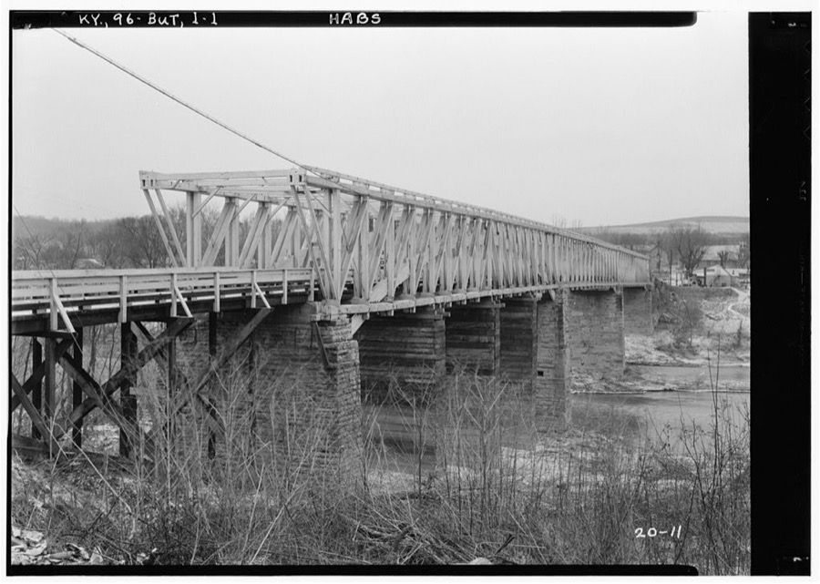
Every property in this county listed on the National Register of Historic Places, with the year it was listed and the federal nomination document.
| Photograph | Property | Type | Listed | Reference |
|---|---|---|---|---|
| Dolph Aluck Smokehouse | building | 1987 | 87000162 | |
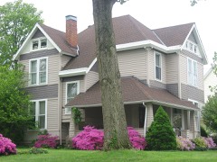 | Leslie T. Applegate House | building | 1983 | 83002845 |
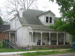 | Bishop House | building | 1983 | 83002846 |
| Central Falmouth Historic District | district | 1983 | 83002847 | |
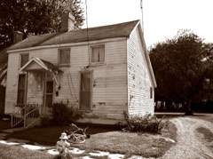 | Charity's House | building | 1983 | 83002848 |
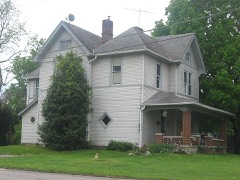 | Chipman House | building | 1983 | 83002849 |
| Henry Colvin House | building | 1987 | 87000145 | |
 | Fryer House | building | 1976 | 76000938 |
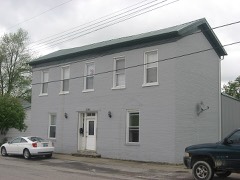 | House at 206 Park Street | building | 1983 | 83002850 |
| Elzey Hughes House | building | 1983 | 83002851 | |
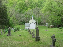 | Immaculate Conception Catholic Church and Cemetery | building | 1987 | 86003729 |
| George W. Jameson House | building | 1983 | 83002852 | |
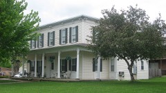 | Kellum House | building | 1983 | 83002853 |
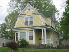 | McBride House | building | 1983 | 83002854 |
 | Pendleton House | building | 1983 | 83002856 |
| Frederick Reed House | building | 1983 | 83002857 | |
| Seaman Sisters' House | building | 1983 | 83002858 | |
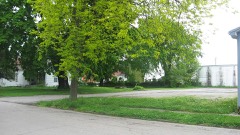 | Sheehan House | building | 1983 | 83002859 |
| Southgate House | building | 1983 | 83002860 | |
| Watson Store | building | 1983 | 83002861 |
Sampled issues, machine-read from the Library of Congress scan and published page by page, so every headline and column is searchable text.
Falmouth, Ky., 1907 to Current. Machine-read from the Library of Congress scan.
Falmouth [Ky.], 187? to 1???. Machine-read from the Library of Congress scan.
Falmouth, Ky., 1881 to 188?. Machine-read from the Library of Congress scan.
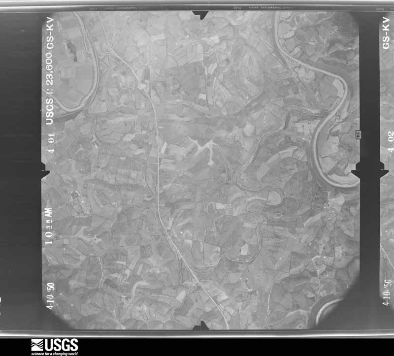
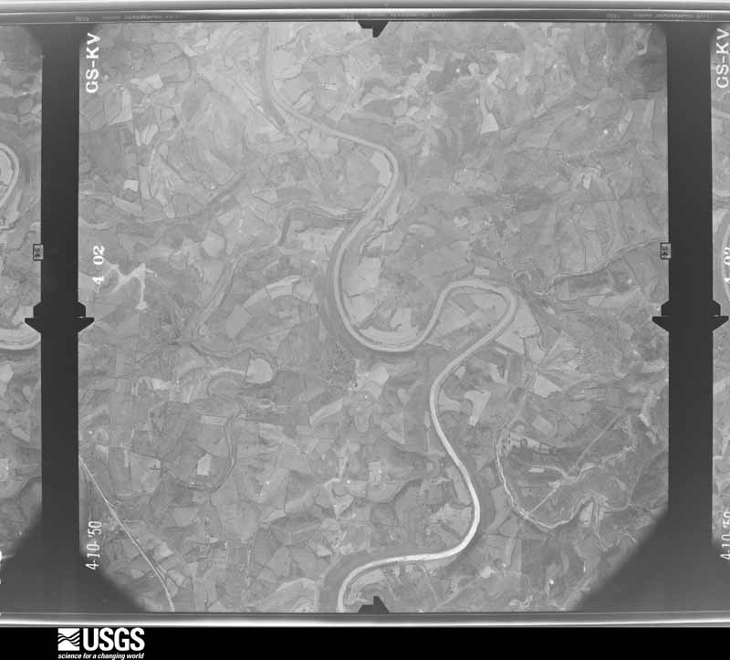
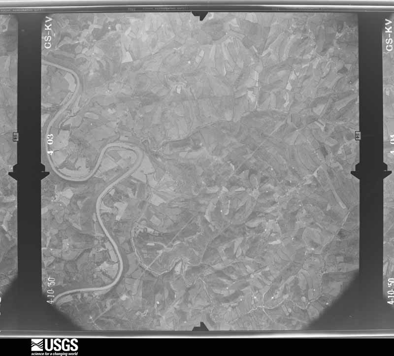
Flown by the U.S. Geological Survey between 1937 and 1989, the Aerial Photo Single Frames collection is the definitive mid-century view of the land: fields, roads and rivers as the camera saw them. The Survey holds 651 frames inside the rectangle that bounds this county; the 24 frames below were taken over the county itself, chosen across the decades of flights (at most four a year from that rectangle), so one flight cannot crowd out the rest. The full set is free to browse and download at EarthExplorer under the dataset Aerial Photo Single Frames.





















The thermometers that kept this county's weather, and the gages that measured the flow of its streams, as the federal records hold them. The extremes below are measured values from those records, not estimates.
Who lived here in 1950, one enumeration district at a time, as the Census Bureau described each district. Each row opens its official National Archives result, with Population Schedules and ED Maps available there.
Every wildfire the federal occurrence database records inside this county: 8 of them, burning about 78 acres. None started naturally and 1 was recorded as arson. Each settlement page carries the fires within five miles of it.
| Reported cause | Fires |
|---|---|
| Debris and open burning | 3 |
| Recreation and ceremony | 2 |
| Equipment and vehicle use | 1 |
| Missing data/not specified/undetermined | 1 |
| Arson/incendiarism | 1 |
The five largest, by the area the report gives. One of them was set deliberately.
| Date | Cause | Size | Reported by | Name on the report |
|---|---|---|---|---|
| 11 April 1999 | Debris and open burning | 25 acres | Kentucky Division of Forestry | not named |
| 12 April 2001 | Arson/incendiarism | 20 acres | Kentucky Division of Forestry | not named |
| 21 March 2014 | Recreation and ceremony | 15 acres | Kentucky Division of Forestry | ANTROBUS RD |
| 28 February 2001 | Debris and open burning | 10 acres | Kentucky Division of Forestry | not named |
| 28 March 1998 | Debris and open burning | 4.0 acres | Kentucky Division of Forestry | not named |
| 25 February 2002 | Recreation and ceremony | 3.0 acres | Kentucky Division of Forestry | not named |
| 26 February 2000 | Equipment and vehicle use | 1.0 acres | Kentucky Division of Forestry | not named |
| 4 November 2003 | Missing data/not specified/undetermined | under an acre | Kentucky Division of Forestry | not named |
Every settlement page carries the fires within five miles of it - see the settlement index below.
The NOAA Storm Events Database holds 218 reports for this county, causing 5 deaths, 358 injuries and about $38,707,500 in recorded property damage. Each settlement page carries the reports that name it.
| Kind of event | Reports |
|---|---|
| Thunderstorm Wind | 123 |
| Flood | 33 |
| Hail | 27 |
| Flash Flood | 24 |
| Tornado | 9 |
| Lightning | 1 |
| Heavy Rain | 1 |
The most serious of them, by death, then injury, then recorded damage. The accounts are quoted exactly as the forecast office filed them.
| When | Event | Place named | Harm | What the report says |
|---|---|---|---|---|
| April 1968 | Tornado (F4) | not stated | 4 killed, 350 hurt, $25,000,000 | no account filed |
| June 2005 | Lightning | Peach Grove | 1 killed | A man was struck by lightning as he walked along State Route 154 in Peach Grove. He later died at the hospital. |
| December 2015 | Tornado (EF1) | Greenwood | 3 hurt, $120,000 | Damage was first observed just north of the intersection of U.S. Route 27 and Bethel Loop. This location is south of Butler and northwest of Falmouth in Pendleton County. A mobile home originally anchored into the ground at 8-10 points was tilted and briefly lifted before rolling onto its top on the east side of Bethel Loop. The three residents sustained minor injuries requiring overnight hospitalization. Debris from the mobile home was carried downwind for approximately one-tenth of a mile. The debris field remained confined to a narrow path as it tapered to the east-northeast. This seemed indicative of convergent motion associated with the circulation. There were also several 6-8 inch trees snapped immediately west of the mobile home. This is likely where the first touchdown occurred. The tornado then lifted. The next damage location was a metal barn on Ashcraft Road. The entire roof was lifted and removed from the barn. The roof measured approximately 60 feet by 30 feet and the barn was relatively new (construction within the last 10 years). The roof was carried into adjacent trees immediately northeast of the structure. There was minor damage to a smaller barn just northwest of the path center line. The homeowner also described a dock approximately 15 square feet that was pulled from its anchor and moved north-northeast across a pond toward the center line of the path. All of this damage indicated a convergent and lifting motion associated with the tornado. The tornado then lifted again, as damage was next observed along Route 609 just south of the intersection with Davis Road. One barn west of Route 609 was destroyed and a tree approximately 20 inches in diameter immediately east of the road was snapped at the trunk and fell against a residence. Debris was carried between one and two tenths of a mile to the northeast. Another barn just to the north was partially destroyed. Tornadic damage was not as conclusive at this location, but debris was confined to a narrow path likely due to convergent wind motion. A number of trees were snapped to the northeast along Davis Road. Trees ranged in diameter from 8 to 16 inches. The clearest evidence of circulation on the ground was located along Route 159 where several types of damage occurred at a residence south of the intersection with Davis Road. The roof was partially removed from the residence and some of the insulation was dispersed to the west and spattered against the west side of the house. Insulation was also spattered on trees immediately to the northwest. Heavy sections of metal fencing from a horse corral were lifted and carried approximately 50 yards to the west. Both of these debris fields were carried and deposited opposite the storm motion. A number of trees just north and south of the residence were also snapped. The tornado lifted again before touching down one last time. The final damage was found along Hickory Grove Road, south of the intersection with Route 10. This is the estimated end of the tornado path. A camper was lifted to the north-northeast approximately 10-15 feet over trees before being dropped and destroyed. There was also minor structural damage at two nearby mobile homes. This damage consisted of garage doors blown inward and some roof damage. |
| May 1996 | Tornado (F2) | Butler | 2 hurt, $75,000 | no account filed |
| November 1989 | Tornado (F1) | not stated | 2 hurt, $25,000 | no account filed |
| November 2000 | Thunderstorm Wind | Countywide | 1 hurt, $50,000 | Thunderstorm winds knocked down numerous trees, one of which fell on a car injuring one person. An unattached garage was destroyed. |
| March 1997 | Flash Flood | Countywide | $10,000,000 | no account filed |
| March 2012 | Tornado (EF3) | Peach Grove | $2,000,000 | The tornado initially touched down in south central Campbell County at 1639 EST near Peach Grove Road and crossed Fisher Road northwest of Peach Grove. The tornado then crossed into Pendleton County at 1641 EST after producing high end EF3 damage along Reid Ridge Road near the Campbell and Pendleton County line. The tornado then moved across Mays Road producing significant and widespread EF2 to low end EF3 damage. The tornado then crossed AA highway and eventually the Ohio River, after crossing Kentucky Highway 8. Based on the damage surveyed, the maximum wind speed of the tornado was estimated to be 160 miles per hour in Campbell County and 140 miles per hour in Pendleton County. The tornado traveled a total of 2.68 miles in Campbell County, and 4 miles in Pendleton County. The tornado moved into Clermont County Ohio at 1646 EST, where it hit the town of Moscow, causing EF3 damage. The tornado continued on the ground across Clermont County, crossing into Brown County at 1658 EST. The tornado then lifted south of Hamersville in western Brown County at 1702 EST. This tornado caused extensive damage to structures and trees along its entire path on both sides of the Ohio River. Numerous homes were very heavily damaged or destroyed. Many homes lost their roofs, having complete exterior wall failure. Some modular homes were completely removed from their foundations, lifted, and thrown in excess of 100 yards where they were destroyed. The damage in Ohio from this tornado was consistent with maximum winds estimated at 160 miles per hour in Clermont County, and 100 miles per hour in Brown County. The tornado traveled a total of 11.04 miles in Clermont County, and 2.69 miles in Brown County. |
| July 1956 | Tornado (F2) | not stated | $250,000 | no account filed |
| January 2000 | Thunderstorm Wind | De Mossville | $200,000 | A weakening supercell tracked from near Louisville across Owen and Grant counties before collapsing over Pendleton county. The storm left a 3 mile long path of damage which ranged from 25 feet to nearly 100 yards wide. Two homes received significant damage and a barn was completely destroyed. Within the path of the storm, numerous trees and limbs were downed. Most of the damage was estimated to occur from 60 to 75 mph winds with gusts as high as 90 mph. |
| December 2000 | Flash Flood | Countywide | $100,000 | Heavy rainfall flooded many roads across the county. A bridge was also washed out. |
| June 2008 | Tornado (EF0) | Peach Grove | $60,000 | Just north of Peach Grove, a tornado touched down on the west side of State Route 10, ripping the siding off portions of a house and damaging a garage door. On the other side of State Route 10, extensive damage took place to a residence. Two old barns and two garages had severe structural damage on the property. The garage door on the standalone garage was blown inward, with a back door blown out into the yard behind the structure. Tools inside this garage were also blown out of the back of the structure and strewn throughout the yard. Next to the garage, a metal trailer was cleanly picked up. In addition, an interior door frame was blown into the kitchen of the residence, and numerous trees were uprooted and broken throughout the area. |
| December 2015 | Thunderstorm Wind | Greenwood | $50,000 | The Bethel Church had half of its roof torn off. Only the trusses were left on the half of the roof that was lost. Some people are concerned the historic building may be well beyond repair. In addition a large tree was knocked over in the adjacent cemetery. |
| January 2000 | Flash Flood | Butler | $50,000 | Persistent heavy rainfall caused creeks and streams to rise out of their banks. Five bridges were submerged by the water. |
| April 2020 | Tornado (EF1) | Locust Grove | $35,000 | The tornado initially touched down 3.5 miles east of the Mt. Zion area, on the western fringe of Williamstown Lake, along Peaceful Hollow Road at 21:47 EST.||The tornado then moved into Pendleton County at 21:50 EST, with the first evidence of tornadic damage in Pendleton County occurring along Hogg Ridge Road. The tornado moved east-southeast, producing damage along its path that impacted West Highway 22, Morgan 4 Oaks Road, Liberty Ridge Road, U.S. 27, and McKinneysburg Road. Damage included the destruction of several barns as well as numerous trees and power poles being snapped or knocked down. The end of the damage occurred along Milford Road, where debris from a destroyed barn was thrown into an adjacent field. Based on this|damage, this tornado produced winds of around 100 mph, and was rated an EF-1 on the Enhanced Fujita Scale. |
| April 2018 | Thunderstorm Wind | Goforth | $30,000 | Part of a roof was knocked off a building and was blocking Highway 22. |
| June 2019 | Flash Flood | Falmouth | $25,000 | A portion of a road was washed out near the intersection of Main Street and Reservoir Hill Road. |
| December 2015 | Thunderstorm Wind | Concord | $25,000 | A roof was blown off a house. |
| August 2007 | Thunderstorm Wind | Gardnersville | $25,000 | Two barns sustained minor damage. A tree fell through a house along State Route 467, causing minor structural damage. A swing set cemented into the ground at a home along State Route 17 was pulled out and flipped. |
| June 2001 | Flash Flood | Falmouth | $25,000 | Heavy rainfall caused a creek to rise over the bridge on Liberty road. |
| June 2021 | Thunderstorm Wind | Falmouth | $20,000 | Numerous trees were downed across Pendleton County. |
| May 2025 | Flash Flood | Hayes | $15,000 | Local officials had to perform two separate water rescues after vehicles were driven into high water. |
| June 2025 | Thunderstorm Wind | Falmouth | $15,000 | A large tree fell onto a house. Numerous trees were also downed elsewhere across the county. |
| April 2011 | Thunderstorm Wind | Butler | $15,000 | A barn was blown over due to damaging thunderstorm winds. |
| June 2009 | Flash Flood | Gardnersville | $15,000 | Two trailers were flooded due to flash flooding caused by heavy rainfall. |
| April 2005 | Thunderstorm Wind | Peach Grove | $15,000 | A home sustained damage to its roof and front porch. |
| August 2021 | Thunderstorm Wind | Caldwell | $10,000 | Multiple trees and power lines were downed in the Demossville and Butler areas. |
| December 2015 | Thunderstorm Wind | Peach Grove | $10,000 | A mobile home was flipped on Fardo Road. |
| June 2012 | Thunderstorm Wind | Mc Kinneysburg | $10,000 | Numerous trees were downed due to damaging thunderstorm winds. |
| July 2012 | Thunderstorm Wind | Falmouth | $10,000 | Numerous trees and power lines were downed due to damaging thunderstorm winds. |
| June 2010 | Thunderstorm Wind | Catawba | $10,000 | Roof damage occurred at Kincaid Lake State Park. Several trees were also reported down in this area. |
| September 2009 | Flood | Falmouth | $10,000 | Flooding was reported with some cars stranded in the water. |
| August 2007 | Thunderstorm Wind | Knoxville | $10,000 | Trees were knocked down. A roof was peeled off of a garage along Northcutt Road. |
| February 2000 | Flash Flood | Countywide | $10,000 | Showers and thunderstorms with heavy rainfall caused creeks to overflow their creeks, mainly in the southern half of the county. |
| August 2000 | Thunderstorm Wind | Falmouth | $10,000 | Numerous trees were knocked down, especially in Falmouth. Dime size hail also fell with this storm. |
| August 2000 | Thunderstorm Wind | Falmouth | $10,000 | Trees were knocked down across the county, especially in Falmouth. Quarter size hail also fell in the northern part of the county. |
| April 1999 | Thunderstorm Wind | Countywide | $10,000 | Several trees were knocked down across the county. |
| June 1998 | Thunderstorm Wind | Countywide | $10,000 | Trees down across the county. |
| August 1997 | Thunderstorm Wind | Countywide | $10,000 | Many trees downed. |
| April 2020 | Thunderstorm Wind | De Mossville | $8,000 | Damage was reported to trees, a roof and an outbuilding. |
| February 2009 | Thunderstorm Wind | Falmouth | $8,000 | Gutters and shingles were blown off of a few houses. |
| April 2006 | Thunderstorm Wind | Falmouth | $8,000 | A garage door was blown off a house. Trees were also downed. |
| May 2004 | Thunderstorm Wind | Countywide | $8,000 | Numerous trees were knocked down. |
| April 2026 | Thunderstorm Wind | Falmouth | $7,000 | A few trees and power lines were downed. |
| July 2015 | Thunderstorm Wind | Falmouth | $7,000 | Several large trees were downed and a portion of a roof was torn off of a house. |
| May 1997 | Thunderstorm Wind | Concord | $7,000 | Numerous trees downed and a roof was damaged. |
| August 2023 | Thunderstorm Wind | Four Oaks | $5,000 | Multiple trees were downed south of Falmouth. |
| July 2023 | Thunderstorm Wind | Meridian | $5,000 | Several trees were downed in the Butler area, including along U.S. 27. |
| June 2022 | Thunderstorm Wind | Falmouth | $5,000 | Several trees were downed throughout Pendleton County. |
| June 2019 | Thunderstorm Wind | Falmouth | $5,000 | Several large trees were knocked down and a power pole was snapped. |
| March 2017 | Thunderstorm Wind | Boston | $5,000 | Several trees were uprooted or snapped. A roof of a house was also damaged. |
| November 2013 | Thunderstorm Wind | Butler | $5,000 | Trees were reported down across roadways at several locations around the Butler and Greenwood areas due to thunderstorm winds. |
| April 2011 | Tornado (EF1) | Knoxville | $5,000 | The tornado touched down in Grant County near Greenville Road at 1410 and passed into Pendleton County on Price Pike at 1412. The tornado continued in Pendleton County until 1415 when it lifted near Route 467 just passed Fogle Road. The tornado was on the ground in Grant County for 1.47 miles and in Pendleton County for 2.81 miles. The total tornado path was 4.28 miles. Damage in Grant County was around thirty thousand dollars and damage in Pendleton County was around five thousand dollars. Estimated maximum wind speed based on damage was around 90 miles per hour. The tornado in both counties was rated EF1. In Grant County significant damage occurred to a well constructed barn near Greenville Road. Numerous trees were down along the path, both in Grant and in Pendleton Counties. |
| May 2010 | Flash Flood | Falmouth | $5,000 | Numerous roads and low level bridges were reported flooded countywide. |
| February 2008 | Thunderstorm Wind | Falmouth | $5,000 | Numerous trees were knocked down, including one that landed on a vehicle. |
| March 2008 | Flood | Greenwood | $5,000 | Five bridges were flooded across the county. |
| June 2008 | Flash Flood | Caldwell | $5,000 | Numerous roads throughout the county were flooded and closed. |
| September 2006 | Flash Flood | Falmouth | $5,000 | A few roads were flooded at a depth of up to a foot. |
| July 2003 | Thunderstorm Wind | Countywide | $5,000 | Several trees were knocked down. |
| July 2001 | Thunderstorm Wind | Countywide | $5,000 | Numerous trees knocked down. |
The Survey's mineral resources record lists 4 workings inside this county. 3 still produce and 1 is closed or unrecorded. Each settlement page carries the workings within five miles of it.
| Commodity | Workings |
|---|---|
| Stone, Crushed/Broken | 3 |
| Stone, Crushed/Broken, Calcium | 1 |
The least common of them first, because a county's hundredth gravel pit says nothing its first ten did not.
| Where | Site | Commodity | Status | Recorded |
|---|---|---|---|---|
| Black River Mining Limekiln | Stone, Crushed/Broken, Calcium | Plant | ||
| Butler Quarry | Stone, Crushed/Broken | Producer | ||
| Carntown Limekiln | Stone, Crushed/Broken | Unknown | ||
| Pendleton County Underground | Stone, Crushed/Broken | Producer |
Named settlements recorded in the Geographic Names Information System, each with the topographic sheets covering it. Villages, hamlets and abandoned places alike. Each is shown with the nearest named watercourse or landform and the survey quadrangle it falls on. The 2 places that were also surveyed for fire insurance come first, with the number of atlases and photographs held for them.
Butler census division · 41006 · On Lick Creek · Butler quadrangle
10 sheets, 1929 to 1986
Fire insurance: 3 atlases
Falmouth census division · 41040 · On South Fork Licking River · Falmouth quadrangle
10 sheets, 1930 to 1986
Fire insurance: 7 atlases
Butler census division · 41033 · On Sandy Branch · De Mossville quadrangle
11 sheets, 1929 to 1986
Goforth-Locust Grove census division · 41040 · On Fork Lick Creek · Berry quadrangle
9 sheets, 1930 to 1986
No longer a settlement
Butler census division · 41043 · On Jimmie Creek · Moscow quadrangle
13 sheets, 1931 to 1986
Goforth-Locust Grove census division · 41006 · On Kincaid Creek · Falmouth quadrangle
10 sheets, 1930 to 1986
Butler census division · 41040 · On North Little Kincaid Creek · Falmouth quadrangle
10 sheets, 1930 to 1986
Goforth-Locust Grove census division · 41040 · Berry quadrangle
9 sheets, 1930 to 1986
No longer a settlement
Butler census division · 41006 · On Flour Creek · Butler quadrangle
10 sheets, 1929 to 1986
No longer a settlement
Falmouth census division · 41040 · Kelat quadrangle
11 sheets, 1930 to 1986
No longer a settlement
Butler census division · 41006 · On Greenwood Hill · De Mossville quadrangle
11 sheets, 1929 to 1986
Falmouth census division · 41040 · On Johnsons Branch · Falmouth quadrangle
10 sheets, 1930 to 1986
Goforth-Locust Grove census division · 41040 · Goforth quadrangle
10 sheets, 1930 to 1986
Goforth-Locust Grove census division · 41003 · On Low Branch Fork Lick Creek · Berry quadrangle
9 sheets, 1930 to 1986
Goforth-Locust Grove census division · 41006 · On Steel Creek · Falmouth quadrangle
10 sheets, 1930 to 1986
Butler census division · 41006 · On Kennedy Branch · Butler quadrangle
10 sheets, 1929 to 1986
Falmouth census division · 41040 · On Fork Lick Creek · Berry quadrangle
9 sheets, 1930 to 1986
Butler census division · 41006 · On Deer Lick · Butler quadrangle
10 sheets, 1929 to 1986
Butler census division · 41033 · On Walnut Branch · Goforth quadrangle
10 sheets, 1930 to 1986
The vanished settlements of Pendleton County: the places named above that are no longer on the map.
10 topographic sheets and 7 fire insurance atlases, 1886 to 1945
10 topographic sheets and 3 fire insurance atlases, 1886 to 1927
The complete index, with nothing left out. Each of these is a separate record with its own page: a federal survey report, or the case file that argued a property on to the National Register. Both are public domain and reproduced word for word.
The vanished settlements of Pendleton County, the places these records name that are no longer on the map.