 Block
Pottsville, Kentucky
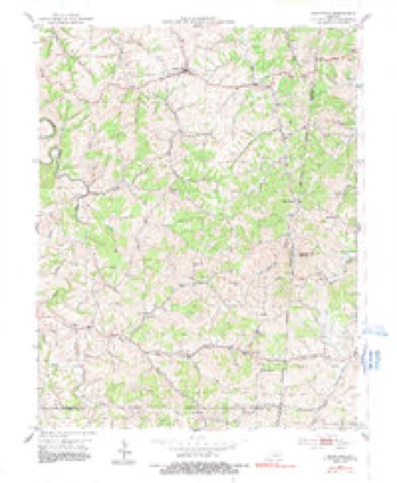
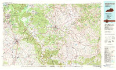
7 topographic sheets cover this place, the earliest surveyed in 1953 and the latest in 1981. It stands in the Springfield census division. It lies in ZIP code area 40069. It stands on Turkey Creek. The Survey maps it on the Mackville quadrangle.
Topographic sheets covering this place
4 surveys from 7 printed sheetsMatched by testing this settlement's coordinate against the published boundary of every sheet in the United States Geological Survey's historical collection. Each opens the scanned sheet at the Survey.
- 1953 USGS Mackville quadrangle1:24000, 2 printings
- 1957 USGS Winchester quadrangle1:250000, 3 printings
- 1960 USGS Winchester quadrangle1:250000
- 1981 USGS Elizabethtown quadrangle1:100000


Fires near this place
3 since 2003Regional context, not property-specific evidence. The federal wildfire occurrence database lists 3 fires within 5 miles of Pottsville between 2003 and 2019, burning about 96 acres in total. None started naturally. 1 was recorded as arson. Distance is straight-line from the map coordinates, so a fire counted here may appear on a neighbouring settlement's page as well.
| Reported cause | Fires |
|---|---|
| Missing data/not specified/undetermined | 1 |
| Recreation and ceremony | 1 |
| Arson/incendiarism | 1 |
The most recent of them, most recent first, with the day each was reported and the service that recorded it.
| Date | Cause | Size | Reported by | Name on the report |
|---|---|---|---|---|
| 16 March 2003 | Missing data/not specified/undetermined | 80 acres | Kentucky Division of Forestry | not named |
| 3 October 2019 | Arson/incendiarism | 15 acres | Kentucky Division of Forestry | DEEP CREEK |
| 24 October 2010 | Recreation and ceremony | 1.0 acres | Kentucky Division of Forestry | TEXAS ROAD |
Settlements close enough to share some of these fires:
Storms near this place
1 since 2025Regional context, not property-specific evidence. The National Weather Service names Pottsville in 1 storm report in 2025: 1 tornado. The reports record 1 death and 14 injuries. Each account below is quoted exactly as the forecast office filed it, from the NOAA Storm Events Database, and each date opens the federal record of that event.
| When | Event | Place named | Harm | What the report says |
|---|---|---|---|---|
| May 2025 | Tornado (EF2) | Pottsville | 1 killed, 14 hurt | An NWS damage survey team determined that an EF2 tornado with peak winds of 125 mph, maximum width of 450 yards, and track length of 5.55 miles initially touched down on the morning of Friday, May 30th in southeastern Washington County, Kentucky. ||The tornado touched down on a ridgetop near the|intersection of Coyle Lane and Long Run Road, initially snapping|and twisting some hardwood trees, and throwing a chicken cage|almost a quarter mile to the northeast of the path. From there, the|tornado quickly intensified into solid EF-2 strength as a vortex|within the parent circulation produced a third of a mile long|swath of intense damage starting only about 100-200 yards from|the touchdown point. Here, a well built barn with living quarters|was completely swept off the concrete foundation and thrown into|the valley below. Sill plates were anchored to the concrete|foundation, so construction was good, however three large overhead|doors likely contributed to the demise of the structure as they|faced the direction of the tornado path directly. Eyewitness|accounts from inside the structure said the overhead doors caved|inward first, and then the whole building went. Several occupants|were thrown into the valley below among the debris, but|miraculously survived.||From there, the intense EF2 vortex traveled east-northeast across Long Run|Road and completely destroyed another structure/home just to the |east of the road. Here, debris from the complete destruction of |the home was thrown about 75 yards directly to the north of the |path into a ravine. Sadly, one occupant of the home was killed, |with at least two others injured. The foundation of this structure|was on cinder blocks, with quite a bit of open space beneath the |floor. Peak winds reached 125 mph for both of these structures, |with broader EF1 damage noted on either side of the path. Peak |width was right at a quarter of a mile, or roughly 450 yards here |before the tornado narrowed considerably and weakened.||EF1 strength winds continued along and just north of Long Run |Road as the tornado traveled ESE toward the Boyle County line. |
Nearest settlements
The eight closest, with where each one stands in the county. Distances are straight-line, computed from the Geographic Names Information System coordinates.
| Map | Place | Distance | Sheets |
|---|---|---|---|
| Texas | 2.4 miles | 7 | |
| Rineltown | 4.8 miles | 9 | |
| Simstown | 5.9 miles | 9 | |
| Jenkinsville | 6.0 miles | 7 | |
| Mackville | 6.2 miles | 7 | |
| Oakland (historical) | 6.3 miles | 9 | |
| Thompsonville | 6.6 miles | 9 | |
| Jimtown | 7.7 miles | 9 |
Provenance
This settlement is recorded in the Geographic Names Information System as feature 508865. The sheet list is computed by point-in-boundary test against the United States Geological Survey's historical topographic inventory. Both are works of the United States government and carry no copyright under 17 U.S.C. 105.
Wildfire. Short, Karen C. 2022. Spatial wildfire occurrence data for the United States, 1992-2020 [FPA_FOD_20221014]. 6th Edition. Fort Collins, CO: Forest Service Research Data Archive. https://doi.org/10.2737/RDS-2013-0009.6 Collected with United States Government funding and usable without additional permissions or fees.
Storms. NOAA National Centers for Environmental Information, Storm Events Database https://www.ncei.noaa.gov/stormevents/ A work of the United States government, no copyright under 17 U.S.C. 105. Narratives are quoted verbatim from the National Weather Service report and are not edited or summarised.