 Block
Winchester, Kentucky
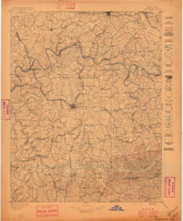
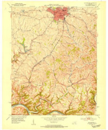
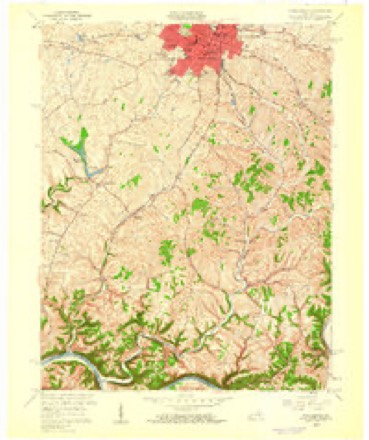
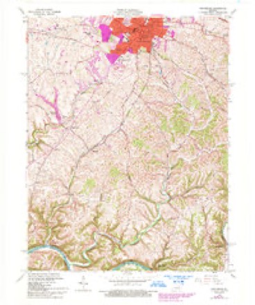
17 topographic sheets cover this place, the earliest surveyed in 1892 and the latest in 1991. It stands in the Winchester census division. It lies in ZIP code area 40391. The Survey maps it on the Winchester quadrangle. 19,134 people lived here at the 2020 count. It stands 994 feet above sea level.
Research this city
On record in Winchester
Buildings and businesses the archive holds for this place. Each opens its own page, with the source record it came from.
On the National Register 12 of 44 shown
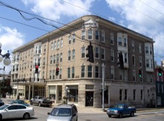 Brown-Proctoria Hotellisted 1977
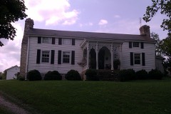 Bybee Houselisted 1979
 Clark County Courthouselisted 1974
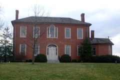 Gov. James A. Clark Mansionlisted 1974
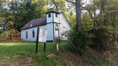 Corinth Christian Methodist Episcopal Churchlisted 2007
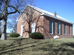 Goshen Primitive Baptist Churchlisted 1979
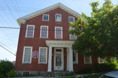 William Hickman Houselisted 1982
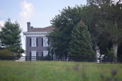 Hodgkins Houselisted 1979
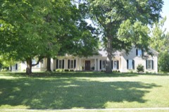 Hood-Tucker Houselisted 2007
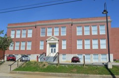 Oliver Schoollisted 2004
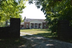 Owen-Gay Farmlisted 1997
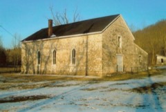 Providence Baptist Churchlisted 1976
Surveyed buildings and structures 3 records
- Leeds Theatre, 37 North Main Street, Winchesterfederal building survey, 1 photograph
- St. George Hotel, 100-108 North Main Street, Winchesterfederal building survey, 9 photographs
- Wincester Administration Building, Winchesterfederal building survey
Population over time
2 figuresWinchester grew from 18,368 to 19,134 between 2010 and 2020. These are the recorded population figures Wikidata holds for this place, reached through the Geographic Names Information System number this page is keyed on rather than by name, so they belong to this place and not to another of the same name. Most are census counts, but not all are: an early figure may be a founding or settlement estimate, and an estimate published within five years of a census is left out. The change column is computed, and is left blank where more than 20 years separate a figure from the one before it, because a gap that long is not a change between two counts.
| Year | People | Change |
|---|---|---|
| 2010 | 18,368 | |
| 2020 | 19,134 | +766 (+4%) |
Topographic sheets covering this place
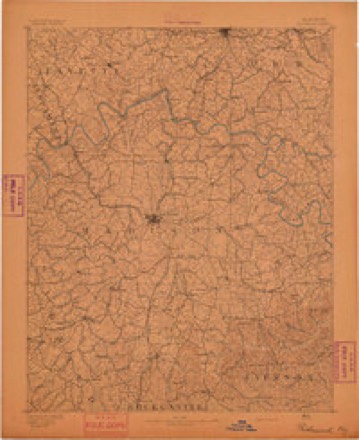
9 surveys from 17 printed sheetsMatched by testing this settlement's coordinate against the published boundary of every sheet in the United States Geological Survey's historical collection. Each opens the scanned sheet at the Survey.
- 1892 USGS Richmond quadrangle1:125000
- 1897 USGS Richmond quadrangle1:125000, 5 printings
- 1952 USGS Winchester quadrangle1:24000
- 1957 USGS Winchester quadrangle1:250000, 3 printings
- 1959 USGS Winchester quadrangle1:24000
- 1960 USGS Winchester quadrangle1:250000
- 1965 USGS Winchester quadrangle1:24000, 3 printings
- 1986 USGS Harrodsburg quadrangle1:100000
- 1991 USGS Harrodsburg quadrangle1:100000


Photographs
8 of 14 photographs shown, 1916 to 2020Taken for the Office of War Information and the Farm Security Administration, who photographed the country between 1935 and 1944. Works of United States government photographers, with no known restriction on use. Each opens its catalogue record.
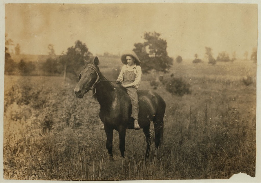
Hine, Lewis Wickes, 1916. Library of Congress

Highsmith, Carol M, 2020. Library of Congress
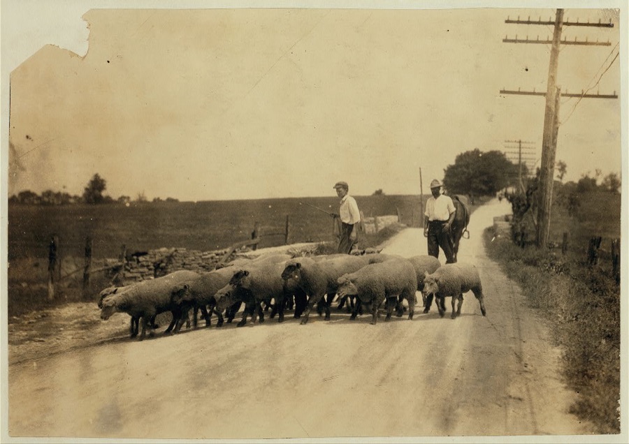
Hine, Lewis Wickes, 1916. Library of Congress
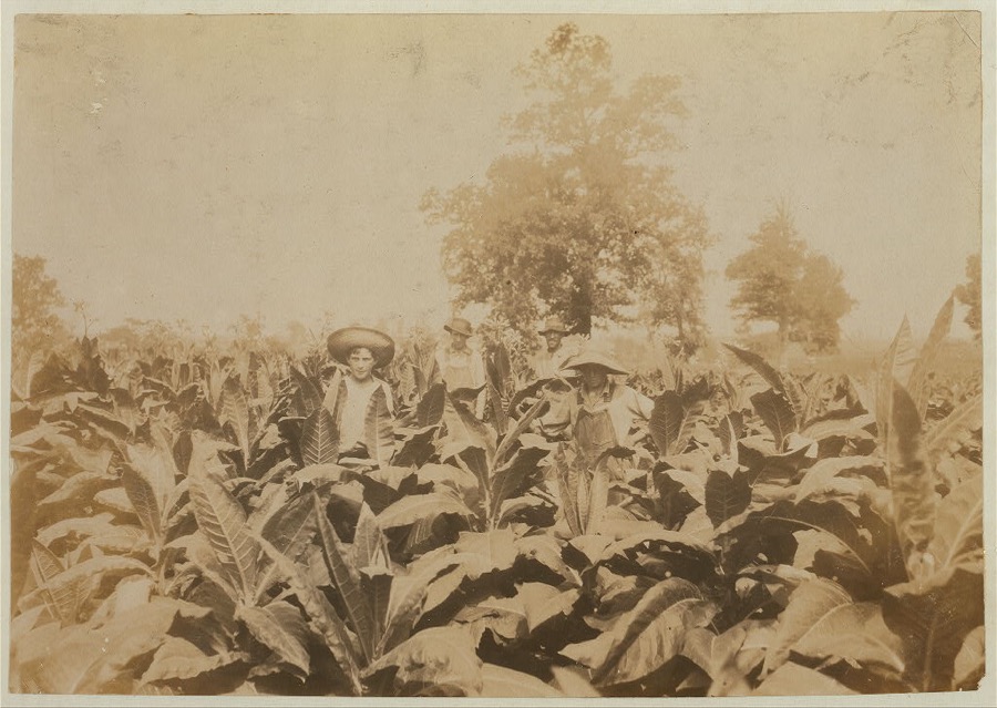
Hine, Lewis Wickes, 1916. Library of Congress
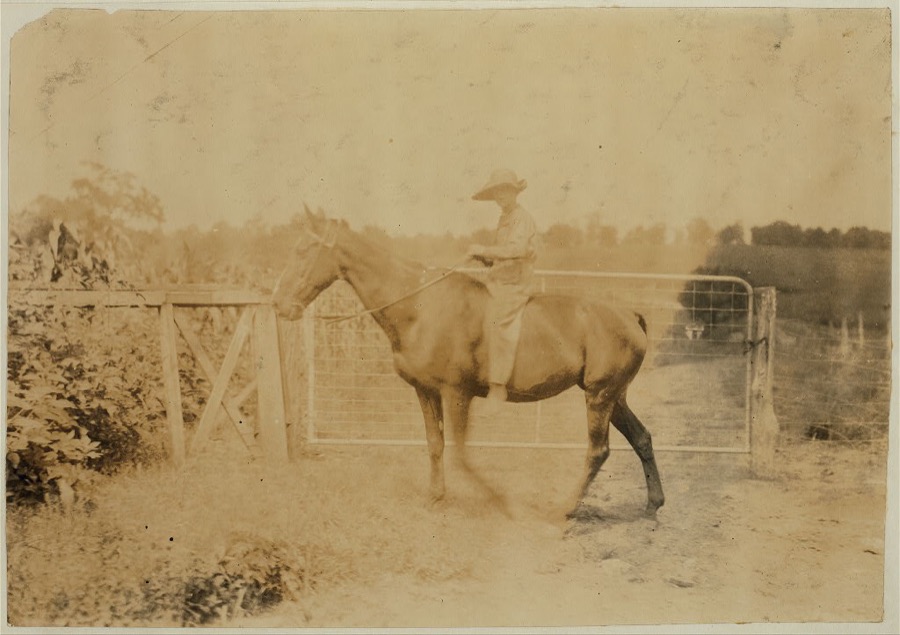
Hine, Lewis Wickes, 1916. Library of Congress
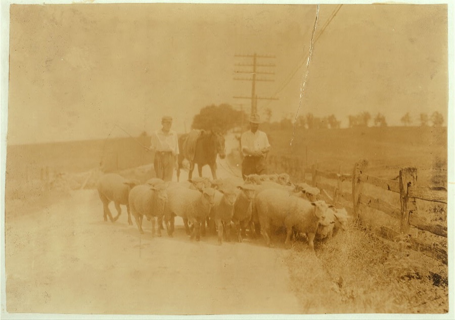
Hine, Lewis Wickes, 1916. Library of Congress

Hine, Lewis Wickes, 1916. Library of Congress
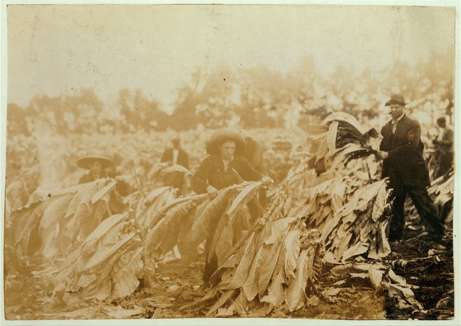
Hine, Lewis Wickes, 1916. Library of Congress
Every photograph of Clark County
Fires near this place
1 since 2001Regional context, not property-specific evidence. The federal wildfire occurrence database lists 1 fire within 5 miles of Winchester in 2001, burning about 3 acres in total. None started naturally. None was recorded as arson. Distance is straight-line from the map coordinates, so a fire counted here may appear on a neighbouring settlement's page as well.
| Reported cause | Fires |
|---|---|
| Debris and open burning | 1 |
The most recent of them, most recent first, with the day each was reported and the service that recorded it.
| Date | Cause | Size | Reported by | Name on the report |
|---|---|---|---|---|
| 9 November 2001 | Debris and open burning | 3.0 acres | Kentucky Division of Forestry | not named |
Settlements close enough to share some of these fires:
Storms near this place
60 of 83 shownRegional context, not property-specific evidence. The National Weather Service names Winchester in 83 storm reports between 1995 and 2025: 57 thunderstorm wind, 13 flash flood, 10 hail, 2 lightning. The reports record 3 injuries. Each account below is quoted exactly as the forecast office filed it, from the NOAA Storm Events Database, and each date opens the federal record of that event.
| When | Event | Place named | Harm | What the report says |
|---|---|---|---|---|
| May 1995 | Thunderstorm Wind | Winchester | 3 hurt, $50,000,000 | The damage path was from Combs Ferry Road Northeast through the county. The roof off the Red Carpet Inn on West Lexington Avenue was blown off. Debris from the roof was thrown on Shoney's Restaurant and Hatfield Chrysler-Plymouth. Three workers at OHI America were injured when the roof collapsed. Three tractor-semitrailers were blown into a building. Also, there was extensive damage to homes and barns. Winds greater than 100 mph estimated. |
| April 2015 | Thunderstorm Wind | Winchester | $1,000,000 | Law enforcement reported several trees down in the county. The Clark County KY Mesonet observation recorded a 53 mph wind gust. |
| April 2017 | Thunderstorm Wind | Winchester | $50,000 | The Clark County emergency manager reported power lines down in the area along with a tree on a house. |
| July 2016 | Thunderstorm Wind | Winchester | $30,000 | Local law enforcement reported trees and power lines down in the area due to severe thunderstorm winds. |
| May 1996 | Thunderstorm Wind | Winchester | $25,000 | no account filed |
| November 2005 | Thunderstorm Wind | Winchester | $20,000 | The roof was blown off a house that was under construction. |
| May 1998 | Thunderstorm Wind | Winchester | $10,000 | no account filed |
| July 2021 | Flash Flood | Winchester | $5,000 | A vehicle got stuck in flood waters covering North Maple Street. Cost of damage is unknown. |
| February 2009 | Thunderstorm Wind | Winchester | $5,000 | Roof damage to a barn on Crow Ridge Road was reported. |
| May 1998 | Lightning | Winchester | $5,000 | An old opera house in the downtown area caught fire as lightning struck it. The roof and ceiling of the top floor were heavily damaged. |
| October 2001 | Thunderstorm Wind | Winchester | $5,000 | no account filed |
| October 2013 | Thunderstorm Wind | Winchester | $2,000 | A spotter reported that winds associated with a strong line of showers brought damage to his storm doors and his garage. In his neighborhood many large tree limbs were downed, causing power outages. Thirteen minutes earlier, just 3 miles northwest of Winchester, a Kentucky mesonet site recorded a wind gust of 57 mph. |
| May 1998 | Lightning | Winchester | $2,000 | Lightning struck a tree which then fell on a house damaging the roof. |
| April 2025 | Thunderstorm Wind | Winchester | - | There were multiple trees reported down around Winchester. |
| February 2024 | Thunderstorm Wind | Winchester | - | There were large tree limbs down near a home. |
| May 2024 | Thunderstorm Wind | Winchester | - | Trees were blown down by strong winds onto cars at Winchester Country Club. |
| August 2024 | Thunderstorm Wind | Winchester | - | Social media reported that power lines were snapped near Taco Bell in Winchester. |
| August 2024 | Thunderstorm Wind | Winchester | - | There were multiple reports of tree damage and limbs down across portions of Clark County, including within the city of Winchester along Meadowbrook Drive. |
| July 2023 | Thunderstorm Wind | Winchester | - | There were trees down over multiple roads. |
| July 2022 | Thunderstorm Wind | Winchester | - | There were reports of trees down in Winchester. |
| July 2021 | Flash Flood | Winchester | - | There was water over multiple roadways. The 200 block of Shoppers Drive and Old Boonesboro Road were all closed. Two cars stalled in the flood waters. |
| October 2021 | Flash Flood | Winchester | - | The intersection of Broadway and Washington was closed due to flooding. |
| October 2021 | Flash Flood | Winchester | - | The emergency manager reported that roads were closed and water rescues were taking place. |
| June 2021 | Thunderstorm Wind | Winchester | - | A tree fell down. |
| May 2020 | Flash Flood | Winchester | - | Boonesboro Road was closed due to high water. |
| June 2019 | Thunderstorm Wind | Winchester | - | Several trees were down across Clark County. |
| September 2018 | Flash Flood | Winchester | - | State Road 89, Irvine Road, was underwater 1 to 2 miles southeast of Winchester, Kentucky. |
| June 2016 | Thunderstorm Wind | Winchester | - | Local law enforcement reported several power lines down across the county due to severe thunderstorm winds. |
| June 2016 | Thunderstorm Wind | Winchester | - | Local law enforcement reported several downed trees across the county, some of which were blocking roadways. |
| July 2016 | Flash Flood | Winchester | - | A trained spotter reported flash flooding and impassable roads on Old Ruckerville Road. |
| July 2015 | Hail | Winchester | - | The Clark County emergency manager reported hail 3/4 inch in diameter. |
| July 2015 | Thunderstorm Wind | Winchester | - | The Clark County emergency manager reported trees down in the Winchester area due to severe thunderstorm winds. |
| May 2015 | Thunderstorm Wind | Winchester | - | A county official reported that trees were down across the county due to severe thunderstorm winds. |
| July 2015 | Thunderstorm Wind | Winchester | - | A Clark County law enforcement official reported power lines down in the city of Winchester. Numerous trees were reported down across the county as well. |
| June 2014 | Thunderstorm Wind | Winchester | - | Thunderstorms winds toppled half of a tree in Winchester. |
| January 2013 | Thunderstorm Wind | Winchester | - | The Clark County emergency manager reported a few trees downed in Winchester. |
| June 2012 | Thunderstorm Wind | Winchester | - | A gust front associated with a line of storms across southern Ohio downed trees and power lines across Clark County. |
| April 2009 | Thunderstorm Wind | Winchester | - | A tree was downed across College Street. |
| February 2009 | Thunderstorm Wind | Winchester | - | A heavy awning was blown off of a home and was blocking Ashland Avenue in Winchester. |
| May 2009 | Flash Flood | Winchester | - | Four inches of water was flowing across the road in Highview. |
| June 2009 | Flash Flood | Winchester | - | Water was flowing over Route 89 between Winchester and the Estill County line. |
| September 2009 | Heavy Rain | Winchester | - | The Clark County Kentucky Mesonet site measured 2.31 inches of rainfall in a little less than two hours. |
| March 2008 | Thunderstorm Wind | Winchester | - | Thunderstorm winds downed trees. |
| July 2008 | Thunderstorm Wind | Winchester | - | Numerous trees were reported down across the county. |
| April 2007 | Thunderstorm Wind | Winchester | - | Several trees were downed. |
| April 2007 | Thunderstorm Wind | Winchester | - | Several trees were blown down over the western part of the county, between Winchester and Pine Grove. |
| October 2007 | Thunderstorm Wind | Winchester | - | Trees were downed. |
| May 2004 | Thunderstorm Wind | Winchester | - | Trees and power lines were downed. |
| May 2004 | Flash Flood | Winchester | - | Up to one foot of water was over Richmond Road in southwestern Clark County. |
| May 2004 | Thunderstorm Wind | Winchester | - | Trees and power lines were downed along Redhouse Road. |
| June 2004 | Thunderstorm Wind | Winchester | - | Trees and power lines were downed. |
| May 2004 | Flash Flood | Winchester | - | Highway 89 and Ruckersville Road were flooded. |
| July 2004 | Thunderstorm Wind | Winchester | - | Four roads were blocked by downed trees. |
| May 2003 | Thunderstorm Wind | Winchester | - | Trees were downed. |
| July 2002 | Flash Flood | Winchester | - | Water covered part of the Highway 1927 Bypass. |
| May 2002 | Thunderstorm Wind | Winchester | - | Trees were downed. |
| June 2000 | Thunderstorm Wind | Winchester | - | Trees were downed. |
| August 1997 | Thunderstorm Wind | Winchester | - | Numerous trees down. |
| February 2024 | Hail | Winchester | - | no account filed |
| April 2017 | Hail | Winchester | - | no account filed |
Newspapers printed here
1,717 digitised pages1 paper published in this town, digitised by the Library of Congress and free to read: 270 issues, 1,717 pages. Every page is searchable, so a name or a street can be looked for directly in what the town printed about itself at the time.
| Newspaper | Published |
|---|---|
| The Winchester News | 1908 to 19?? |
What the paper printed
21,326 wordsFront pages of the local paper, read from the Library of Congress scans: 6 issues spread across its run from 1908 to 1912, 21,326 words in total. Each is reproduced on its own page, exactly as the recogniser returned it.
These pages read less well than anything else here, and the number is worth stating: about three words in four come through cleanly, against nine in ten for the building records. An 1896 broadsheet sets eight-point type in seven columns on microfilm, which is the hardest thing in this archive to read by machine. We tested our own recognisers against the Library's and they were not better, so the Library's text is what appears, with the wholly unreadable columns removed. Read it as a guide to what the paper covered, and follow the link to the scan before quoting anything.
| Issue | Paper | Length |
|---|---|---|
| 1908-10-12 | The Winchester News | 3,254 words |
| 1908-10-29 | The Winchester News | 3,843 words |
| 1908-11-16 | The Winchester News | 3,460 words |
| 1908-12-03 | The Winchester News | 3,538 words |
| 1908-12-21 | The Winchester News | 3,477 words |
| 1912-02-29 | The Winchester News | 3,754 words |
Nearest settlements
The eight closest, with where each one stands in the county. Distances are straight-line, computed from the Geographic Names Information System coordinates.
| Map | Place | Distance | Sheets |
|---|---|---|---|
| Wesleyan Park | 0.7 miles | 17 | |
| Hampton Manor | 0.8 miles | 17 | |
| Colby Hills | 1.0 miles | 17 | |
| Forrest Park | 1.0 miles | 7 | |
| Victory Heights (historical) | 1.1 miles | 7 | |
| Bon Haven | 1.3 miles | 7 | |
| Bel Air | 1.5 miles | 7 | |
| Green Fields Estates | 1.5 miles | 17 |
Elsewhere
Matched on this settlement's Geographic Names Information System number rather than its name, so it cannot be a different place of the same name in another state.
| Wikipedia article on Winchester | An encyclopaedic summary. Its text is share-alike, so it is linked here rather than copied. |
| Wikidata item Q985302 | The structured record the population and elevation above come from. Public domain (CC0). |
Provenance
This settlement is recorded in the Geographic Names Information System as feature 506924. The sheet list is computed by point-in-boundary test against the United States Geological Survey's historical topographic inventory. Both are works of the United States government and carry no copyright under 17 U.S.C. 105.
Wildfire. Short, Karen C. 2022. Spatial wildfire occurrence data for the United States, 1992-2020 [FPA_FOD_20221014]. 6th Edition. Fort Collins, CO: Forest Service Research Data Archive. https://doi.org/10.2737/RDS-2013-0009.6 Collected with United States Government funding and usable without additional permissions or fees.
Storms. NOAA National Centers for Environmental Information, Storm Events Database https://www.ncei.noaa.gov/stormevents/ A work of the United States government, no copyright under 17 U.S.C. 105. Narratives are quoted verbatim from the National Weather Service report and are not edited or summarised.