 Block
Woodsonville, Kentucky
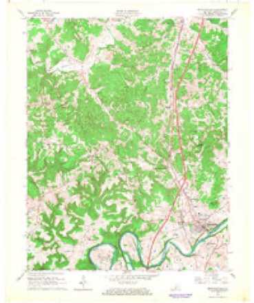
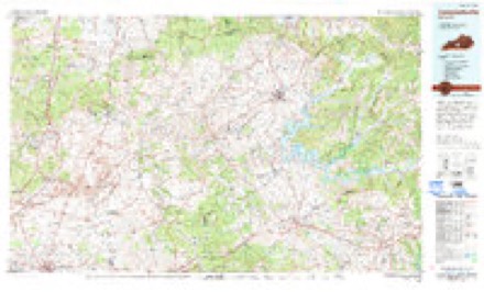
11 topographic sheets cover this place, the earliest surveyed in 1934 and the latest in 1986. It stands in the Horse Cave census division. It lies in ZIP code area 42765. It lies near Town Knob. The Survey maps it on the Munfordville quadrangle.
On record in Woodsonville
Buildings and businesses the archive holds for this place. Each opens its own page, with the source record it came from.
On the National Register within a mile 11 records
The National Register names another town for these. They stand within one mile of this settlement's coordinate.
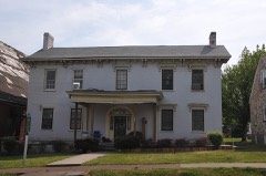 F. A. Smith Houselisted 1980 · 0.6 miles away
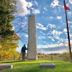 Col. Robert A. Smith Monumentlisted 1997 · 0.6 miles away
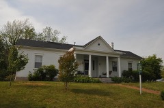 Munfordville Schoollisted 1984 · 0.6 miles away
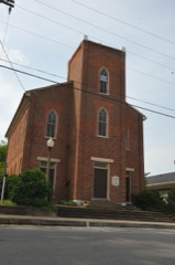 Munfordville Presbyterian Church and Green River Lodge No.88listed 1980 · 0.6 miles away
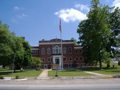 Hart County Courthouselisted 1980 · 0.6 miles away
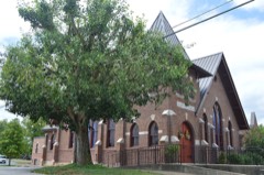 Munfordville Baptist Churchlisted 1980 · 0.7 miles away
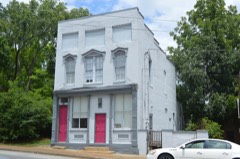 Hart County Deposit Bank and Trust Company Buildinglisted 1980 · 0.7 miles away
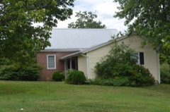 Alvey Cox Houselisted 1980 · 0.9 miles away
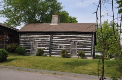 Munford Innlisted 1984 · 0.9 miles away
- Battle of Munfordville Sitelisted 1999 · 0.3 miles away
- Dr. Lewis Barrett Houselisted 1980 · 0.7 miles away
Topographic sheets covering this place
7 surveys from 11 printed sheetsMatched by testing this settlement's coordinate against the published boundary of every sheet in the United States Geological Survey's historical collection. Each opens the scanned sheet at the Survey.
- 1934 USGS Munfordville quadrangle1:48000
- 1937 USGS Munfordville quadrangle1:62500
- 1953 USGS Munfordville quadrangle1:24000, 2 printings
- 1957 USGS Winchester quadrangle1:250000, 3 printings
- 1960 USGS Winchester quadrangle1:250000
- 1966 USGS Munfordville quadrangle1:24000
- 1986 USGS Campbellsville quadrangle1:100000, 2 printings


Fires near this place
13 since 1998Regional context, not property-specific evidence. The federal wildfire occurrence database lists 13 fires within 5 miles of Woodsonville between 1998 and 2020, burning about 86 acres in total. None started naturally. None was recorded as arson. Distance is straight-line from the map coordinates, so a fire counted here may appear on a neighbouring settlement's page as well.
| Reported cause | Fires |
|---|---|
| Missing data/not specified/undetermined | 7 |
| Debris and open burning | 3 |
| Recreation and ceremony | 2 |
| Misuse of fire by a minor | 1 |
The most recent of them, most recent first, with the day each was reported and the service that recorded it.
| Date | Cause | Size | Reported by | Name on the report |
|---|---|---|---|---|
| 24 September 1999 | Missing data/not specified/undetermined | 20 acres | Kentucky Division of Forestry | not named |
| 24 August 2007 | Missing data/not specified/undetermined | 1.0 acres | Kentucky Division of Forestry | not named |
| 7 July 2012 | Misuse of fire by a minor | under an acre | Kentucky Division of Forestry | YODER FIRE |
| 5 April 2005 | Missing data/not specified/undetermined | 5.0 acres | Kentucky Division of Forestry | not named |
| 3 April 2011 | Recreation and ceremony | 4.0 acres | Kentucky Division of Forestry | MCCUBBINS FIRE |
| 18 April 2016 | Debris and open burning | 1.0 acres | Kentucky Division of Forestry | CHESTNUT GROVE CEM. |
| 24 March 2009 | Recreation and ceremony | 1.0 acres | Kentucky Division of Forestry | not named |
| 18 March 2009 | Missing data/not specified/undetermined | 1.0 acres | Kentucky Division of Forestry | not named |
Settlements close enough to share some of these fires:
Mines and quarries near this place
1 within 5 milesRegional context, not property-specific evidence. The federal mineral resources record lists 1 working within 5 miles of Woodsonville: 1 producer. All of them still produce. What was taken out: Stone, Crushed/Broken. Distance is straight-line from the map coordinates, so a quarry counted here may appear on a neighbouring settlement's page as well.
| Where | Site | Commodity | Status | Recorded |
|---|---|---|---|---|
| Geralds Stone Mine and Mill | Stone, Crushed/Broken | Producer |
Storms near this place
16 since 2009Regional context, not property-specific evidence. The National Weather Service names Woodsonville in 16 storm reports between 2009 and 2023: 10 flood, 5 thunderstorm wind, 1 hail. No death or injury is recorded in these reports. Each account below is quoted exactly as the forecast office filed it, from the NOAA Storm Events Database, and each date opens the federal record of that event.
| When | Event | Place named | Harm | What the report says |
|---|---|---|---|---|
| December 2023 | Thunderstorm Wind | Woodsonville | $5,000 | A tree fell on a power line. |
| January 2009 | Flood | Woodsonville | $5,000 | Ice melt from a recent ice storm coupled with heavy rain created minor flooding along the Green River near Munfordville. The river crested at 32.73 feet, 4.73 feet above flood stage, on January 30th at 1945 local time. |
| March 2023 | Thunderstorm Wind | Woodsonville | - | Dispatch reported trees and power lines were down in Munfordville. |
| July 2022 | Thunderstorm Wind | Woodsonville | - | A power line fell on a house and started a fire. |
| February 2021 | Flood | Woodsonville | - | There was a water rescue on West Back Street. |
| March 2015 | Flood | Woodsonville | - | Several inches of snow followed by 1 to 2 inches of rain resulted in the Green River at Munfordville to rise above flood stage. The river crested at 32.49 feet during the early morning hours of March 6th and then fell below flood stage late on March 6th. |
| April 2015 | Flood | Woodsonville | - | Approximately 3 inches of rain fell on top of saturated ground and brought the Green River at Munfordville into flood. The river crested at 32.08 feet on the evening of April 15th. |
| April 2015 | Flood | Woodsonville | - | County officials reported that several roads had water flowing across them. |
| July 2015 | Thunderstorm Wind | Woodsonville | - | A broadcast meteorologist relayed a report of trees down in Munfordville due to severe thunderstorm winds. |
| July 2015 | Thunderstorm Wind | Woodsonville | - | A law enforcement official reported that trees were down in town as a result of severe thunderstorm winds. |
| December 2015 | Flood | Woodsonville | - | Several heavy rain events in late December brought 3 to locally 6 inches of rain to the area. This resulted in minor flooding on the Green River at Munfordville. The river crested at 28.27 feet on December 27th. |
| July 2013 | Flood | Woodsonville | - | Heavy rains from the 4th through the 6th of July led to minor flooding on the Green River at Munfordville. Flood stage is 28 feet. The river crested at 31.8 feet during the early evening of July 7th. |
| May 2011 | Flood | Woodsonville | - | The Green River at Munfordville crested around 29.6 feet at 345 PM CST on May 4. Flood stage at Munfordville is 28 feet. Minor flooding occurs at this level, with the city park under the US 31W bridge flooded. |
| April 2011 | Flood | Woodsonville | - | The Green River at Munfordville crested around 34.6 feet at 5 PM CST on April 13. Flood stage at Munfordville is 28 feet. Minor flooding occurs at this level with the city park covered by water. |
| November 2011 | Flood | Woodsonville | - | The Green River in Munfordville flooded due to heavy rain over the previous several days. The river crested at 30.66 feet. Flood stage is 28 feet. |
| April 2017 | Hail | Woodsonville | - | no account filed |
Nearest settlements
The eight closest, with where each one stands in the county. Distances are straight-line, computed from the Geographic Names Information System coordinates.
| Map | Place | Distance | Sheets |
|---|---|---|---|
| Munfordville | 0.7 miles | 11 | |
| Rowletts | 1.5 miles | 12 | |
| Perryville | 1.6 miles | 11 | |
| Leitchfield Crossing | 3.0 miles | 11 | |
| Mount Beulah | 3.7 miles | 11 | |
| Logsdon Valley | 3.9 miles | 11 | |
| Kessinger | 4.8 miles | 11 | |
| Bunnell Crossing | 4.9 miles | 11 |
Provenance
This settlement is recorded in the Geographic Names Information System as feature 507125. The sheet list is computed by point-in-boundary test against the United States Geological Survey's historical topographic inventory. Both are works of the United States government and carry no copyright under 17 U.S.C. 105.
Wildfire. Short, Karen C. 2022. Spatial wildfire occurrence data for the United States, 1992-2020 [FPA_FOD_20221014]. 6th Edition. Fort Collins, CO: Forest Service Research Data Archive. https://doi.org/10.2737/RDS-2013-0009.6 Collected with United States Government funding and usable without additional permissions or fees.
Mines and quarries. USGS Mineral Resources Data System (MRDS) https://mrdata.usgs.gov/mrds/ A work of the United States government, no copyright under 17 U.S.C. 105.
Storms. NOAA National Centers for Environmental Information, Storm Events Database https://www.ncei.noaa.gov/stormevents/ A work of the United States government, no copyright under 17 U.S.C. 105. Narratives are quoted verbatim from the National Weather Service report and are not edited or summarised.