 Block
From the record
One of 11 National Register listings published here for Carroll County · listed in 2000 · category: Building.
Sources: the case file at the National Archives · the National Register database, National Park Service
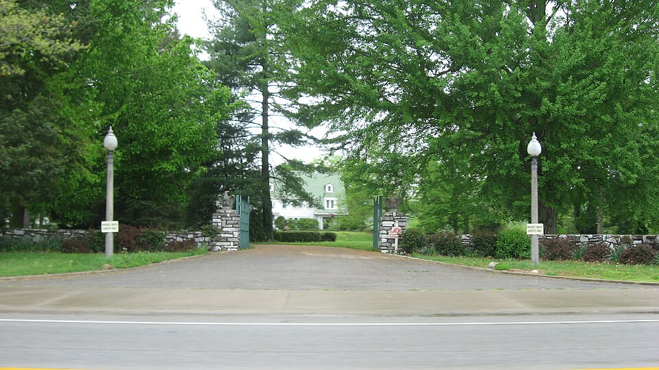
Listed on the National Register of Historic Places in 2000.
One of 11 National Register listings published here for Carroll County · listed in 2000 · category: Building.
Sources: the case file at the National Archives · the National Register database, National Park Service
Regional context, not property-specific evidence. The National Weather Service names Carrollton, the town this property stands in, in 65 storm reports between 1996 and 2026: 35 thunderstorm wind, 15 hail, 8 flood, 6 flash flood. No death or injury is recorded in these reports. Each account below is quoted exactly as the forecast office filed it, from the NOAA Storm Events Database, and each date opens the federal record of that event.
| When | Event | Place named | Harm | What the report says |
|---|---|---|---|---|
| March 2017 | Thunderstorm Wind | Carrollton | $200,000 | Numerous houses, buildings and churches sustained significant roof damage. There was also substantial damage to a concrete building. In addition, dozens of trees were downed. |
| June 2022 | Thunderstorm Wind | Carrollton | $25,000 | Two trees were downed, one on a house and another on a car. |
| May 2014 | Thunderstorm Wind | Carrollton | $20,000 | A warehouse at Polk and 11th Street in Carollton was damaged and 3 large limbs were downed due to thunderstorm winds. |
| July 2003 | Flash Flood | Carrollton | $20,000 | High water flooded a few roads. Several homes sustained basement flooding in town. |
| November 1996 | Thunderstorm Wind | Carrollton | $20,000 | no account filed |
| June 2025 | Thunderstorm Wind | Carrollton | $15,000 | A large tree fell onto a house. Numerous trees were also downed across the county. |
| July 2012 | Thunderstorm Wind | Carrollton | $10,000 | Tree limbs were reported down in the city and trees were downed around the county due to damaging thunderstorm winds. |
| November 2000 | Thunderstorm Wind | Carrollton | $10,000 | Winds knocked down large limbs and snapped power poles. |
| August 2007 | Thunderstorm Wind | Carrollton | $6,000 | Trees were downed countywide. |
| April 2011 | Thunderstorm Wind | Carrollton | $5,000 | A large tree fell on a house due to the winds. |
| October 2010 | Thunderstorm Wind | Carrollton | $5,000 | Large tree limbs and power lines were reported down countywide due to damaging thunderstorm winds. |
| April 2026 | Thunderstorm Wind | Carrollton | $4,000 | A few trees were downed on both Hawkins and Taylor Streets. |
| May 2024 | Thunderstorm Wind | Carrollton | $4,000 | A few trees were downed. |
| April 2006 | Thunderstorm Wind | Carrollton | $4,000 | Tree limbs were knocked down. |
| July 2024 | Thunderstorm Wind | Carrollton | $3,000 | A few trees were downed in the Carrollton area, including one on Martin Road and one on State Route 55. |
| June 2019 | Thunderstorm Wind | Carrollton | $3,000 | Three large trees were snapped at the intersection of 6th Street and Village Lane. |
| July 2016 | Thunderstorm Wind | Carrollton | $3,000 | A large tree fell through a shed. |
| May 2010 | Flash Flood | Carrollton | $3,000 | Several roads in the county were closed due to rapidly rising water. |
| July 2008 | Thunderstorm Wind | Carrollton | $3,000 | Several trees were downed. |
| June 2006 | Thunderstorm Wind | Carrollton | $3,000 | Three trees were knocked down. |
| August 2004 | Thunderstorm Wind | Carrollton | $3,000 | Trees were knocked down. |
| January 2000 | Thunderstorm Wind | Carrollton | $3,000 | Trees knocked down and a barn roof damaged. |
| August 2006 | Hail | Carrollton | $3,000 | no account filed |
| July 2015 | Flash Flood | Carrollton | $2,000 | Many roads across the county were completely flooded, leaving a few cars stranded. |
| January 2006 | Thunderstorm Wind | Carrollton | $2,000 | Two trees were downed along State Route 55. |
| July 2003 | Thunderstorm Wind | Carrollton | $2,000 | Two trees were downed. |
| April 1996 | Thunderstorm Wind | Carrollton | $2,000 | no account filed |
| July 2023 | Thunderstorm Wind | Carrollton | $1,000 | A tree fell onto State Route 55. |
| April 2019 | Thunderstorm Wind | Carrollton | $1,000 | One tree was knocked down in Carrollton. |
| December 2013 | Thunderstorm Wind | Carrollton | $1,000 | A couple of large trees were downed due to thunderstorm winds. |
| March 2012 | Thunderstorm Wind | Carrollton | $1,000 | Numerous large tree limbs were reported down due to damaging thunderstorm winds. |
| April 2011 | Thunderstorm Wind | Carrollton | $1,000 | Large tree limbs were reported down due to damaging thunderstorm winds. |
| June 2010 | Thunderstorm Wind | Carrollton | $1,000 | Large tree limbs were down on power lines due to thunderstorm winds. |
| May 2010 | Flash Flood | Carrollton | $1,000 | A few roads were closed due to high water. |
| July 2010 | Thunderstorm Wind | Carrollton | $1,000 | Large branches were reported down due to damaging thunderstorm winds. |
| August 2009 | Flood | Carrollton | $1,000 | High water was still present on area roadways. |
| September 2016 | Thunderstorm Wind | Carrollton | $500 | A tree was downed on Mound Hill Road. |
| April 2026 | Flood | Carrollton | - | Schuerman Street was closed due to high water. |
| June 2021 | Flood | Carrollton | - | High water resulted in a brief closure of Schuerman Street. |
| June 2019 | Flood | Carrollton | - | High water was reported on a few roads in the Carrollton area. |
| September 2018 | Flood | Carrollton | - | High water was reported over a portion of Lock Road near the river. |
| February 2018 | Flash Flood | Carrollton | - | Multiple roads were closed throughout the county due to high water. |
| May 2017 | Flood | Carrollton | - | High water was covering a portion of Highway 55 in the 3000 block. |
| March 2017 | Thunderstorm Wind | Carrollton | - | This was recorded at a Kentucky Mesonet site. A wind gust of 51 Knots was also recorded at 06:35 EST. |
| August 2016 | Flash Flood | Carrollton | - | Shuerman Street was closed due to flooding. |
| April 2015 | Flood | Carrollton | - | High water was reported on several roads throughout the county. |
| November 2013 | Heavy Rain | Carrollton | - | Whites Run Road was closed in a low lying location due to high water caused by heavy rainfall. |
| November 2011 | Thunderstorm Wind | Carrollton | - | The public estimated the gust. |
| May 2010 | Flood | Carrollton | - | Roads were still reported closed due to previous flash flooding. |
| March 2024 | Thunderstorm Wind | Carrollton | - | no account filed |
| July 2023 | Hail | Carrollton | - | no account filed |
| April 2016 | Hail | Carrollton | - | no account filed |
| May 2014 | Hail | Carrollton | - | no account filed |
| May 2012 | Hail | Carrollton | - | no account filed |
| July 2012 | Thunderstorm Wind | Carrollton | - | no account filed |
| March 2012 | Hail | Carrollton | - | no account filed |
| March 2012 | Hail | Carrollton | - | no account filed |
| March 2012 | Hail | Carrollton | - | no account filed |
| March 2010 | Hail | Carrollton | - | no account filed |
| August 2009 | Hail | Carrollton | - | no account filed |
No historic map-sheet match is published for this property yet. That does not mean no map exists. This record needs a coordinate-quality review before it can be joined to a sheet boundary. Browse the county's mapped places while that work is pending.
Other National Register properties close enough to walk or drive between, ordered by distance from this one. Both positions come from the same geocoding pass that matched these properties to their map sheets.
| Photograph | Property | Distance | Listed |
|---|---|---|---|
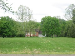 | Richard Masterson House | 0.2 miles | 1975 |
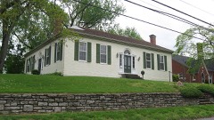 | Gen. William O. Butler House | 1.2 miles | 1976 |
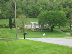 | Henry Ogburn House | 1.2 miles | 1987 |
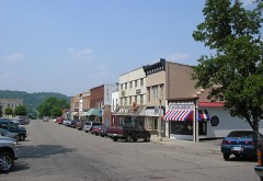 | Carrollton Historic District | 1.4 miles | 1982 |
| Turpin House | 1.4 miles | 1977 | |
| Paschal Todd Baker House | 1.5 miles | 1980 |
| National Archives record | The nomination case file for reference 00000274 in Record Group 79. |
| Carroll County | All 11 listed properties in this county. |