 Block
From the record
One of 102 National Register listings published here for Warren County · listed in 2004 · category: District.
Sources: the case file at the National Archives · the National Register database, National Park Service
Listed on the National Register of Historic Places in 2004.
One of 102 National Register listings published here for Warren County · listed in 2004 · category: District.
Sources: the case file at the National Archives · the National Register database, National Park Service
Regional context, not property-specific evidence. The federal wildfire occurrence database lists 13 fires within 5 miles of Oakland-Freeport Historic District between 1999 and 2013, burning about 146 acres in total. None started naturally. None was recorded as arson. Distance is straight-line from the map coordinates, so a fire counted here may appear on a neighbouring settlement's page as well.
| Reported cause | Fires |
|---|---|
| Missing data/not specified/undetermined | 4 |
| Recreation and ceremony | 3 |
| Railroad operations and maintenance | 3 |
| Debris and open burning | 2 |
| Smoking | 1 |
The most recent of them, most recent first, with the day each was reported and the service that recorded it.
| Date | Cause | Size | Reported by | Name on the report |
|---|---|---|---|---|
| 17 September 2008 | Railroad operations and maintenance | 75 acres | Kentucky Division of Forestry | not named |
| 17 September 1999 | Debris and open burning | 15 acres | Kentucky Division of Forestry | not named |
| 14 September 2010 | Missing data/not specified/undetermined | 2.0 acres | Kentucky Division of Forestry | LOVING RD. FIRE |
| 30 June 2012 | Railroad operations and maintenance | under an acre | Kentucky Division of Forestry | NOAH BLEDS |
| 6 April 2013 | Recreation and ceremony | 4.2 acres | Kentucky Division of Forestry | LITTLE KNOB FIRE |
| 6 March 2002 | Recreation and ceremony | 21 acres | Kentucky Division of Forestry | not named |
| 3 March 2006 | Missing data/not specified/undetermined | 9.5 acres | Kentucky Division of Forestry | not named |
| 15 March 2000 | Debris and open burning | 4.0 acres | Kentucky Division of Forestry | not named |
Regional context, not property-specific evidence. The federal mineral resources record lists 2 workings within 5 miles of Oakland-Freeport Historic District: 1 producer, 1 past producer. 1 still produces. What was taken out: Stone, Crushed/Broken. Distance is straight-line from the map coordinates, so a quarry counted here may appear on a neighbouring settlement's page as well.
| Where | Site | Commodity | Status | Recorded |
|---|---|---|---|---|
| Bowling Green Quarry | Stone, Crushed/Broken | Producer | ||
| Bowling Green Quarry | Stone, Crushed/Broken | Past Producer |
Regional context, not property-specific evidence. The National Weather Service names Oakland, the town this property stands in, in 10 storm reports between 2006 and 2025: 6 thunderstorm wind, 2 hail, 1 tornado, 1 flood. No death or injury is recorded in these reports. Each account below is quoted exactly as the forecast office filed it, from the NOAA Storm Events Database, and each date opens the federal record of that event.
| When | Event | Place named | Harm | What the report says |
|---|---|---|---|---|
| January 2013 | Tornado (EF2) | Oakland | $400,000 | An EF-2 tornado touched down just to the east of Interstate 65 around 3 miles southwest of Smith's Grove. After damaging several outbuildings, it encountered a set of 4 grain silos just to the south of Glasgow Road. It destroyed all 4 silos and threw their remains several hundred yards to the east. The tornado stayed on the ground for 3 miles, eventually crossing Interstate 65 just south of Smith's Grove. This tornado overturned a semi-trailer on the interstate. Before lifting up just to the east of Smith's Grove, it destroyed an older wooden barn and a large well constructed dairy barn, ripping steel I-beams out of their concrete base, scattering its roof, and collapsing its southern and eastern cinder block walls. |
| March 2017 | Thunderstorm Wind | Oakland | $50,000 | Multiple structures were damaged due to severe thunderstorm winds. |
| March 2020 | Thunderstorm Wind | Oakland | $5,000 | Two trees were blown down damaging a garage on Goshen Church North Road. |
| May 2024 | Hail | Oakland | - | Quarter sized hail was observed in Oakland in eastern Warren County. |
| April 2017 | Thunderstorm Wind | Oakland | - | A barn was damaged due to severe thunderstorm winds. |
| March 2017 | Thunderstorm Wind | Oakland | - | The public reported multiple structures sustained damage due to severe thunderstorm winds. |
| March 2013 | Flood | Oakland | - | The local media reported water covering Freeport Road in Bowling Green. |
| July 2008 | Thunderstorm Wind | Oakland | - | A tree was reported down near Oakland. |
| March 2006 | Thunderstorm Wind | Oakland | - | Power lines were blown down at the intersection of US Highway 31W and Kentucky Highway 101. |
| May 2025 | Hail | Oakland | - | no account filed |
No historic map-sheet match is published for this property yet. That does not mean no map exists. This record needs a coordinate-quality review before it can be joined to a sheet boundary. Browse the county's mapped places while that work is pending.
Other National Register properties close enough to walk or drive between, ordered by distance from this one. Both positions come from the same geocoding pass that matched these properties to their map sheets.
| Photograph | Property | Distance | Listed |
|---|---|---|---|
| Aubrey Burnett House | 0.3 miles | 1979 | |
| Peyton Cooke House | 1.4 miles | 1979 | |
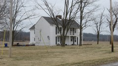 | Jesse Middleton House | 2.4 miles | 1979 |
| John Jackson Ford House | 2.4 miles | 1979 | |
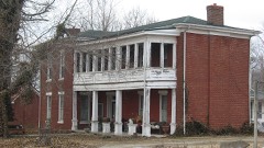 | J. L. Wright House | 2.5 miles | 1979 |
| Smiths Grove District | 2.6 miles | 1979 |
| National Archives record | The nomination case file for reference 04000801 in Record Group 79. |
| Warren County | All 102 listed properties in this county. |