 Block
From the record
One of 25 National Register listings published here for Boyd County · listed in 2008 · category: Building.
Sources: the case file at the National Archives · the National Register database, National Park Service
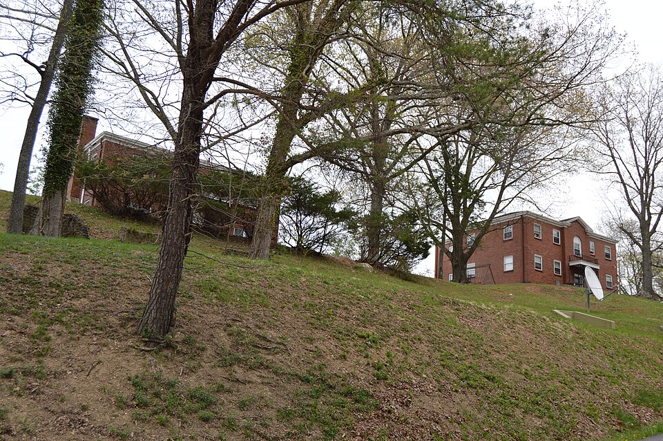
Listed on the National Register of Historic Places in 2008.
One of 25 National Register listings published here for Boyd County · listed in 2008 · category: Building.
Sources: the case file at the National Archives · the National Register database, National Park Service
Regional context, not property-specific evidence. The federal wildfire occurrence database lists 100 fires within 5 miles of Ashland Tuberculosis Hospital between 1997 and 2020, burning about 733 acres in total. None started naturally. 18 were recorded as arson. Distance is straight-line from the map coordinates, so a fire counted here may appear on a neighbouring settlement's page as well.
| Reported cause | Fires |
|---|---|
| Debris and open burning | 42 |
| Arson/incendiarism | 18 |
| Missing data/not specified/undetermined | 18 |
| Recreation and ceremony | 15 |
| Equipment and vehicle use | 2 |
| Railroad operations and maintenance | 1 |
| Smoking | 1 |
| Misuse of fire by a minor | 1 |
| Power generation/transmission/distribution | 1 |
| Other causes | 1 |
The most recent of them, most recent first, with the day each was reported and the service that recorded it.
| Date | Cause | Size | Reported by | Name on the report |
|---|---|---|---|---|
| 24 September 2019 | Debris and open burning | 1.0 acres | Kentucky Division of Forestry | ELIZABETH COURT |
| 12 August 1998 | Equipment and vehicle use | 10 acres | Kentucky Division of Forestry | not named |
| 4 July 2012 | Missing data/not specified/undetermined | under an acre | Kentucky Division of Forestry | REBEL ROAD |
| 3 May 2018 | Arson/incendiarism | 3.0 acres | Kentucky Division of Forestry | BUCK HAVEN |
| 13 May 2015 | Missing data/not specified/undetermined | 2.0 acres | Kentucky Division of Forestry | COLLINS ROAD |
| 9 April 2001 | Arson/incendiarism | 3.0 acres | Kentucky Division of Forestry | not named |
| 8 April 1997 | Arson/incendiarism | 2.0 acres | Kentucky Division of Forestry | not named |
| 6 April 2018 | Debris and open burning | under an acre | Wayne National Forest | HOG |
Regional context, not property-specific evidence. The federal mineral resources record lists 6 workings within 5 miles of Ashland Tuberculosis Hospital: 4 past producers, 2 unknowns. None of them still produces. What was taken out: Clay, Sand and Gravel, Construction, Iron, Sulfur. Distance is straight-line from the map coordinates, so a quarry counted here may appear on a neighbouring settlement's page as well.
| Where | Site | Commodity | Status | Recorded |
|---|---|---|---|---|
| Armco Steel/ Ashland, Ky. | Iron | Unknown | ||
| Ashland Oil/ Catlettsburg, Ky. | Sulfur | Unknown | ||
| Clinton Shale Mine | Clay | Past Producer | ||
| Ironton Plant Number 85 | Clay | Past Producer | ||
| Jerrys Sand and Gravel Pit | Sand and Gravel, Construction | Past Producer | Sedimentary | |
| Jerrys Sand and Gravel Pit | Sand and Gravel, Construction | Past Producer |
Regional context, not property-specific evidence. The National Weather Service names Ashland, the town this property stands in, in 77 storm reports between 1995 and 2025: 48 thunderstorm wind, 23 hail, 2 flash flood, 1 funnel cloud. No death or injury is recorded in these reports. Each account below is quoted exactly as the forecast office filed it, from the NOAA Storm Events Database, and each date opens the federal record of that event.
| When | Event | Place named | Harm | What the report says |
|---|---|---|---|---|
| May 2010 | Flood | Ashland | $500,000 | In Boyd County, the flooding damaged 28 homes, 11 were major damage. About 25 people were rescued from various locations in the county. Roads such as Tarpin Ridge and Marsh Hill received significant damage. The county high school baseball, softball, and football fields were completely submerged. Equipment for the fields and the concession stand was damaged. |
| June 2014 | Thunderstorm Wind | Ashland | $150,000 | Trees were blown down in scattered locations about the city. One tree went through the roof of a house on Chadwick Street, but there were no injuries. |
| June 2012 | Thunderstorm Wind | Ashland | $100,000 | Large trees and branches were blown down, some fell onto vehicles. In the aftermath, due to the lack of electricity, several citizens in town used charcoal grills to cook donated food before it spoiled. |
| May 2018 | Thunderstorm Wind | Ashland | $25,000 | A tree was blown over and fell onto a house. |
| July 2015 | Thunderstorm Wind | Ashland | $25,000 | Several trees were blown down. Electric power outages occurred. |
| April 2011 | Thunderstorm Wind | Ashland | $25,000 | Trees were blown down. Some power lines were brought down. One tree fell onto a car. |
| November 2013 | Thunderstorm Wind | Ashland | $20,000 | Wind gusts were estimated at 60 to 65 mph. One tree fell onto a garage. |
| May 1995 | Thunderstorm Wind | Ashland | $20,000 | Ashland police closed several streets until crews removed fallen trees. One tree destroyed a carport and damaged the roof of a home. One resident said, "It looked like war zone." Carter County also had several trees and power lines blown down. |
| May 2011 | Hail | Ashland | $20,000 | no account filed |
| May 2011 | Hail | Ashland | $20,000 | no account filed |
| August 2013 | Thunderstorm Wind | Ashland | $15,000 | A thunderstorm wind gust was strong enough to blow a portion of the roof off of the Castle Apartment building in the 2300 block of Winchester Avenue. |
| July 1998 | Thunderstorm Wind | Ashland | $15,000 | One building sustained minor wind damage. |
| June 1995 | Thunderstorm Wind | Ashland | $15,000 | no account filed |
| April 2015 | Hail | Ashland | $10,000 | Hail broke a few house windows and put dents in siding. |
| April 2015 | Thunderstorm Wind | Ashland | $10,000 | A few trees were blown down in downtown Ashland. One tree fell onto a van. |
| April 2013 | Thunderstorm Wind | Ashland | $10,000 | Several trees fell within the city. |
| August 2013 | Thunderstorm Wind | Ashland | $10,000 | A severe thunderstorm wind gust blew down the awning at a gas station at 2900 Winchester Avenue. |
| April 2011 | Thunderstorm Wind | Ashland | $10,000 | Several trees were blown down in the city. |
| July 2006 | Flash Flood | Ashland | $10,000 | Hoods Creek flooded roads and affected homes in the Westwood section of Ashland. The cooperative observer in Ashland measured 2.1 inches of rain. |
| June 1996 | Thunderstorm Wind | Ashland | $10,000 | no account filed |
| September 2025 | Thunderstorm Wind | Ashland | $5,000 | A tree and adjacent power lines fell onto a residence on Clay Street. |
| June 2019 | Thunderstorm Wind | Ashland | $5,000 | A tree fell onto power lines and smashed an unoccupied vehicle. |
| August 2013 | Lightning | Ashland | $5,000 | A lightning strike caused a house fire at a residence on Skyline Drive in Ashland. |
| March 2011 | Thunderstorm Wind | Ashland | $5,000 | A portion of a roof to a house was damaged. |
| May 2011 | Thunderstorm Wind | Ashland | $5,000 | Trees were blown down. One fell onto a house. |
| June 2011 | Thunderstorm Wind | Ashland | $5,000 | Several trees were blown down. |
| June 2011 | Thunderstorm Wind | Ashland | $5,000 | Several trees were blown down. |
| February 1998 | Thunderstorm Wind | Ashland | $5,000 | Trees fell across power lines. |
| May 2011 | Hail | Ashland | $5,000 | no account filed |
| August 1997 | Thunderstorm Wind | Ashland | $5,000 | no account filed |
| June 1996 | Thunderstorm Wind | Ashland | $5,000 | no account filed |
| May 1996 | Thunderstorm Wind | Ashland | $5,000 | no account filed |
| May 2017 | Thunderstorm Wind | Ashland | $3,000 | Thunderstorms winds broke some branches, which fell onto a car. |
| June 2024 | Thunderstorm Wind | Ashland | $2,000 | A tree and adjacent power lines were blown down along Mound Street near Ashland. |
| July 2018 | Thunderstorm Wind | Ashland | $2,000 | A large branch was blown down along Woodland Avenue. The tree fell on a power line and brought it down too. |
| June 2008 | Thunderstorm Wind | Ashland | $2,000 | Trees fell onto power lines. |
| April 2000 | Thunderstorm Wind | Ashland | $2,000 | Large tree branches were blown down within the city. |
| June 1998 | Thunderstorm Wind | Ashland | $2,000 | Large branches and a few trees were blown down. |
| March 1997 | Thunderstorm Wind | Ashland | $2,000 | no account filed |
| June 2022 | Thunderstorm Wind | Ashland | $1,000 | Multiple trees blew down along Cactus Street. |
| June 2022 | Thunderstorm Wind | Ashland | $1,000 | Multiple trees were blown down onto Oakville Road. |
| May 2018 | Thunderstorm Wind | Ashland | $1,000 | One tree and several limbs were blown down in Central Park in Ashland. Another tree was blown down along Sucks Creek Road. |
| February 2011 | Thunderstorm Wind | Ashland | $1,000 | Trees were blown down. |
| January 2008 | Thunderstorm Wind | Ashland | $1,000 | Minor structural damage occurred to a home. |
| January 2018 | Thunderstorm Wind | Ashland | $500 | A large tree limb fell down across Valley View Drive. |
| June 2025 | Flash Flood | Ashland | - | Flooding was observed at the intersection of Winchester Avenue and 29th Street in Ashland and the 2200 block of Greenup Avenue. |
| April 2020 | Heavy Rain | Ashland | - | In the town of Ashland, a residential street was covered in standing water. |
| February 2008 | Thunderstorm Wind | Ashland | - | Several trees were blown down. |
| July 2008 | Thunderstorm Wind | Ashland | - | Large tree branches were broken off. |
| June 2008 | Thunderstorm Wind | Ashland | - | Trees were blown down. |
| June 2008 | Thunderstorm Wind | Ashland | - | Large branches were broken off. |
| June 2007 | Thunderstorm Wind | Ashland | - | Trees were knocked down in scattered locations. |
| May 2004 | Thunderstorm Wind | Ashland | - | Trees were blown down in the city. |
| June 2004 | Thunderstorm Wind | Ashland | - | Trees were knocked down in the city. |
| July 1995 | Thunderstorm Wind | Ashland | - | Large tree branches were snapped off. |
| May 1995 | Hail | Ashland | - | Ashland police closed several streets until crews removed fallen trees. One tree destroyed a carport and damaged the roof of a home. One resident said, "It looked like war zone." Carter County also had several trees and power lines blown down. |
| February 2024 | Thunderstorm Wind | Ashland | - | no account filed |
| June 2015 | Hail | Ashland | - | no account filed |
| March 2011 | Hail | Ashland | - | no account filed |
| March 2011 | Hail | Ashland | - | no account filed |
No historic map-sheet match is published for this property yet. That does not mean no map exists. This record needs a coordinate-quality review before it can be joined to a sheet boundary. Browse the county's mapped places while that work is pending.
Other National Register properties close enough to walk or drive between, ordered by distance from this one. Both positions come from the same geocoding pass that matched these properties to their map sheets.
| Photograph | Property | Distance | Listed |
|---|---|---|---|
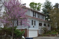 | Martin Hilton House | 1.9 miles | 1979 |
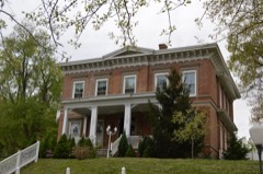 | Culbertson House | 1.9 miles | 1979 |
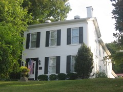 | Alexander Bagby House | 2.0 miles | 1979 |
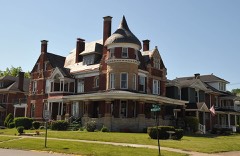 | Timothy Fields House | 2.0 miles | 1979 |
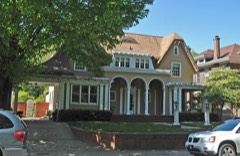 | Lon Rogers House | 2.1 miles | 1979 |
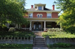 | Bath Avenue Historic District | 2.1 miles | 1979 |
| National Archives record | The nomination case file for reference 08000002 in Record Group 79. |
| Boyd County | All 25 listed properties in this county. |