 Block
From the record
One of 8 National Register listings published here for Trigg County · listed in 2024 · category: Building.
Sources: the National Register database, National Park Service
Listed on the National Register of Historic Places in 2024.
One of 8 National Register listings published here for Trigg County · listed in 2024 · category: Building.
Sources: the National Register database, National Park Service
Regional context, not property-specific evidence. The federal wildfire occurrence database lists 16 fires within 5 miles of George and Nellie White Smith House between 1999 and 2012, burning about 42 acres in total. None started naturally. None was recorded as arson. Distance is straight-line from the map coordinates, so a fire counted here may appear on a neighbouring settlement's page as well.
| Reported cause | Fires |
|---|---|
| Recreation and ceremony | 7 |
| Missing data/not specified/undetermined | 6 |
| Debris and open burning | 2 |
| Smoking | 1 |
The most recent of them, most recent first, with the day each was reported and the service that recorded it.
| Date | Cause | Size | Reported by | Name on the report |
|---|---|---|---|---|
| 4 September 1999 | Missing data/not specified/undetermined | 2.0 acres | Kentucky Division of Forestry | not named |
| 8 August 2012 | Debris and open burning | 5.0 acres | Kentucky Division of Forestry | RILEY HOL |
| 7 March 2010 | Recreation and ceremony | 1.0 acres | Kentucky Division of Forestry | not named |
| 7 March 2007 | Recreation and ceremony | 1.0 acres | Kentucky Division of Forestry | not named |
| 24 March 2004 | Missing data/not specified/undetermined | 1.5 acres | Kentucky Division of Forestry | not named |
| 24 March 2004 | Missing data/not specified/undetermined | 1.5 acres | Kentucky Division of Forestry | not named |
| 20 March 2005 | Missing data/not specified/undetermined | under an acre | Kentucky Division of Forestry | not named |
| 27 February 2004 | Missing data/not specified/undetermined | 10 acres | Kentucky Division of Forestry | not named |
Regional context, not property-specific evidence. The National Weather Service names Cadiz, the town this property stands in, in 118 storm reports between 1995 and 2025: 60 thunderstorm wind, 26 hail, 11 flash flood, 8 heavy rain. No death or injury is recorded in these reports. Each account below is quoted exactly as the forecast office filed it, from the NOAA Storm Events Database, and each date opens the federal record of that event.
| When | Event | Place named | Harm | What the report says |
|---|---|---|---|---|
| May 2011 | Thunderstorm Wind | Cadiz | $300,000 | A microburst with estimated winds up to 100 mph struck the south and east sides of Cadiz. The average path width of the microburst was 3/4 mile, and the path length was a mile and three-quarters. Thirty homes sustained light to moderate damage, mainly due to fallen trees. One home was destroyed by a large fallen tree. One business was heavily damaged, with the end of a storage building destroyed. Several other structures received damage, primarily to roofs. Sheet metal and attached framing smashed three delivery trucks. Signs were in the road on U.S. Highway 68 east of Cadiz. |
| April 2011 | Thunderstorm Wind | Cadiz | $200,000 | Numerous trees and power lines were blown down. About 1,500 utility customers lost power. A number of houses and public buildings were damaged. Emergency declarations were signed by the city of Cadiz and Trigg County. |
| June 2019 | Tornado (EF1) | Cadiz | $150,000 | Minor roof damage occurred to at least eight homes, primarily from falling trees. One home had a broken window. One barn was levelled. Several power lines were downed, mainly from falling trees. At least 200 trees were uprooted, snapped, or had broken limbs. The tornado traveled mainly along and north of Kings Chapel Road initially, then traveled along Cool Spring Cave Road before crossing South Montgomery Road, north of Caledonia. Peak winds were estimated near 95 mph. |
| July 2016 | Flash Flood | Cadiz | $150,000 | Water entered a home in Cadiz, along with another home on Highway 276 in northern Trigg County. Several Cadiz city streets were closed due to flooding. A few roads outside the city limits were flooded. At least one road was completely washed out in Cadiz. There was at least one bridge washout in the county. City crews rescued one person, and a few others were rescued outside the city. The Little River came out of its banks in Cadiz, flooding a parking lot and a few roads. A trained spotter near Cadiz measured 3.16 inches of rain in two hours. A state of emergency was declared for Trigg County. |
| October 2014 | Thunderstorm Wind | Cadiz | $100,000 | A private boat dock was heavily damaged. A boat was overturned. Between 30 and 40 trees were blown down across roads in the area. |
| March 2012 | Hail | Cadiz | $100,000 | Golf ball size hail was reported in Cadiz along Princeton Road and Stone Road causing damage to roofs of homes. |
| May 1995 | Hail | Cadiz | $100,000 | Baseball-size hail damaged cars, windows, and siding. Extensive damage was done to a greenhouse. |
| May 2025 | Thunderstorm Wind | Cadiz | $80,000 | A large tree was blown down, going all the way through a house as a line of thunderstorms moved through Cadiz. |
| February 2018 | Flood | Cadiz | $75,000 | Water was over a few low-lying secondary roads near the Little River, mainly along a fork that runs north of Cadiz. |
| March 1997 | Flash Flood | Cadiz | $70,000 | no account filed |
| May 2024 | Thunderstorm Wind | Cadiz | $45,000 | A morning thunderstorm line swept through Cadiz. Emergency management reported that the storm took out power and generator at the county hospital in Cadiz. Multiple trees were downed onto power lines near the hospital. A spotter reported that lots of trees were downed, many on roads such as Oliver Rd and N. Montgomery Rd. |
| April 2011 | Tornado (EF1) | Cadiz | $30,000 | Approximately a dozen trees were uprooted or snapped. Several tree limbs were blown down. Two homes on the outskirts of north Cadiz received shingle damage. Peak winds were estimated near 90 mph. The average path width was 100 yards. |
| October 2021 | Thunderstorm Wind | Cadiz | $25,000 | A tree fell on a power line and brought down three poles on the outskirts of Cadiz. |
| February 2019 | Flash Flood | Cadiz | $25,000 | Water was over Highway 1175. Several other state and county roads were closed, including a road that crosses the Little River. One roadway was partially washed out. A trained spotter in Rockcastle measured a 48-hour total of 4.20 inches. |
| June 2018 | Lightning | Cadiz | $20,000 | Two houses were struck by lightning and on fire. |
| October 2013 | Thunderstorm Wind | Cadiz | $20,000 | Numerous trees were blown down. |
| July 2012 | Thunderstorm Wind | Cadiz | $20,000 | Two 40-inch trees were snapped off at the ground. A wood garage was levelled. Several awnings and carports were damaged. |
| April 2011 | Thunderstorm Wind | Cadiz | $20,000 | A wind gust to 68 mph was measured at a local radio station. A gust to 65 mph was measured on the west side of Cadiz. Trees were blown down. |
| October 2009 | Thunderstorm Wind | Cadiz | $20,000 | Outbuildings and trees on a farm were damaged. |
| May 2001 | Thunderstorm Wind | Cadiz | $20,000 | About 15 trees were blown down, mainly across northern parts of the county. Near Cadiz, two structures which were under construction were blown down, including a house and a church. |
| June 2018 | Thunderstorm Wind | Cadiz | $15,000 | Multiple trees were down on the north side of Cadiz, along with power lines. Widespread power outages were reported in the county. |
| August 2012 | Thunderstorm Wind | Cadiz | $15,000 | A tree was blown down on a car off State Route 139 north of Cadiz. One person was trapped. On Highway 139 south of Cadiz, a tree was blown onto a power line. Several other trees were blown down. |
| February 2011 | Thunderstorm Wind | Cadiz | $12,000 | A number of trees and tree limbs were broken or snapped. Some shingles were blown off several homes on Highway 139 a couple miles north of Cadiz, and one home had siding damage. Tree limbs were down at Interstate 24 and Kentucky 124. |
| March 2017 | Thunderstorm Wind | Cadiz | $10,000 | A wind gust to 70 mph was measured by emergency management personnel. Some roof damage was reported. |
| August 2015 | Lightning | Cadiz | $10,000 | Lightning struck a substation near Cadiz, causing several circuits to go down. About 12,000 utility customers lost power for up to an hour. Power went out throughout all of Cadiz and parts of three other counties. |
| February 2012 | Flash Flood | Cadiz | $10,000 | On U.S. Highway 68 east of Cadiz, law enforcement officers conducted a water rescue after a vehicle became stranded in floodwaters. |
| September 2012 | Thunderstorm Wind | Cadiz | $10,000 | Power lines were blown down. |
| April 2010 | Thunderstorm Wind | Cadiz | $10,000 | Several trees were blown down, blocking roads. A barn was slightly damaged. |
| September 2006 | Flash Flood | Cadiz | $10,000 | Floodwaters entered homes in Raleigh Hollow, northwest of Cadiz. A section of U.S. Highway 68 and Kentucky Highway 525 was closed. Several streets were closed in Cadiz due to high water. |
| December 2005 | Thunderstorm Wind | Cadiz | $10,000 | Part of the roof of a storage building collapsed. The 200-by-30 foot building was located at a lumber yard. |
| January 1996 | Thunderstorm Wind | Cadiz | $10,000 | no account filed |
| December 2015 | Thunderstorm Wind | Cadiz | $8,000 | A tree fell on a house. A radio station in Cadiz measured a wind gust to 56 mph. |
| April 2011 | Tornado (EF0) | Cadiz | $8,000 | A very brief touchdown occurred. Several trees were snapped or uprooted. Peak winds were estimated near 80 mph. |
| August 2022 | Thunderstorm Wind | Cadiz | $5,000 | Trees were down east of Cadiz near the Christian County line. |
| December 2018 | Thunderstorm Wind | Cadiz | $5,000 | A number of trees were blown down, causing power outages. |
| September 2013 | Thunderstorm Wind | Cadiz | $5,000 | Several trees were blown down along Route 139 through Cadiz and vicinity. A healthy one-foot diameter tree limb was down. |
| January 2002 | Thunderstorm Wind | Cadiz | $5,000 | In downtown Cadiz, winds ripped a metal awning off the front of a store. Numerous trees were down in the Muddy Fork Creek area, leaving about 200 homes without power. |
| January 2000 | Thunderstorm Wind | Cadiz | $5,000 | Nine or ten trees were down. |
| July 1995 | Thunderstorm Wind | Cadiz | $5,000 | The roof was blown off a baseball dugout. |
| September 2002 | Flash Flood | Cadiz | $5,000 | no account filed |
| June 2018 | Thunderstorm Wind | Cadiz | $4,000 | A billboard was blown over. A trained spotter estimated winds gusted to 65 mph. |
| May 2011 | Thunderstorm Wind | Cadiz | $4,000 | A couple of trees were blown down. |
| September 2002 | Thunderstorm Wind | Cadiz | $4,000 | Several trees were blown down in the Cadiz area, including one that fell across power lines. |
| April 1999 | Thunderstorm Wind | Cadiz | $4,000 | Trees were down. |
| June 1999 | Thunderstorm Wind | Cadiz | $4,000 | A National Weather Service damage survey revealed straight-line thunderstorm winds around 70 MPH caused minor damage to three homes. One vehicle was damaged by a falling tree limb. The damage path was about 1.5 miles wide. |
| May 2015 | Thunderstorm Wind | Cadiz | $3,000 | A few metal panels were blown off a small garage. Power lines were blown down. |
| November 2013 | Thunderstorm Wind | Cadiz | $3,000 | A large tree was blown down, blocking U.S. Highway 68 near Highway 274. |
| June 2007 | Thunderstorm Wind | Cadiz | $3,000 | Trees were reported down off Interstate 24 near the Cadiz exit. One of the trees took down part of a fence, which allowed several cows to escape onto the interstate. |
| July 2002 | Thunderstorm Wind | Cadiz | $3,000 | Trees were down on the west side of Cadiz. |
| February 2001 | Thunderstorm Wind | Cadiz | $3,000 | Trees were blown down near Highway 274. |
| May 1999 | Thunderstorm Wind | Cadiz | $3,000 | Two trees were down. |
| July 1999 | Thunderstorm Wind | Cadiz | $3,000 | Several trees were blown down near Cadiz. |
| November 1996 | Thunderstorm Wind | Cadiz | $3,000 | no account filed |
| October 2014 | Thunderstorm Wind | Cadiz | $2,000 | Trees were blown down. Construction barrels were blown down on Interstate 24 into some nearby fields. |
| August 2010 | Thunderstorm Wind | Cadiz | $2,000 | A mobile spotter measured a wind gust of 60 mph on Highway 139 about three miles south of Interstate 24. Numerous tree limbs were down. |
| March 2006 | Thunderstorm Wind | Cadiz | $2,000 | A large sign was blown down off of a building. |
| March 2002 | Thunderstorm Wind | Cadiz | $2,000 | A tree was down, and a tree limb broke a window on a house. |
| May 1995 | Tornado (F1) | Cadiz | $2,000 | This was the first of two tornadoes spawned by a supercell thunderstorm that moved through Trigg County. The second more powerful and longer-lived tornado is detailed in the next entry. This first brief tornado only knocked down several trees. |
| November 2017 | Thunderstorm Wind | Cadiz | $1,000 | Trees were blown down along Highway 124. A shed was blown from the front yard to the back yard. Power outages were reported. |
| June 2011 | Thunderstorm Wind | Cadiz | $1,000 | Several large tree limbs were blown down. |
No historic map-sheet match is published for this property yet. That does not mean no map exists. This record needs a coordinate-quality review before it can be joined to a sheet boundary. Browse the county's mapped places while that work is pending.
Other National Register properties close enough to walk or drive between, ordered by distance from this one. Both positions come from the same geocoding pass that matched these properties to their map sheets.
| Photograph | Property | Distance | Listed |
|---|---|---|---|
| Confederate Monument of Cadiz | 0.1 miles | 1997 | |
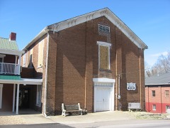 | Cadiz Masonic Lodge No. 121 F. and A.M. | 0.2 miles | 1979 |
| Cadiz Downtown Historic District | 0.2 miles | 1988 | |
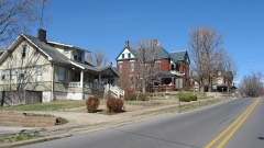 | Cadiz Main Street Residential District | 0.5 miles | 1989 |
| John McCaughan House | 5.4 miles | 1987 |
| National Archives record | The nomination case file for reference 100009731 in Record Group 79. |
| Trigg County | All 8 listed properties in this county. |