 Block
From the record
One of 3 National Register listings published here for McLean County · listed in 2025 · category: Building.
Sources: the National Register database, National Park Service
Listed on the National Register of Historic Places in 2025.
One of 3 National Register listings published here for McLean County · listed in 2025 · category: Building.
Sources: the National Register database, National Park Service
Regional context, not property-specific evidence. The federal wildfire occurrence database lists 13 fires within 5 miles of J. W. Quigg Establishment between 1998 and 2012, burning about 187 acres in total. 1 started naturally. 1 was recorded as arson. Distance is straight-line from the map coordinates, so a fire counted here may appear on a neighbouring settlement's page as well.
| Reported cause | Fires |
|---|---|
| Missing data/not specified/undetermined | 6 |
| Debris and open burning | 3 |
| Recreation and ceremony | 2 |
| Arson/incendiarism | 1 |
| Natural | 1 |
The most recent of them, most recent first, with the day each was reported and the service that recorded it.
| Date | Cause | Size | Reported by | Name on the report |
|---|---|---|---|---|
| 29 September 2010 | Debris and open burning | 3.0 acres | Kentucky Division of Forestry | KNOBS #1 |
| 14 September 2008 | Missing data/not specified/undetermined | 110 acres | Kentucky Division of Forestry | not named |
| 17 August 2012 | Natural | under an acre | Kentucky Division of Forestry | LONE OAK |
| 10 June 2000 | Debris and open burning | 20 acres | Kentucky Division of Forestry | not named |
| 4 April 2002 | Recreation and ceremony | 5.0 acres | Kentucky Division of Forestry | not named |
| 4 March 2006 | Missing data/not specified/undetermined | 1.0 acres | Kentucky Division of Forestry | not named |
| 30 March 1998 | Arson/incendiarism | 20 acres | Kentucky Division of Forestry | not named |
| 2 March 2000 | Debris and open burning | 3.0 acres | Kentucky Division of Forestry | not named |
Regional context, not property-specific evidence. The federal mineral resources record lists 2 workings within 5 miles of J. W. Quigg Establishment: 1 prospect, 1 past producer. None of them still produces. What was taken out: Clay, Fluorine-Fluorite. Distance is straight-line from the map coordinates, so a quarry counted here may appear on a neighbouring settlement's page as well.
| Where | Site | Commodity | Status | Recorded |
|---|---|---|---|---|
| H M Mine | Fluorine-Fluorite | Past Producer | ||
| Livermore Shale | Clay | Prospect |
Regional context, not property-specific evidence. The National Weather Service names Livermore, the town this property stands in, in 30 storm reports between 1997 and 2024: 9 thunderstorm wind, 8 hail, 6 flood, 4 flash flood. No death or injury is recorded in these reports. Each account below is quoted exactly as the forecast office filed it, from the NOAA Storm Events Database, and each date opens the federal record of that event.
| When | Event | Place named | Harm | What the report says |
|---|---|---|---|---|
| May 2011 | Flood | Livermore | $3,000,000 | Major flooding continued on the Green River from April. At the Calhoun river gage, the flood crest of 34.01 feet on the morning of May 7 was just a few inches lower than the 1997 flood. This 2011 flood crest was the sixth highest on record. Green River floodwaters inundated the entire community of Rumsey and about 20 percent of Calhoun. A very small part of Livermore was flooded. |
| April 2001 | Thunderstorm Wind | Livermore | $125,000 | A short-lived downburst affected a small area 1 to 3 miles west of U.S. Highway 431 near the community of Island. About a dozen farm buildings sustained varying degrees of damage, ranging from minor to severe. A barn was blown several feet off its foundation, a tool shed was blown down, and a hog house was unroofed. Three residences received minor damage. Trees were blown down. |
| May 2024 | Thunderstorm Wind | Livermore | $75,000 | A very powerful thunderstorm outflow boundary resulted in a mile wide swath of straight line wind damage as the line pushed through Livermore. Several large trees were uprooted with several large tree branches down. A few homes sustained minor shingle damage while a warehouse had partial roof loss. According to Livermore Public Works and McLean County EMA, several power lines were down along with damaged poles in town. |
| May 2024 | Thunderstorm Wind | Livermore | $25,000 | A thunderstorm moving northeastward through Livermore caused large trees to be uprooted with a tree falling onto a house. |
| April 2015 | Flood | Livermore | $10,000 | Moderate flooding occurred along the Green River. At the Calhoun river gage, the river crested at 28.02 feet on the 22nd. Flood stage is 23 feet. Thousands of acres were flooded in the Rumsey, Island, and Jewel City areas of Mclean County. Spring planting was not yet underway, so crop losses were negligible. Several county roads were closed. Kentucky Highway 85 near Island was closed, along with West Second Street in Rumsey. A couple of streets in Livermore were closed. A riverfront park in Calhoun was submerged. |
| June 2019 | Thunderstorm Wind | Livermore | $5,000 | In Livermore, a tree was down on a house. The roof was torn off a tool shed. A couple miles northeast of Livermore, a large tree that was 100 to 150 years old was uprooted. |
| July 2001 | Lightning | Livermore | $2,000 | Lightning struck a tree, causing it to fall on power lines and start a fire. |
| May 2000 | Thunderstorm Wind | Livermore | $2,000 | A couple of large tree limbs were blown down. |
| July 2024 | Flash Flood | Livermore | - | Most of KY-2110 flooded due to torrential rainfall. Overnight rainfall in Livermore measured 5.24in. |
| June 2022 | Thunderstorm Wind | Livermore | - | A wind gust to 59 mph was measured by a personal weather station. |
| August 2021 | Flash Flood | Livermore | - | A significant amount of water was reported across Highway 136 just east of Livermore. |
| February 2019 | Flood | Livermore | - | Numerous roads were flooded across the county. |
| March 2019 | Flood | Livermore | - | Moderate flooding continued on the Green River from February into March. At the Calhoun river gage, the river crested at 30.69 feet on the 1st. Flood stage there is 23 feet. Several roads were closed in the flood plain. Thousands of acres were flooded in the Island, Rumsey, and Jewel City areas. The acreage was primarily farm fields. Since planting season was not underway when flooding began, there was little if any crop damage. |
| February 2019 | Flood | Livermore | - | Moderate flooding occurred on the Green River. At the Calhoun river gage, the river crested at 29.91 feet on the 20th. Flood stage there is 23 feet. Several roads were closed in the flood plain. Thousands of acres were flooded in the Island, Rumsey, and Jewel City areas. The acreage was primarily farm fields. Since planting season was not underway when flooding began, there was little if any crop damage. |
| April 2015 | Thunderstorm Wind | Livermore | - | A trained spotter reported 60 to 65 mph wind gusts and pea-size hail. |
| April 2011 | Hail | Livermore | - | This large hail was from the same storm that struck the Sacramento area earlier. |
| May 2010 | Flood | Livermore | - | High water signs were posted at spots on three state highways: Kentucky 140, 1046, and 2110. No road closures were reported. |
| June 2007 | Flash Flood | Livermore | - | Standing water was reported on secondary roads off U.S. 431 between Livermore and Island. A co-operative observer in Livermore measured 1.5 inches within an hour. Total rainfall was estimated by radar from 3 to 6 inches over southern parts of the county. |
| April 2006 | Hail | Livermore | - | Quarter size hail fell in Livermore and other portions of southern Mclean County. |
| April 2004 | Flash Flood | Livermore | - | Six to eight inches of water was reported on numerous sections of Highway 431 between Livermore and the Daviess County line. A line of thunderstorms produced heavy rain on ground that was already moist from rain during the early morning hours. |
| May 2004 | Hail | Livermore | - | A few of the hailstones were up to 1 inch in diameter. A National Weather Service co-operative observer reported the hail. |
| May 2004 | Hail | Livermore | - | Nickel-size hail was reported. |
| July 2004 | Thunderstorm Wind | Livermore | - | Large tree limbs were blown down. |
| September 2003 | Heavy Rain | Livermore | - | Water was reportedly 6 to 8 inches deep over Highway 2110 for a 75-foot stretch between Livermore and Island. |
| May 2003 | Thunderstorm Wind | Livermore | - | About one third of the roof of a furniture business was torn off. Numerous large trees were down, with power outages in the area. |
| August 2022 | Hail | Livermore | - | no account filed |
| May 2006 | Hail | Livermore | - | no account filed |
| May 2005 | Hail | Livermore | - | no account filed |
| April 2002 | Hail | Livermore | - | no account filed |
| March 1997 | Tornado (F0) | Livermore | - | no account filed |
No historic map-sheet match is published for this property yet. That does not mean no map exists. This record needs a coordinate-quality review before it can be joined to a sheet boundary. Browse the county's mapped places while that work is pending.
Other National Register properties close enough to walk or drive between, ordered by distance from this one. Both positions come from the same geocoding pass that matched these properties to their map sheets.
| Photograph | Property | Distance | Listed |
|---|---|---|---|
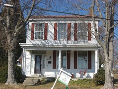 | Griffith-Franklin House | 7.6 miles | 1975 |
| National Archives record | The nomination case file for reference 100012243 in Record Group 79. |
| McLean County | All 3 listed properties in this county. |