 Block
From the record
One of 25 National Register listings published here for Boyd County · listed in 1973 · category: Building.
Sources: the case file at the National Archives · the National Register database, National Park Service
Listed on the National Register of Historic Places in 1973.
One of 25 National Register listings published here for Boyd County · listed in 1973 · category: Building.
Sources: the case file at the National Archives · the National Register database, National Park Service
Regional context, not property-specific evidence. The federal wildfire occurrence database lists 89 fires within 5 miles of Catlettsburg National Bank between 1992 and 2020, burning about 514 acres in total. None started naturally. 20 were recorded as arson. Distance is straight-line from the map coordinates, so a fire counted here may appear on a neighbouring settlement's page as well.
| Reported cause | Fires |
|---|---|
| Debris and open burning | 32 |
| Arson/incendiarism | 20 |
| Recreation and ceremony | 11 |
| Equipment and vehicle use | 8 |
| Missing data/not specified/undetermined | 8 |
| Railroad operations and maintenance | 4 |
| Misuse of fire by a minor | 3 |
| Other causes | 1 |
| Power generation/transmission/distribution | 1 |
| Smoking | 1 |
The most recent of them, most recent first, with the day each was reported and the service that recorded it.
| Date | Cause | Size | Reported by | Name on the report |
|---|---|---|---|---|
| 7 September 2002 | Arson/incendiarism | 10 acres | Ohio State Fire Marshal's Office | not named |
| 4 September 1999 | Arson/incendiarism | 2.0 acres | West Virginia Division of Forestry | WAYNE AVE. |
| 24 September 2019 | Debris and open burning | 1.0 acres | Kentucky Division of Forestry | ELIZABETH COURT |
| 20 August 2007 | Recreation and ceremony | 1.0 acres | Kentucky Division of Forestry | not named |
| 12 August 2005 | Equipment and vehicle use | 6.0 acres | West Virginia Division of Forestry | RT 75 AND RT 52 INTERSECTION |
| 26 June 2017 | Recreation and ceremony | under an acre | Ohio Department of Natural Resources | 8485 |
| 3 May 2018 | Arson/incendiarism | 3.0 acres | Kentucky Division of Forestry | BUCK HAVEN |
| 1 May 2018 | Railroad operations and maintenance | 5.0 acres | West Virginia Division of Forestry | BIG SANDY RIVER ROAD |
Regional context, not property-specific evidence. The federal mineral resources record lists 7 workings within 5 miles of Catlettsburg National Bank: 5 past producers, 2 unknowns. None of them still produces. What was taken out: Sand and Gravel, Construction, Clay, Iron, Sulfur. Distance is straight-line from the map coordinates, so a quarry counted here may appear on a neighbouring settlement's page as well.
| Where | Site | Commodity | Status | Recorded |
|---|---|---|---|---|
| Armco Steel/ Ashland, Ky. | Iron | Unknown | ||
| Ashland Oil/ Catlettsburg, Ky. | Sulfur | Unknown | ||
| Clinton Shale Mine | Clay | Past Producer | ||
| Burlington Pit | Sand and Gravel, Construction | Past Producer | Sedimentary | |
| Burlington Pit | Sand and Gravel, Construction | Past Producer | ||
| Jerrys Sand and Gravel Pit | Sand and Gravel, Construction | Past Producer | Sedimentary | |
| Jerrys Sand and Gravel Pit | Sand and Gravel, Construction | Past Producer |
Regional context, not property-specific evidence. The National Weather Service names Catlettsburg, the town this property stands in, in 20 storm reports between 1998 and 2025: 8 thunderstorm wind, 7 hail, 4 flood, 1 flash flood. No death or injury is recorded in these reports. Each account below is quoted exactly as the forecast office filed it, from the NOAA Storm Events Database, and each date opens the federal record of that event.
| When | Event | Place named | Harm | What the report says |
|---|---|---|---|---|
| May 2010 | Flash Flood | Catlettsburg | $100,000 | A narrow band of 2 to 3 inches of rain fell. Paddle Creek flooded and damaged houses. About 8 to 9 houses were affected. A few vehicles were also flooded. |
| March 2021 | Flood | Catlettsburg | $20,000 | In the town of Ashland, the Ohio River rose above its 52 foot flood stage on the second day of March. The river crested at 58 feet on March 3rd and would gradually return to its banks a few days later on the 5th. Backwater caused flooding to occur along Route 3 down into Catlettsburg and surrounding areas of Ashland outside of the flood wall. |
| March 2011 | Flood | Catlettsburg | $20,000 | no account filed |
| July 2012 | Thunderstorm Wind | Catlettsburg | $15,000 | Trees were blown onto power lines. Electric outages occurred. |
| January 1998 | Hail | Catlettsburg | $10,000 | A few vehicles, plus awning on homes, were dented. |
| June 2011 | Thunderstorm Wind | Catlettsburg | $5,000 | Large branches were blown down. Metal roofing was damaged. A section to a privacy fence was blown away. |
| February 2009 | Thunderstorm Wind | Catlettsburg | $5,000 | Part of a metal roof was blown off a house along Oakland Ave. It landed on a transformer. |
| May 2017 | Thunderstorm Wind | Catlettsburg | $3,000 | A tree was blown down and fell onto telephone lines, causing a utility pole to break. |
| June 2010 | Thunderstorm Wind | Catlettsburg | $2,000 | A few trees fell along Terrace Boulevard and along Route 168. |
| February 2022 | Flood | Catlettsburg | $1,000 | High water was observed over Walnut Street along US Route 23 in the city of Catlettsburg. |
| June 2011 | Thunderstorm Wind | Catlettsburg | $1,000 | Trees were blown down in various locations around town. |
| July 2000 | Thunderstorm Wind | Catlettsburg | $1,000 | A few trees and several large branches were blown down. |
| February 2025 | Flood | Catlettsburg | $500 | The intersection of Barbecue Road and Barbecue Spur was closed for a period of time due to washed out culvert from storms. |
| June 2004 | Thunderstorm Wind | Catlettsburg | - | Trees were blown down. |
| September 2012 | Hail | Catlettsburg | - | no account filed |
| April 2011 | Hail | Catlettsburg | - | no account filed |
| May 2010 | Hail | Catlettsburg | - | no account filed |
| April 2010 | Hail | Catlettsburg | - | no account filed |
| June 2008 | Hail | Catlettsburg | - | no account filed |
| May 2004 | Hail | Catlettsburg | - | no account filed |
No historic map-sheet match is published for this property yet. That does not mean no map exists. This record needs a coordinate-quality review before it can be joined to a sheet boundary. Browse the county's mapped places while that work is pending.
Other National Register properties close enough to walk or drive between, ordered by distance from this one. Both positions come from the same geocoding pass that matched these properties to their map sheets.
| Photograph | Property | Distance | Listed |
|---|---|---|---|
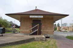 | Kentucky Catlettsburg Chesapeake and Ohio Railway Depot | 0.2 miles | 2012 |
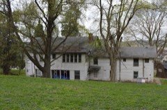 | Catlett House | 0.2 miles | 1973 |
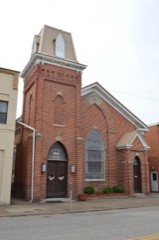 | First United Methodist Church | 0.7 miles | 1974 |
 | Ashland Armory | 4.0 miles | 2002 |
| Indian Mounds in Central Park | 4.3 miles | 1974 | |
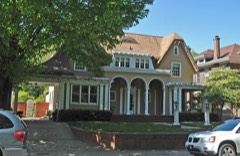 | Lon Rogers House | 4.4 miles | 1979 |
| National Archives record | The nomination case file for reference 73000789 in Record Group 79. |
| Boyd County | All 25 listed properties in this county. |