 Block
From the record
One of 6 National Register listings published here for Estill County · listed in 1973 · category: Structure.
Sources: the case file at the National Archives · the National Register database, National Park Service
Listed on the National Register of Historic Places in 1973.
One of 6 National Register listings published here for Estill County · listed in 1973 · category: Structure.
Sources: the case file at the National Archives · the National Register database, National Park Service
Regional context, not property-specific evidence. The federal wildfire occurrence database lists 126 fires within 5 miles of Cottage Iron Furnace between 1994 and 2020, burning about 1,991 acres in total. 1 started naturally. 29 were recorded as arson. Distance is straight-line from the map coordinates, so a fire counted here may appear on a neighbouring settlement's page as well.
| Reported cause | Fires |
|---|---|
| Missing data/not specified/undetermined | 40 |
| Debris and open burning | 37 |
| Arson/incendiarism | 29 |
| Recreation and ceremony | 15 |
| Equipment and vehicle use | 3 |
| Natural | 1 |
| Railroad operations and maintenance | 1 |
The most recent of them, most recent first, with the day each was reported and the service that recorded it.
| Date | Cause | Size | Reported by | Name on the report |
|---|---|---|---|---|
| 24 September 1998 | Arson/incendiarism | under an acre | Daniel Boone National Forest | CHESTNUT STAND |
| 14 September 2008 | Recreation and ceremony | 1.0 acres | Kentucky Division of Forestry | not named |
| 21 August 1999 | Natural | 70 acres | Kentucky Division of Forestry | not named |
| 8 April 2013 | Debris and open burning | 2.0 acres | Kentucky Division of Forestry | FURNACE JUNCTION ROAD |
| 7 April 2013 | Debris and open burning | 3.0 acres | Kentucky Division of Forestry | OIL WELL |
| 7 April 2010 | Missing data/not specified/undetermined | 225 acres | Kentucky Division of Forestry | SWEET LICK ROAD |
| 7 April 2001 | Arson/incendiarism | 20 acres | Kentucky Division of Forestry | not named |
| 30 April 1997 | Arson/incendiarism | 1.0 acres | Kentucky Division of Forestry | not named |
Regional context, not property-specific evidence. The federal mineral resources record lists 1 working within 5 miles of Cottage Iron Furnace: 1 producer. All of them still produce. What was taken out: Stone, Crushed/Broken. Distance is straight-line from the map coordinates, so a quarry counted here may appear on a neighbouring settlement's page as well.
| Where | Site | Commodity | Status | Recorded |
|---|---|---|---|---|
| Tipton Ridge Quarry | Stone, Crushed/Broken | Producer |
Regional context, not property-specific evidence. The National Weather Service names Irvine, the town this property stands in, in 198 storm reports between 1995 and 2025: 106 thunderstorm wind, 36 flash flood, 26 hail, 23 flood. The reports record 1 injury. Each account below is quoted exactly as the forecast office filed it, from the NOAA Storm Events Database, and each date opens the federal record of that event.
| When | Event | Place named | Harm | What the report says |
|---|---|---|---|---|
| June 2002 | Flash Flood | Irvine | 1 hurt | One person was rescued from fast flowing, high water along Wagersville Road. |
| February 2011 | Thunderstorm Wind | Irvine | $100,000 | Numerous trees were blown down around the county between about 7 and 10 am. Four to five thousand people were without power during the morning hours. |
| April 2008 | Thunderstorm Wind | Irvine | $100,000 | Trees were blown down on Stacy Lane, Worrells Road, Richmond Road, Blackburn Road, and Regis Road. A power line was also blown down on Blackburn Road and a tree was blown onto a trailer. Thunderstorm wind damage occurred countywide. |
| February 2011 | Thunderstorm Wind | Irvine | $75,000 | Numerous trees and power lines were blown down county wide. Areas affected included Ravenna, Wagersville, McKee, Cow Creek, and Richmond Rd. Power outages were also reported across the county. |
| February 2008 | Thunderstorm Wind | Irvine | $50,000 | Electric lines and trees were reported down county wide. Electricity was also out at the 911 dispatch office. |
| June 2007 | Thunderstorm Wind | Irvine | $50,000 | Numerous trees down countywide. |
| June 1997 | Flash Flood | Irvine | $50,000 | no account filed |
| May 1996 | Lightning | Irvine | $50,000 | no account filed |
| June 2008 | Thunderstorm Wind | Irvine | $35,000 | Numerous trees blown down countywide. Trees were felled on Route 89 in the southern part of the county. Trees were also blown down on Route 594 in western Estill County and on Route 213 in eastern Estill County. The damage swath was estimated at one quarter of a mile wide at times. |
| February 2011 | Thunderstorm Wind | Irvine | $30,000 | Powers outages were reported around the county. Numerous trees were blown down around the county as well. |
| March 1997 | Flash Flood | Irvine | $30,000 | no account filed |
| January 2010 | Flood | West Irvine | $25,000 | The following roads were still under water as of report time, Driftwood Drive, Nolands Creek, Dark Hollow Road and State Road 3328. A section of Congleton road had collapsed in the Cobb Hill area and Stewart Fork Road had been washed out. |
| June 2012 | Thunderstorm Wind | Irvine | $20,000 | There were trees blown down in town and throughout the county. |
| May 2002 | Flash Flood | Irvine | $20,000 | Heavy rains caused six to eight inches of water to flow over Dark Hallow Road, Maggie Lane and Eads Drive. In Wisemantown, Red Lick Bridge was washed out along with ten feet of road. |
| May 1996 | Thunderstorm Wind | Irvine | $20,000 | no account filed |
| October 2009 | Thunderstorm Wind | Irvine | $15,000 | Twelve to fifteen large trees were blown down with some trees snapped off at the top. |
| April 2007 | Thunderstorm Wind | Irvine | $12,000 | Trees down throughout the county at Doug Hill Rd and Blackburn Rd. Trees down within Irvine city limits. |
| June 2011 | Thunderstorm Wind | Irvine | $10,000 | Multiple trees were blown down in Irvine. |
| February 2009 | Thunderstorm Wind | Irvine | $10,000 | Multiple trees were blown down. |
| April 2009 | Thunderstorm Wind | Irvine | $10,000 | Several trees were blown down on Highway 594. There were also roofs blown off of 2 sheds in the same area. |
| June 2003 | Flash Flood | Irvine | $10,000 | A nursing home on Rice Street was evacuated with 12 to 18 inches of water inundating the building. Three homes along Broadway and River drive were evacuated. One grocery store was flooded, and a sundry store had over a foot of water in it. |
| July 2006 | Thunderstorm Wind | South Irvine | $8,000 | One tree down on a car. Power lines also down in the city. |
| June 2009 | Thunderstorm Wind | Irvine | $7,000 | Trees were down on Wisemantown and Markham roads. |
| January 2010 | Flood | West Irvine | $5,000 | Dark Hollow Road was flooded and Congleton Road was partially washed out. |
| June 2010 | Thunderstorm Wind | Irvine | $5,000 | Several trees were blown down in the northern part of the county. |
| May 2009 | Thunderstorm Wind | Irvine | $5,000 | Trees were reported down in Irvine on Kirkland Ave. |
| August 2006 | Thunderstorm Wind | Irvine | $5,000 | Trees and power lines down on Highway 89 and McKee Road. |
| July 1998 | Lightning | West Irvine | $5,000 | Windows were blown out and a tree was splintered. Some of the wood splinters pierced the garage door of a house. |
| June 1998 | Thunderstorm Wind | Irvine | $5,000 | Trees and power lines were downed across the county. |
| January 1997 | Thunderstorm Wind | Irvine | $5,000 | no account filed |
| August 2010 | Thunderstorm Wind | Irvine | $4,000 | Dispatch reported that a tree had been blown down onto a home. |
| October 2010 | Thunderstorm Wind | Irvine | $4,000 | A tree was blown down and onto two cars. |
| August 2005 | Thunderstorm Wind | Irvine | $4,000 | Several trees down along with widespread power outages. |
| July 2001 | Thunderstorm Wind | North Irvine | $4,000 | Thunderstorm winds blew the roof off of a storage building. |
| February 2011 | Thunderstorm Wind | Irvine | $3,000 | A tree was blown down and onto the corner of a home located at the intersection of Estill Ave and River Drive in Irvine. |
| June 2011 | Thunderstorm Wind | Irvine | $3,000 | A tree fell on a power line along Hood Ave in Irvine. |
| August 2010 | Thunderstorm Wind | Irvine | $3,000 | The emergency management office reported that three trees were blocking the Happy Top Roadway and had to be removed 8 miles southwest of Irvine. |
| April 2010 | Thunderstorm Wind | Irvine | $3,000 | Between 1130 pm and midnight EST, many tents were blown down at the Mushroom Festival in Irvine. |
| October 2009 | Thunderstorm Wind | Irvine | $3,000 | Trees down on Millers Creek Road and Murphys Ford Road. Tree down on phone and cable lines at 714 Broadway Street in Irvine. |
| June 2008 | Thunderstorm Wind | Irvine | $3,000 | Large limbs were blown down by thunderstorm wind gusts within Irvine city limits. |
| June 2008 | Thunderstorm Wind | Irvine | $3,000 | Three trees were blown down on Winchester Road in Irvine. |
| September 2006 | Thunderstorm Wind | Irvine | $3,000 | Numerous trees down along Noland Creek, Old Fox Way and New Fox Roads. Tree on house on Dry Ridge Road. |
| May 1998 | Thunderstorm Wind | South Irvine | $3,000 | Power lines were downed. |
| June 2023 | Thunderstorm Wind | West Irvine | $2,000 | A member of the public reported a tree blown down onto a privacy fence at a residence. |
| October 2010 | Thunderstorm Wind | Irvine | $2,000 | Metal roofing material was blown onto an electric line on Main Street and Broadway. |
| October 2009 | Thunderstorm Wind | Irvine | $2,000 | Two trees were blown down on Highway 1571 just east of Irvine at the American Legion post. |
| July 2008 | Thunderstorm Wind | Irvine | $2,000 | Two trees were blown down and onto Highway 89 North. |
| July 2008 | Thunderstorm Wind | Irvine | $2,000 | Two trees were blown down on Highway 89. |
| May 2006 | Thunderstorm Wind | Irvine | $2,000 | Tree down on Tickey Fork road. Tree fell on transformer and telephone pole. |
| May 2006 | Thunderstorm Wind | Irvine | $2,000 | Several trees blown down, one onto a mobile home in the White Oak community. |
| July 2001 | Thunderstorm Wind | Irvine | $2,000 | Trees and power lines were blown down. |
| June 1998 | Flash Flood | Irvine | $2,000 | Cow Creek flooded portions of Highway 52 just east of Irvine, and another road near the town was flooded by 5 feet of water. |
| April 2025 | Thunderstorm Wind | South Irvine | $1,000 | Picture of power lines downed by a fallen tree in the South Irvine community. |
| May 2024 | Thunderstorm Wind | Irvine | $1,000 | A power line was reported downed at a residence on Armour Street in downtown Irvine. |
| August 2023 | Thunderstorm Wind | North Irvine | $1,000 | A tree was blown down onto a utility line near 350 Sweet Lick Road just northeast of Irvine. |
| July 2022 | Thunderstorm Wind | North Irvine | $1,000 | A large tree limb fell on a power line on White Oak Road near Stump and Irvine. |
| July 2021 | Flash Flood | Irvine | $1,000 | Sweet Lick Road in Irvine had approximately 4 to 5 feet of water flowing across it. |
| July 2021 | Flash Flood | North Irvine | $1,000 | Several inches of water were observed flowing across White Oak Road in Irvine. |
| July 2021 | Flash Flood | Irvine | $1,000 | The Dispatch Office in Irvine had water flowing into the building. At least 3 inches of water had accumulated in the buildings basement and had also entered some of the duct work in 2 of the buildings offices. |
| July 2021 | Flood | Irvine | $1,000 | Water of unknown depth was observed flowing across Hwy 89 at the Bypass and Winchester Rd in Irvine. |
No historic map-sheet match is published for this property yet. That does not mean no map exists. This record needs a coordinate-quality review before it can be joined to a sheet boundary. Browse the county's mapped places while that work is pending.
Other National Register properties close enough to walk or drive between, ordered by distance from this one. Both positions come from the same geocoding pass that matched these properties to their map sheets.
| Photograph | Property | Distance | Listed |
|---|---|---|---|
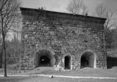 | Red River Iron Furnace | 3.8 miles | 1974 |
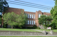 | Irvine Grade School | 5.0 miles | 2000 |
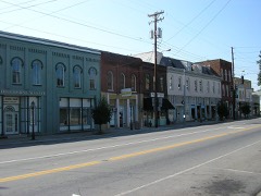 | Irvine Historic Business District | 5.2 miles | 2000 |
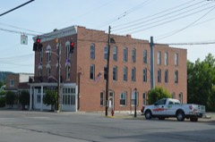 | Riverview Hotel | 5.2 miles | 1992 |
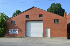 | Ravenna Motor Vehicle Service Building | 5.5 miles | 2000 |
| National Archives record | The nomination case file for reference 73000794 in Record Group 79. |
| Estill County | All 6 listed properties in this county. |