 Block
From the record
One of 10 National Register listings published here for Lawrence County · listed in 1975 · category: Building.
Sources: the case file at the National Archives · the National Register database, National Park Service
Listed on the National Register of Historic Places in 1975.
One of 10 National Register listings published here for Lawrence County · listed in 1975 · category: Building.
Sources: the case file at the National Archives · the National Register database, National Park Service
Regional context, not property-specific evidence. The federal wildfire occurrence database lists 164 fires within 5 miles of Garred House, Chapel, and Burial Vault between 1997 and 2020, burning about 6,907 acres in total. 1 started naturally. 55 were recorded as arson. Distance is straight-line from the map coordinates, so a fire counted here may appear on a neighbouring settlement's page as well.
| Reported cause | Fires |
|---|---|
| Arson/incendiarism | 55 |
| Debris and open burning | 49 |
| Missing data/not specified/undetermined | 34 |
| Recreation and ceremony | 20 |
| Equipment and vehicle use | 4 |
| Natural | 1 |
| Railroad operations and maintenance | 1 |
The most recent of them, most recent first, with the day each was reported and the service that recorded it.
| Date | Cause | Size | Reported by | Name on the report |
|---|---|---|---|---|
| 25 September 2010 | Recreation and ceremony | 25 acres | Kentucky Division of Forestry | PINEY POINT FARM |
| 24 September 2008 | Missing data/not specified/undetermined | 1.0 acres | Kentucky Division of Forestry | not named |
| 16 September 1999 | Arson/incendiarism | 1.0 acres | Kentucky Division of Forestry | not named |
| 14 September 2008 | Missing data/not specified/undetermined | 10 acres | Kentucky Division of Forestry | not named |
| 12 September 1999 | Debris and open burning | 1.0 acres | Kentucky Division of Forestry | not named |
| 10 September 2010 | Missing data/not specified/undetermined | 6.0 acres | Kentucky Division of Forestry | CHARLIE HOLLOW |
| 29 August 2007 | Missing data/not specified/undetermined | 5.0 acres | Kentucky Division of Forestry | not named |
| 28 August 2007 | Recreation and ceremony | 1.0 acres | Kentucky Division of Forestry | not named |
Regional context, not property-specific evidence. The federal mineral resources record lists 2 workings within 5 miles of Garred House, Chapel, and Burial Vault: 2 prospects. None of them still produces. What was taken out: Clay, Silica. Distance is straight-line from the map coordinates, so a quarry counted here may appear on a neighbouring settlement's page as well.
| Where | Site | Commodity | Status | Recorded |
|---|---|---|---|---|
| Busseyville Sandstone Outcrop | Silica | Prospect | ||
| Lick Creek Clay | Clay | Prospect |
Regional context, not property-specific evidence. The National Weather Service names Louisa, the town this property stands in, in 47 storm reports between 1995 and 2026: 26 thunderstorm wind, 14 hail, 3 flash flood, 3 flood. The reports record 5 injuries. Each account below is quoted exactly as the forecast office filed it, from the NOAA Storm Events Database, and each date opens the federal record of that event.
| When | Event | Place named | Harm | What the report says |
|---|---|---|---|---|
| July 2016 | Tornado (EF2) | Louisa | 5 hurt, $500,000 | The tornado did extensive damage to the Louisa Walmart and the Brown Food Service Warehouse. Cars and shipping containers were overturned and moved up to 30 yards in the Walmart parking lot. Structural damage to the Walmart and the Brown Food Service warehouse occurred. Numerous trees were snapped and uprooted. The tornado crossed the Tug Fork into West Virginia before dissipating.||Maximum wind gusts were estimated at 120 mph. There were 5 minor injuries at the Walmart. |
| March 2012 | Hail | Louisa | $325,000 | no account filed |
| May 2011 | Thunderstorm Wind | Louisa | $200,000 | Several trees were blown down throughout the community. Extensive power outages and scattered damage to structures occurred. The damage also crossed the river to Fort Gay in West Virginia. |
| March 2012 | Hail | Louisa | $200,000 | no account filed |
| July 2010 | Thunderstorm Wind | Louisa | $100,000 | Several trees were blown down in the city. Roads were blocked and power lines were knocked down. Electricity was interrupted for most of the town. |
| June 2014 | Thunderstorm Wind | Louisa | $75,000 | Trees were blown down, blocking roads. Roof damage occurred to a few homes. One mobile home had damage from a fallen tree. |
| July 2015 | Thunderstorm Wind | Louisa | $50,000 | Several trees were blown down. A few trees fell on power lines. |
| July 2000 | Flash Flood | Louisa | $40,000 | Streams and culverts flooded streets when 1 to 2 inches of rain fell in less than 2 hours on saturated ground. A few vehicles were submerged. |
| July 2015 | Thunderstorm Wind | Louisa | $20,000 | Several trees were blown down around town, with 1 tree damaging a house. |
| June 2012 | Thunderstorm Wind | Louisa | $20,000 | Large trees were blown down. |
| June 2016 | Thunderstorm Wind | Louisa | $15,000 | Wind caused roof damage to a building in Louisa. Their metal roof was partially torn from rafters. |
| May 2015 | Thunderstorm Wind | Louisa | $10,000 | A gust of 50 mph was measured. A few trees were blown down. One tree fell on a mobile home. A small section of a corrugated metal roof and overhang to a thrift shop was torn off. |
| May 1996 | Thunderstorm Wind | Louisa | $10,000 | no account filed |
| February 2016 | Flash Flood | Louisa | $5,000 | Streams, such as Lick and Greenbrier Creeks, overflowed and closed roads. A few road examples included Route 32, Greenbrier Road, and Old Lick Road. |
| April 2011 | Thunderstorm Wind | Louisa | $5,000 | Trees were blown down. |
| August 2010 | Flash Flood | Louisa | $5,000 | Roads were flooded by overflowing small streams and by poor drainage. No dwellings were flooded. |
| June 1998 | Thunderstorm Wind | Louisa | $5,000 | Trees were blown down, damaging a few outbuildings. |
| June 1995 | Thunderstorm Wind | Louisa | $5,000 | State Police reported trees blown down and across roads in the four counties. In Greenup, a power pole was snapped by the wind causing traffic lights to dangle on Route 23. |
| May 1997 | Hail | Louisa | $5,000 | no account filed |
| April 1996 | Thunderstorm Wind | Louisa | $5,000 | no account filed |
| June 2020 | Thunderstorm Wind | Louisa | $3,000 | In Fort Gay, two trees were downed onto Highway 1690. Another two trees were downed onto Highway 2037. |
| June 1996 | Thunderstorm Wind | Louisa | $3,000 | no account filed |
| December 2019 | Flood | Louisa | $2,000 | Old Lick Creek road was closed due to flooding along Lick Creek and Clayton Branch. |
| July 2012 | Thunderstorm Wind | Louisa | $2,000 | Large branches were blown down. |
| April 2011 | Thunderstorm Wind | Louisa | $2,000 | Trees were blown down. |
| August 2000 | Thunderstorm Wind | Louisa | $2,000 | Several trees and large branches fell across roads. |
| March 2026 | Thunderstorm Wind | Louisa | $1,500 | A tree and power line were blown down along Harley Drive south of Louisa. |
| May 2025 | Thunderstorm Wind | Louisa | $1,500 | In Louisa, nearly 100 homes were without power due to downed trees and power lines around the area. |
| February 2003 | Thunderstorm Wind | Louisa | $1,000 | Trees fell across Route 32. |
| April 2026 | Thunderstorm Wind | Louisa | $500 | One downed tree was observed on Town Hill Road. |
| February 2022 | Flood | Louisa | $500 | High water was observed along Old Lick Creek Road. |
| January 2025 | Flood | Louisa | $150 | A low dip in Old Lick Creek Road south of Louisa was underwater throughout the day. |
| May 2004 | Thunderstorm Wind | Louisa | - | Trees were blown into power lines. |
| July 2003 | Thunderstorm Wind | Louisa | - | A few trees and large branches fell in town. |
| June 2015 | Hail | Louisa | - | no account filed |
| February 2012 | Hail | Louisa | - | no account filed |
| April 2011 | Hail | Louisa | - | no account filed |
| May 2011 | Hail | Louisa | - | no account filed |
| June 2011 | Hail | Louisa | - | no account filed |
| May 2010 | Hail | Louisa | - | no account filed |
| February 2008 | Thunderstorm Wind | Louisa | - | no account filed |
| June 2008 | Hail | Louisa | - | no account filed |
| July 2005 | Hail | Louisa | - | no account filed |
| July 2005 | Hail | Louisa | - | no account filed |
| July 1999 | Hail | Louisa | - | no account filed |
| June 1998 | Hail | Louisa | - | no account filed |
| May 1996 | Thunderstorm Wind | Louisa | - | no account filed |
1 paper published in this town, digitised by the Library of Congress and free to read: 1,488 issues, 9,533 pages. Every page is searchable, so a name or a street can be looked for directly in what the town printed about itself at the time.
| Newspaper | Published |
|---|---|
| The Big Sandy News | 1885 to 1929 |
No historic map-sheet match is published for this property yet. That does not mean no map exists. This record needs a coordinate-quality review before it can be joined to a sheet boundary. Browse the county's mapped places while that work is pending.
Other National Register properties close enough to walk or drive between, ordered by distance from this one. Both positions come from the same geocoding pass that matched these properties to their map sheets.
| Photograph | Property | Distance | Listed |
|---|---|---|---|
 | First United Methodist Church | 7.3 miles | 1984 |
| Louisa Residential Historic District | 7.4 miles | 1988 | |
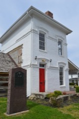 | Fred M. Vinson Birthplace | 7.4 miles | 1974 |
 | Louisa United Methodist Church | 7.4 miles | 1988 |
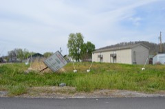 | Big Sandy Milling Company | 7.4 miles | 1988 |
 | Atkins-Carter House | 7.4 miles | 1988 |
| National Archives record | The nomination case file for reference 75000790 in Record Group 79. |
| Lawrence County | All 10 listed properties in this county. |