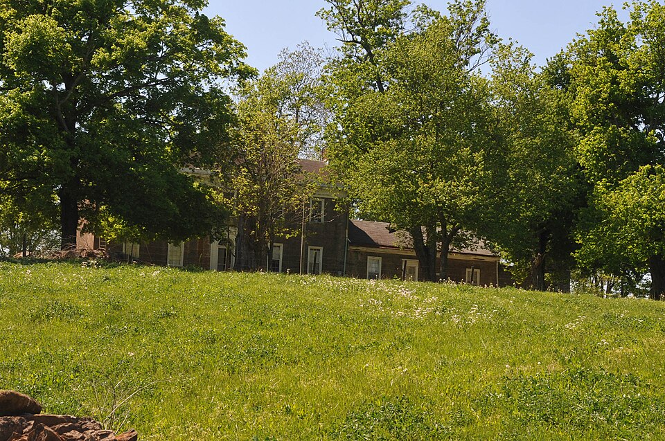
| February 2008 | Tornado (EF0) | Taylorsville | 1 hurt, $200,000 | This tornado destroyed two barns, and did heavy damage to several other barns and homes. |
| May 1996 | Tornado (F3) | Taylorsville | $1,000,000 | no account filed |
| May 2010 | Flood | Taylorsville | $75,000 | Four to six inches of rain across Spencer county May 1-2 led to areal flooding in spots across the county on the 2nd. |
| May 2017 | Thunderstorm Wind | Taylorsville | $50,000 | The National Weather Service in conjunction with Spencer County Emergency Management conducted a damage survey near Highway 44 and Carl Monroe Road 2 to 3 miles west of Taylorsville. The survey found a narrow path of straight line wind damage with estimated winds between 75 and 85 MPH. The most significant damage occurred at the path start on Carl Monroe Road where the second level of a cinder block farm building was removed. Roofing material and cinder block debris was scattered to the ENE 100-200 yards downwind. A two-story home also suffered damage in this area with the removal of siding, soffit, and shingles. Debris shattered a window, and a dead-bolted door was blown open after the storm door was ripped off. Several large limbs were ripped out of a tree and tossed across Carl Monroe Road.||Wind damage continued east while paralleling just south of Highway 44 where 3 more hardwood trees were broken or uprooted. Several large hardwood trees were uprooted in the Elk Creek Bottom. Continuing east, wind took shingles off of a home and damaged several trees. Damage ceased 2 miles west of Taylorsville with a final downed tree along Highway 44.||The event lasted 1 to 2 minutes and occurred on the leading edge of a gust front. Many residents noted that no rain was occurring at the time of the event, bur rain started a few minutes later. This matches the radar presentation. All debris was scattered in a divergent ENE to NE direction. |
| February 2008 | Thunderstorm Wind | Taylorsville | $50,000 | Straight line winds caused extensive damage to trees and power lines. They also did shingle damage to buildings, and damaged some outbuildings. |
| July 2015 | Flash Flood | Taylorsville | $25,000 | A law enforcement official reported that excessive rainfall and flash flooding impacted numerous roads in Taylorsville. The high water also was flooding parts of some homes in the area. Approximately 4 inches of rain fell across the region in a 2 to 3 hour period. |
| April 1974 | Tornado (F4) | Taylorsville | $25,000 | no account filed |
| April 1996 | Thunderstorm Wind | Taylorsville | $2,000 | no account filed |
| June 2025 | Thunderstorm Wind | Taylorsville | - | Several trees were downed by strong thunderstorm winds along Kentucky Route 44 west of Taylorsville. |
| February 2025 | Flash Flood | Taylorsville | - | Water was reported over West River Road. |
| July 2023 | Thunderstorm Wind | Taylorsville | - | Trees fell down over the road. |
| August 2023 | Thunderstorm Wind | Taylorsville | - | A large tree fell on Brashears Creek Road. |
| February 2021 | Flood | Taylorsville | - | The bridge over Simpson Creek on Kentucky 2885 was closed. |
| June 2018 | Thunderstorm Wind | Taylorsville | - | There was a tree that had to be removed from Oak Tree Way, and another one that had to be removed from Elk Creek Road. |
| February 2018 | Flood | Taylorsville | - | KY 2885 closed at mile 2.6 due to high water and flooding. |
| February 2018 | Flood | Taylorsville | - | Brashears Creek Road closed at the Taylorsville Road intersection due to high water and flooding. |
| February 2018 | Flood | Taylorsville | - | Kentucky 2885 flooded due to excessive rainfall. |
| March 2017 | Thunderstorm Wind | Taylorsville | - | The Spencer County Emergence Manager reported trees down across the county, on Highway 44, Lilly Pike, and Stevens Lane. |
| March 2016 | Thunderstorm Wind | Taylorsville | - | Trees were reported down across the county. |
| March 2015 | Flood | Taylorsville | - | Kentucky Highway 2885 was briefly closed by flooding from Simpson Creek. |
| April 2015 | Hail | Taylorsville | - | A social media picture from Taylorsville showed golf ball sized hail. |
| June 2015 | Thunderstorm Wind | Taylorsville | - | The Spencer County dispatch center reported dozens of trees down across the entire county due to severe thunderstorm winds. |
| July 2015 | Flash Flood | Taylorsville | - | A Spencer County law enforcement official reported that KY 44 was under high water and flooded. All traffic lanes were blocked. |
| April 2015 | Hail | Taylorsville | - | Confirmed picture via social media of quarter sized hail near Taylorsville. |
| April 2013 | Hail | Taylorsville | - | A spotter in Taylorsville reported 1.75 inch hail. A second spotter nearby reported 1 inch hail covering the ground. |
| July 2012 | Thunderstorm Wind | Taylorsville | - | Local law enforcement reported trees and power lines down across Taylorsville. |
| November 2011 | Flood | Taylorsville | - | Local law enforcement reported that BeShear's Creek and Old Heady Roads were closed. |
| July 2011 | Flash Flood | Taylorsville | - | Law enforcement reported that 2 roads were closed in Taylorsville due to flooding. |
| April 2010 | Thunderstorm Wind | Taylorsville | - | A large tree was blown down blocking Highway 44 west of Taylorsville. |
| June 2009 | Thunderstorm Wind | Taylorsville | - | Trees were down across several roads in Taylorsville and throughout the county. |
| August 2009 | Flash Flood | Taylorsville | - | The entire length of Main St. in Taylorsville was closed due to flowing water. |
| December 2007 | Flood | Taylorsville | - | West River Road was closed due to high water. |
| April 2007 | Thunderstorm Wind | Taylorsville | - | Power lines were downed on Highway 1633 near State Highway 44. |
| January 2006 | Thunderstorm Wind | Taylorsville | - | Law enforcement estimated a 65 mph wind gust. |
| April 2006 | Hail | Taylorsville | - | Penny size hail fell near Hunter Road. |
| August 2006 | Thunderstorm Wind | Taylorsville | - | Trees were downed. |
| December 2006 | Thunderstorm Wind | Taylorsville | - | Tree limbs were downed on Bloomfield Road in Taylorsville. Limbs were also downed on Highway 55 in the northern part of the county. |
| April 2005 | Thunderstorm Wind | Taylorsville | - | Several trees were blown down. |
| July 2004 | Flash Flood | Taylorsville | - | Two feet of water covered Little Mount Church Road. Hochstrasser Road was flooded. |
| June 2000 | Thunderstorm Wind | Taylorsville | - | Trees were downed along Highway 44. |
| April 1999 | Hail | Taylorsville | - | 3/4 inch hail fell in western Spencer county |
| May 1995 | Thunderstorm Wind | Taylorsville | - | Trees down report from Department of Emergency Service. |
| May 2025 | Hail | Taylorsville | - | no account filed |
| June 2016 | Hail | Taylorsville | - | no account filed |
| July 2014 | Hail | Taylorsville | - | no account filed |
| April 2012 | Hail | Taylorsville | - | no account filed |
| March 2012 | Hail | Taylorsville | - | no account filed |
| March 2010 | Hail | Taylorsville | - | no account filed |
| April 2007 | Hail | Taylorsville | - | no account filed |
| April 2005 | Thunderstorm Wind | Taylorsville | - | no account filed |
| June 2004 | Hail | Taylorsville | - | no account filed |
| October 2004 | Hail | Taylorsville | - | no account filed |
| May 2003 | Hail | Taylorsville | - | no account filed |
| February 2000 | Flash Flood | Taylorsville | - | no account filed |
| August 2000 | Hail | Taylorsville | - | no account filed |
| August 2000 | Hail | Taylorsville | - | no account filed |
| June 1998 | Thunderstorm Wind | Taylorsville | - | no account filed |
| June 1998 | Thunderstorm Wind | Taylorsville | - | no account filed |
| June 1998 | Thunderstorm Wind | Taylorsville | - | no account filed |
| May 1998 | Thunderstorm Wind | Taylorsville | - | no account filed |
 Block