 Block
From the record
One of 22 National Register listings published here for Lincoln County · listed in 1978 · category: Building.
Sources: the case file at the National Archives · the National Register database, National Park Service
Listed on the National Register of Historic Places in 1978.
One of 22 National Register listings published here for Lincoln County · listed in 1978 · category: Building.
Sources: the case file at the National Archives · the National Register database, National Park Service
Regional context, not property-specific evidence. The federal wildfire occurrence database lists 32 fires within 5 miles of Walnut Meadows between 1998 and 2020, burning about 667 acres in total. None started naturally. 7 were recorded as arson. Distance is straight-line from the map coordinates, so a fire counted here may appear on a neighbouring settlement's page as well.
| Reported cause | Fires |
|---|---|
| Missing data/not specified/undetermined | 15 |
| Debris and open burning | 10 |
| Arson/incendiarism | 7 |
The most recent of them, most recent first, with the day each was reported and the service that recorded it.
| Date | Cause | Size | Reported by | Name on the report |
|---|---|---|---|---|
| 21 September 2020 | Debris and open burning | 40 acres | Kentucky Division of Forestry | PETTIT |
| 28 August 1998 | Arson/incendiarism | 1.0 acres | Kentucky Division of Forestry | not named |
| 30 May 2001 | Missing data/not specified/undetermined | under an acre | Kentucky Division of Forestry | not named |
| 1 May 2001 | Arson/incendiarism | 25 acres | Kentucky Division of Forestry | not named |
| 8 April 2013 | Arson/incendiarism | 40 acres | Kentucky Division of Forestry | SOUTH FORK |
| 5 March 2000 | Arson/incendiarism | 50 acres | Kentucky Division of Forestry | not named |
| 31 March 2015 | Missing data/not specified/undetermined | 2.0 acres | Kentucky Division of Forestry | PINE GROVE |
| 27 March 2003 | Missing data/not specified/undetermined | 15 acres | Kentucky Division of Forestry | not named |
Regional context, not property-specific evidence. The federal mineral resources record lists 3 workings within 5 miles of Walnut Meadows: 3 prospects. None of them still produces. What was taken out: Fire Clay (Refractory). Distance is straight-line from the map coordinates, so a quarry counted here may appear on a neighbouring settlement's page as well.
| Where | Site | Commodity | Status | Recorded |
|---|---|---|---|---|
| Eastside Roadcut Clay Bed | Fire Clay (Refractory) | Prospect | ||
| Roadcut Clay Bed | Fire Clay (Refractory) | Prospect | ||
| Westside Roadcut Clay Bed | Fire Clay (Refractory) | Prospect |
Regional context, not property-specific evidence. The National Weather Service names Stanford, the town this property stands in, in 39 storm reports between 1996 and 2025: 30 thunderstorm wind, 5 hail, 3 flash flood, 1 tornado. The reports record 1 death. Each account below is quoted exactly as the forecast office filed it, from the NOAA Storm Events Database, and each date opens the federal record of that event.
| When | Event | Place named | Harm | What the report says |
|---|---|---|---|---|
| May 2010 | Flash Flood | Stanford | 1 killed, $30,000 | Heavy rains caused flash flooding of the Hanging Fork River on KY 300 near Stanford. One person died when a van with multiple passengers was swept off the road into the river. The driver of the van exited the vehicle and climbed onto the roof. He then lost his grip and fell into the rushing water. M47VE. |
| February 2011 | Tornado (EF1) | Stanford | $100,000 | An NWS storm survey confirmed an EF-1 tornado with maximum wind speeds of 100 mph touched down about a mile southwest of Stanford. It traveled southeast damaging the middle school complex on Highway 27 about a mile south of Stanford. The tornado continued to damage large barns and out buildings as well as snap trees until it lifted about 2.1 miles northwest of Crab Orchard. |
| July 2015 | Thunderstorm Wind | Stanford | $15,000 | The Lincoln County emergency manager reported trees down in the city and that a tin roof was blown off a home due to severe thunderstorm winds. |
| June 1998 | Thunderstorm Wind | Stanford | $10,000 | no account filed |
| May 2016 | Thunderstorm Wind | Stanford | $6,000 | The emergency manager reported trees and a few power lines down. Also nickel size hail fell. |
| July 2004 | Thunderstorm Wind | Stanford | $5,000 | Trees and power lines were blown down. A tree limb was blown on to a police cruiser. |
| August 1999 | Thunderstorm Wind | Stanford | $5,000 | Trees down. One home was damaged. |
| April 2006 | Thunderstorm Wind | Stanford | $2,000 | A tree was blown on to a car on Kentucky Highway 3245. |
| May 2025 | Thunderstorm Wind | Stanford | - | A tree was blown down onto a house and went through the roof on Spring Valley Drive in Stanford. |
| May 2025 | Thunderstorm Wind | Stanford | - | Power lines were blown down along the 300 block of Anderson Heights in Stanford. |
| June 2025 | Thunderstorm Wind | Stanford | - | Power lines were downed near the intersection of Danville Avenue and Lee Drive in Stanford. |
| September 2024 | Thunderstorm Wind | Stanford | - | A few trees and large tree limbs were downed in Stanford. |
| May 2023 | Thunderstorm Wind | Stanford | - | A tree and power lines were blown down on Danville Avenue between Portman Avenue and Maxwell Street. |
| December 2021 | Thunderstorm Wind | Stanford | - | Trees and power lines were reported down near Stanford and western portions of the county. |
| June 2016 | Thunderstorm Wind | Stanford | - | State officials reported trees down in the area due to severe thunderstorm winds. |
| May 2016 | Thunderstorm Wind | Stanford | - | Trained spotters reported trees down in the area. |
| May 2016 | Thunderstorm Wind | Stanford | - | Trees were reported down in the city of Stanford due to severe thunderstorm winds. |
| May 2014 | Thunderstorm Wind | Stanford | - | Local law enforcement reported trees down throughout the county. At 925 pm EDT, the Kentucky Mesonet 4 miles northeast of Stanford measured a 51 mph wind gust. |
| March 2012 | Flash Flood | Stanford | - | Flash Flooding caused by the training of several storms briefly closed 3rd Street in Stanford. |
| March 2012 | Thunderstorm Wind | Stanford | - | A spotter reported trees down around Stanford. |
| April 2011 | Thunderstorm Wind | Stanford | - | Trees were blown down county-wide. A roof was also blown off a trailer. |
| May 2011 | Thunderstorm Wind | Stanford | - | Numerous trees were blown down. |
| June 2009 | Thunderstorm Wind | Stanford | - | Trees were downed in Stanford and just west of Stanford on Hatcher Road. |
| June 2009 | Flash Flood | Stanford | - | Some roads were covered with water in the city. |
| May 2006 | Thunderstorm Wind | Stanford | - | Trees were downed. |
| July 2004 | Thunderstorm Wind | Stanford | - | Trees were downed. |
| April 2000 | Thunderstorm Wind | Stanford | - | Several trees were downed. |
| June 1997 | Thunderstorm Wind | Stanford | - | Several trees down as a squall line moved through. |
| January 2006 | Hail | Stanford | - | no account filed |
| June 2005 | Thunderstorm Wind | Stanford | - | no account filed |
| July 2004 | Hail | Stanford | - | no account filed |
| July 2004 | Hail | Stanford | - | no account filed |
| June 2001 | Hail | Stanford | - | no account filed |
| July 2001 | Thunderstorm Wind | Stanford | - | no account filed |
| October 2001 | Thunderstorm Wind | Stanford | - | no account filed |
| November 2000 | Thunderstorm Wind | Stanford | - | no account filed |
| May 1998 | Thunderstorm Wind | Stanford | - | no account filed |
| June 1997 | Hail | Stanford | - | no account filed |
| May 1996 | Thunderstorm Wind | Stanford | - | no account filed |
5 papers published in this town, digitised by the Library of Congress and free to read: 4,048 issues, 18,016 pages. Every page is searchable, so a name or a street can be looked for directly in what the town printed about itself at the time.
| Newspaper | Published |
|---|---|
| The Interior Journal | 1872 to 1881 |
| Semi-Weekly Interior Journal | 1881 to 1905 |
| The Interior Journal | 1905 to 1910 |
| The Stanford Interior Journal | 1911 to 1912 |
| The Interior Journal | 1912 to 1984 |
No historic map-sheet match is published for this property yet. That does not mean no map exists. This record needs a coordinate-quality review before it can be joined to a sheet boundary. Browse the county's mapped places while that work is pending.
Other National Register properties close enough to walk or drive between, ordered by distance from this one. Both positions come from the same geocoding pass that matched these properties to their map sheets.
| Photograph | Property | Distance | Listed |
|---|---|---|---|
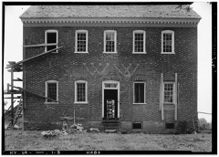 | William Whitley House State Shrine | 1.8 miles | 1973 |
| Adam Pence House | 3.9 miles | 1978 | |
| Confederate Monument at Crab Orchard | 4.0 miles | 1997 | |
| John Baughman House | 4.3 miles | 1978 | |
| Swope-Dudderar House and Mill Site | 4.9 miles | 1979 | |
| John Logan House | 4.9 miles | 1975 |
| National Archives record | The nomination case file for reference 78001377 in Record Group 79. |
| Lincoln County | All 22 listed properties in this county. |