 Block
From the record
One of 62 National Register listings published here for Clark County · listed in 1979 · category: Building.
Sources: the case file at the National Archives · the National Register database, National Park Service
Listed on the National Register of Historic Places in 1979.
One of 62 National Register listings published here for Clark County · listed in 1979 · category: Building.
Sources: the case file at the National Archives · the National Register database, National Park Service
Regional context, not property-specific evidence. The federal mineral resources record lists 1 working within 5 miles of Maj. Walter Preston House: 1 past producer. None of them still produces. What was taken out: Fluorine-Fluorite, Zinc, Barium-Barite. Distance is straight-line from the map coordinates, so a quarry counted here may appear on a neighbouring settlement's page as well.
| Where | Site | Commodity | Status | Recorded |
|---|---|---|---|---|
| Smitha Vein | Fluorine-Fluorite, Zinc, Barium-Barite | Past Producer | Barite, Fluorite, Sphalerite |
Regional context, not property-specific evidence. The National Weather Service names Becknerville, the town this property stands in, in 2 storm reports between 1998 and 2024: 1 thunderstorm wind, 1 tornado. No death or injury is recorded in these reports. Each account below is quoted exactly as the forecast office filed it, from the NOAA Storm Events Database, and each date opens the federal record of that event.
| When | Event | Place named | Harm | What the report says |
|---|---|---|---|---|
| April 2024 | Tornado (EF1) | Becknerville | - | Tornado damage appeared to have started to a barn and some trees across a field from each other west of Combs Ferry Road. The tornado continued southeast towards homes on a family's property. Trees were downed here with some outfieldings' roofs damaged.|Residents of one home said a set of 2nd story windows popped out and fell to the ground. Another nearby resident said all the interior doors of their home opened up as the tornado passed by. A security camera video showed a white intense area of rainfall|moving across the property in an area where a row of trees ended up getting snapped. The tornado continued east southeastward toward a home near the intersection of Jones Nursery Road and Combs Ferry Road. The resident was in a nearby attached garage when it went through. He witnessed the rains going in one direction before the tornado hit and then switch quickly to a different direction behind it. One section of the main home's roof was completely taken off and thrown east southeast. The wind hit the west-facing garage doors flush, causing both doors to buckle but not collapse. The brick work in between the doors was buckled as well. No further damage was noted southeast of this property, so the tornado appeared to have lifted by this point. There were several trees downed on the south side of the tornado, likely with strong inflow winds. Jones Nursery Road had trees down all along the road, but most of the damage had been cleaned up before the survey occurred. |
| June 1998 | Thunderstorm Wind | Becknerville | - | no account filed |
No historic map-sheet match is published for this property yet. That does not mean no map exists. This record needs a coordinate-quality review before it can be joined to a sheet boundary. Browse the county's mapped places while that work is pending.
Other National Register properties close enough to walk or drive between, ordered by distance from this one. Both positions come from the same geocoding pass that matched these properties to their map sheets.
| Photograph | Property | Distance | Listed |
|---|---|---|---|
| Maj. John Martin House | 0.7 miles | 1982 | |
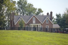 | Capt. Robert V. Bush House | 0.8 miles | 1979 |
| Tarleton Chiles House | 1.4 miles | 1979 | |
| Henry W. Calmes House | 1.4 miles | 1979 | |
| Jesse Fishback House | 1.5 miles | 1979 | |
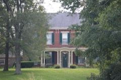 | Stanley F. Tebbs House | 1.5 miles | 1979 |
| National Archives record | The nomination case file for reference 79003594 in Record Group 79. |
| Clark County | All 62 listed properties in this county. |