 Block
From the record
One of 62 National Register listings published here for Clark County · listed in 1979 · category: Building.
Sources: the case file at the National Archives · the National Register database, National Park Service
Listed on the National Register of Historic Places in 1979.
One of 62 National Register listings published here for Clark County · listed in 1979 · category: Building.
Sources: the case file at the National Archives · the National Register database, National Park Service
Regional context, not property-specific evidence. The federal wildfire occurrence database lists 2 fires within 5 miles of Joel Quisenberry House between 2007 and 2017, burning about 3 acres in total. None started naturally. None was recorded as arson. Distance is straight-line from the map coordinates, so a fire counted here may appear on a neighbouring settlement's page as well.
| Reported cause | Fires |
|---|---|
| Missing data/not specified/undetermined | 2 |
The most recent of them, most recent first, with the day each was reported and the service that recorded it.
| Date | Cause | Size | Reported by | Name on the report |
|---|---|---|---|---|
| 13 September 2007 | Missing data/not specified/undetermined | 3.0 acres | Kentucky Division of Forestry | not named |
| 19 November 2017 | Missing data/not specified/undetermined | under an acre | Kentucky Division of Forestry | MT. MORIAH FIRE |
Regional context, not property-specific evidence. The federal mineral resources record lists 1 working within 5 miles of Joel Quisenberry House: 1 producer. All of them still produce. What was taken out: Stone, Crushed/Broken. Distance is straight-line from the map coordinates, so a quarry counted here may appear on a neighbouring settlement's page as well.
| Where | Site | Commodity | Status | Recorded |
|---|---|---|---|---|
| Boonesboro Quarry | Stone, Crushed/Broken | Producer |
Regional context, not property-specific evidence. The National Weather Service names Winchester, the town this property stands in, in 83 storm reports between 1995 and 2025: 57 thunderstorm wind, 13 flash flood, 10 hail, 2 lightning. The reports record 3 injuries. Each account below is quoted exactly as the forecast office filed it, from the NOAA Storm Events Database, and each date opens the federal record of that event.
| When | Event | Place named | Harm | What the report says |
|---|---|---|---|---|
| May 1995 | Thunderstorm Wind | Winchester | 3 hurt, $50,000,000 | The damage path was from Combs Ferry Road Northeast through the county. The roof off the Red Carpet Inn on West Lexington Avenue was blown off. Debris from the roof was thrown on Shoney's Restaurant and Hatfield Chrysler-Plymouth. Three workers at OHI America were injured when the roof collapsed. Three tractor-semitrailers were blown into a building. Also, there was extensive damage to homes and barns. Winds greater than 100 mph estimated. |
| April 2015 | Thunderstorm Wind | Winchester | $1,000,000 | Law enforcement reported several trees down in the county. The Clark County KY Mesonet observation recorded a 53 mph wind gust. |
| April 2017 | Thunderstorm Wind | Winchester | $50,000 | The Clark County emergency manager reported power lines down in the area along with a tree on a house. |
| July 2016 | Thunderstorm Wind | Winchester | $30,000 | Local law enforcement reported trees and power lines down in the area due to severe thunderstorm winds. |
| May 1996 | Thunderstorm Wind | Winchester | $25,000 | no account filed |
| November 2005 | Thunderstorm Wind | Winchester | $20,000 | The roof was blown off a house that was under construction. |
| May 1998 | Thunderstorm Wind | Winchester | $10,000 | no account filed |
| July 2021 | Flash Flood | Winchester | $5,000 | A vehicle got stuck in flood waters covering North Maple Street. Cost of damage is unknown. |
| February 2009 | Thunderstorm Wind | Winchester | $5,000 | Roof damage to a barn on Crow Ridge Road was reported. |
| May 1998 | Lightning | Winchester | $5,000 | An old opera house in the downtown area caught fire as lightning struck it. The roof and ceiling of the top floor were heavily damaged. |
| October 2001 | Thunderstorm Wind | Winchester | $5,000 | no account filed |
| October 2013 | Thunderstorm Wind | Winchester | $2,000 | A spotter reported that winds associated with a strong line of showers brought damage to his storm doors and his garage. In his neighborhood many large tree limbs were downed, causing power outages. Thirteen minutes earlier, just 3 miles northwest of Winchester, a Kentucky mesonet site recorded a wind gust of 57 mph. |
| May 1998 | Lightning | Winchester | $2,000 | Lightning struck a tree which then fell on a house damaging the roof. |
| April 2025 | Thunderstorm Wind | Winchester | - | There were multiple trees reported down around Winchester. |
| February 2024 | Thunderstorm Wind | Winchester | - | There were large tree limbs down near a home. |
| May 2024 | Thunderstorm Wind | Winchester | - | Trees were blown down by strong winds onto cars at Winchester Country Club. |
| August 2024 | Thunderstorm Wind | Winchester | - | Social media reported that power lines were snapped near Taco Bell in Winchester. |
| August 2024 | Thunderstorm Wind | Winchester | - | There were multiple reports of tree damage and limbs down across portions of Clark County, including within the city of Winchester along Meadowbrook Drive. |
| July 2023 | Thunderstorm Wind | Winchester | - | There were trees down over multiple roads. |
| July 2022 | Thunderstorm Wind | Winchester | - | There were reports of trees down in Winchester. |
| July 2021 | Flash Flood | Winchester | - | There was water over multiple roadways. The 200 block of Shoppers Drive and Old Boonesboro Road were all closed. Two cars stalled in the flood waters. |
| October 2021 | Flash Flood | Winchester | - | The intersection of Broadway and Washington was closed due to flooding. |
| October 2021 | Flash Flood | Winchester | - | The emergency manager reported that roads were closed and water rescues were taking place. |
| June 2021 | Thunderstorm Wind | Winchester | - | A tree fell down. |
| May 2020 | Flash Flood | Winchester | - | Boonesboro Road was closed due to high water. |
| June 2019 | Thunderstorm Wind | Winchester | - | Several trees were down across Clark County. |
| September 2018 | Flash Flood | Winchester | - | State Road 89, Irvine Road, was underwater 1 to 2 miles southeast of Winchester, Kentucky. |
| June 2016 | Thunderstorm Wind | Winchester | - | Local law enforcement reported several power lines down across the county due to severe thunderstorm winds. |
| June 2016 | Thunderstorm Wind | Winchester | - | Local law enforcement reported several downed trees across the county, some of which were blocking roadways. |
| July 2016 | Flash Flood | Winchester | - | A trained spotter reported flash flooding and impassable roads on Old Ruckerville Road. |
| July 2015 | Hail | Winchester | - | The Clark County emergency manager reported hail 3/4 inch in diameter. |
| July 2015 | Thunderstorm Wind | Winchester | - | The Clark County emergency manager reported trees down in the Winchester area due to severe thunderstorm winds. |
| May 2015 | Thunderstorm Wind | Winchester | - | A county official reported that trees were down across the county due to severe thunderstorm winds. |
| July 2015 | Thunderstorm Wind | Winchester | - | A Clark County law enforcement official reported power lines down in the city of Winchester. Numerous trees were reported down across the county as well. |
| June 2014 | Thunderstorm Wind | Winchester | - | Thunderstorms winds toppled half of a tree in Winchester. |
| January 2013 | Thunderstorm Wind | Winchester | - | The Clark County emergency manager reported a few trees downed in Winchester. |
| June 2012 | Thunderstorm Wind | Winchester | - | A gust front associated with a line of storms across southern Ohio downed trees and power lines across Clark County. |
| April 2009 | Thunderstorm Wind | Winchester | - | A tree was downed across College Street. |
| February 2009 | Thunderstorm Wind | Winchester | - | A heavy awning was blown off of a home and was blocking Ashland Avenue in Winchester. |
| May 2009 | Flash Flood | Winchester | - | Four inches of water was flowing across the road in Highview. |
| June 2009 | Flash Flood | Winchester | - | Water was flowing over Route 89 between Winchester and the Estill County line. |
| September 2009 | Heavy Rain | Winchester | - | The Clark County Kentucky Mesonet site measured 2.31 inches of rainfall in a little less than two hours. |
| March 2008 | Thunderstorm Wind | Winchester | - | Thunderstorm winds downed trees. |
| July 2008 | Thunderstorm Wind | Winchester | - | Numerous trees were reported down across the county. |
| April 2007 | Thunderstorm Wind | Winchester | - | Several trees were downed. |
| April 2007 | Thunderstorm Wind | Winchester | - | Several trees were blown down over the western part of the county, between Winchester and Pine Grove. |
| October 2007 | Thunderstorm Wind | Winchester | - | Trees were downed. |
| May 2004 | Thunderstorm Wind | Winchester | - | Trees and power lines were downed. |
| May 2004 | Flash Flood | Winchester | - | Up to one foot of water was over Richmond Road in southwestern Clark County. |
| May 2004 | Thunderstorm Wind | Winchester | - | Trees and power lines were downed along Redhouse Road. |
| June 2004 | Thunderstorm Wind | Winchester | - | Trees and power lines were downed. |
| May 2004 | Flash Flood | Winchester | - | Highway 89 and Ruckersville Road were flooded. |
| July 2004 | Thunderstorm Wind | Winchester | - | Four roads were blocked by downed trees. |
| May 2003 | Thunderstorm Wind | Winchester | - | Trees were downed. |
| July 2002 | Flash Flood | Winchester | - | Water covered part of the Highway 1927 Bypass. |
| May 2002 | Thunderstorm Wind | Winchester | - | Trees were downed. |
| June 2000 | Thunderstorm Wind | Winchester | - | Trees were downed. |
| August 1997 | Thunderstorm Wind | Winchester | - | Numerous trees down. |
| February 2024 | Hail | Winchester | - | no account filed |
| April 2017 | Hail | Winchester | - | no account filed |
1 paper published in this town, digitised by the Library of Congress and free to read: 270 issues, 1,717 pages. Every page is searchable, so a name or a street can be looked for directly in what the town printed about itself at the time.
| Newspaper | Published |
|---|---|
| The Winchester News | 1908 to 19?? |
No historic map-sheet match is published for this property yet. That does not mean no map exists. This record needs a coordinate-quality review before it can be joined to a sheet boundary. Browse the county's mapped places while that work is pending.
Other National Register properties close enough to walk or drive between, ordered by distance from this one. Both positions come from the same geocoding pass that matched these properties to their map sheets.
| Photograph | Property | Distance | Listed |
|---|---|---|---|
| Elkin House | 0.4 miles | 1979 | |
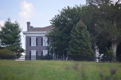 | Hodgkins House | 1.1 miles | 1979 |
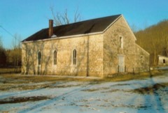 | Providence Baptist Church | 1.6 miles | 1976 |
| Nathaniel Haggard House | 1.8 miles | 1979 | |
| Achilles Eubank House | 2.0 miles | 1979 | |
| J. Quisenberry House | 2.0 miles | 1979 |
| National Archives record | The nomination case file for reference 79003595 in Record Group 79. |
| Clark County | All 62 listed properties in this county. |