 Block
From the record
One of 10 National Register listings published here for Bell County · listed in 1980 · category: District.
Sources: the case file at the National Archives · the National Register database, National Park Service
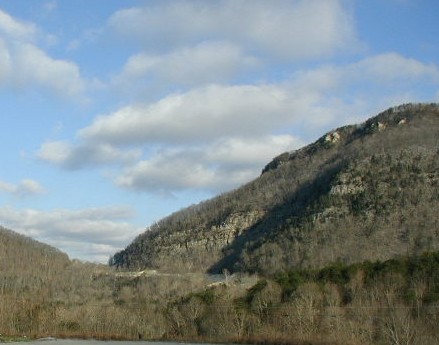
Listed on the National Register of Historic Places in 1980.
One of 10 National Register listings published here for Bell County · listed in 1980 · category: District.
Sources: the case file at the National Archives · the National Register database, National Park Service
Regional context, not property-specific evidence. The federal wildfire occurrence database lists 150 fires within 5 miles of Cumberland Gap Historic District between 1992 and 2020, burning about 2,439 acres in total. 6 started naturally. 31 were recorded as arson. Distance is straight-line from the map coordinates, so a fire counted here may appear on a neighbouring settlement's page as well.
| Reported cause | Fires |
|---|---|
| Debris and open burning | 44 |
| Missing data/not specified/undetermined | 41 |
| Arson/incendiarism | 31 |
| Recreation and ceremony | 15 |
| Natural | 6 |
| Smoking | 4 |
| Equipment and vehicle use | 4 |
| Railroad operations and maintenance | 3 |
| Power generation/transmission/distribution | 2 |
The most recent of them, most recent first, with the day each was reported and the service that recorded it.
| Date | Cause | Size | Reported by | Name on the report |
|---|---|---|---|---|
| 7 September 1995 | Natural | 1.0 acres | Cumberland Gap National Historic Park | STEEL TANK |
| 5 September 2007 | Debris and open burning | 1.0 acres | Kentucky Division of Forestry | not named |
| 24 September 2005 | Missing data/not specified/undetermined | 2.0 acres | Kentucky Division of Forestry | not named |
| 22 September 2007 | Recreation and ceremony | 2.0 acres | Kentucky Division of Forestry | not named |
| 20 September 2019 | Missing data/not specified/undetermined | 2.0 acres | Kentucky Division of Forestry | LOWASH |
| 11 September 2012 | Missing data/not specified/undetermined | under an acre | Cumberland Gap National Historic Park | TIPRELL R&R |
| 31 August 1998 | Smoking | under an acre | Tennessee Division of Forestry | not named |
| 22 August 2012 | Debris and open burning | 1.0 acres | Kentucky Division of Forestry | POLLY HOLO |
Regional context, not property-specific evidence. The federal mineral resources record lists 3 workings within 5 miles of Cumberland Gap Historic District: 2 past producers, 1 prospect. None of them still produces. What was taken out: Stone, Crushed/Broken, Clay, Limestone, Dimension. Distance is straight-line from the map coordinates, so a quarry counted here may appear on a neighbouring settlement's page as well.
| Where | Site | Commodity | Status | Recorded |
|---|---|---|---|---|
| Claiborne County Quarry | Stone, Crushed/Broken | Past Producer | ||
| Limestone Quarry | Limestone, Dimension | Past Producer | ||
| Old Railroad Shale | Clay | Prospect |
Regional context, not property-specific evidence. The National Weather Service names Middlesboro, the town this property stands in, in 56 storm reports between 1996 and 2025: 28 thunderstorm wind, 11 hail, 7 flash flood, 7 heavy rain. No death or injury is recorded in these reports. Each account below is quoted exactly as the forecast office filed it, from the NOAA Storm Events Database, and each date opens the federal record of that event.
| When | Event | Place named | Harm | What the report says |
|---|---|---|---|---|
| April 2007 | Thunderstorm Wind | Middlesboro | $100,000 | Numerous trees and powerlines down throughout the county. Roof and siding damage to a few homes in the Dorton Branch area. |
| July 2012 | Thunderstorm Wind | Middlesboro | $50,000 | The roof of a Big Lots store and various other business signs along Hwy 25E were damaged or blown away completely. |
| June 1998 | Lightning | Middlesboro | $50,000 | Lightning struck and burned up a transformer. |
| November 1996 | Flash Flood | Middlesboro | $20,000 | no account filed |
| March 2012 | Thunderstorm Wind | Middlesboro | $15,000 | Trees were blown down in Middlesboro. |
| March 1997 | Flash Flood | Middlesboro | $10,000 | no account filed |
| February 2011 | Thunderstorm Wind | Middlesboro | $8,000 | An 8 by 12 foot shed was moved about 40 feet by a thunderstorm wind gust. A few shingles and some siding was torn off one structure. An unsupported concrete block wall was also knocked over. The damage occurred at the corner of 23rd and Winchester Streets in Middlesboro. |
| February 2008 | Thunderstorm Wind | Middlesboro | $8,000 | Both trees and powerlines were blown down along Highway 2079. |
| April 2011 | Thunderstorm Wind | Middlesboro | $6,000 | Trees were blown down and onto power lines at the Bella Gardens Apt complex on Old Pineville Pike in Middlesboro. |
| April 2011 | Thunderstorm Wind | Middlesboro | $5,000 | There were trees blown down on the right fork of Polly Hollow Rd outside of Middlesboro. |
| June 2006 | Thunderstorm Wind | Middlesboro | $5,000 | One tree down in Spade Acres in Middlesboro. Trees down on Highway 987 towards Cubage. Power outages in the Ferndale area south of Pineville. |
| June 2011 | Thunderstorm Wind | Middlesboro | $3,000 | A tree and large tree limbs were blown down by thunderstorm wind gusts in Middlesboro. |
| June 1998 | Thunderstorm Wind | Middlesboro | $3,000 | Trees and power lines downed. |
| June 1997 | Tornado (F0) | Middlesboro | $3,000 | A small tornado damaged trees and downed power lines. |
| May 2010 | Thunderstorm Wind | Middlesboro | $2,000 | Two good sized trees were blown down in city limits. There was also ankle deep water on most streets and parking lots. |
| November 2007 | Thunderstorm Wind | Middlesboro | $2,000 | Two trees were blown down in Cumberland Gap NHP. Time was estimated from radar. |
| July 1999 | Thunderstorm Wind | Middlesboro | $2,000 | Strong winds blew several trees down onto power lines across the town of Middlesboro. Approximately one-third of the town was without power for several hours. |
| May 2024 | Thunderstorm Wind | Middlesboro | $1,000 | Tree was reported down onto power lines on Edgewood Road in Middlesboro via a social media report. |
| May 2025 | Hail | Middlesboro | - | A public report on social media of quarter sized hail in Middlesboro. |
| May 2024 | Thunderstorm Wind | Middlesboro | - | A social media report with drone photos showed large trees down on the east side of Middlesboro. |
| May 2024 | Thunderstorm Wind | Middlesboro | - | Many trees were blown down around the city of Middlesboro. |
| September 2023 | Heavy Rain | Middlesboro | - | The National Park Service YELK2 RAWS site at Cumberland Gap recorded 1.68 inches of rainfall in 1 hour. |
| September 2023 | Flash Flood | Middlesboro | - | Middlesboro Police Department reported that Cumberland Avenue was closed between 15th and 19th Streets due to flash flooding. |
| September 2023 | Flash Flood | Middlesboro | - | Middlesboro Police Department reported that North 15th Street was closed at Ashbury Avenue in the vicinity of Little Yellow Creek due to flash flooding. |
| September 2023 | Heavy Rain | Middlesboro | - | A two hour rainfall total of 4 inches was recorded at the Cumberland Gap National Park Service RAWS - YELK2. |
| July 2022 | Thunderstorm Wind | Middlesboro | - | Pictures on social media show a large portion of a pine tree sanpped off in someone's yard along West Chester Avenue in Middlesboro. |
| March 2021 | Heavy Rain | Middlesboro | - | The YELK2 (Yellow Creek) RAWS observing site near Cumberland Gap measured 4.34 inches of rainfall in a 24 hour period. |
| June 2015 | Thunderstorm Wind | Middlesboro | - | A tree was blown down. |
| April 2014 | Thunderstorm Wind | Middlesboro | - | One tree was reported to have been blown down. This report was a public report relayed via social media. |
| June 2014 | Thunderstorm Wind | Middlesboro | - | One tree was downed by thunderstorm winds. |
| January 2013 | Thunderstorm Wind | Middlesboro | - | Tree was reported down on Hwy 74. |
| February 2011 | Heavy Rain | Middlesboro | - | Two inches of rain fell along Clear Creek in Middlesboro. |
| June 2011 | Heavy Rain | Middlesboro | - | A rainfall total of 4.42 inches was measured by the Middlesboro Bell county Airport AWOS between 235 and 635 am, with 1.88 inches of that rain falling between 535 and 635 am. |
| June 2011 | Heavy Rain | Middlesboro | - | It was reported that 5.71 inches of rain had fallen near Middlesboro between 3 and 725 am, with 1.26 inches of that total accumulating between 625 and 725 am. |
| June 2011 | Heavy Rain | Middlesboro | - | The Yellow Creek RAWS site measured a three hour rainfall total of 3.05 inches. |
| June 2011 | Flash Flood | Middlesboro | - | Numerous roads were under water throughout Middlesboro, including 35th, 19th, and 25A. A spotter reported that at least 3-4 inches of rain had fallen overnight. |
| May 2006 | Thunderstorm Wind | Middlesboro | - | Few trees down at 25th Street, Cumberland Ave, and Fords Woods Park. |
| August 2006 | Thunderstorm Wind | Middlesboro | - | Tree down behind West End School. Tree down and blocking Airport Road. Trees also down at various locations across the county. |
| March 2005 | Flash Flood | Middlesboro | - | An area of showers and thunderstorms formed ahead of an eastward moving cold front, leading to flash flooding of creeks and streams in the Middlesboro area. |
| July 2005 | Thunderstorm Wind | Middlesboro | - | Trees down on Exeter and Chester Avenues. |
| July 2004 | Thunderstorm Wind | Middlesboro | - | Several trees were down on 24th Street. |
| April 2002 | Thunderstorm Wind | Middlesboro | - | Trees and large branches were down. |
| November 2002 | Hail | Middlesboro | - | Three quarter inch diameter hail was reported along United States Highway 25 East. |
| April 2000 | Flash Flood | Middlesboro | - | Heavy rains produced flooding in Middlesboro. Several roads had to be closed due to the high water. |
| March 2012 | Hail | Middlesboro | - | no account filed |
| March 2012 | Hail | Middlesboro | - | no account filed |
| March 2012 | Hail | Middlesboro | - | no account filed |
| May 2010 | Hail | Middlesboro | - | no account filed |
| June 2009 | Funnel Cloud | Middlesboro | - | no account filed |
| July 2008 | Hail | Middlesboro | - | no account filed |
| April 2006 | Hail | Middlesboro | - | no account filed |
| November 2002 | Hail | Middlesboro | - | no account filed |
| November 2002 | Hail | Middlesboro | - | no account filed |
| April 1998 | Hail | Middlesboro | - | no account filed |
| January 1997 | Thunderstorm Wind | Middlesboro | - | no account filed |
| January 1997 | Thunderstorm Wind | Middlesboro | - | no account filed |
2 papers published in this town, digitised by the Library of Congress and free to read: 901 issues, 4,903 pages. Every page is searchable, so a name or a street can be looked for directly in what the town printed about itself at the time.
| Newspaper | Published |
|---|---|
| The Weekly Herald | 1895 to 1898 |
| The Herald | 1898 to 1??? |
No historic map-sheet match is published for this property yet. That does not mean no map exists. This record needs a coordinate-quality review before it can be joined to a sheet boundary. Browse the county's mapped places while that work is pending.
Other National Register properties close enough to walk or drive between, ordered by distance from this one. Both positions come from the same geocoding pass that matched these properties to their map sheets.
| Photograph | Property | Distance | Listed |
|---|---|---|---|
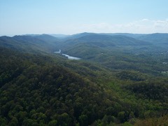 | Cumberland Gap National Historical Park | under 500 feet | 1966 |
 | Mt. Moriah Baptist Church | 2.2 miles | 1985 |
 | Middlesboro Downtown Commercial District | 2.3 miles | 1983 |
 | American Association, Limited, Office Building | 2.4 miles | 1978 |
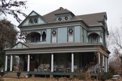 | Brooks House | 2.4 miles | 2009 |
| Middlesboro Jewish Cemetery | 2.6 miles | 2017 |
| National Archives record | The nomination case file for reference 80000366 in Record Group 79. |
| Bell County | All 10 listed properties in this county. |