 Block
From the record
One of 21 National Register listings published here for Edmonson County · listed in 1980 · category: Building.
Sources: the case file at the National Archives · the National Register database, National Park Service
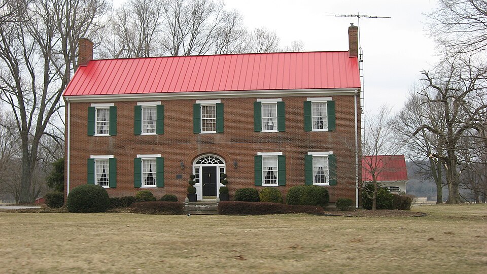
Listed on the National Register of Historic Places in 1980.
One of 21 National Register listings published here for Edmonson County · listed in 1980 · category: Building.
Sources: the case file at the National Archives · the National Register database, National Park Service
Regional context, not property-specific evidence. The federal wildfire occurrence database lists 12 fires within 5 miles of William Ford House between 1998 and 2014, burning about 47 acres in total. None started naturally. 1 was recorded as arson. Distance is straight-line from the map coordinates, so a fire counted here may appear on a neighbouring settlement's page as well.
| Reported cause | Fires |
|---|---|
| Debris and open burning | 3 |
| Recreation and ceremony | 3 |
| Missing data/not specified/undetermined | 2 |
| Railroad operations and maintenance | 2 |
| Equipment and vehicle use | 1 |
| Arson/incendiarism | 1 |
The most recent of them, most recent first, with the day each was reported and the service that recorded it.
| Date | Cause | Size | Reported by | Name on the report |
|---|---|---|---|---|
| 30 June 2012 | Railroad operations and maintenance | under an acre | Kentucky Division of Forestry | NOAH BLEDS |
| 6 April 2013 | Recreation and ceremony | 4.2 acres | Kentucky Division of Forestry | LITTLE KNOB FIRE |
| 19 April 2014 | Recreation and ceremony | 1.0 acres | Kentucky Division of Forestry | PIG ROAD |
| 6 March 2002 | Recreation and ceremony | 21 acres | Kentucky Division of Forestry | not named |
| 29 March 1998 | Debris and open burning | 3.0 acres | Kentucky Division of Forestry | not named |
| 15 March 2000 | Debris and open burning | 4.0 acres | Kentucky Division of Forestry | not named |
| 15 February 1999 | Debris and open burning | 4.0 acres | Kentucky Division of Forestry | not named |
| 12 November 2005 | Missing data/not specified/undetermined | 5.0 acres | Kentucky Division of Forestry | not named |
Regional context, not property-specific evidence. The federal mineral resources record lists 1 working within 5 miles of William Ford House: 1 producer. All of them still produce. What was taken out: Stone, Crushed/Broken. Distance is straight-line from the map coordinates, so a quarry counted here may appear on a neighbouring settlement's page as well.
| Where | Site | Commodity | Status | Recorded |
|---|---|---|---|---|
| Park City Quarry | Stone, Crushed/Broken | Producer |
Regional context, not property-specific evidence. The National Weather Service names Brownsville, the town this property stands in, in 51 storm reports between 1993 and 2019: 24 thunderstorm wind, 15 flood, 9 hail, 3 flash flood. No death or injury is recorded in these reports. Each account below is quoted exactly as the forecast office filed it, from the NOAA Storm Events Database, and each date opens the federal record of that event.
| When | Event | Place named | Harm | What the report says |
|---|---|---|---|---|
| May 2010 | Flood | Brownsville | $100,000 | The Green River at Brownsville crested at 37.5 feet around 645 AM EST on May 5. Flood stage at Brownsville is 18 feet. Moderate flooding occurs at this level, with homes in the bottom land flooded. |
| May 2004 | Thunderstorm Wind | Brownsville | $100,000 | Two barns were blown down. |
| April 2018 | Thunderstorm Wind | Brownsville | $25,000 | Power and cable lines were reported down. |
| May 2016 | Thunderstorm Wind | Brownsville | $5,000 | Trained spotters relayed pictures from a Facebook post of sign and siding damage due to severe thunderstorm winds in the Brownsville area. |
| April 1995 | Hail | Brownsville | $1,000 | no account filed |
| April 1993 | Hail | Brownsville | $500 | no account filed |
| June 2019 | Thunderstorm Wind | Brownsville | - | A tree fell on Houchin Ferry Road. |
| July 2016 | Flash Flood | Brownsville | - | Local law enforcement reported 4 bridges closed across the county due to high water flowing over them from excessive heavy rainfall. |
| March 2015 | Flood | Brownsville | - | Several inches of snow followed by 1 to 2 inches of rain resulted in the Green River at Brownsville to rise above flood stage. The river crested at 23.48 feet late on March 6th and then fell below flood stage late on the 7th. |
| April 2015 | Flood | Brownsville | - | Approximately 5 inches of rain fell on top of saturated ground and this resulted in the Green River at Brownsville to flood. The river crested at 23.95 feet early on April 17th. |
| April 2015 | Thunderstorm Wind | Brownsville | - | A trained spotter reported wind gusts 50 to 55 mph. |
| July 2015 | Flash Flood | Brownsville | - | An Edmonson County law enforcement official reported that Highway 187 had high water flowing over it in places. The same official reported that Highway 70 also had high water flowing over it. |
| December 2015 | Flood | Brownsville | - | Several heavy rain events resulted in widespread 3 to 5 inches of rain across the Green River basin. This brought the Green River at Brownsville into minor flood. The river crested at 19.74 feet late on December 27th. |
| July 2013 | Flood | Brownsville | - | The Green river flooded in several locations from the 7th to the 10th of July. In Brownsville, flood state is 18 feet. The river crested in Brownsville at 21 feet around noon on July 8th. |
| July 2012 | Thunderstorm Wind | Brownsville | - | The Edmonson County emergency dispatch confirmed a spotter report of several trees downed by thunderstorm winds in Brownsville. |
| May 2011 | Flood | Brownsville | - | The Green River at Brownsville crested around 22.1 feet at midnight on May 5. Minor flooding of agricultural bottom land occurs at this level. |
| March 2011 | Flood | Brownsville | - | The Green River at Brownsville crested around 18.5 feet at 1130 AM CST on March 2. Flood stage at Brownsville is 18 feet. Minor flooding occurs at this level, with water covering some agricultural bottom land. |
| April 2011 | Thunderstorm Wind | Brownsville | - | A trained spotter reported wind gusts to 60 mph. |
| April 2011 | Thunderstorm Wind | Brownsville | - | A trained spotter reported wind gusts to 60 mph. |
| April 2011 | Thunderstorm Wind | Brownsville | - | Trees were down on homes in the southern part of the county. |
| April 2011 | Flood | Brownsville | - | Dispatch reported road closures on Grassland Black Gold Rd., Willy Webb Rd., and Alexander Creek bridge. |
| April 2011 | Flood | Brownsville | - | The Green River at Brownsville crested around 24.8 feet at 1015 AM CST on April 14. Flood stage at Brownsville is 18 feet. Minor flooding occurs at this level. |
| April 2011 | Flood | Brownsville | - | The Green River at Brownsville crested around 20.3 feet at 10 AM CST on April 29. Flood stage at Brownsville is 18 feet. Minor flooding occurs at this level. |
| November 2011 | Flood | Brownsville | - | The Green River went into flood around noon on November 29th. It crested later in December. Flood stage is 18 feet. |
| December 2011 | Flood | Brownsville | - | The Green River at Brownsville had been in flood since late November, cresting around 20.8 feet late in the evening of November 30. |
| October 2010 | Thunderstorm Wind | Brownsville | - | A tree was blown down on a house in Brownsville. |
| February 2009 | Thunderstorm Wind | Brownsville | - | Trees were reported downed near Brownsville. |
| June 2009 | Thunderstorm Wind | Brownsville | - | Trees were downed across the county. |
| March 2008 | Flood | Brownsville | - | The Green River at Brownsville crested at 18.7 feet around 630 AM CST on March 21. Flood stage at Brownsville is 18 feet. Minor flooding occurs at this level, with the river overflowing some of its banks and covering some bottom land. |
| February 2008 | Flood | Brownsville | - | The Green River at Brownsville crested at 18.8 feet around 730 AM EST on February 8. Flood stage at Brownsville is 18 feet. Minor flooding occurs at this level, with the river overflowing lock walls, creeks, sloughs, and some bottom land. |
| January 2008 | Thunderstorm Wind | Brownsville | - | Thunderstorm winds downed numerous trees and power lines. |
| April 2008 | Flood | Brownsville | - | The Green River at Brownsville crested at 22.1 feet around 245 AM CST on April 6. Flood stage at Brownsville is 18 feet. Minor flooding occurs at this level, with the river overflowing the lock walls and some lower banks and creeks. |
| April 2006 | Hail | Brownsville | - | Several spotters relayed reports via amateur radio. |
| December 2006 | Thunderstorm Wind | Brownsville | - | Trees were downed near Brownsville, and near the Hart County line. |
| May 2003 | Thunderstorm Wind | Brownsville | - | Two trees were downed. Pea size hail was also reported. |
| November 2002 | Thunderstorm Wind | Brownsville | - | Three power poles were downed. |
| January 1999 | Thunderstorm Wind | Brownsville | - | Multiple trees down |
| April 2011 | Hail | Brownsville | - | no account filed |
| March 2006 | Hail | Brownsville | - | no account filed |
| March 2006 | Thunderstorm Wind | Brownsville | - | no account filed |
| May 2006 | Hail | Brownsville | - | no account filed |
| April 2006 | Hail | Brownsville | - | no account filed |
| April 2005 | Hail | Brownsville | - | no account filed |
| May 2005 | Thunderstorm Wind | Brownsville | - | no account filed |
| August 2005 | Hail | Brownsville | - | no account filed |
| November 2005 | Thunderstorm Wind | Brownsville | - | no account filed |
| November 2005 | Thunderstorm Wind | Brownsville | - | no account filed |
| August 2004 | Thunderstorm Wind | Brownsville | - | no account filed |
| September 2002 | Flash Flood | Brownsville | - | no account filed |
| October 2001 | Thunderstorm Wind | Brownsville | - | no account filed |
| June 1998 | Thunderstorm Wind | Brownsville | - | no account filed |
No historic map-sheet match is published for this property yet. That does not mean no map exists. This record needs a coordinate-quality review before it can be joined to a sheet boundary. Browse the county's mapped places while that work is pending.
Other National Register properties close enough to walk or drive between, ordered by distance from this one. Both positions come from the same geocoding pass that matched these properties to their map sheets.
| Photograph | Property | Distance | Listed |
|---|---|---|---|
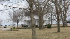 | Mitchell-Estes Farmstead | 1.6 miles | 1996 |
| Chalybeate Springs Hotel Springhouse | 2.7 miles | 2018 | |
| Mill Hole Farm | 5.4 miles | 1978 | |
 | Joppa Baptist Church and Cemetery | 6.2 miles | 1991 |
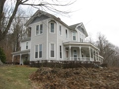 | Reed-Dorsey House | 7.6 miles | 1986 |
| National Archives record | The nomination case file for reference 80001506 in Record Group 79. |
| Edmonson County | All 21 listed properties in this county. |