 Block
From the record
One of 526 National Register listings published here for Jefferson County · listed in 1980 · category: Building.
Sources: the case file at the National Archives · the National Register database, National Park Service
Listed on the National Register of Historic Places in 1980.
One of 526 National Register listings published here for Jefferson County · listed in 1980 · category: Building.
Sources: the case file at the National Archives · the National Register database, National Park Service
Regional context, not property-specific evidence. The federal wildfire occurrence database lists 5 fires within 5 miles of Aydelott House between 2002 and 2010, burning about 35 acres in total. None started naturally. None was recorded as arson. Distance is straight-line from the map coordinates, so a fire counted here may appear on a neighbouring settlement's page as well.
| Reported cause | Fires |
|---|---|
| Recreation and ceremony | 3 |
| Missing data/not specified/undetermined | 2 |
The most recent of them, most recent first, with the day each was reported and the service that recorded it.
| Date | Cause | Size | Reported by | Name on the report |
|---|---|---|---|---|
| 12 March 2007 | Recreation and ceremony | 8.0 acres | Kentucky Division of Forestry | not named |
| 27 February 2006 | Missing data/not specified/undetermined | 4.0 acres | Kentucky Division of Forestry | not named |
| 25 February 2002 | Recreation and ceremony | 2.0 acres | Kentucky Division of Forestry | not named |
| 22 November 2010 | Recreation and ceremony | 17 acres | Kentucky Division of Forestry | BLEVINS GAP |
| 8 January 2006 | Missing data/not specified/undetermined | 4.0 acres | Kentucky Division of Forestry | not named |
Regional context, not property-specific evidence. The federal mineral resources record lists 3 workings within 5 miles of Aydelott House: 3 producers. All of them still produce. What was taken out: Stone, Silica. Distance is straight-line from the map coordinates, so a quarry counted here may appear on a neighbouring settlement's page as well.
| Where | Site | Commodity | Status | Recorded |
|---|---|---|---|---|
| Gem Silica Elizabeth Plant | Silica | Producer | ||
| Kosmos Cement Division | Stone | Producer | ||
| Kosmosdale Pit | Stone | Producer |
Regional context, not property-specific evidence. The National Weather Service names Valley Station, the town this property stands in, in 37 storm reports between 1995 and 2025: 23 thunderstorm wind, 9 hail, 3 flash flood, 1 flood. No death or injury is recorded in these reports. Each account below is quoted exactly as the forecast office filed it, from the NOAA Storm Events Database, and each date opens the federal record of that event.
| When | Event | Place named | Harm | What the report says |
|---|---|---|---|---|
| September 2018 | Flash Flood | Valley Station | $10,000 | A water rescue took place to rescue a person stuck in a vehicle on Grafton Hall Road. |
| May 2010 | Lightning | Valley Station | $6,000 | A lightning strike caused limbs to fly. Some of the limbs broke windows in homes along Rogers St. off West Pages Ln. |
| May 2001 | Hail | Valley Station | $5,000 | Several cars were damaged by hail. |
| May 2019 | Thunderstorm Wind | Valley Station | $1,000 | Large branches were downed, damaging a fence along Deering Road. |
| May 2025 | Thunderstorm Wind | Valley Station | - | A carport was lifted into power lines by strong winds near Valley Station. |
| October 2025 | Flash Flood | Valley Station | - | There was an SUV submerged in water. |
| May 2024 | Thunderstorm Wind | Valley Station | - | Trees and power lines were downed by strong winds in Valley Station. |
| May 2018 | Thunderstorm Wind | Valley Station | - | Trees were reported down. |
| May 2018 | Thunderstorm Wind | Valley Station | - | Trees were down near West Pages Lane at Devonshire Lane. |
| July 2018 | Hail | Valley Station | - | The hail was measured at Stonestreet Road. |
| March 2016 | Thunderstorm Wind | Valley Station | - | A large tree limb fell down on Aristides Drive. |
| June 2016 | Thunderstorm Wind | Valley Station | - | Local broadcast media meteorologists reported trees down in Valley Station. |
| June 2016 | Thunderstorm Wind | Valley Station | - | Severe thunderstorm winds resulted in a tree falling through a roof of a home. |
| June 2015 | Thunderstorm Wind | Valley Station | - | A member of the broadcast media relayed a report of a large tree limb down in Valley Station. |
| August 2015 | Thunderstorm Wind | Valley Station | - | A broadcast meteorologist relayed a report of a large tree snapped off. |
| August 2015 | Thunderstorm Wind | Valley Station | - | An off-duty NWS employee relayed a report of a tree snapped off along Johnsontown Road near Highway 31W. |
| June 2011 | Thunderstorm Wind | Valley Station | - | The public reported a tree down on a house near the Valley Station subdivision. |
| June 2009 | Thunderstorm Wind | Valley Station | - | Winds caused some trees to fall. There were also some areas of standing water. |
| September 2009 | Flash Flood | Valley Station | - | Dixie Highway was closed at Valley Station Road due to high water. |
| March 2008 | Flood | Valley Station | - | The Ohio River below Louisville crested around 57.6 feet around 800 AM EST on March 21. Flood stage on the lower gage is 55 feet. Minor flooding occurs at this level, with River Front Park in downtown Louisville flooded. |
| July 2007 | Thunderstorm Wind | Valley Station | - | Trees were downed. Spotters estimated a 70 MPH wind gust. |
| May 2006 | Hail | Valley Station | - | Nickel size hail was also reported in the Pleasure Ridge Park area. |
| May 2006 | Thunderstorm Wind | Valley Station | - | Trees and power lines were downed. |
| August 2006 | Thunderstorm Wind | Valley Station | - | Widespread tree damage and numerous large trees were split. |
| May 2004 | Thunderstorm Wind | Valley Station | - | Power lines were downed. |
| July 2004 | Thunderstorm Wind | Valley Station | - | Trees and power lines were blown down. |
| July 2004 | Thunderstorm Wind | Valley Station | - | Trees were downed in the Stonestreet Road area. Some of the trees were blown on to power lines. Electricity was out to about 6000 customers. |
| September 2003 | Thunderstorm Wind | Valley Station | - | Numerous large limbs were downed. |
| May 2003 | Thunderstorm Wind | Valley Station | - | Trees were downed along Dixie Highway. |
| February 2002 | Hail | Valley Station | - | Hail covered the ground. |
| May 1995 | Thunderstorm Wind | Valley Station | - | Large tree down reported by Department of Emergency Service. |
| July 2008 | Hail | Valley Station | - | no account filed |
| March 2002 | Hail | Valley Station | - | no account filed |
| October 2000 | Hail | Valley Station | - | no account filed |
| May 1998 | Thunderstorm Wind | Valley Station | - | no account filed |
| March 1997 | Hail | Valley Station | - | no account filed |
| May 1996 | Hail | Valley Station | - | no account filed |
No historic map-sheet match is published for this property yet. That does not mean no map exists. This record needs a coordinate-quality review before it can be joined to a sheet boundary. Browse the county's mapped places while that work is pending.
Other National Register properties close enough to walk or drive between, ordered by distance from this one. Both positions come from the same geocoding pass that matched these properties to their map sheets.
| Photograph | Property | Distance | Listed |
|---|---|---|---|
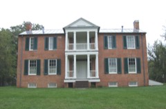 | Farnsley-Moremen House | 0.4 miles | 1979 |
| Jones House | 2.3 miles | 1983 | |
 | Waverly Hills Tuberculosis Sanitarium Historic Buildings | 3.6 miles | 1983 |
| Kosmosdale Depot | 4.9 miles | 1984 | |
| David Farnsley House | 5.9 miles | 1983 | |
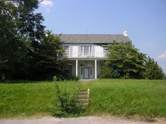 | Lewiston House | 6.0 miles | 1980 |
| National Archives record | The nomination case file for reference 80001644 in Record Group 79. |
| Jefferson County | All 526 listed properties in this county. |