 Block
From the record
One of 83 National Register listings published here for Scott County · listed in 1983 · category: Building.
Sources: the case file at the National Archives · the National Register database, National Park Service
Listed on the National Register of Historic Places in 1983.
One of 83 National Register listings published here for Scott County · listed in 1983 · category: Building.
Sources: the case file at the National Archives · the National Register database, National Park Service
Regional context, not property-specific evidence. The federal mineral resources record lists 3 workings within 5 miles of Ash Emison Quarters: 2 past producers, 1 producer. 1 still produces. What was taken out: Barium-Barite, Lead, Zinc, Iron, Strontium, Sulfur. Distance is straight-line from the map coordinates, so a quarry counted here may appear on a neighbouring settlement's page as well.
| Where | Site | Commodity | Status | Recorded |
|---|---|---|---|---|
| Johnson Vein | Barium-Barite, Lead, Zinc | Past Producer | Barite, Galena, Sphalerite | |
| Nally and Gibson | Stone, Crushed/Broken | Producer | ||
| Wm. Davis Vein | Barium-Barite, Iron, Strontium, Sulfur | Past Producer | 1908 |
Regional context, not property-specific evidence. The National Weather Service names Delaplain, the town this property stands in, in 12 storm reports between 2001 and 2022: 10 thunderstorm wind, 2 flash flood. No death or injury is recorded in these reports. Each account below is quoted exactly as the forecast office filed it, from the NOAA Storm Events Database, and each date opens the federal record of that event.
| When | Event | Place named | Harm | What the report says |
|---|---|---|---|---|
| March 2017 | Thunderstorm Wind | Delaplain | $40,000 | Local amateur radio reported a business lost a roof due to severe thunderstorm winds. |
| May 2004 | Thunderstorm Wind | Delaplain | $30,000 | A small barn was moved across a field in the Sims Pike area. |
| March 2017 | Thunderstorm Wind | Delaplain | $25,000 | The Scott County Emergency Manager reported trees on power lines near the county Emergency Operations Center. |
| March 2017 | Thunderstorm Wind | Delaplain | $20,000 | Amateur radio operators reported that severe thunderstorm winds resulted in a semi truck being overturned near mile marker 129 on Interstate 75. |
| March 2017 | Thunderstorm Wind | Delaplain | $15,000 | Local amateur radio reported trees fell on a home. |
| July 2015 | Thunderstorm Wind | Delaplain | $10,000 | The Scott County emergency manager reported a tree fell down on a car on Oxford Drive. |
| June 2022 | Thunderstorm Wind | Delaplain | - | A 61 mph wind gust was recorded at the Scott County EOC. |
| May 2018 | Thunderstorm Wind | Delaplain | - | It was reported that Scott County had numerous trees down county wide. |
| May 2018 | Flash Flood | Delaplain | - | Broadcast media reported Burton Pike near Cincinnati Road was impassable due to high water. |
| September 2018 | Flash Flood | Delaplain | - | HighwaY 25, Cincinnati Road, had water over the roadway. |
| March 2017 | Thunderstorm Wind | Delaplain | - | no account filed |
| August 2001 | Thunderstorm Wind | Delaplain | - | no account filed |
No historic map-sheet match is published for this property yet. That does not mean no map exists. This record needs a coordinate-quality review before it can be joined to a sheet boundary. Browse the county's mapped places while that work is pending.
Other National Register properties close enough to walk or drive between, ordered by distance from this one. Both positions come from the same geocoding pass that matched these properties to their map sheets.
| Photograph | Property | Distance | Listed |
|---|---|---|---|
| Main Street Commercial District | 0.3 miles | 1975 | |
| James Briscoe Quarters | 0.6 miles | 1983 | |
| Osburn House | 0.7 miles | 1973 | |
| Rhodin Coppage Spring House | 1.0 miles | 1983 | |
| Fielding Bradford House | 1.6 miles | 1973 | |
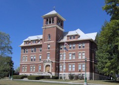 | Cardome | 2.6 miles | 1975 |
| National Archives record | The nomination case file for reference 83002866 in Record Group 79. |
| Scott County | All 83 listed properties in this county. |