 Block
From the record
One of 47 National Register listings published here for Green County · listed in 1984 · category: Building.
Sources: the case file at the National Archives · the National Register database, National Park Service
Listed on the National Register of Historic Places in 1984.
One of 47 National Register listings published here for Green County · listed in 1984 · category: Building.
Sources: the case file at the National Archives · the National Register database, National Park Service
Regional context, not property-specific evidence. The federal wildfire occurrence database lists 40 fires within 5 miles of David Hilliard House between 1998 and 2020, burning about 184 acres in total. None started naturally. 8 were recorded as arson. Distance is straight-line from the map coordinates, so a fire counted here may appear on a neighbouring settlement's page as well.
| Reported cause | Fires |
|---|---|
| Missing data/not specified/undetermined | 11 |
| Arson/incendiarism | 8 |
| Debris and open burning | 8 |
| Recreation and ceremony | 6 |
| Smoking | 3 |
| Equipment and vehicle use | 2 |
| Railroad operations and maintenance | 2 |
The most recent of them, most recent first, with the day each was reported and the service that recorded it.
| Date | Cause | Size | Reported by | Name on the report |
|---|---|---|---|---|
| 23 June 2005 | Missing data/not specified/undetermined | under an acre | Kentucky Division of Forestry | not named |
| 9 April 1999 | Arson/incendiarism | 1.0 acres | Kentucky Division of Forestry | not named |
| 7 April 1999 | Arson/incendiarism | 5.0 acres | Kentucky Division of Forestry | not named |
| 6 April 2010 | Recreation and ceremony | 3.0 acres | Kentucky Division of Forestry | not named |
| 2 April 2010 | Debris and open burning | 25 acres | Kentucky Division of Forestry | not named |
| 9 March 2010 | Recreation and ceremony | 20 acres | Kentucky Division of Forestry | not named |
| 8 March 2017 | Debris and open burning | under an acre | Kentucky Division of Forestry | LEMONS BEND RD. FIRE |
| 7 March 2000 | Debris and open burning | 2.0 acres | Kentucky Division of Forestry | not named |
Regional context, not property-specific evidence. The federal mineral resources record lists 1 working within 5 miles of David Hilliard House: 1 producer. All of them still produce. What was taken out: Stone, Crushed/Broken. Distance is straight-line from the map coordinates, so a quarry counted here may appear on a neighbouring settlement's page as well.
| Where | Site | Commodity | Status | Recorded |
|---|---|---|---|---|
| Greensburg Quarry | Stone, Crushed/Broken | Producer |
Regional context, not property-specific evidence. The National Weather Service names Greensburg, the town this property stands in, in 63 storm reports between 1995 and 2026: 46 thunderstorm wind, 11 hail, 4 flash flood, 1 tornado. No death or injury is recorded in these reports. Each account below is quoted exactly as the forecast office filed it, from the NOAA Storm Events Database, and each date opens the federal record of that event.
| When | Event | Place named | Harm | What the report says |
|---|---|---|---|---|
| May 2004 | Thunderstorm Wind | Greensburg | $75,000 | A shingle roof was blown off a warehouse. A portion of a sheet metal wall was blown out of another warehouse. Part of the roof was blown off a gas station. A few warehouse doors were blown in. Several large trees were downed. |
| February 2018 | Thunderstorm Wind | Greensburg | $50,000 | Local media reported trees and power lines down with power outages. |
| May 2004 | Thunderstorm Wind | Greensburg | $50,000 | A shingle roof was blown off a warehouse. A portion of a sheet metal wall was blown out of another warehouse. Part of the roof was blown off a gas station. A few warehouse doors were blown in. Several large trees were downed. |
| May 2004 | Thunderstorm Wind | Greensburg | $30,000 | Numerous trees and power lines were downed. The roof was blown off a building. |
| July 2016 | Thunderstorm Wind | Greensburg | $25,000 | Local law enforcement reported trees down on a structure on Water Street in Greensburg. Other trees were reported down county wide. |
| May 1998 | Thunderstorm Wind | Greensburg | $20,000 | no account filed |
| April 2002 | Thunderstorm Wind | Greensburg | $10,000 | Numerous trees and power lines were downed, along with some unspecified structural damage. |
| March 2017 | Thunderstorm Wind | Greensburg | $5,000 | State officials reported power poles down blocking portions of Highway 88 near Greensburg. |
| December 2013 | Thunderstorm Wind | Greensburg | $5,000 | A storm survey confirmed that sporadic damage across Green County was due to straight line winds up to 65 mph associated with a severe squall line. The most significant damage surveyed was noted in Greenville near the intersection of State Highways 61 and 68, where roof and shingle damage occurred. |
| May 2004 | Thunderstorm Wind | Greensburg | $5,000 | A number of trees were blown down. Windows were blown out of a residence. |
| May 2004 | Thunderstorm Wind | Greensburg | $5,000 | A number of trees were downed. Windows were blown out of a residence. |
| January 1999 | Thunderstorm Wind | Greensburg | $5,000 | Trees down. Tree fell on a car in eastern section of county |
| June 2013 | Thunderstorm Wind | Greensburg | $2,000 | A spotter reported several trees and power lines down in Greensburg. |
| June 2015 | Thunderstorm Wind | Greensburg | $1,000 | The Green County Emergency Manager reported a tree fell down on a house resulting in minor damage. |
| May 2006 | Thunderstorm Wind | Greensburg | $1,000 | no account filed |
| April 2026 | Thunderstorm Wind | Greensburg | - | The National Weather Service conducted a damage survey in Green County for the storms that occurred in the early morning hours on April 28, 2026. Straight line wind damage was observed to occur with max wind speeds of 80 mph.||Damage was mainly concentrated near Greensburg, KY along US Highway 68. Damage to trees and power lines were observed to the south and southeast of Greensburg along Columbia Highway, on route 417 (East Columbia Avenue) and on Brummal Avenue near Green County High School. Damage continued to the east and fanned out in nature consistent with a straight line wind downdraft along Cox Bend area near Taylor Cox Road. Mostly trees were damaged with large limbs in the Cox Bend area. The most notable damage was a single wide trailer roof completely peeled off near Coxes Bend |Road and Darnell Road. All damage was consistent with facing in the easterly direction associated with straight line wind damage.||Another damage point was reported near the Exie fire department well south of Greensburg on US Highway 68 where a couple of power poles were down, but no other tree or structure damage was observed near this area. This damage was also straight |line wind damage, but was in a different area than the points near and east of Greensburg, KY. |
| April 2025 | Flash Flood | Greensburg | - | There were water rescues south of Greensburg. |
| May 2024 | Thunderstorm Wind | Greensburg | - | Multiple trees were blown down by strong winds in and around Greensburg. Two fallen trees caused damage to a home on Legion Park Road. |
| July 2024 | Thunderstorm Wind | Greensburg | - | Trees were blown down on Henry Street in Greensburg. |
| July 2023 | Thunderstorm Wind | Greensburg | - | A couple trees were blown down in and around Greensburg. |
| July 2021 | Thunderstorm Wind | Greensburg | - | A tree was down on a house. |
| February 2021 | Flash Flood | Greensburg | - | There were numerous roads flooded and closed. The Old Bottling Company collapsed onto a power pole which cut power to much of Greensburg. Water rescues were also conducted. |
| January 2020 | Thunderstorm Wind | Greensburg | - | There were numerous trees reported down across the county. |
| June 2018 | Thunderstorm Wind | Greensburg | - | Multiple trees were down across the county including some blocking roads. Some side roads are covered with water from small creeks that have overflown. |
| May 2018 | Thunderstorm Wind | Greensburg | - | Large tree limbs blew down and street lights don't have power. |
| November 2018 | Flood | Greensburg | - | There was water reported across several roadways in Green County, KY. |
| March 2017 | Thunderstorm Wind | Greensburg | - | State officials reported trees down across West Hodgenville Avenue. |
| April 2017 | Thunderstorm Wind | Greensburg | - | The Green County emergency manager reported trees down in the area. |
| April 2017 | Thunderstorm Wind | Greensburg | - | State officials reported trees down on Happyville Road. |
| April 2017 | Thunderstorm Wind | Greensburg | - | State officials reported trees down on Hodgenville Road. |
| June 2015 | Thunderstorm Wind | Greensburg | - | A Green County official reported trees down on Durham Street. |
| July 2015 | Thunderstorm Wind | Greensburg | - | A Green County law enforcement official reported numerous trees down across the county as a result of severe thunderstorm winds. |
| July 2015 | Thunderstorm Wind | Greensburg | - | A law enforcement official reported that trees were down across town as a result of severe thunderstorm winds. |
| June 2013 | Thunderstorm Wind | Greensburg | - | A spotter reported several trees down in Greensburg. |
| January 2012 | Thunderstorm Wind | Greensburg | - | A trained spotter reported a tree down at a local park. This tree blocked the entrance. . |
| February 2012 | Flash Flood | Greensburg | - | The local emergency manager reported that both Goose Creek and Bluff Boone roads were closed due to flooding. Radar estimated that around 2 inches fell within 2 hours. |
| April 2011 | Tornado (EF1) | Greensburg | - | An NWS storm survey confirmed an EF-1 tornado with maximum winds of 105 mph touched down in Greensburg. Numerous windows and chimneys were damaged in downtown Greensburg. Trees were snapped and uprooted along US 68 throughout the path. Greensburg's industrial park suffered the worst damage when a brick building suffered exterior and interior damage. North of Bluff Boom Road the tornado significantly damaged a mobile home and destroyed two barns. |
| May 2011 | Thunderstorm Wind | Greensburg | - | Several trees were downed across the county. |
| February 2009 | Thunderstorm Wind | Greensburg | - | A few trees were downed by thunderstorm wind gusts. |
| July 2008 | Thunderstorm Wind | Greensburg | - | Trees were downed on State Highway 88 two miles west of Greensburg. |
| April 2006 | Thunderstorm Wind | Greensburg | - | Utility poles were downed. |
| September 2006 | Thunderstorm Wind | Greensburg | - | A tree was downed. |
| June 2005 | Thunderstorm Wind | Greensburg | - | Trees were downed. |
| May 2003 | Thunderstorm Wind | Greensburg | - | Trees were downed. |
| June 2001 | Flash Flood | Greensburg | - | Highway 61 was closed, covered by 4 feet of water. One motorist was stranded by high water. |
| July 1997 | Thunderstorm Wind | Greensburg | - | 911 operator reported trees down just south of Greensburg in sparsely populated areas. |
| June 1995 | Thunderstorm Wind | Greensburg | - | Trees down across roads. A tree eight inches in diameter fell on a van owned by city police dispatcher. No injuries reported. |
| May 2025 | Hail | Greensburg | - | no account filed |
| May 2025 | Hail | Greensburg | - | no account filed |
| May 2017 | Hail | Greensburg | - | no account filed |
| April 2017 | Hail | Greensburg | - | no account filed |
| May 2007 | Hail | Greensburg | - | no account filed |
| May 2006 | Hail | Greensburg | - | no account filed |
| May 2006 | Hail | Greensburg | - | no account filed |
| May 2005 | Hail | Greensburg | - | no account filed |
| May 2004 | Thunderstorm Wind | Greensburg | - | no account filed |
| August 2004 | Thunderstorm Wind | Greensburg | - | no account filed |
| July 2001 | Hail | Greensburg | - | no account filed |
| July 2001 | Hail | Greensburg | - | no account filed |
| May 2000 | Hail | Greensburg | - | no account filed |
No historic map-sheet match is published for this property yet. That does not mean no map exists. This record needs a coordinate-quality review before it can be joined to a sheet boundary. Browse the county's mapped places while that work is pending.
Other National Register properties close enough to walk or drive between, ordered by distance from this one. Both positions come from the same geocoding pass that matched these properties to their map sheets.
| Photograph | Property | Distance | Listed |
|---|---|---|---|
| Emory-Blakeman-Penick House | 1.3 miles | 1984 | |
| Livesay House | 1.6 miles | 1984 | |
| Ebenezer School | 2.6 miles | 1984 | |
| Montgomery-Sandidge House | 2.9 miles | 2017 | |
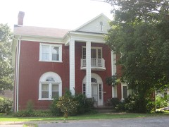 | Elijah Creel House | 3.2 miles | 2008 |
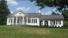 | William Hobson House | 3.3 miles | 1985 |
| National Archives record | The nomination case file for reference 84001511 in Record Group 79. |
| Green County | All 47 listed properties in this county. |