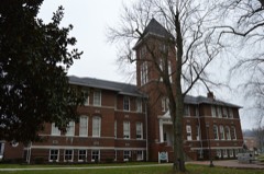
| March 2012 | Heavy Rain | Barbourville | 6 hurt, $20,000 | The roof of the Tru-Seal factory in Barbourville due to the weight of rain water that had accumulated on the roof. Six injuries were reported. |
| July 2008 | Thunderstorm Wind | Barbourville | $100,000 | Part of the roof was blown off a barn along Highway 459. Extensive tree and power line damage occurred county wide, with the hardest area being the south side of Barbourville. |
| April 2007 | Thunderstorm Wind | Barbourville | $100,000 | Numerous trees down countywide. Road signs blown down. Roof blown off a trailer. Eight children in a shelter due to their home being uninhabitable. Unconfirmed report of 2 people trapped in their basement due to wind damage. |
| March 2002 | Flash Flood | Barbourville | $50,000 | Heavy rains during the afternoon and evening of March 17, resulted in repeated episodes of flash flooding. Numerous roads were flooded, a bridge was washed out, and a trailer was washed away. |
| July 2008 | Thunderstorm Wind | Barbourville | $35,000 | Numerous trees were blown down across the western and northern portions of the county. The worst of the damage occurred near the Laurel county line. |
| January 2008 | Thunderstorm Wind | Barbourville | $30,000 | Trees and power poles were blown down throughout the county by winds estimated at 67 mph. |
| April 2011 | Thunderstorm Wind | Barbourville | $25,000 | Numerous trees and large limbs were downed by thunderstorm wind gusts in Barbourville. Two large trees were felled near the intersection of North Main and School Streets. One of the trees fell onto a parked truck, causing substantial damage to the vehicle. |
| May 2004 | Thunderstorm Wind | Barbourville | $10,000 | Windows were blown out of numerous homes. Trees were down countywide, including along College Street, College Park Drive, and Davis Bend Road. |
| August 2006 | Thunderstorm Wind | Barbourville | $5,000 | Numerous trees down. Signs down in town. Power lines down. |
| May 2003 | Thunderstorm Wind | Barbourville | $5,000 | Numerous trees and power lines were down in Barbourville. Numerous trees were also down countywide. |
| May 2011 | Thunderstorm Wind | Barbourville | $3,000 | Thunderstorm wind gusts caused extensive damage on the property of a volunteer storm spotter. The damage included a tri-axle RV trailer being moved 2 to 3 feet with awning ripped apart, limbs roughly 2 inches in diameter being broken off of trees, and one tree blown down. |
| May 2011 | Thunderstorm Wind | Barbourville | $3,000 | High winds moved a triaxle RV trailer approximately 2 to 3 feet. The winds also ripped an awning apart. Limbs approximately 2 inches in diameter were broken off trees and a tree was knocked over. |
| August 2010 | Thunderstorm Wind | Barbourville | $3,000 | A few trees were blown down north northwest of Barbourville. |
| April 2006 | Thunderstorm Wind | Barbourville | $3,000 | Tree down on trailer. |
| July 2006 | Thunderstorm Wind | Barbourville | $3,000 | Twelve to 15 trees down including on a house and power lines. |
| May 2011 | Thunderstorm Wind | Barbourville | $2,000 | Two trees were blown across a road 4 miles east of Barbourville. |
| June 2008 | Thunderstorm Wind | Barbourville | $2,000 | Two trees were blown down by thunderstorm wind gusts. |
| January 2022 | Thunderstorm Wind | Barbourville | $1,500 | A utility pole was reported down on Knox Street in downtown Barbourville. |
| February 2018 | Flood | Barbourville | $1,000 | The following roads were partially blocked throughout the county due to flooding: KY 3153, KY 3439, KY 225, KY 11, KY 223, KY 1527, and KY 459. Kentucky Highway 459 at Wynn Hollow Road was impassable due to flooding (broadcast media). |
| July 2015 | Flash Flood | Barbourville | $1,000 | Kentucky Hwy 459 was closed due to flooding. |
| April 2015 | Flash Flood | Barbourville | $1,000 | A couple of feet of water was observed flowing across Whitesburg Hollow located on Hwy 3439. Three to four inches of water was observed flowing across US 25 at Knox Street. Five to six inches of water was observed flowing across Cumberland Ave at US 25E. |
| June 2014 | Lightning | Barbourville | $1,000 | A 70 to 80 foot tall poplar tree was struck and damaged by lightning. |
| August 2013 | Flood | Barbourville | $1,000 | Up to two feet of water was covering College St near downtown Barbourville. |
| February 2012 | Thunderstorm Wind | Barbourville | $1,000 | A tree was blown down and across Hwy 229 approximately 1/4 to 1/2 mile north of US25E, partially blocking the northbound lane of the road. |
| April 2011 | Flash Flood | Barbourville | $1,000 | There was 18 inches of water flowing on Cumberland Avenue. |
| April 2006 | Thunderstorm Wind | Barbourville | $1,000 | Tree and power lines down just north of town on Route 11. |
| May 2002 | Thunderstorm Wind | Barbourville | $1,000 | Two trees were downed by strong winds across highway 930 and route 6. |
| January 1999 | Thunderstorm Wind | Barbourville | $1,000 | Tree fell on house. |
| September 2021 | Thunderstorm Wind | Barbourville | $100 | Knox County Dispatch reported a tree was down across KY-3441 near the GR Hampton Elementary School in southern Barbourville. |
| May 2025 | Hail | Barbourville | - | Social media pistures show a few quarter-sized hail stones in Barbourville amongst piles of smaller hail on the ground. |
| February 2022 | Flood | Barbourville | - | North KY-11 in Heidrick was reported blocked due to flood waters between mile markers 11 and 12. |
| August 2018 | Flash Flood | Barbourville | - | Dispatch reported water flowing over several roads in Barbourville, including Cumberland Avenue. |
| April 2017 | Flash Flood | Barbourville | - | Dispatch relayed reports of standing and flowing water up to three feet deep on numerous streets in Barbourville. |
| July 2015 | Thunderstorm Wind | Barbourville | - | Trees were blown down in Barbourville and through out the county. |
| June 2014 | Thunderstorm Wind | Barbourville | - | Large limbs were blown down. |
| February 2014 | Thunderstorm Wind | Barbourville | - | Trees were blown down at the intersection of Highways 459 and 6. |
| August 2013 | Flash Flood | Barbourville | - | Four to eight inches of water was flowing across Dozier Lane. |
| June 2013 | Thunderstorm Wind | Barbourville | - | A tree was blown down on Clover Ridge Rd. |
| January 2013 | Thunderstorm Wind | Barbourville | - | Numerous trees were reported down across the county. |
| July 2013 | Thunderstorm Wind | Barbourville | - | A large tree was blown down. |
| April 2011 | Thunderstorm Wind | Barbourville | - | An estimated thunderstorm wind gust of 65mph occurred in Barbourville between 501 and 516 pm EDT. |
| April 2011 | Thunderstorm Wind | Barbourville | - | A 59 mph thunderstorm wind gust was measured by the mesonet site 3 miles east of Barbourville. |
| November 2010 | Heavy Rain | Barbourville | - | A COOP observer reports 2.56 inches of rainfall since 7 AM 3.02 inches storm total as of 445 PM. |
| July 2008 | Thunderstorm Wind | Barbourville | - | A thunderstorm wind gust estimated at 70 mph occurred near Barbourville. |
| July 2008 | Flash Flood | Barbourville | - | Twelve to eighteen inches of water were seen flowing over several area roads in downtown Barbourville. |
| June 2007 | Hail | Barbourville | - | Quarter sized hail occurring at the emergency management office. |
| June 2007 | Hail | Barbourville | - | Media report of hail a little larger than quarters. |
| June 2007 | Hail | Barbourville | - | Hail piling up on the ground. |
| June 2007 | Hail | Barbourville | - | One to two inches of hail covering the ground. |
| April 2006 | Thunderstorm Wind | Barbourville | - | A few large tree limbs blown down. |
| July 2006 | Thunderstorm Wind | Barbourville | - | Tree down on North Main and Tye St. Tree also down on Swanpond Road 3 miles southwest of Barbourville. |
| July 2006 | Thunderstorm Wind | Barbourville | - | Several trees down on Swanpond Road and Tye Bend Road. |
| June 2006 | Thunderstorm Wind | Barbourville | - | Numerous trees down on Route 11 North. |
| August 2006 | Thunderstorm Wind | Barbourville | - | Trees down near Barbourville, at Stinking Creek. Trees also down at Walker Park 2 miles southwest of Barbourville. Trees down along Route 6 west of Barbourville. |
| August 2006 | Flash Flood | Barbourville | - | One foot of water standing in places on the city streets. |
| April 2005 | Thunderstorm Wind | Barbourville | - | Trees down on both Highway 223 and Highway 718. |
| May 2005 | Thunderstorm Wind | Barbourville | - | Trees down on Highway 11. |
| December 2004 | Flash Flood | Barbourville | - | Six to eight inches of water were reported to be running over Route 6 at the Smokey Holiness Church. Water was also over Higgins Branch Road about three miles north of Barbourville. |
| May 2004 | Thunderstorm Wind | Barbourville | - | Large tree limbs were down. |
| July 2004 | Thunderstorm Wind | Barbourville | - | Trees were down on Pope Hollow Road in Barbourville and on Sam Parker Road in Gray. |
 Block