 Block
From the record
One of 18 National Register listings published here for Greenup County · listed in 1988 · category: District.
Sources: the case file at the National Archives · the National Register database, National Park Service
Listed on the National Register of Historic Places in 1988.
One of 18 National Register listings published here for Greenup County · listed in 1988 · category: District.
Sources: the case file at the National Archives · the National Register database, National Park Service
Regional context, not property-specific evidence. The federal wildfire occurrence database lists 175 fires within 5 miles of South Greenup District between 1995 and 2020, burning about 3,009 acres in total. 1 started naturally. 43 were recorded as arson. Distance is straight-line from the map coordinates, so a fire counted here may appear on a neighbouring settlement's page as well.
| Reported cause | Fires |
|---|---|
| Debris and open burning | 59 |
| Missing data/not specified/undetermined | 46 |
| Arson/incendiarism | 43 |
| Recreation and ceremony | 16 |
| Power generation/transmission/distribution | 6 |
| Misuse of fire by a minor | 2 |
| Equipment and vehicle use | 2 |
| Natural | 1 |
The most recent of them, most recent first, with the day each was reported and the service that recorded it.
| Date | Cause | Size | Reported by | Name on the report |
|---|---|---|---|---|
| 6 September 2007 | Missing data/not specified/undetermined | 1.0 acres | Wayne National Forest | JANIE FIRE |
| 28 September 1998 | Arson/incendiarism | 10 acres | Kentucky Division of Forestry | not named |
| 19 September 1999 | Arson/incendiarism | 1.0 acres | Kentucky Division of Forestry | not named |
| 10 September 2018 | Power generation/transmission/distribution | 250 acres | Ohio Department of Natural Resources | 11905 |
| 1 September 2007 | Missing data/not specified/undetermined | 7.0 acres | Wayne National Forest | SNAP 2 FIRE |
| 9 July 2002 | Missing data/not specified/undetermined | 1.0 acres | Kentucky Division of Forestry | not named |
| 5 July 1999 | Arson/incendiarism | 30 acres | Kentucky Division of Forestry | not named |
| 15 July 2012 | Missing data/not specified/undetermined | 2.0 acres | Ohio Department of Natural Resources | not named |
Regional context, not property-specific evidence. The federal mineral resources record lists 7 workings within 5 miles of South Greenup District: 6 past producers, 1 plant. 1 still produces. What was taken out: Clay, Sand and Gravel, Construction. Distance is straight-line from the map coordinates, so a quarry counted here may appear on a neighbouring settlement's page as well.
| Where | Site | Commodity | Status | Recorded |
|---|---|---|---|---|
| Franklin Furnace Pit | Sand and Gravel, Construction | Past Producer | Sedimentary | |
| Franklin Furnace Pit | Sand and Gravel, Construction | Past Producer | ||
| Haverhill Plant & Dredge | Sand and Gravel, Construction | Plant | ||
| Bush-Corn Mine | Clay | Past Producer | ||
| Hoods Run Mine | Clay | Past Producer | ||
| Madden Mine | Clay | Past Producer | ||
| Smith Mine | Clay | Past Producer |
Regional context, not property-specific evidence. The National Weather Service names Greenup, the town this property stands in, in 33 storm reports between 1996 and 2025: 15 thunderstorm wind, 10 hail, 3 flash flood, 3 flood. No death or injury is recorded in these reports. Each account below is quoted exactly as the forecast office filed it, from the NOAA Storm Events Database, and each date opens the federal record of that event.
| When | Event | Place named | Harm | What the report says |
|---|---|---|---|---|
| April 2024 | Tornado (EF1) | Greenup | $2,000,000 | A broken path of damage was noted on the Kentucky side of the tornado track, beginning at the Riverview Cemetery west of Greenup. Additional damage occurred on Seaton Avenue near South 5th Street and in the Greenup Fairgrounds, where a few buildings suffered roof damage and a large tree fell onto another building. The tornado then likely tracked along the Ohio River before intersecting land again on the Kentucky side and causing roof and tree damage to several homes along Calumet Drive. |
| May 2011 | Flash Flood | Greenup | $500,000 | Serious urban street flooding occurred around such communities as Bellefonte, Russell, and Flatwoods. Water surrounded homes and businesses. A trailer was swept away in Flatwoods. A few rural streams, such as Indian Run, flooded in the eastern portion of the county. Damage to roads occurred. |
| April 2011 | Thunderstorm Wind | Greenup | $80,000 | A section of roof was blown off an apartment building, damaging some vehicles in the adjacent parking lot. |
| March 2012 | Thunderstorm Wind | Greenup | $40,000 | Trees were blown down in the town of Greenup. Overhead wires were brought down by the trees. At least one vehicle was damaged when a garage door was blown off. |
| June 2015 | Flash Flood | Greenup | $15,000 | Route 827 was flooded and closed along Coal Branch. No dwellings were known to flood. Rain estimates were around 2 inches in 1 to 2 hours. |
| July 2009 | Heavy Rain | Greenup | $10,000 | Rains of 1.5 to 2 inches in an hour caused urban street and poor drainage flooding. Underpasses were briefly closed. |
| May 2001 | Flash Flood | Greenup | $10,000 | Streams feeding the East Fork of the Little Sandy River flooded and damaged roads. White Oak Creek also overflowed. |
| November 2013 | Thunderstorm Wind | Greenup | $5,000 | Several trees were blown down, but no significant damage occurred to structures. |
| April 2011 | Thunderstorm Wind | Greenup | $5,000 | Several trees were blown down. Some trees fell onto power lines. |
| June 1996 | Thunderstorm Wind | Greenup | $5,000 | no account filed |
| August 2023 | Thunderstorm Wind | Greenup | $2,000 | Within the Greenup township, a tree was blown down across State Route 2, taking down phone and cable lines as well. Down the road near Wurtland, another tree fell down onto Leadingham Road near State Route 207. |
| February 2020 | Flood | Greenup | $2,000 | As the Ohio River began to rise in the town of Greenup, 5th Street was closed due to flooding. |
| February 2020 | Flood | Greenup | $2,000 | The Ohio River rose above its 54 foot minor flood stage at the Lloyd Greenup Lock on the morning of the 14th, cresting around 55 feet just after midnight on the 15th. The river returned to its banks later on that afternoon. Minor flooding of mainly low-lying areas from backwater occurred. |
| March 2025 | Thunderstorm Wind | Greenup | $1,500 | Tree and power line damage occurred along Henson Road in Greenup. |
| April 2011 | Thunderstorm Wind | Greenup | $1,000 | Large branches were blown down. |
| November 2002 | Thunderstorm Wind | Greenup | $1,000 | Fallen trees were along Route 2. |
| June 1996 | Thunderstorm Wind | Greenup | $1,000 | no account filed |
| July 2022 | Thunderstorm Wind | Greenup | $500 | Several trees and power lines were blown down in Flatwoods. |
| April 2023 | Thunderstorm Wind | Greenup | $200 | A tree was blown down along State Route 3307 between Greenup and Little Sandy. |
| February 2011 | Flood | Greenup | - | Near the mouth of the East Fork of the Little Sandy River, Route 207 was flooded. Nearby, the water from Grassy Creek flooded Route 1459 in the Low Gap vicinity. |
| June 2010 | Hail | Greenup | - | Nickel size hail fell. |
| July 2008 | Thunderstorm Wind | Greenup | - | Trees were blown down. |
| June 2005 | Thunderstorm Wind | Greenup | - | Trees fell across Route 3307. |
| June 2004 | Thunderstorm Wind | Greenup | - | Trees were blown down along Route 1 and Route 2. |
| March 2011 | Hail | Greenup | - | no account filed |
| May 2011 | Hail | Greenup | - | no account filed |
| May 2011 | Hail | Greenup | - | no account filed |
| May 2010 | Hail | Greenup | - | no account filed |
| May 2009 | Hail | Greenup | - | no account filed |
| June 2008 | Hail | Greenup | - | no account filed |
| December 2005 | Hail | Greenup | - | no account filed |
| April 2000 | Hail | Greenup | - | no account filed |
| July 1998 | Hail | Greenup | - | no account filed |
No historic map-sheet match is published for this property yet. That does not mean no map exists. This record needs a coordinate-quality review before it can be joined to a sheet boundary. Browse the county's mapped places while that work is pending.
Other National Register properties close enough to walk or drive between, ordered by distance from this one. Both positions come from the same geocoding pass that matched these properties to their map sheets.
| Photograph | Property | Distance | Listed |
|---|---|---|---|
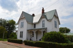 | Warnock House | 0.1 miles | 1988 |
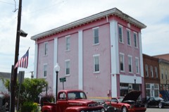 | Greenup Masonic Lodge | 0.1 miles | 1988 |
| West Main Street District | 0.2 miles | 1988 | |
 | Methodist Episcopal Church South | 0.2 miles | 1988 |
| Front Street District | 0.2 miles | 1988 | |
| Kouns-Hoffman House | 0.3 miles | 1988 |
| National Archives record | The nomination case file for reference 87002443 in Record Group 79. |
| Greenup County | All 18 listed properties in this county. |