 Block
From the record
One of 30 National Register listings published here for Hopkins County · listed in 1988 · category: Building.
Sources: the case file at the National Archives · the National Register database, National Park Service
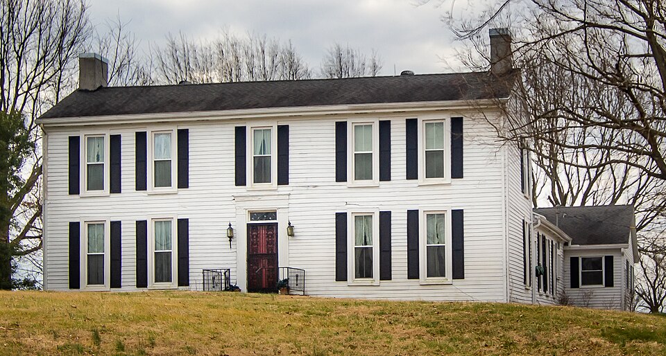
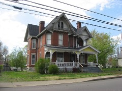
Listed on the National Register of Historic Places in 1988.
One of 30 National Register listings published here for Hopkins County · listed in 1988 · category: Building.
Sources: the case file at the National Archives · the National Register database, National Park Service
Regional context, not property-specific evidence. The federal wildfire occurrence database lists 29 fires within 5 miles of Bradford Porter House between 1998 and 2018, burning about 286 acres in total. 1 started naturally. 3 were recorded as arson. Distance is straight-line from the map coordinates, so a fire counted here may appear on a neighbouring settlement's page as well.
| Reported cause | Fires |
|---|---|
| Missing data/not specified/undetermined | 8 |
| Recreation and ceremony | 7 |
| Debris and open burning | 6 |
| Arson/incendiarism | 3 |
| Railroad operations and maintenance | 2 |
| Equipment and vehicle use | 2 |
| Natural | 1 |
The most recent of them, most recent first, with the day each was reported and the service that recorded it.
| Date | Cause | Size | Reported by | Name on the report |
|---|---|---|---|---|
| 6 April 2001 | Arson/incendiarism | 1.0 acres | Kentucky Division of Forestry | not named |
| 5 April 2006 | Missing data/not specified/undetermined | 16 acres | Kentucky Division of Forestry | not named |
| 20 April 2005 | Missing data/not specified/undetermined | 1.0 acres | Kentucky Division of Forestry | not named |
| 20 April 2000 | Natural | under an acre | Kentucky Division of Forestry | not named |
| 2 April 2011 | Recreation and ceremony | 6.0 acres | Kentucky Division of Forestry | TREE SWING |
| 12 April 2014 | Debris and open burning | 2.0 acres | Kentucky Division of Forestry | JOHNSON ISLAND CEM . RD. |
| 7 March 2002 | Debris and open burning | 2.0 acres | Kentucky Division of Forestry | not named |
| 7 March 2002 | Recreation and ceremony | 6.0 acres | Kentucky Division of Forestry | not named |
Regional context, not property-specific evidence. The National Weather Service names Nebo, the town this property stands in, in 19 storm reports between 2002 and 2025: 11 thunderstorm wind, 3 flood, 2 funnel cloud, 1 tornado. No death or injury is recorded in these reports. Each account below is quoted exactly as the forecast office filed it, from the NOAA Storm Events Database, and each date opens the federal record of that event.
| When | Event | Place named | Harm | What the report says |
|---|---|---|---|---|
| April 2002 | Tornado (F3) | Nebo | $1,800,000 | The tornado crossed into Hopkins County just west-northwest of Nebo, and finally lifted after moving through Hanson. The tornado was rated at F-3 intensity in the Nebo area, where four chicken houses were blown off their foundations. About 45,000 chickens were left in the debris. Damage to one chicken facility was estimated between one and two million dollars. The tornado weakened as it progressed across the county. About 10 to 15 residences were significantly damaged. |
| February 2025 | Flood | Nebo | $270,000 | Flash flooding from the evening of the 15th transitioned to areal flooding early on the 16th. Alternate U.S. 41 near the Webster County line and U.S. 62 near Nortonville continued to flood, along with numerous county roads. |
| July 2016 | Thunderstorm Wind | Nebo | $60,000 | Multiple trees and power lines were down throughout the county. In Madisonville, where several trees were blown down and telephone poles were leaning, a trained spotter estimated winds gusted around 65 mph. Traffic lights were out at a number of intersections in the city, and signs were blown down. At least a few city streets were blocked by downed trees. A tree crashed onto the roof and front porch of a residence. |
| May 2024 | Thunderstorm Wind | Nebo | $35,000 | A morning thunderstorm line caused power lines to lean with metal across the road near Nebo. Following the storm line, roughly a third of the county was without power. |
| May 2004 | Thunderstorm Wind | Nebo | $10,000 | no account filed |
| March 2020 | Thunderstorm Wind | Nebo | $8,000 | Trees were damaged along Highway 41. One tree was across a power line. The trees were estimated at two to three feet in diameter. |
| August 2019 | Thunderstorm Wind | Nebo | $7,000 | Tree limbs were blown down in parts of central and northern Hopkins County. Several tree limbs were down at Nebo. Large tree limbs were down around the city of Madisonville. |
| June 2023 | Thunderstorm Wind | Nebo | $5,000 | Trees were blown down. |
| March 2016 | Thunderstorm Wind | Nebo | $5,000 | The roof of a rural farm home was damaged. Numerous shingles were blown off. |
| May 2004 | Thunderstorm Wind | Nebo | $5,000 | no account filed |
| June 2014 | Thunderstorm Wind | Nebo | $2,000 | Large branches were blown down. |
| February 2025 | Flash Flood | Nebo | - | Flash flooding closed Alternate U.S. 41 near the Webster County line. |
| May 2017 | Thunderstorm Wind | Nebo | - | A trained spotter estimated wind gusts around 60 mph at mile marker 10 on U.S. Highway 41A. |
| July 2016 | Flood | Nebo | - | Ponding of water was reported on U.S. Highway 41A in and around Nebo. |
| March 2008 | Flood | Nebo | - | About 20 homes in Nortonville were evacuated when floodwaters approached. |
| May 2003 | Thunderstorm Wind | Nebo | - | Several trees were down over the north half of the county. |
| April 2011 | Funnel Cloud | Nebo | - | no account filed |
| June 2004 | Funnel Cloud | Nebo | - | no account filed |
| May 2003 | Hail | Nebo | - | no account filed |
No historic map-sheet match is published for this property yet. That does not mean no map exists. This record needs a coordinate-quality review before it can be joined to a sheet boundary. Browse the county's mapped places while that work is pending.
Other National Register properties close enough to walk or drive between, ordered by distance from this one. Both positions come from the same geocoding pass that matched these properties to their map sheets.
| Photograph | Property | Distance | Listed |
|---|---|---|---|
| John Cox House | 2.4 miles | 1988 | |
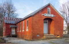 | Munn's School | 5.8 miles | 1983 |
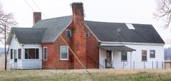 | Beckley Jackson House | 6.0 miles | 1989 |
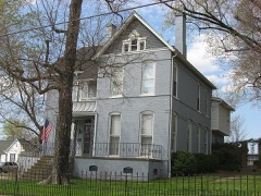 | Dr. Thomas Gardiner House | 6.3 miles | 1988 |
 | John Harvey House | 6.4 miles | 1988 |
| North Main Street Historic District | 6.4 miles | 1988 |
| National Archives record | The nomination case file for reference 88002714 in Record Group 79. |
| Hopkins County | All 30 listed properties in this county. |