 Block
From the record
One of 30 National Register listings published here for Hopkins County · listed in 1988 · category: Building.
Sources: the case file at the National Archives · the National Register database, National Park Service
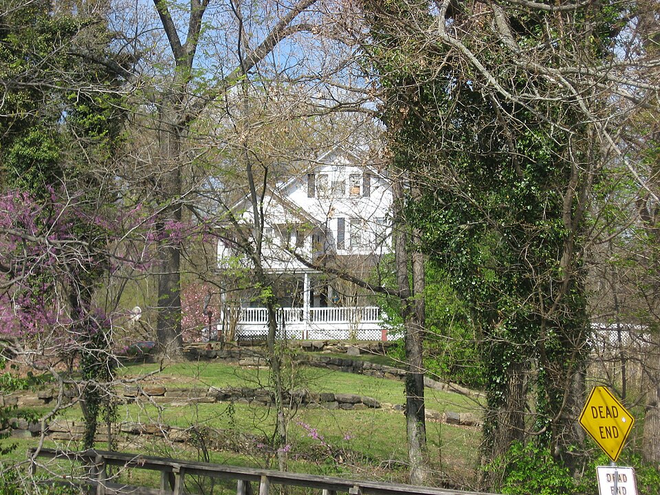
Listed on the National Register of Historic Places in 1988.
One of 30 National Register listings published here for Hopkins County · listed in 1988 · category: Building.
Sources: the case file at the National Archives · the National Register database, National Park Service
Regional context, not property-specific evidence. The federal wildfire occurrence database lists 35 fires within 5 miles of Oakmoor between 1998 and 2017, burning about 384 acres in total. 1 started naturally. 3 were recorded as arson. Distance is straight-line from the map coordinates, so a fire counted here may appear on a neighbouring settlement's page as well.
| Reported cause | Fires |
|---|---|
| Debris and open burning | 13 |
| Missing data/not specified/undetermined | 8 |
| Recreation and ceremony | 7 |
| Arson/incendiarism | 3 |
| Railroad operations and maintenance | 2 |
| Equipment and vehicle use | 1 |
| Natural | 1 |
The most recent of them, most recent first, with the day each was reported and the service that recorded it.
| Date | Cause | Size | Reported by | Name on the report |
|---|---|---|---|---|
| 6 September 2011 | Missing data/not specified/undetermined | 2.0 acres | Kentucky Division of Forestry | B & K SAWMILL |
| 6 September 2010 | Recreation and ceremony | 10 acres | Kentucky Division of Forestry | LABOR |
| 3 August 2010 | Missing data/not specified/undetermined | 4.0 acres | Kentucky Division of Forestry | 2 FENCE |
| 20 August 2007 | Debris and open burning | 74 acres | Kentucky Division of Forestry | not named |
| 31 July 2006 | Missing data/not specified/undetermined | 114 acres | Kentucky Division of Forestry | BIRDS NEST |
| 23 July 2008 | Arson/incendiarism | 2.0 acres | Kentucky Division of Forestry | not named |
| 1 July 2012 | Railroad operations and maintenance | under an acre | Kentucky Division of Forestry | ROCK SPARK |
| 24 May 2012 | Recreation and ceremony | under an acre | Kentucky Division of Forestry | EARLINGTON |
Regional context, not property-specific evidence. The National Weather Service names Earlington, the town this property stands in, in 16 storm reports between 2003 and 2025: 5 thunderstorm wind, 3 flash flood, 2 hail, 2 heavy rain. The reports record 40 injuries. Each account below is quoted exactly as the forecast office filed it, from the NOAA Storm Events Database, and each date opens the federal record of that event.
| When | Event | Place named | Harm | What the report says |
|---|---|---|---|---|
| November 2005 | Tornado (F4) | Earlington | 40 hurt, $31,000,000 | This violent tornado reached its peak intensity on the north side of Earlington, near the beginning of its track. Peak winds there were estimated near 220 MPH. Several houses in this area, on either side of U.S. Highway 41, were levelled. Large oak trees were reduced to nubs, and the ground was scoured to bare dirt. A steel beam was carried some distance and became wedged against trees and other debris. 24 people were treated for injuries at a local hospital, and three of the injuries were critical. About 151 homes and buildings were destroyed, 67 suffered major damage, and 303 received minor damage. Damage indications, as well as eyewitness accounts, indicate the occurrence of multiple vortices near Earlington. The tornado continued northeast and weakened, crossing the Pennyrile Parkway at mile marker 41. The tornado lifted less than a mile from the Mclean County border. The average path width was 525 yards. The tornado was close to a half mile wide in places. |
| July 2022 | Flash Flood | Earlington | $4,000 | Flash flooding was reported up to the back porch in the garage of a home. Six to eight inches of water was up to the front porch step. A Kentucky mesonet site in the immediate area measured 4.80 inches of rain. |
| May 2025 | Thunderstorm Wind | Earlington | $2,000 | Tree limbs were reported down in the Earlington area as a line of storms moved eastward through the county. |
| May 2017 | Thunderstorm Wind | Earlington | $2,000 | In southern Hopkins County, damaging thunderstorm winds gusted up to 62 mph. A trained spotter in Mortons Gap estimated winds gusted to 60 mph, causing a power outage and snapping a large tree. Another nearby large tree was uprooted onto a home. A Kentucky mesonet site just east of Earlington measured a wind gust to 62 mph. |
| July 2012 | Thunderstorm Wind | Earlington | $2,000 | Large tree limbs were blown down. |
| July 2020 | Flood | Earlington | - | Minor street and yard flooding occurred. |
| April 2016 | Tornado (EF0) | Earlington | - | Law enforcement personnel reported a brief tornado near Earlington. No damage was located. Based on radar indications, the parent circulation of this tornado also produced the funnel cloud that was earlier reported west of Mortons Gap. The parent circulation crossed over U.S. Highway 41 less than a mile south of Earlington. |
| July 2012 | Thunderstorm Wind | Earlington | - | A wind gust to 66 mph was measured by the Kentucky mesonet site near Earlington. |
| May 2011 | Thunderstorm Wind | Earlington | - | A trained spotter estimated a wind gust to 60 mph. |
| March 2009 | Hail | Earlington | - | Quarter-size hail fell on the south side of Earlington. |
| April 2009 | Heavy Rain | Earlington | - | U.S. Highway 41 was flooded out. Numerous other smaller roads were flooded. A mesonet site in Hopkins County measured 1.03 inches. |
| June 2009 | Flash Flood | Earlington | - | Several roads in the Earlington area were covered with water at least three inches deep. Several roads in the city of Dawson Springs were impassable. A mesonet site near Madisonville reported 0.94 inches in 30 minutes, and a total of 2.97 inches in three hours. |
| May 2008 | Flash Flood | Earlington | - | Six inches of water was flowing over U.S. Highway 41 at Earlington. Both sides of the road were flooded over on U.S. Highway 41 by the county central high school. A spotter reported two to three inches of rain in an hour. |
| October 2004 | Heavy Rain | Earlington | - | Six inches of water was over U.S. Highway 41. |
| March 2017 | Funnel Cloud | Earlington | - | no account filed |
| July 2003 | Hail | Earlington | - | no account filed |
1 paper published in this town, digitised by the Library of Congress and free to read: 1,513 issues, 8,848 pages. Every page is searchable, so a name or a street can be looked for directly in what the town printed about itself at the time.
| Newspaper | Published |
|---|---|
| The Bee | 1889 to 19?? |
No historic map-sheet match is published for this property yet. That does not mean no map exists. This record needs a coordinate-quality review before it can be joined to a sheet boundary. Browse the county's mapped places while that work is pending.
Other National Register properties close enough to walk or drive between, ordered by distance from this one. Both positions come from the same geocoding pass that matched these properties to their map sheets.
| Photograph | Property | Distance | Listed |
|---|---|---|---|
| Hotel Earlington | 0.3 miles | 1988 | |
 | Munn's School | 2.9 miles | 1983 |
 | Madisonville Armory | 2.9 miles | 2002 |
 | W. W. Kington House | 3.2 miles | 1988 |
 | Chittenden P. Lyon Jr. House | 3.3 miles | 1976 |
 | Turner Ruby House | 3.3 miles | 1988 |
| National Archives record | The nomination case file for reference 88002726 in Record Group 79. |
| Hopkins County | All 30 listed properties in this county. |