 Block
From the record
One of 36 National Register listings published here for Johnson County · listed in 1989 · category: Building.
Sources: the case file at the National Archives · the National Register database, National Park Service
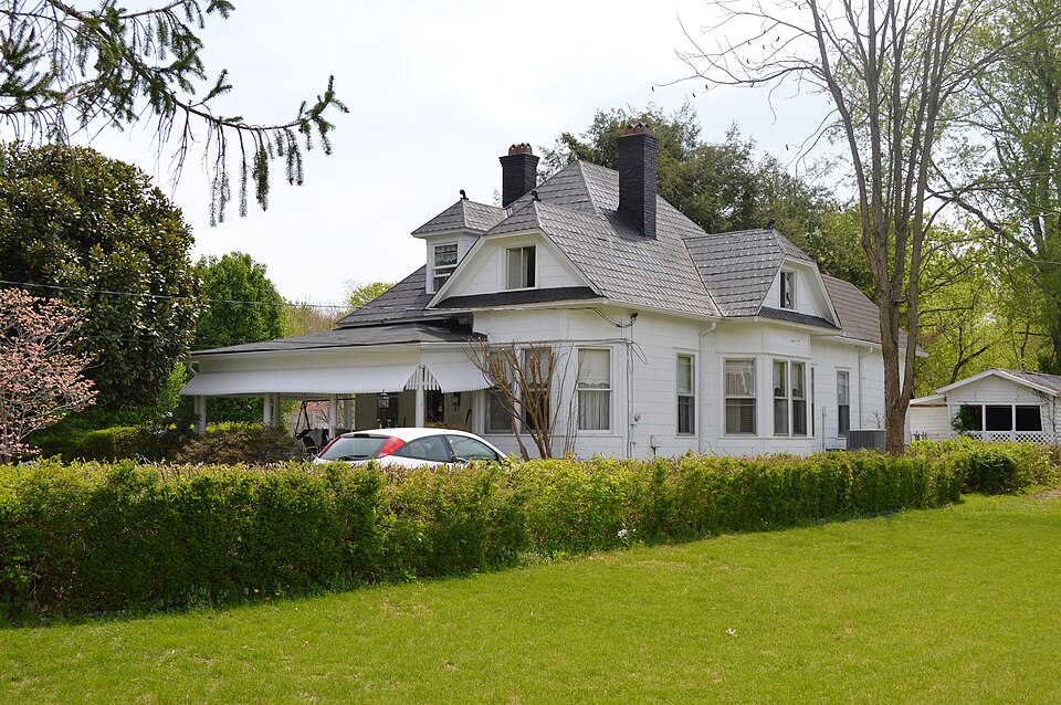
Listed on the National Register of Historic Places in 1989.
One of 36 National Register listings published here for Johnson County · listed in 1989 · category: Building.
Sources: the case file at the National Archives · the National Register database, National Park Service
Regional context, not property-specific evidence. The federal wildfire occurrence database lists 250 fires within 5 miles of Webb House between 1997 and 2020, burning about 4,176 acres in total. None started naturally. 43 were recorded as arson. Distance is straight-line from the map coordinates, so a fire counted here may appear on a neighbouring settlement's page as well.
| Reported cause | Fires |
|---|---|
| Debris and open burning | 80 |
| Missing data/not specified/undetermined | 66 |
| Recreation and ceremony | 56 |
| Arson/incendiarism | 43 |
| Railroad operations and maintenance | 2 |
| Equipment and vehicle use | 2 |
| Smoking | 1 |
The most recent of them, most recent first, with the day each was reported and the service that recorded it.
| Date | Cause | Size | Reported by | Name on the report |
|---|---|---|---|---|
| 28 September 1998 | Arson/incendiarism | 4.0 acres | Kentucky Division of Forestry | not named |
| 25 September 2010 | Debris and open burning | 1.0 acres | Kentucky Division of Forestry | LITTLE MUD LICK RT. 201 |
| 25 September 2008 | Debris and open burning | 30 acres | Kentucky Division of Forestry | not named |
| 24 September 2008 | Debris and open burning | 25 acres | Kentucky Division of Forestry | not named |
| 24 September 1999 | Arson/incendiarism | 2.0 acres | Kentucky Division of Forestry | not named |
| 22 September 2008 | Missing data/not specified/undetermined | 1.0 acres | Kentucky Division of Forestry | not named |
| 22 September 2008 | Missing data/not specified/undetermined | 25 acres | Kentucky Division of Forestry | not named |
| 21 September 2019 | Arson/incendiarism | 6.0 acres | Kentucky Division of Forestry | BARBER BRANCH III |
Regional context, not property-specific evidence. The federal mineral resources record lists 3 workings within 5 miles of Webb House: 3 prospects. None of them still produces. What was taken out: Clay, Silica. Distance is straight-line from the map coordinates, so a quarry counted here may appear on a neighbouring settlement's page as well.
| Where | Site | Commodity | Status | Recorded |
|---|---|---|---|---|
| Stffordsville Sandstone Roadcut | Silica | Prospect | ||
| Greasy Creek Clay Bed | Clay | Prospect | ||
| Whippoorwill Branch Shale | Clay | Prospect |
Regional context, not property-specific evidence. The National Weather Service names Paintsville, the town this property stands in, in 96 storm reports between 1995 and 2024: 58 thunderstorm wind, 21 hail, 12 flash flood, 4 flood. No death or injury is recorded in these reports. Each account below is quoted exactly as the forecast office filed it, from the NOAA Storm Events Database, and each date opens the federal record of that event.
| When | Event | Place named | Harm | What the report says |
|---|---|---|---|---|
| July 2018 | Thunderstorm Wind | Paintsville | $60,000 | An NWS Storm Survey confirmed microburst winds of between 75-85 mph removed half of a roof off of an office building and a steeple off of a church building in Paintsville. Several trees were also blown down, including one onto a residential building. A portion of Kentucky Highway 321/40 was shut down for a period of time due to downed and damaged trees. |
| February 2009 | Thunderstorm Wind | Paintsville | $50,000 | Trees were blown down on Rt 172 at Staffordsville. Power lines were down county wide. The roof was blown off a house at Millers Creek. An estimated 300 homes were without power. |
| March 2008 | Thunderstorm Wind | Paintsville | $50,000 | Numerous trees and power lines were blown down countywide. |
| June 2008 | Thunderstorm Wind | Paintsville | $50,000 | Numerous trees and powerlines were blown down by thundestorm wind gusts. |
| January 2008 | Thunderstorm Wind | Paintsville | $50,000 | Numerous trees were blown down county wide. Trees were also down and blocking Highway 1750. This damage was caused by wind gusts estimated at 67 mph. |
| March 2008 | Thunderstorm Wind | Paintsville | $30,000 | A small barn was blown onto Stone Coal Road. Several trees were also blown down on Routes 1596 and 172. |
| February 2008 | Thunderstorm Wind | Paintsville | $30,000 | Large trees were blown down county wide by thunderstorm wind gusts. A trampoline was blown onto KY 581 in Paintsville. |
| August 2007 | Thunderstorm Wind | Paintsville | $30,000 | Numerous trees down countywide. |
| June 2012 | Thunderstorm Wind | Paintsville | $10,000 | There were trees down in downtown Paintsville. |
| July 2012 | Thunderstorm Wind | Paintsville | $10,000 | A tree was reported to have been blow down onto a house. |
| March 2012 | Thunderstorm Wind | Paintsville | $10,000 | The roof of Paintsville High School was damaged by thunderstorm wind gusts. |
| June 2010 | Thunderstorm Wind | Paintsville | $10,000 | Several trees were blown down in and all around Paintsville. |
| June 2010 | Thunderstorm Wind | Paintsville | $10,000 | Several trees and power lines were blown down along Ponderosa Dr in Paintsville. |
| May 2008 | Thunderstorm Wind | Paintsville | $10,000 | Eight to ten trees were blown down in the eastern part of the county. |
| November 2003 | Flash Flood | Paintsville | $10,000 | Homes were flooded and water was over roads on Rough Ridge. |
| March 1997 | Thunderstorm Wind | Paintsville | $10,000 | no account filed |
| March 1997 | Thunderstorm Wind | Paintsville | $10,000 | no account filed |
| May 2011 | Hail | Paintsville | $5,000 | Quarter size hail was reported by law enforcement officers who were on a foot pursuit in the Paintsville area. The hail dented cars in the area. |
| June 2008 | Thunderstorm Wind | Paintsville | $5,000 | The roof was blown of the elevator shaft at the top of the five story tall Citizens National Bank building. |
| June 2011 | Thunderstorm Wind | Paintsville | $3,000 | Trees were blown across Dogwood Fork Rd. |
| June 2000 | Flash Flood | Paintsville | $3,000 | Heavy rain brought numerous problems to the area just south and southeast of Paintsville. Water was blocking the road on Highway 302 near Van Lear. A tree was washed down onto Highway 40 near Meally, also power lines were down due to trees being washed out. A rock slide was reported on Route 321 just south of Paintsville and blocked one lane until the debris could be cleared. |
| June 1998 | Thunderstorm Wind | Paintsville | $3,000 | Power lines downed. |
| January 1997 | Thunderstorm Wind | Paintsville | $3,000 | no account filed |
| June 2012 | Thunderstorm Wind | Paintsville | $2,000 | The wind rolled and demolished a shed. |
| July 2015 | Flash Flood | Paintsville | $1,000 | A foot of flowing water was observed crossing Hwy 321 near the Highland Regional Hospital. |
| June 2014 | Flash Flood | Paintsville | $1,000 | A foot of water was over the roadway at the intersection of KY 581 and Boyds Branch. |
| December 2013 | Flood | Paintsville | $1,000 | Offut Road, KY 2040, was closed due to flooding. The water was still rising at the time of the report. |
| June 2011 | Thunderstorm Wind | Paintsville | $1,000 | A tree was blown down and across Dogwood Fork Rd. |
| August 2002 | Thunderstorm Wind | Paintsville | $1,000 | Two trees were down along Kentucky Highway 40. One tree was three miles west of Paintsville and fell onto power lines. The other tree was two miles east of Paintsville. |
| May 2009 | Thunderstorm Wind | Paintsville | $500 | A fence was blown onto a road near Paintsville. |
| May 2020 | Thunderstorm Wind | Paintsville | $300 | Dispatch reported a tree blown down onto powerlines in Paintsville, subsequently knocking all traffic lights out in town. |
| August 2024 | Thunderstorm Wind | Paintsville | - | A tree was blown down onto State Hwy 581 (Tutor Key Road), near the S curve - or about a tenth of a mile north of KY-40 (Euclid Avenue) int eh community of Thealka, near Paintsville. |
| August 2024 | Thunderstorm Wind | Paintsville | - | A tree was blown down along Church Street in the city of Paintsville. |
| June 2022 | Thunderstorm Wind | Paintsville | - | Several trees were blown down in the town of Paintsville according to pictures on social media. |
| March 2021 | Flood | Paintsville | - | Water rescues are ongoing this morning in Paintsville as the river continues to rise. |
| June 2020 | Thunderstorm Wind | Paintsville | - | Dispatch reported a tree blown down in Paintsville. |
| February 2019 | Flood | Paintsville | - | Broadcast media reported water on Kentucky Highways 1107 and 581 from Thealka to Thelma. |
| March 2017 | Thunderstorm Wind | Paintsville | - | The roof of a building was damaged in downtown Paintsville. |
| June 2017 | Thunderstorm Wind | Paintsville | - | A local media outlet relayed a report of a few trees downed in Paintsville. |
| July 2015 | Thunderstorm Wind | Paintsville | - | A tree was blown down and onto a power line. |
| July 2015 | Thunderstorm Wind | Paintsville | - | A tree was blown down on 8th Street in Paintsville. |
| June 2014 | Thunderstorm Wind | Paintsville | - | A tree was blown down on Route 40 West on the east side of Paintsville. |
| February 2014 | Thunderstorm Wind | Paintsville | - | This report was made by the Big Sandy Recc. Trees and power lines were blown down county wide with 3 power outages reported. |
| August 2013 | Flood | Paintsville | - | Six inches of water temporarily covered the roadway at the intersection of 8th and Madison Streets in Paintsville. Several roads were temporarily blocked by flood water. |
| April 2011 | Funnel Cloud | Paintsville | - | At around 6 pm EDT a rotating wall cloud was observed moving toward Paintsville. Heavy rain and strong winds were occurring at the time as well. |
| April 2011 | Thunderstorm Wind | Paintsville | - | A trained spotter reported estimated thunderstorm wind gusts of 55-60 mph. |
| April 2011 | Thunderstorm Wind | Paintsville | - | The Johnson county dispatch office reported that trees had been blown down at numerous locations around the county. Power outages were also occurring all around the county. These events occurred between 935 PM and 10 PM. |
| April 2011 | Hail | Paintsville | - | The hail was the size of walnuts. |
| July 2006 | Flash Flood | Paintsville | - | Route 40 closed for a time due to high water. |
| July 2006 | Thunderstorm Wind | Paintsville | - | Trees down across the road. Power outages reported. |
| April 2005 | Flash Flood | Paintsville | - | Highway 40 closed due to high water at Boons Camp and Oil Springs. |
| April 2004 | Flash Flood | Paintsville | - | Water was over Highway 40, on the east side of Paintsville. Water was also over many side roads in Oil Springs, Collista, and Staffordsville. |
| October 2004 | Flash Flood | Paintsville | - | Over two inches of rain fell in an hour causing flood waters to surround a car on Hidden Valley Road. |
| November 2003 | Thunderstorm Wind | Paintsville | - | Trees were down on Rough Ridge. |
| February 2003 | Flash Flood | Paintsville | - | Mill Branch Road was closed due to high, flowing water. |
| June 2003 | Flash Flood | Paintsville | - | More than six inches of water flowed across Mill Branch Road. |
| June 2003 | Flash Flood | Paintsville | - | High water was over Patterson Creek Road. |
| April 2002 | Thunderstorm Wind | Paintsville | - | Three trees were down at the Paintsville Country Club. Also, a golf cart with two men on board was lifted off of the ground. |
| June 2002 | Thunderstorm Wind | Paintsville | - | Two trees were down along Kentucky Highway 825. |
| May 2001 | Thunderstorm Wind | Paintsville | - | Power lines were down on Kentucky highway 201 near U.S. highway 23. |
No historic map-sheet match is published for this property yet. That does not mean no map exists. This record needs a coordinate-quality review before it can be joined to a sheet boundary. Browse the county's mapped places while that work is pending.
Other National Register properties close enough to walk or drive between, ordered by distance from this one. Both positions come from the same geocoding pass that matched these properties to their map sheets.
| Photograph | Property | Distance | Listed |
|---|---|---|---|
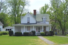 | Byrd and Leona Webb House | under 500 feet | 1989 |
| Tobe Wiley House | under 500 feet | 1989 | |
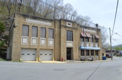 | Paintsville City Hall | under 500 feet | 1989 |
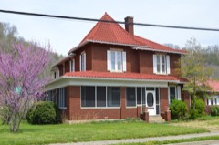 | Archer House | 0.1 miles | 1989 |
 | First National Bank Building | 0.2 miles | 1989 |
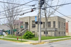 | Paintsville Public Library | 0.2 miles | 1989 |
| National Archives record | The nomination case file for reference 88003160 in Record Group 79. |
| Johnson County | All 36 listed properties in this county. |