 Block
From the record
One of 70 National Register listings published here for Mercer County · listed in 1989 · category: Building.
Sources: the case file at the National Archives · the National Register database, National Park Service
Listed on the National Register of Historic Places in 1989.
One of 70 National Register listings published here for Mercer County · listed in 1989 · category: Building.
Sources: the case file at the National Archives · the National Register database, National Park Service
Regional context, not property-specific evidence. The federal wildfire occurrence database lists 1 fire within 5 miles of Smith-Williams House in 2019, burning about 78 acres in total. None started naturally. None was recorded as arson. Distance is straight-line from the map coordinates, so a fire counted here may appear on a neighbouring settlement's page as well.
| Reported cause | Fires |
|---|---|
| Equipment and vehicle use | 1 |
The most recent of them, most recent first, with the day each was reported and the service that recorded it.
| Date | Cause | Size | Reported by | Name on the report |
|---|---|---|---|---|
| 3 October 2019 | Equipment and vehicle use | 78 acres | Kentucky Division of Forestry | CHINN FIRE |
Regional context, not property-specific evidence. The federal mineral resources record lists 3 workings within 5 miles of Smith-Williams House: 2 producers, 1 past producer. 2 still produce. What was taken out: Stone, Crushed/Broken. Distance is straight-line from the map coordinates, so a quarry counted here may appear on a neighbouring settlement's page as well.
| Where | Site | Commodity | Status | Recorded |
|---|---|---|---|---|
| Central Rock Co., Inc. | Stone, Crushed/Broken | Producer | ||
| Harrodsburg Quarry | Stone, Crushed/Broken | Producer | ||
| Mercer County Quarry | Stone, Crushed/Broken | Past Producer |
Regional context, not property-specific evidence. The National Weather Service names Burgin, the town this property stands in, in 18 storm reports between 1996 and 2025: 14 thunderstorm wind, 2 hail, 1 flash flood, 1 tornado. No death or injury is recorded in these reports. Each account below is quoted exactly as the forecast office filed it, from the NOAA Storm Events Database, and each date opens the federal record of that event.
| When | Event | Place named | Harm | What the report says |
|---|---|---|---|---|
| November 2002 | Thunderstorm Wind | Burgin | $30,000 | Numerous trees and phone poles were blown down near Highway 152 and Kennedy Bridge Road. A roof was ripped off a house. |
| December 2005 | Thunderstorm Wind | Burgin | $2,000 | Fifteen to twenty small trees were downed. Some roof damage was reported. |
| February 2025 | Hail | Burgin | - | Multiple reports of between ping pong and golf ball size hail near Burgin. |
| May 2025 | Tornado (EF1) | Burgin | - | The National Weather Service completed a storm survey and|determined that an EF1, 100 mph tornado occurred just north of|Burgin in Mercer County Friday morning, May 30th, 2025. Damage was first|observed along Handy Lane where several trees had been topped. The damage continued along Handy Lane where a|house had some outbuilding damage and a garage door was blown in.| Some healthy trees also had extensive very large branches|snapped. Maximum wind speeds along Handy Lane were estimated to|be at 100 mph, EF1 strength.||The tornado continued across Shakertown Road and damage |was observed along Ison Lane where trees were uprooted and a barn |roof was blown off. The tornado continued across farmland before |additional damage was observed to trees with large branches |snapped along Hogue Lane. Estimated maximum wind speeds along |this portion was EF1, 95 mph strength. No additional damage was |observed beyond Hogue Lane. |
| May 2025 | Thunderstorm Wind | Burgin | - | A tree was blown down onto powerlines on the 400 block of Bailey Pike. |
| May 2022 | Hail | Burgin | - | Golf ball-sized hail was observed near the Burgin community in eastern Mercer County. |
| July 2021 | Flash Flood | Burgin | - | Highway 33 and Pleasant Hill Drive were flooded near Burgin. Flash flooding was also reported along college street near Harrodsburg. |
| March 2017 | Thunderstorm Wind | Burgin | - | Trained spotters reported large trees down in the area due to severe thunderstorm winds. |
| June 2015 | Thunderstorm Wind | Burgin | - | A trained spotter reported that several trees fell due to the severe thunderstorm winds. |
| June 2015 | Thunderstorm Wind | Burgin | - | A trained spotter reported that several trees fell due to the severe thunderstorm winds. |
| July 2015 | Thunderstorm Wind | Burgin | - | A public report was received of trees down in the area. |
| August 2007 | Thunderstorm Wind | Burgin | - | Trees and power lines were downed. |
| August 2006 | Thunderstorm Wind | Burgin | - | Trees were downed. |
| March 2002 | Thunderstorm Wind | Burgin | - | There was a 60 mph wind gust along with 1.75 inch hail. |
| May 2006 | Thunderstorm Wind | Burgin | - | no account filed |
| July 2005 | Thunderstorm Wind | Burgin | - | no account filed |
| May 1996 | Thunderstorm Wind | Burgin | - | no account filed |
| November 1996 | Thunderstorm Wind | Burgin | - | no account filed |
No historic map-sheet match is published for this property yet. That does not mean no map exists. This record needs a coordinate-quality review before it can be joined to a sheet boundary. Browse the county's mapped places while that work is pending.
Other National Register properties close enough to walk or drive between, ordered by distance from this one. Both positions come from the same geocoding pass that matched these properties to their map sheets.
| Photograph | Property | Distance | Listed |
|---|---|---|---|
| Froman-McCann House | 1.7 miles | 2004 | |
| Greek Revival Houses of Mercer County: Lynnwood, Walnut Hall, Glenworth | 2.0 miles | 1978 | |
| Stone Quarters on Burgin Road | 2.2 miles | 1983 | |
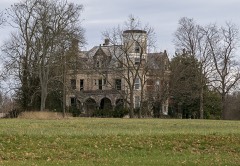 | Moreland House | 2.8 miles | 1989 |
| Bonta House | 2.8 miles | 1989 | |
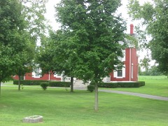 | Roach-Ison House | 2.8 miles | 1989 |
| National Archives record | The nomination case file for reference 88003355 in Record Group 79. |
| Mercer County | All 70 listed properties in this county. |