BlockBefore
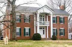
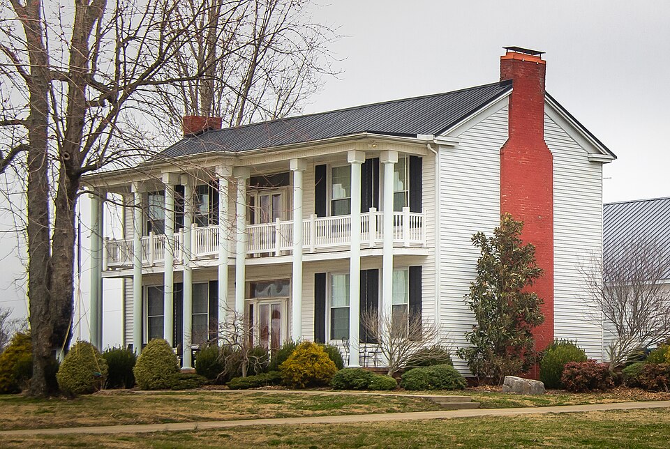
Photograph of Longview Farm House
Photograph by rossograph, CC BY-SA 4.0. Via Wikimedia Commons.

Longview Farm House

Listed on the National Register of Historic Places in 1992.

From the record

“The Longview Farm House near Adairville, Kentucky, United States, was listed on the National Register of Historic Places in 1992.”

Wikipedia article Longview Farm House, CC BY-SA 4.0.

One of 20 National Register listings published here for Logan County · listed in 1992 · category: Building.

Sources: the Wikipedia article · the case file at the National Archives · the National Register database, National Park Service
The listing

  • What is counted as historic. The nomination lists 1 building as contributing to the listing.
  • Address. Bores Rd., Adairville, 42202
  • When was it listed? March 1992
  • Category. building
  • Census division. Adairville
  • Architectural style. Renaissance Revival architecture
  • National Register reference number. 92000170 - the number the National Park Service assigned this property when it was listed, and the key its nomination file is catalogued under at the National Archives.

Storms near this property

36 since 1996

Regional context, not property-specific evidence. The National Weather Service names Adairville, the town this property stands in, in 36 storm reports between 1996 and 2025: 24 thunderstorm wind, 6 hail, 4 tornado, 1 lightning. No death or injury is recorded in these reports. Each account below is quoted exactly as the forecast office filed it, from the NOAA Storm Events Database, and each date opens the federal record of that event.

WhenEvent Place namedHarm What the report says
November 1996Tornado (F0)Adairville$500,000no account filed
November 2005Tornado (F1)Adairville$250,000A supercell thunderstorm developed over northern Tennessee and moved into south central Kentucky during the early evening hours of November 15. It produced multiple, short-lived tornado touchdowns along its path, which stretched for nearly 25 miles across three counties. The first touchdown in Logan County was just north of Adairville in southern Logan County. Many homes, trailers, barns and outbuildings were damaged along the intermittent path of the tornado. The tornado finally lifted near the Logan/Simpson County line near State Highway 100.
March 2017Tornado (EF1)Adairville$100,000A NWS Nashville Storm Survey concluded that an EF-1 tornado down southeast of Adairville, traveled 1.5 miles, and then lifted approximately 2.5 miles east of Adairville. Along its path, the tornado did minor roof damage to a house near Martin Rd. A home and an outbuilding had minor damage near Barnes Rd, along with several downed trees. The most significant damage happened just before the tornado lifted near Prices Mill Road, where a large barn lost a significant portion of its roof structure. Maximum estimated winds were 90-95 mph, and the max width was 50 to 75 yards.
June 2017LightningAdairville$100,000A house was struck by lightning and caught on fire. The house burned to the ground.
March 2006Thunderstorm WindAdairville$75,000A barn was blown over.
May 2003Thunderstorm WindAdairville$70,000Thunderstorm winds blew the roofs off buildings. Barns were destroyed. Trees were uprooted.
June 2007Thunderstorm WindAdairville$50,000The top floor of a two story business building on Main Street was blown 75 to 100 yards from the base of the building. The damaged section was of wood frame and sheet metal construction. The intact lower floor was brick construction.
May 2001Tornado (F0)Adairville$25,000A tornado touched down about 2 miles east of Adairville and moved northeast for about 2 miles. The tornado blew the roofs off some houses, damaged some garages, and snapped some trees about 20 feet off the ground. There was evidence of a tornado path in a wheat field.
December 2013Thunderstorm WindAdairville$10,000A spotter reported damage to several signs and porches in Adairville.
January 2008Thunderstorm WindAdairville$10,000Trees were downed by thunderstorm winds. There was unspecified roof damage.
January 2008Thunderstorm WindAdairville$5,000The covering was blown off the porch of a mobile home.
April 2025Thunderstorm WindAdairville-A tree was down on North Walnut Street.
May 2024Flash FloodAdairville-Rising waters from the Red River resulted in a water rescue of a man on top of his house on Riverview Drive near Adairville.
May 2024Thunderstorm WindAdairville-A large tree was blown onto a house in Adairville.
June 2023Thunderstorm WindAdairville-Several trees were down in Adairville.
June 2023Thunderstorm WindAdairville-There was a tree down on East Gallatin Street.
June 2023Thunderstorm WindAdairville-There was a tree down on Tamara Road.
June 2023Thunderstorm WindAdairville-There was a tree down on Trimble Road.
March 2020Thunderstorm WindAdairville-A few trees were reported down.
May 2020Thunderstorm WindAdairville-There was a report of a tree down.
July 2020Thunderstorm WindAdairville-A tree was reported down.
July 2019Thunderstorm WindAdairville-Two trees were down in Adairville.
March 2017Thunderstorm WindAdairville-The public reported approximately 30 large trees down due to severe thunderstorm winds. Two buildings sustained damage as well.
January 2008Thunderstorm WindAdairville-Thunderstorm winds downed several trees.
September 2006Thunderstorm WindAdairville-Trees were downed.
July 2004Thunderstorm WindAdairville-Trees were downed.
July 2004Thunderstorm WindAdairville-A spotter estimated a 60 mph wind gust.
November 2002Thunderstorm WindAdairville-Trees were downed.
March 2009HailAdairville-no account filed
March 2006HailAdairville-no account filed
September 2006HailAdairville-no account filed
August 2005Thunderstorm WindAdairville-no account filed
April 2003HailAdairville-no account filed
March 2002HailAdairville-no account filed
July 2001Thunderstorm WindAdairville-no account filed
April 2000HailAdairville-no account filed

Every storm recorded in Logan County

Map coverage status

No historic map-sheet match is published for this property yet. That does not mean no map exists. This record needs a coordinate-quality review before it can be joined to a sheet boundary. Browse the county's mapped places while that work is pending.

Listed places nearby

4 within 8 miles

Other National Register properties close enough to walk or drive between, ordered by distance from this one. Both positions come from the same geocoding pass that matched these properties to their map sheets.

Photograph PropertyDistance Listed
Red River Presbyterian Meetinghouse Site and Cemetery1.1 miles1976
Pleasant Run Methodist Church3.5 miles1982
Brodnax-Conn House3.8 miles1992
Cedar Grove Rosenwald School7.9 miles2002

Sources for this property

National Archives recordThe nomination case file for reference 92000170 in Record Group 79.
Wikipedia articleCommunity-written account of this property, licensed CC BY-SA.
Logan CountyAll 20 listed properties in this county.

Provenance

  • Listing record. National Park Service National Register of Historic Places, listed-properties dataset, current to 2026-05-22.
  • Map join. Address geocoded through the United States Census geocoder, then tested against the published boundary of every sheet in the USGS Historical Topographic Map Collection.
  • How this page is made. Listing fields come from federal records; map-sheet coverage is a labelled coordinate-to-boundary calculation, not a source-field claim.
  • Storms. NOAA National Centers for Environmental Information, Storm Events Database https://www.ncei.noaa.gov/stormevents/ A work of the United States government, no copyright under 17 U.S.C. 105. Narratives are quoted verbatim from the National Weather Service report and are not edited or summarised.