 Block
From the record
One of 14 National Register listings published here for Rowan County · listed in 1998 · category: Building.
Sources: the case file at the National Archives · the National Register database, National Park Service
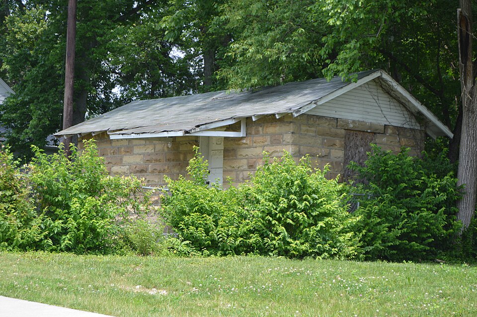
Listed on the National Register of Historic Places in 1998.
One of 14 National Register listings published here for Rowan County · listed in 1998 · category: Building.
Sources: the case file at the National Archives · the National Register database, National Park Service
Regional context, not property-specific evidence. The federal wildfire occurrence database lists 86 fires within 5 miles of Morehead Voting House No. 10 between 1993 and 2020, burning about 900 acres in total. None started naturally. 17 were recorded as arson. Distance is straight-line from the map coordinates, so a fire counted here may appear on a neighbouring settlement's page as well.
| Reported cause | Fires |
|---|---|
| Debris and open burning | 31 |
| Missing data/not specified/undetermined | 19 |
| Arson/incendiarism | 17 |
| Recreation and ceremony | 10 |
| Fireworks | 3 |
| Equipment and vehicle use | 2 |
| Railroad operations and maintenance | 2 |
| Misuse of fire by a minor | 1 |
| Power generation/transmission/distribution | 1 |
The most recent of them, most recent first, with the day each was reported and the service that recorded it.
| Date | Cause | Size | Reported by | Name on the report |
|---|---|---|---|---|
| 28 September 1998 | Arson/incendiarism | under an acre | Daniel Boone National Forest | NATURAL LIGHT |
| 25 September 2008 | Arson/incendiarism | under an acre | Daniel Boone National Forest | BIG PERRY |
| 25 September 2007 | Recreation and ceremony | under an acre | Daniel Boone National Forest | LOCKEGEE ROAD |
| 22 September 2019 | Debris and open burning | 1.0 acres | Kentucky Division of Forestry | BRATTON BRANCH |
| 21 September 2007 | Fireworks | 95 acres | Daniel Boone National Forest | DARK HOLLOW |
| 18 September 2008 | Debris and open burning | 1.0 acres | Kentucky Division of Forestry | not named |
| 13 September 2002 | Equipment and vehicle use | 1.0 acres | Kentucky Division of Forestry | not named |
| 1 September 2009 | Recreation and ceremony | under an acre | Daniel Boone National Forest | LOCKEGEE |
Regional context, not property-specific evidence. The federal mineral resources record lists 4 workings within 5 miles of Morehead Voting House No. 10: 4 past producers. None of them still produces. What was taken out: Clay, Stone, Crushed/Broken. Distance is straight-line from the map coordinates, so a quarry counted here may appear on a neighbouring settlement's page as well.
| Where | Site | Commodity | Status | Recorded |
|---|---|---|---|---|
| Clay Heirs Mine | Clay | Past Producer | ||
| Plant C Mine | Stone, Crushed/Broken | Past Producer | ||
| Plant K Mine | Stone, Crushed/Broken | Past Producer | ||
| Sweetnam Mine | Clay | Past Producer |
Regional context, not property-specific evidence. The National Weather Service names Morehead, the town this property stands in, in 95 storm reports between 1995 and 2025: 51 thunderstorm wind, 21 hail, 15 flash flood, 3 flood. The reports record 1 death. Each account below is quoted exactly as the forecast office filed it, from the NOAA Storm Events Database, and each date opens the federal record of that event.
| When | Event | Place named | Harm | What the report says |
|---|---|---|---|---|
| September 2018 | Flood | Morehead | 1 killed, $200,000 | Several vehicles were submerged in water in Morehead, including police cruisers. Several roads were closed due to water covering them from overflowing creeks and streams. Additionally, a nine year old boy was swept into a culvert by flood waters near Morehead. His body was found a week later in the Triplett Creek area. |
| March 1997 | Flash Flood | Morehead | $350,000 | no account filed |
| June 2009 | Thunderstorm Wind | Morehead | $50,000 | Numerous trees and power lines were blown down in Morehead. |
| August 2003 | Flash Flood | Morehead | $50,000 | Numerous homes were inundated with water in Coppers Hollow and a nearby road was impassable due to high water. |
| June 1996 | Flash Flood | Morehead | $50,000 | no account filed |
| May 2020 | Flash Flood | Morehead | $25,000 | Rowan County Dispatch reported numerous instances of flash flooding south of Morehead. This includes near the Lockegee Rock area where a tree was downed due to flowing water. This caused a vehicle to become trapped by water prior to all occupants being rescued. Additionally, a tree downed by flowing water fell onto power lines, subsequently leading to an apartment fire closer to Morehead. |
| June 2004 | Flash Flood | Morehead | $20,000 | Tripplett Creek was flowing into several houses. Kentucky Highway 519 was closed due to high water about six miles south of Morehead. |
| March 2012 | Thunderstorm Wind | Morehead | $15,000 | Extensive damage occurred to trees and residential structures 1 mile west of Morehead due to thunderstorm wind gusts. |
| May 2008 | Thunderstorm Wind | Morehead | $15,000 | Numerous trees were blown down on Highway 377. |
| June 2008 | Thunderstorm Wind | Morehead | $15,000 | Several trees were blown down by thunderstorm wind gusts. One tree fell onto a home and another onto a powerline. |
| July 2000 | Thunderstorm Wind | Morehead | $15,000 | Strong winds flipped over a recreational vehicle and moved a building off of its foundation. |
| July 2000 | Flash Flood | Morehead | $10,000 | Flash flooding washed out road at Nickel's Branch. Residents of two trailers evacuated by rescue squad, no injuries reported. First floor of city office building flooded. |
| March 1997 | Flash Flood | Morehead | $10,000 | no account filed |
| July 2012 | Thunderstorm Wind | Morehead | $8,000 | An 18 to 24 inch diameter red oak was snapped off and lying on some fiber optic line, causing a telephone pole to break. |
| April 2011 | Thunderstorm Wind | Morehead | $8,000 | Downed power lines were reported. |
| April 2011 | Thunderstorm Wind | Morehead | $8,000 | Downed power lines were reported. |
| June 2011 | Thunderstorm Wind | Morehead | $6,000 | Trees were blown down and onto Nichols Branch and Riddle Fork Roads in the Dry Creek community. |
| August 2010 | Thunderstorm Wind | Morehead | $5,000 | Power lines were blown down in Morehead. |
| June 2007 | Thunderstorm Wind | Morehead | $5,000 | Large 10000 to 12000 cinder block wall blown over at a Wal Mart construction site. |
| November 2007 | Thunderstorm Wind | Morehead | $5,000 | A few trees were blown down in the southern half of the county. |
| May 2004 | Thunderstorm Wind | Morehead | $5,000 | Trees and power lines were down. |
| July 2000 | Thunderstorm Wind | Morehead | $4,000 | Trees and power poles down across northern part of county. |
| June 2010 | Thunderstorm Wind | Morehead | $3,000 | Trees were blown down on Clack Mountain Road near Morehead. |
| August 2010 | Thunderstorm Wind | Morehead | $3,000 | A utility pole was blown down along Buffalo Branch Rd 7 miles northeast of Morehead. |
| July 2000 | Thunderstorm Wind | Morehead | $3,000 | Trees and power lines down. |
| June 1998 | Thunderstorm Wind | Morehead | $3,000 | Power lines downed. |
| April 2025 | Thunderstorm Wind | Morehead | $2,000 | Trees and powerlines were reported to have been blown down at the intersection of Brown Street and Pettit Avenue in Morehead. |
| April 2025 | Thunderstorm Wind | Morehead | $2,000 | Trees and powerlines were reported to have been blown down at residence on Old Flemingsburg Rd in the city of Morehead. This residence sits opposite of Pinnacle Way. |
| January 2008 | Thunderstorm Wind | Morehead | $2,000 | Two trees were blown down on Lower Craney Road by wind gusts estimated at 61 mph. |
| April 2006 | Lightning | Morehead | $2,000 | Tree hit by lightning on Circle Drive exploded and burnt transformer. |
| June 2001 | Thunderstorm Wind | Morehead | $2,000 | Strong thunderstorm winds blew power lines down. |
| July 2024 | Thunderstorm Wind | Morehead | $1,000 | Rowan County dispatch reported a tree down on internet cables at the intersection of Knapp Avenue and Cecil Drive in Morehead. |
| June 2021 | Thunderstorm Wind | Morehead | $1,000 | The Rowan County dispatch reported trees blown down onto North Wilson Avenue due to a strong thunderstorm gust front. |
| April 2015 | Flash Flood | Morehead | $1,000 | Multiple roads around the county were impassable including Open Fork, Dry Creek, and Big Perry. |
| August 2015 | Flash Flood | Morehead | $1,000 | Water of unknown depth was observed flowing across Hwy 60 in Morehead. |
| July 2015 | Flash Flood | Morehead | $1,000 | East Main Street near Morehead was impassable due to flooding. |
| July 2015 | Thunderstorm Wind | Morehead | $1,000 | A 51 mph wind gust was measured at the Rowan county mesonet site. |
| April 2014 | Thunderstorm Wind | Morehead | $1,000 | A 56 mph thunderstorm wind gust was measured at the Morehead Airport AWOS. |
| August 2013 | Flash Flood | Morehead | $1,000 | Some roads within Morehead city limits were flooded. |
| January 2008 | Thunderstorm Wind | Morehead | $1,000 | One tree was blown down on Riddle Lane by wind gusts estimated at 61 mph. |
| April 2006 | Thunderstorm Wind | Morehead | $1,000 | Power line down on University Drive. |
| May 2025 | Hail | Morehead | - | Rowan County dispatch reported up to golfball-sized hail in the city of Morehead. |
| February 2024 | Thunderstorm Wind | Morehead | - | A tree was blown down at the intersection of Robin Hood Drive and Knapp Avenue. |
| June 2022 | Thunderstorm Wind | Morehead | - | A tree was blown down and onto Old Flemingsburg Road in Morehead. |
| May 2018 | Flash Flood | Morehead | - | Emergency Management observed water flowing over Flemingsburg Road about four miles north of Morehead. Additionally, a local creek in Morehead quickly overspilled its banks, leading to water flowing down a local road. |
| June 2017 | Flash Flood | Morehead | - | Dispatch relayed reports of flash flooding throughout the county, including along U.S. Highway 60 in several spots near and around Morehead. Various other roads were closed along Triplett Creek, extending toward Farmers as 2 to 4 inches of rain fell this evening. |
| May 2016 | Thunderstorm Wind | Morehead | - | A large tree was blown down and across a power line at the junction of Jewell Lane and |Skaggs Rd. |
| July 2015 | Thunderstorm Wind | Morehead | - | Numerous trees were blown down county wide. |
| July 2015 | Thunderstorm Wind | Morehead | - | Trees and power lines were blown down near the state police post, causing some power outages nearby. |
| July 2015 | Thunderstorm Wind | Morehead | - | Numerous trees were blown down along Cranston Road west of Morehead. |
| December 2013 | Thunderstorm Wind | Morehead | - | Multiple large trees were uprooted and power lines were blown down. Some roof damage was also reported in the Morehead area. |
| March 2013 | Heavy Rain | Morehead | - | Rainfall amount of 1.75 inches was observed between 8 am and 11:54 am EST at the state highway garage near Morehead. |
| April 2013 | Thunderstorm Wind | Morehead | - | A tree was blown down and across a portion of I-64 near mile marker 135. |
| November 2013 | Thunderstorm Wind | Morehead | - | Downed trees resulted in power outages across Morehead. |
| December 2013 | Thunderstorm Wind | Morehead | - | Several trees were blown down, including one that landed on a house. |
| March 2012 | Thunderstorm Wind | Morehead | - | A thunderstorm wind gust estimated at 60 mph occurred 4 miles west of Morehead. |
| July 2012 | Thunderstorm Wind | Morehead | - | Trees were blown down on Hwy 377. |
| July 2011 | Heavy Rain | Morehead | - | Between 1.49 and 2.15 inches of rain fell in the Morehead vicinity between 1215 and 115 am. The heavy rain caused ponding of water on Main St and other streets within the city of Morehead. |
| May 2010 | Flood | Morehead | - | All lanes of KY 32 at Bratton Branch were blocked by high water. Water had also entered businesses there. KY 32 in downtown Morehead was also impassable along with parts of US 60 both east and west of town. |
| September 2009 | Heavy Rain | Morehead | - | A volunteer weather observer reported that 1.34 inches of rainfall had fallen since their daily report was sent in at 7:10 am. The storm total rainfall at this location measured 2 inches since midnight the night before. |
No historic map-sheet match is published for this property yet. That does not mean no map exists. This record needs a coordinate-quality review before it can be joined to a sheet boundary. Browse the county's mapped places while that work is pending.
Other National Register properties close enough to walk or drive between, ordered by distance from this one. Both positions come from the same geocoding pass that matched these properties to their map sheets.
| Photograph | Property | Distance | Listed |
|---|---|---|---|
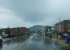 | Downtown Morehead Historic District | 0.3 miles | 2022 |
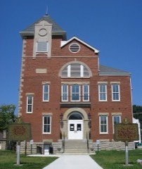 | Rowan County Courthouse | 0.4 miles | 2017 |
 | Morehead State University | 0.5 miles | 1994 |
| Morehead Voting House No. 7 | 0.6 miles | 1998 | |
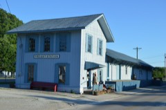 | Morehead Chesapeake and Ohio Railway Freight Depot | 0.8 miles | 2016 |
| Brushy Voting House No. 6 | 4.8 miles | 1998 |
| National Archives record | The nomination case file for reference 98000343 in Record Group 79. |
| Rowan County | All 14 listed properties in this county. |