 Block
From the record
9 National Register listings published here, 1 of them a National Historic Landmark.
Sources: the National Register database, National Park Service
43 topographic sheets cover 20 settlements here, and 9 properties are on the National Register of Historic Places.
9 National Register listings published here, 1 of them a National Historic Landmark.
Sources: the National Register database, National Park Service
Every property in this county listed on the National Register of Historic Places, with the year it was listed and the federal nomination document.
| Photograph | Property | Type | Listed | Reference |
|---|---|---|---|---|
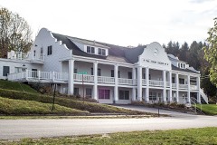 | Benzie County Courthouse | building | 1996 | 96000611 |
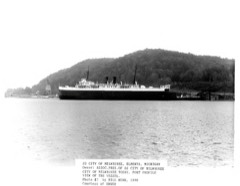 | CITY OF MILWAUKEE | structure | 1990 | 90002221 |
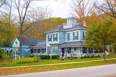 | Frankfort Land Company House | building | 1995 | 95000452 |
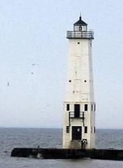 | Frankfort North Breakwater Light | structure | 2005 | 05000983 |
| Gwen Frostic Studio | building | 2021 | 100006321 | |
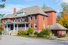 | Mills Community House | building | 1972 | 72000593 |
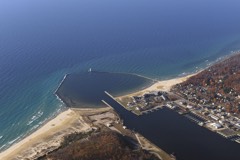 | Navigation Structures at Frankfort Harbor | structure | 1997 | 97000973 |
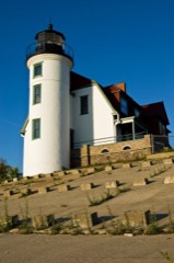 | Point Betsie Light Station | building | 1984 | 84001375 |
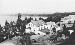 | Watervale Historic District | district | 2003 | 03000624 |
Every wildfire the federal occurrence database records inside this county: 93 of them, burning about 268 acres. 9 started naturally and 3 were recorded as arson. Each settlement page carries the fires within five miles of it.
| Reported cause | Fires |
|---|---|
| Missing data/not specified/undetermined | 33 |
| Debris and open burning | 14 |
| Recreation and ceremony | 12 |
| Equipment and vehicle use | 11 |
| Natural | 9 |
| Power generation/transmission/distribution | 4 |
| Arson/incendiarism | 3 |
| Smoking | 3 |
| Misuse of fire by a minor | 2 |
| Railroad operations and maintenance | 1 |
| Other causes | 1 |
The five largest, by the area the report gives. None of them was recorded as arson.
| Date | Cause | Size | Reported by | Name on the report |
|---|---|---|---|---|
| 31 July 2017 | Natural | 55 acres | Michigan Department of Natural Resources | BENZIE 01 GRASS LAKE MARSH |
| 18 November 2016 | Recreation and ceremony | 36 acres | Sleeping Bear Dunes National Lakeshore | POPLAR |
| 7 October 2007 | Recreation and ceremony | 27 acres | Michigan Department of Natural Resources | not named |
| 2 July 1995 | Natural | 15 acres | Michigan Department of Natural Resources | not named |
| 14 May 2019 | Missing data/not specified/undetermined | 11 acres | Michigan Department of Natural Resources | BENZIE 02 - REYNOLDS ROAD FIRE |
| 18 April 2004 | Power generation/transmission/distribution | 7.6 acres | Sleeping Bear Dunes National Lakeshore | BANCROFT |
| 16 April 2002 | Power generation/transmission/distribution | 7.0 acres | Michigan Department of Natural Resources | not named |
| 13 April 2005 | Misuse of fire by a minor | 5.3 acres | Michigan Department of Natural Resources | not named |
Every settlement page carries the fires within five miles of it - see the settlement index below.
The NOAA Storm Events Database holds 62 reports for this county, causing 2 deaths, 30 injuries and about $470,750 in recorded property damage. Each settlement page carries the reports that name it.
| Kind of event | Reports |
|---|---|
| Thunderstorm Wind | 36 |
| Hail | 20 |
| Tornado | 4 |
| Flash Flood | 1 |
| Lightning | 1 |
The most serious of them, by death, then injury, then recorded damage. The accounts are quoted exactly as the forecast office filed them.
| When | Event | Place named | Harm | What the report says |
|---|---|---|---|---|
| April 1956 | Tornado (F4) | not stated | 2 killed, 24 hurt, $250,000 | no account filed |
| July 1987 | Thunderstorm Wind | not stated | 6 hurt | no account filed |
| July 2006 | Thunderstorm Wind | Lake Ann | $60,000 | Numerous trees downed. Five homes damaged by falling trees. |
| October 1989 | Tornado (F1) | not stated | $25,000 | no account filed |
| June 2010 | Thunderstorm Wind | Watervale | $16,000 | Pockets of tree damage occurred in southern Benzie County. A large barn was partially unroofed. |
| August 2003 | Thunderstorm Wind | Frankfort | $15,000 | A 70 mph gust was measured at the Coast Guard Station on the Lake Michigan shoreline. Numerous trees and tree limbs were downed in Frankfort. |
| September 2005 | Thunderstorm Wind | Lake Ann | $12,000 | Large maple downed onto two vehicles. |
| August 2004 | Thunderstorm Wind | Lake Ann | $12,000 | A large tree was downed onto a car. |
| June 2021 | Thunderstorm Wind | Thompsonville Arpt | $10,000 | Local print and broadcast media report downed trees and damage to artwork at Michigan Legacy Art Park due to thunderstorms. Time approximated from radar data. |
| July 2019 | Thunderstorm Wind | Beulah | $9,000 | Scattered trees were downed from the Beulah area to near Cinder and Homestead Roads. |
| June 2016 | Thunderstorm Wind | Frankfort | $9,000 | Several trees and a few power lines were downed. |
| July 2016 | Thunderstorm Wind | Watervale | $8,000 | Several trees were downed near Lower Herring Lake. |
| August 2013 | Thunderstorm Wind | Frankfort Arpt | $8,000 | Numerous trees were downed between Frankfort and Benzonia. |
| August 2006 | Thunderstorm Wind | Frankfort | $8,000 | Trees down on M-22 near Sutter Road, and on the Crystal Downs golf course. |
| September 2005 | Thunderstorm Wind | Frankfort | $6,000 | Multiple trees and power lines were downed. |
| July 2023 | Thunderstorm Wind | Frankfort | $5,000 | Local media reports multiple trees and powerlines down in the city of Frankfort. Reports confirmed by emergency manager. |
| August 2021 | Thunderstorm Wind | Lake Ann | $5,000 | Trees and powerlines downed. |
| July 2006 | Thunderstorm Wind | Thompsonville | $4,000 | Trees downed. |
| July 2019 | Thunderstorm Wind | Thompsonville Arpt | $3,000 | Two trees were downed across M-115 near King Rd. |
| June 1986 | Tornado (F1) | not stated | $2,500 | no account filed |
| June 2016 | Thunderstorm Wind | Lake Ann | $2,000 | Several large tree limbs were downed. |
| July 1995 | Thunderstorm Wind | Frankfort | $1,000 | Four funnel clouds were sighted by a Coast Guard Vessel, over water, along the shoreline between Frankfort and the Point Betsie Lighthouse. Trees and power lines were reported downed by the wind along two miles of M22 east of the Point Betsie Lighthouse. |
| July 1983 | Tornado (F1) | not stated | $250 | no account filed |
| July 2025 | Thunderstorm Wind | Carter Corner | - | Trees and powerlines down on Thompsonville Highway, south of US-31. |
| July 2025 | Thunderstorm Wind | Frankfort | - | Multiple trees reported down in the vicinity of Frankfort, MI, including South Shore Rd. |
| April 2024 | Hail | Thompsonville | - | Report of three-quarter-inch hail. |
| September 2021 | Hail | Beulah | - | Report from mping. |
| September 2003 | Hail | Frankfort | - | A strong upper level disturbance contributed to widespread thunderstorms. A large number of these produced small hail, though only one report of severe-criteria hail was received. Some waterspouts also occurred over nearby waters of the Great Lakes. |
| August 2003 | Thunderstorm Wind | Frankfort | - | Trees were downed along M-22. |
| July 2003 | Thunderstorm Wind | Benzonia | - | A large tree was downed. |
| April 2002 | Thunderstorm Wind | Frankfort | - | Several trees and power lines down. |
| July 2002 | Thunderstorm Wind | Frankfort | - | Numerous trees down. |
| August 2002 | Thunderstorm Wind | Countywide | - | Numerous trees down. |
| July 2002 | Thunderstorm Wind | Lake Ann | - | Several trees down. |
| August 2001 | Thunderstorm Wind | Thompsonville | - | Large tree fell on van. |
| September 2000 | Flash Flood | Countywide | - | Flooding of roads. |
| September 1998 | Thunderstorm Wind | Countywide | - | Scattered reports of trees uprooted and/or snapped off countywide. |
| May 2019 | Hail | Benzonia | - | no account filed |
| May 2019 | Hail | Nessen City | - | no account filed |
| October 2016 | Hail | Lake Ann | - | no account filed |
| June 2007 | Hail | Benzonia | - | no account filed |
| July 2006 | Hail | Honor | - | no account filed |
| June 2006 | Hail | Lake Ann | - | no account filed |
| October 2006 | Hail | Benzonia | - | no account filed |
| October 2006 | Hail | Honor | - | no account filed |
| September 2005 | Hail | Lake Ann | - | no account filed |
| September 2005 | Hail | Elberta | - | no account filed |
| August 2003 | Hail | Lake Ann | - | no account filed |
| August 2003 | Hail | Lake Ann | - | no account filed |
| May 2002 | Hail | Honor | - | no account filed |
| September 2000 | Lightning | Countywide | - | no account filed |
| June 1999 | Thunderstorm Wind | Honor | - | no account filed |
| April 1993 | Hail | Frankfort | - | no account filed |
| March 1991 | Thunderstorm Wind | not stated | - | no account filed |
| March 1991 | Thunderstorm Wind | not stated | - | no account filed |
| July 1987 | Hail | not stated | - | no account filed |
| September 1985 | Thunderstorm Wind | not stated | - | no account filed |
| September 1985 | Thunderstorm Wind | not stated | - | no account filed |
| July 1983 | Thunderstorm Wind | not stated | - | no account filed |
| July 1982 | Hail | not stated | - | no account filed |
The Survey's mineral resources record lists 2 workings inside this county. All of them still produce. Each settlement page carries the workings within five miles of it.
| Commodity | Workings |
|---|---|
| Sand and Gravel, Construction | 1 |
| Silica | 1 |
The least common of them first, because a county's hundredth gravel pit says nothing its first ten did not.
| Where | Site | Commodity | Status | Recorded |
|---|---|---|---|---|
| Benzie County Pit | Sand and Gravel, Construction | Producer | ||
| Walter Rohn Property | Silica | Producer | Sedimentary |
Named settlements recorded in the Geographic Names Information System, each with the topographic sheets covering it. Villages, hamlets and abandoned places alike. Each is shown with the nearest named watercourse or landform and the survey quadrangle it falls on.
Lake township · 49640 · On Otter Creek · Empire quadrangle
10 sheets, 1954 to 1998
No longer a settlement
Benzonia township · 49640 · On North Branch Platte River · Beulah quadrangle
10 sheets, 1954 to 1984
No longer a settlement
Lake township · 49635 · On Round Lake Creek · Frankfort quadrangle
11 sheets, 1954 to 1984
Crystal Lake township · 49635 · On Burrows Creek · Frankfort quadrangle
11 sheets, 1954 to 1984
Crystal Lake township · 49635 · On Burrows Creek · Frankfort quadrangle
11 sheets, 1954 to 1984
Inland township · 49617 · On Brundage Creek · Platte River quadrangle
15 sheets, 1954 to 1989
Weldon township · 49683 · On Little Betsie River · Thompsonville quadrangle
14 sheets, 1954 to 1989
Blaine township · 49613 · On Herring Lake Outlet · Elberta quadrangle
10 sheets, 1954 to 1984
The vanished settlements of Benzie County: the places named above that are no longer on the map.