 Block
From the record
9 National Register listings published here.
Sources: the National Register database, National Park Service
61 topographic sheets cover 34 settlements here, and 9 properties are on the National Register of Historic Places.
9 National Register listings published here.
Sources: the National Register database, National Park Service
Every property in this county listed on the National Register of Historic Places, with the year it was listed and the federal nomination document.
| Photograph | Property | Type | Listed | Reference |
|---|---|---|---|---|
 | Criffield-Whiteley House | building | 2016 | 16000818 |
 | First Methodist Episcopal Church of Pokagon | building | 2002 | 02000295 |
 | Jones, Carroll and Bessie E. (Caul), House | building | 1997 | 97001482 |
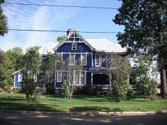 | G. W. Jones House | building | 1994 | 94001427 |
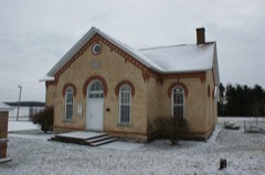 | Mason District Number 5 Schoolhouse | building | 1985 | 85002153 |
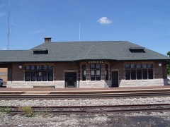 | Michigan Central Railroad Dowagiac Depot | building | 1993 | 93001349 |
 | George Newton House | building | 1982 | 82002830 |
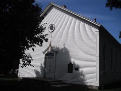 | Smith's Chapel | building | 1987 | 87002224 |
 | Thompson Road-Air Line Railroad Bridge | structure | 1999 | 99001612 |
Every wildfire the federal occurrence database records inside this county: 63 of them, burning about 73 acres. 6 started naturally and none was recorded as arson. Each settlement page carries the fires within five miles of it.
| Reported cause | Fires |
|---|---|
| Equipment and vehicle use | 40 |
| Missing data/not specified/undetermined | 16 |
| Natural | 6 |
| Recreation and ceremony | 1 |
The five largest, by the area the report gives. None of them was recorded as arson.
| Date | Cause | Size | Reported by | Name on the report |
|---|---|---|---|---|
| 27 March 2019 | Equipment and vehicle use | 9.0 acres | Michigan Department of Natural Resources | NEWBERG TOWNSHIP FD 0002393 - 2019 |
| 7 April 2019 | Natural | 2.0 acres | Michigan Department of Natural Resources | CASSOPOLIS VFD 0000054 - 2019 |
| 3 April 2019 | Natural | 2.0 acres | Michigan Department of Natural Resources | POKAGON VFD 2019022 - 2019 |
| 23 March 2019 | Equipment and vehicle use | 1.0 acres | Michigan Department of Natural Resources | SEPSA FIRE AUTHORITY 138 - 2019 |
| 8 April 2019 | Equipment and vehicle use | 1.0 acres | Michigan Department of Natural Resources | SEPSA FIRE AUTHORITY 182 - 2019 |
| 31 July 2020 | Equipment and vehicle use | 1.0 acres | Michigan Department of Natural Resources | SEPSA FIRE AUTHORITY 408 - 2020 |
| 27 March 2019 | Equipment and vehicle use | 1.0 acres | Michigan Department of Natural Resources | SEPSA FIRE AUTHORITY 149 - 2019 |
| 7 April 2019 | Equipment and vehicle use | 1.0 acres | Michigan Department of Natural Resources | SEPSA FIRE AUTHORITY 178 - 2019 |
Every settlement page carries the fires within five miles of it - see the settlement index below.
The NOAA Storm Events Database holds 306 reports for this county, causing 2 deaths, 34 injuries and about $11,975,000 in recorded property damage. Each settlement page carries the reports that name it.
| Kind of event | Reports |
|---|---|
| Thunderstorm Wind | 213 |
| Hail | 55 |
| Tornado | 21 |
| Flash Flood | 9 |
| Flood | 6 |
| Funnel Cloud | 1 |
| Lightning | 1 |
The most serious of them, by death, then injury, then recorded damage. The accounts are quoted exactly as the forecast office filed them.
| When | Event | Place named | Harm | What the report says |
|---|---|---|---|---|
| March 2026 | Tornado (EF1) | Edwardsburg | 1 killed | A disorganized circulation touched down northwest of the|intersection of Runkle St and Conrad Rd, destroying an attached|garage, and destroying the center part of the home (back windows failed and resulted in front of house blowing out). One fatality, a 12 year|old boy, was confirmed at the home as he was located in the attached garage at the time. A female resident was also injured. The tornado continued|northeast, causing damage to mainly trees with some minor roof|damage as it moved across Yankee St, east of Dailey Rd. The|tornado then widen and intensified with the peak damage occurring|along Harris St, between Hess Rd and M-62 where numerous trees|were snapped or uprooted. Some damage to pole barns and homes|(mainly roofs) was noted. The tornado crossed M-62 and continued|northeast, crossing portions of Oil City Rd and Monette St to|Curtis, Day and Chain Lakes before lifting just east of the|intersection of South and Walnut Rd. |
| August 2022 | Thunderstorm Wind | Pokagon | 1 killed | Local law enforcement reported a large tree limb fell onto the cab of a vehicle, spun the limb into the road way while the vehicle continued westbound, striking another tree on the side of the road. A 17 year old male was pronounced dead at the scene. |
| July 1992 | Tornado (F2) | not stated | 25 hurt, $250,000 | no account filed |
| June 2003 | Thunderstorm Wind | Cassopolis | 4 hurt | Law enforcement reported a large tree fell on a church tent injuring 4 people, one seriously. |
| May 1988 | Thunderstorm Wind | not stated | 3 hurt | no account filed |
| March 2000 | Thunderstorm Wind | Dowagiac | 1 hurt, $10,000 | A strong thunderstorm microburst blew down trees, branches, and windows out of a house. A woman at the residence at the time was outside when the storm hit and suffered minor injuries from the blown debris. |
| September 2014 | Thunderstorm Wind | Dailey | 1 hurt | Local law enforcement reported a tree was blown down onto a vehicle traveling on M-60, near Liberty Road. One of the two occupants in the vehicle was transported to the hospital with minor injuries. |
| October 2001 | Tornado (F1) | Edwardsburg | $5,000,000 | no account filed |
| June 1986 | Tornado (F2) | not stated | $2,500,000 | no account filed |
| February 2018 | Flood | Barron Lake | $550,000 | Flooding occurred due to high water levels in many creeks, streams and rivers in the county. Several roads were closed for a period of time until flood waters receded. A few dozen structures were impacted by the flood waters as well as minor road damage. Damage of around 550,000 dollars was estimated. |
| May 2024 | Lightning | Sandy Shores | $500,000 | Ramona Skating Rink was struck by lightning, caught fire, then burned to the ground according to broadcast media. |
| September 2008 | Flood | Barron Lake | $500,000 | The rainfall from the remnants of Lowell and Ike continued to drop heavy rainfall into the early morning hours of the 15th. When the rain finally stopped, total rainfall amounts of 10 to 12 inches was reported from the extreme eastern parts of Niles into Edwardsburg. Numerous roads remained closed with some culverts and bridges suffering damage. No injuries were reported. No exact figures are available for the damage to the area from the flooding. |
| August 1998 | Tornado (F2) | Edwardsburg | $500,000 | ONE MOBILE HOME WAS COMPLETELY DEMOLISHED ON SOUTH SIDE OF JUNO LAKE AND SEVERAL OTHER HOMES AROUND JUNO, PAINTER, EAGLE AND CHRISTAN LAKE SUFFERED MINOR TO MODERATE STRUCTURAL DAMAGE. AN RV WAS TOSSED ABOUT AND ROTATED 180 DEGREES WHICH CAUSED MAJOR DAMAGE. NUMEROUS TREES WERE COMPLETELY FLATTENED WHICH ALSO CAUSED DAMAGE TO HOMES. MANY ROADS WERE BLOCKED BY FALLEN TREES...SNAPPED POWER POLES AND DOWNED POWER LINES.THIS TORNADO BEGAN IN NILES AND PEAKED IN INTENSITY AND WIDTH 3 MILES NORTHWEST OF EDWARDSBURG WHERE IT WIDENED OUT TO ONE HALF MILE. IT CONTINUED ON TOWARD THE TOWN OF BRISTOL IN NORTHEAST ELKHART COUNTY BEFORE LIFTING. |
| April 2010 | Thunderstorm Wind | Dowagiac Cass Arpt | $400,000 | An area of scattered damage originated at the Dowagiac airport, with a hangar suffering moderate damage. The wind damage continued to expand with the roof being shifted off a business in the 54000 block of M-51. The remainder of the damage was confined to numerous three to four foot diameter trees being uprooted or snapped, as well as some large branches down. A few of these did fall on a few structure but damage was very limited. Damage for the area is estimated at $400,000. |
| August 1998 | Tornado (F1) | Adamsville | $300,000 | THE TORNADO HAD WEAKENED AS IT PASSED JUST EAST OF ADAMSVILLE. IT STILL CAUSED EXTENSIVE DAMAGE TO SEVERAL FARMS ALONG AND PRIMARILY SOUTH OF HIGHWAY 12.SEVERAL HOMES AND VEHICLES SUSTAINED MAJOR DAMAGE DUE TO FALLEN TREES. |
| July 1997 | Thunderstorm Wind | Edwardsburg | $300,000 | More than six dozen large trees were uprooted with hundreds of other trees either split or missing large limbs after a severe thunderstorm with estimated 70 mph winds blew through the Edwardsburg area around 7:50 AM EDT Wednesday, July 2, 1997. Downed trees and utility poles limited travel by blocking at least 6 area roads and road crews worked through the day to clear debris. Almost all of the village's 1,200 residents were without power for most of the day. The hardest hit area of Pleasant Lake reported 16 large trees uprooted. On the south side of the lake along Washington Street, one home was destroyed. Trees were downed onto several houses. The Ontwa Township/Edwardsburg Police Department received reports of at least one boat having been thrown into trees by damaging winds. No injuries were reported. |
| March 2025 | Tornado (EF1) | Edwardsburg | $100,000 | A brief EF-1 tornado was confirmed in Edwardsburg, MI on March 30th, 2025. The tornado started in a field west of Conrad Rd, snapping and uprooting trees as it moved northeast towards the Edwardsburg Primary School, where EF-0 damage was noted. The tornado continued to the northeast and intensified, where several homes and businesses sustained damage on the east side of Pleasant Lake. The Starboard Choice Marina building sustained roof damage, a boat lift and dock were removed from the lake and flipped over, and a few boats were damaged as well, including one that was flipped and lifted over a fence. The most intense damage was seen along Dailey Road, where numerous large trees were snapped and uprooted, with estimated peak wind speeds of 90 mph. Overall, the tornado was on the ground for 3 minutes and had a peak intensity of EF-1. There were also areas of straight-line wind damage noted throughout Edwardsburg, indicative that the tornado was likely embedded within the line of storms that moved through. |
| March 2016 | Tornado (EF0) | Edwardsburg | $100,000 | A survey of damage indicated a tornado touched down at the north end of Sundance Road, just South of US-12. A video was taken showing debris being lofted with notable rotation. The tornado tracked east northeast and heavily damaged a barn, as well as removing shingled and part of the roof of a church just south of US-12. The tornado tracked into Edwardsburg, uprooting or damaging trees before lifting near the intersection of M-62 and US-12. |
| June 2010 | Thunderstorm Wind | Indian Lake | $100,000 | Microburst damage continued into Cass County from Berrien County, near County Line Road and Frost Street. Tree damaged continued along the track, with somewhat more concentrated damage towards the end of the path as it tracked across some residential areas. Three homes suffered minor damage from either the winds or trees falling onto them. A barn and garage were destroyed at the end of the microburst near Wilbur Hill Road and Peavine Street. The supercell that caused the microburst produced yet another tornado just to the east of this microburst damage. |
| June 2010 | Tornado (EF2) | Dowagiac | $100,000 | After leaving behind a swath of microburst winds, the storm intensified with a tornado touching down about a half mile southwest of Southwestern Michigan College, near Dowagiac. The circulation initially impacted the Pokagon subdivision with numerous homes suffering varying degrees of damage (DI: FR12 DOD: 4). The circulation continued east-southeast through mainly open and wooded areas, severely damaging numerous trees. The most extensive tree damage occurred near Michigan 62, west of Twin Lake Road where a 600 yard wide area of trees suffered extensive damage. The circulation was likely embedded within a much larger area of rear flank downdraft winds. The circulation then turned more southeast and hit a cemetery on Michigan 62, south of Cass Street. The circulation quickly dissipated after this point. Maximum winds are estimated at around 115 mph. |
| March 2025 | Tornado (EF0) | Dailey | $50,000 | A tornado developed in a field west of M62 and impacted several outbuildings near the intersection of M62 and Pine Lake Street. One outbuilding lost a majority of its metal roof, with debris lofted across the street. The tornado then continued northeast, reaching peak intensity between M62 and Oil City Road. Several groves of trees were snapped or uprooted where peak wind speeds reached 90 mph. The tornado then crossed Oil City Road, snapping trees near the intersection of Jefferson Center Street and M62. Several center pivots were also flipped near that intersection. The tornado then dissipated north of Jefferson Center Street. The tornado was on the ground for 2 minutes and had a peak width of 200 yards. |
| November 1998 | Thunderstorm Wind | Countywide | $50,000 | EXTENSIVE DAMAGE OCCURRED TO TREES...POWER LINES AND POLES ACROSS THE COUNTY. |
| August 1993 | Thunderstorm Wind | Dowagiac | $50,000 | Between Sister lakes and Twin lakes numerous trees and power lines down with high winds reported by sheriffs dept. with no speed given. |
| June 2023 | Thunderstorm Wind | Edwardsburg | $32,000 | Power poles were snapped on Fir Road. |
| March 2025 | Thunderstorm Wind | Edwardsburg | $30,000 | Tree down on garage and tree down over Elkhart Rd, just east of M62. Power lines down at Redfield St and Conrad. Irrigation flipped in field near M62 northeast of M62 and May street. |
| August 2021 | Thunderstorm Wind | Union | $25,000 | Two trees were downed onto structures. One tree fell onto a mobile home, and the second fell on a house. Several other tree limbs were downed in the area. |
| May 2007 | Thunderstorm Wind | Dowagiac Cass Arpt | $25,000 | Several trees and power lines reported across the entire county. |
| June 1998 | Thunderstorm Wind | Dowagiac | $25,000 | NUMEROUS TREES AND POWER LINES BLOWN DOWN. |
| July 1997 | Thunderstorm Wind | Pokagon | $25,000 | Trees and power lines reported downed in Pokagon Township, in western Cass County. |
| July 1997 | Thunderstorm Wind | Dowagiac | $25,000 | Trees and power lines reported downed on the south side of Dowagiac. Lightning also damaged several power transformers. |
| June 1980 | Tornado (F1) | not stated | $25,000 | no account filed |
| August 1978 | Tornado (F1) | not stated | $25,000 | no account filed |
| July 2022 | Thunderstorm Wind | Edwardsburg | $20,000 | Trees and power lines were downed in town. |
| December 2007 | Thunderstorm Wind | Dowagiac | $20,000 | Law enforcement officials reported numerous trees and power lines down across the county. |
| August 1997 | Thunderstorm Wind | Jones | $20,000 | The Cass County Road Commission reported numerous trees downed in the Birch Lake area of Porter Township, resulting in about 3,000 power outages there. Trees were reported downed south of Michigan Highway 60 along Michigan Highway 40 in Porter Township. |
| March 2025 | Thunderstorm Wind | Marcellus | $15,000 | Pictures of a barn that sustained damage at Bradt and W Main St. |
| July 2023 | Thunderstorm Wind | Cassopolis | $15,000 | A few large tree branches down in Cassopolis, including one onto an unoccupied car. |
| July 2022 | Thunderstorm Wind | Cassopolis | $15,000 | Several trees were downed and at least one power pole was downed in Cassopolis and vicinity. |
| July 2022 | Thunderstorm Wind | Marcellus | $15,000 | Trees and power poles are down. |
| May 1999 | Thunderstorm Wind | Dowagiac | $15,000 | Several trees and power lines were blown down. |
| October 1996 | Thunderstorm Wind | Indian Lake | $15,000 | no account filed |
| June 1997 | Thunderstorm Wind | Marcellus | $12,500 | A severe thunderstorm downed a tree and several large limbs in the village of Marcellus. The downed tree landed on a vehicle parked at the corner of S. Centre and Dibble Street. Limbs and power lines were downed on N. Centre and North Streets and at the corner of Arbor and Snyder Street. |
| May 2004 | Hail | Edwardsburg | $12,000 | Public reported hail to ping pong ball size in Edwardsburg on Eagle Lake. Damage was to roofs and a recreational vehicle. |
| March 2025 | Thunderstorm Wind | Cassopolis | $10,000 | Roof blown off of a building. |
| June 2024 | Flood | Dowagiac | $10,000 | A trained spotter reported a flooded road in both directions of Depot Drive and Division Street. |
| June 2024 | Thunderstorm Wind | Jones | $10,000 | County dispatch reports trees and powerlines down across the county. |
| August 2022 | Thunderstorm Wind | Dowagiac | $10,000 | Several tree branches were down in Dowagiac. Power lines are down in the street. |
| April 2008 | Thunderstorm Wind | Cassopolis | $10,000 | Local law enforcement reported trees and power lines blown down by estimated winds of around 65 mph. |
| June 2008 | Thunderstorm Wind | Indian Lake | $10,000 | Amateur radio operators reported a tree down onto an occupied house. No injuries were reported. Damage is estimated at $10,000. |
| August 2007 | Thunderstorm Wind | Jones | $10,000 | Several trees and power lines were reported blown down. |
| July 2006 | Thunderstorm Wind | Countywide | $10,000 | Trees and power lines were reported down in Dowagiac, Union City and Edwardsberg. |
| August 1998 | Thunderstorm Wind | Adamsville | $10,000 | TREE FELL ONTO A PICKUP TRUCK TOTALLY SMASHING IT. |
| June 2023 | Thunderstorm Wind | Barron Lake | $8,000 | A utility pole was snapped in half. |
| September 2021 | Thunderstorm Wind | Five Mile Corners | $8,000 | Six trees down across roadway. Two reports of power lines down. |
| June 2010 | Thunderstorm Wind | Barron Lake | $7,500 | A tree fell into a house and collapsed the bathroom wall. |
| June 2024 | Flood | La Grange | $5,000 | Water is flowing over both lanes of Shurte Street. |
| June 2007 | Thunderstorm Wind | Vandalia | $5,000 | A tree was blown down onto power lines. |
| July 2006 | Thunderstorm Wind | Edwardsburg | $5,000 | Power lines were blown down. |
| May 2004 | Thunderstorm Wind | Cassopolis | $5,000 | Law enforcement reported trees and power lines down countywide and a semi truck rolled over. |
| May 1999 | Thunderstorm Wind | Edwardsburg | $5,000 | Power lines reported down. |
The Survey's mineral resources record lists 17 workings inside this county. 13 still produce and 4 are closed or unrecorded. Each settlement page carries the workings within five miles of it.
| Commodity | Workings |
|---|---|
| Sand and Gravel, Construction | 14 |
| Limestone, General | 2 |
| Clay | 1 |
The least common of them first, because a county's hundredth gravel pit says nothing its first ten did not.
| Where | Site | Commodity | Status | Recorded |
|---|---|---|---|---|
| Unnamed Clay Prospect | Clay | Prospect | ||
| Pipher's Marl Quarry | Limestone, General | Past Producer | ||
| Poehlman Marl Pit | Limestone, General | Producer | ||
| A&K Excavating Pit | Sand and Gravel, Construction | Producer | ||
| Bret Schneider Pit & Mill | Sand and Gravel, Construction | Producer | ||
| Cass Co Pit Lowitz Pit | Sand and Gravel, Construction | Producer | ||
| Cass Co Pit Yerington Const | Sand and Gravel, Construction | Producer | ||
| Cass County Pit | Sand and Gravel, Construction | Producer | ||
| Indiana Highways Materials | Sand and Gravel, Construction | Producer | ||
| Indiana Highways Materials, Inc | Sand and Gravel, Construction | Past Producer | ||
| Millikin Pit & Mill | Sand and Gravel, Construction | Producer | ||
| Niles Dredge and Mill | Sand and Gravel, Construction | Producer | ||
| Rudell Pit | Sand and Gravel, Construction | Producer | ||
| Silver Creek Pit & Mill | Sand and Gravel, Construction | Producer | ||
| Three S Pit & Mill | Sand and Gravel, Construction | Producer | ||
| West Rate Pit & Mill | Sand and Gravel, Construction | Producer | ||
| Whit Pond Pit & Mill | Sand and Gravel, Construction | Past Producer |
Named settlements recorded in the Geographic Names Information System, each with the topographic sheets covering it. Villages, hamlets and abandoned places alike. Each is shown with the nearest named watercourse or landform and the survey quadrangle it falls on.
Penn township · 49031 · Near Diamond Island · Vandalia quadrangle
16 sheets, 1948 to 1985
Calvin township · 49031 · Near Diamond Island · Vandalia quadrangle
16 sheets, 1948 to 1985
Silver Creek township · 49047 · Near Rattlesnake Island · Sister Lakes quadrangle
10 sheets, 1927 to 1981
Silver Creek township · 49047 · Near Rattlesnake Island · Sister Lakes quadrangle
10 sheets, 1927 to 1981
Penn township · 49031 · Near Diamond Island · Vandalia quadrangle
16 sheets, 1948 to 1985
Pokagon township · 49120 · On Pokagon Creek · Sumnerville quadrangle
14 sheets, 1945 to 1983