Block
From the record
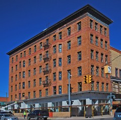
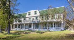
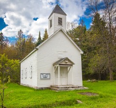
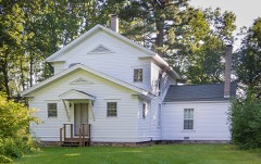
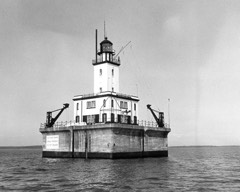
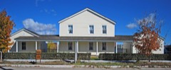
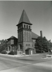
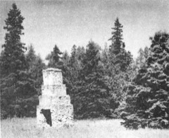
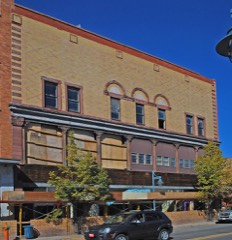
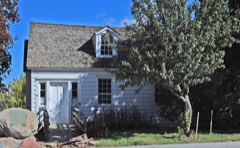
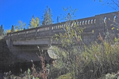
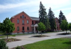
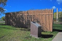
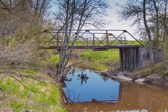
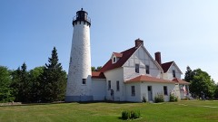
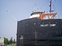
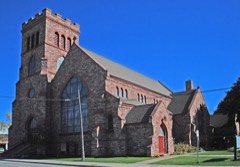
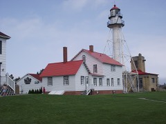
26 National Register listings published here, 1 of them a National Historic Landmark.
Sources: the National Register database, National Park Service
116 topographic sheets cover 56 settlements here, and 26 properties are on the National Register of Historic Places.
26 National Register listings published here, 1 of them a National Historic Landmark.
Sources: the National Register database, National Park Service
Every property in this county listed on the National Register of Historic Places, with the year it was listed and the federal nomination document.
Every wildfire the federal occurrence database records inside this county: 303 of them, burning about 4,291 acres. 28 started naturally and 27 were recorded as arson. Each settlement page carries the fires within five miles of it.
| Reported cause | Fires |
|---|---|
| Debris and open burning | 86 |
| Missing data/not specified/undetermined | 72 |
| Equipment and vehicle use | 42 |
| Natural | 28 |
| Arson/incendiarism | 27 |
| Recreation and ceremony | 18 |
| Power generation/transmission/distribution | 14 |
| Misuse of fire by a minor | 7 |
| Smoking | 5 |
| Fireworks | 2 |
| Railroad operations and maintenance | 1 |
| Other causes | 1 |
The five largest, by the area the report gives. None of them was recorded as arson.
| Date | Cause | Size | Reported by | Name on the report |
|---|---|---|---|---|
| 17 May 1998 | Debris and open burning | 1,832 acres | Hiawatha National Forest | CAMP FAUNCE |
| 18 June 2007 | Missing data/not specified/undetermined | 214 acres | Hiawatha National Forest | BLUEBERRY BLOSSOM |
| 30 April 2005 | Debris and open burning | 158 acres | Michigan Department of Natural Resources | not named |
| 30 April 2016 | Debris and open burning | 154 acres | Michigan Department of Natural Resources | not named |
| 20 May 2020 | Missing data/not specified/undetermined | 116 acres | Michigan Department of Natural Resources | SAULT STE MARIE FD F20-093 - 2020 |
| 26 April 2003 | Missing data/not specified/undetermined | 112 acres | Michigan Department of Natural Resources | SAULT STE MARIE |
| 29 June 2016 | Debris and open burning | 82 acres | Michigan Department of Natural Resources | not named |
| 8 May 2003 | Debris and open burning | 67 acres | Michigan Department of Natural Resources | not named |
Every settlement page carries the fires within five miles of it - see the settlement index below.
The NOAA Storm Events Database holds 119 reports for this county, causing no deaths, 1 injury and about $796,300 in recorded property damage. Each settlement page carries the reports that name it.
| Kind of event | Reports |
|---|---|
| Hail | 54 |
| Thunderstorm Wind | 49 |
| Tornado | 7 |
| Flash Flood | 4 |
| Flood | 3 |
| Waterspout | 1 |
| Lightning | 1 |
The most serious of them, by death, then injury, then recorded damage. The accounts are quoted exactly as the forecast office filed them.
| When | Event | Place named | Harm | What the report says |
|---|---|---|---|---|
| August 2021 | Thunderstorm Wind | Cottage Park | 1 hurt, $20,000 | Drone pictures show numerous trees down about 1/4 mile west of M-129 on M-80. |
| August 1978 | Tornado | not stated | $250,000 | no account filed |
| July 1999 | Waterspout | Drummond Is | $200,000 | Waterspout damaged boat house and storage building on a marina dock. |
| September 2013 | Flash Flood | Sault Ste Marie | $125,000 | Radar estimated that 3 to 5 inches of rain fell in a few hours beginning late in the evening of the 9th, resulting in flash flood in the pre-dawn hours of the 10th. A number of roads were washed out and/or otherwise rendered impassable, in some cases for several days. West Shore Drive, and 1 1/2 Mile Road, were among the roads that suffered considerable damage. |
| June 2017 | Thunderstorm Wind | Munnscong | $35,000 | Dozens of trees were downed and/or uprooted. A camper was moved. Some damage to shingles near Pickford. |
| August 1977 | Tornado (F1) | not stated | $25,000 | no account filed |
| August 2021 | Thunderstorm Wind | Neebish | $20,000 | Drone footage of a swath of trees downed. |
| April 2020 | Flood | Kelden | $20,000 | A culvert was washed out along 20 Mile Road near Kelden. |
| August 2010 | Thunderstorm Wind | Rudyard | $16,000 | A barn was destroyed, and several trees were snapped off. |
| July 2006 | Thunderstorm Wind | Pickford | $12,000 | Trees downed. A scoreboard at the Pickford High School football field was destroyed. |
| August 2016 | Thunderstorm Wind | Kinross | $9,000 | The metal roof of an outbuilding was partially removed. A few trees were also downed. |
| June 2017 | Thunderstorm Wind | Goetzville | $8,000 | A large tree was downed onto a vehicle. |
| July 2006 | Thunderstorm Wind | Eckerman | $8,000 | Numerous trees and power lines downed in western Chippewa County. |
| August 2007 | Thunderstorm Wind | Rudyard | $7,500 | A shed was damaged, and several large tree limbs were downed. |
| August 2019 | Thunderstorm Wind | Dollar Settlement | $6,000 | Multiple trees were downed along Lakeshore Drive. |
| July 2019 | Thunderstorm Wind | Shallows | $6,000 | Trees were downed onto power lines. |
| August 2025 | Flash Flood | Whitefish Pt | $5,000 | Flooding in basements reported at Whitefish Point museums after 4.34 inches of rain fell in 7 hours. |
| August 2021 | Thunderstorm Wind | Pickford | $4,000 | Social media reports with pictures showing house siding and horse shelter roof blown off. |
| July 2006 | Thunderstorm Wind | Paradise | $3,000 | Trees down near Lower Tahquamenon Falls. |
| August 2005 | Thunderstorm Wind | Raber | $3,000 | Trees and power lines were downed. |
| May 2008 | Lightning | Paradise | $2,800 | Lightning struck a large pine tree just outside the administration building of Tahquamenon Falls State Park. The tree was blasted into pieces, and most of the electronic equipment in the admin building was destroyed. Some electrical damage also occurred in a staff building, not quite an eighth of a mile away. |
| April 1987 | Tornado (F0) | not stated | $2,500 | no account filed |
| July 2023 | Thunderstorm Wind | Eckerman | $2,000 | Trained spotter reported trees downed on McNearney Lake. Time estimated by radar. |
| July 2017 | Thunderstorm Wind | (Ssm)Ssmarie Muni Ap | $2,000 | Several large tree limbs were downed, and some shingles were blown off of a roof. |
| July 2013 | Thunderstorm Wind | Eckerman | $2,000 | Multiple power lines were blown down. |
| August 2005 | Thunderstorm Wind | De Tour Vlg | $1,000 | Large trees limbs were downed onto a road. |
| August 2005 | Thunderstorm Wind | Eckerman | $1,000 | Several pine trees lost large limbs. |
| July 1987 | Tornado (F0) | not stated | $250 | no account filed |
| July 1987 | Tornado (F1) | not stated | $250 | no account filed |
| March 2025 | Hail | Oak Ridge | - | Report of 1 diameter hail on Neebish Island. |
| March 2025 | Hail | Stirlingville | - | Multiple reports of accumulating hail up to 0.75inch diameter between Pickford and Barbeau, MI, including report from COOP observer 2NE Pickford. |
| June 2024 | Hail | Eckerman | - | Report of one inch hail. |
| June 2024 | Hail | Brimley | - | Report from Facebook of up to quarter size hail east of Brimley, MI. |
| June 2023 | Hail | Dafter | - | Media van reported nickel sized hail while driving. |
| August 2023 | Hail | Oak Ridge | - | Report via social media. Pictures of measured 1.5 inch hailstones on far north side of Neebish Island. Time estimated via radar. |
| July 2023 | Hail | Brimley | - | Fire chief reported quarter sized hail at 6 Mile Road and East Birch Point Trail. Time estimated by radar. |
| June 2022 | Thunderstorm Wind | (Ciu)Chippewa Co Arp | - | AWOS at Chippewa County International Airport. |
| August 2021 | Thunderstorm Wind | (Ciu)Chippewa Co Arp | - | AWOS station KCIU Kinross - Chippewa County International Airport. |
| August 2021 | Tornado (EF0) | Munnscong | - | A brief EF-0 tornado was analyzed in satellite imagery by the Northern Tornadoes Project of Canada. Damage was limited to trees on Neebish Island. |
| September 2019 | Hail | Rudyard | - | Hail covered the ground near Rudyard. The largest hailstones were the size of quarters. |
| July 2018 | Hail | Brimley | - | Hail covered the ground. |
| September 2010 | Flood | Dryburg | - | The Pine River near Rudyard crested near 18 feet at midday on the 24th. Flood stage was 17 feet. The river reached the bottom of the Prairie Road Bridge deck. |
| July 2006 | Hail | Sault Ste Marie | - | A cluster of thunderstorms moved through the Whitefish Bay and St Marys River valley region in the morning. One storm produced penny sized hail. |
| July 2005 | Hail | Paradise | - | Several waves of thunderstorms affect the northern Great Lakes region in the morning. Most were not severe. |
| July 2005 | Hail | Eckerman | - | Several strong thunderstorms developed along a cold front in eastern Upper Michigan. |
| August 2002 | Thunderstorm Wind | Paradise | - | Trees down at Tahquamenon State Park |
| October 2002 | Thunderstorm Wind | Sault Ste Marie | - | Numerous trees down. |
| June 2001 | Thunderstorm Wind | Countywide | - | Numerous reports of trees and power lines down around Rudyard, Sugar Island, Sault Ste. Marie and Paradise. |
| June 2001 | Thunderstorm Wind | Homestead | - | Two ten inch diameter trees blown down. |
| July 1999 | Thunderstorm Wind | Brimley | - | Trees and power lines down. |
| August 1998 | Thunderstorm Wind | Sault Ste Marie | - | Several trees were toppled across the city. One tree fell against a house damaging the roof...a porch and some siding. |
| August 1998 | Thunderstorm Wind | Sault Ste Marie | - | Several trees were toppled across the city. |
| July 1998 | Thunderstorm Wind | Sault Ste Marie | - | Wind gusts to 60 mph were reported by ships along the Soo Locks. |
| July 1995 | Hail | Sault Ste. Marie | - | Large hail reported by NWS office and a storm spotter within city. |
| July 1995 | Hail | Brimley | - | Large hail reported by storm spotter. |
| July 1995 | Hail | Sault Ste. Marie | - | Off-duty National Weather Service employee reported large hail at home. |
| July 1995 | Thunderstorm Wind | Whitefish Bay | - | Vessel reported a measured wind gust of 70 mph. |
| July 1995 | Thunderstorm Wind | Sugar Island | - | Winds estimated at greater than 58 mph blew over several eight-nine inch diameter trees. |
| July 1994 | Hail | Pickford | - | One-inch diameter hail fell from 1300 EST to 1310 EST near Pickford. Canadian radio news reported crop damage on St. Joseph Island 25 miles East of Pickford, south of Neebish Island. No reports of crop damage in Chippewa County, where only hay is grown. |
| August 1993 | Thunderstorm Wind | Drummond Island Airpo | - | Winds gusted to 63 mph at the Drummond Island Municipal Airport when gusty thunderstorm winds blew across the Island. No damage was reported. |
The Survey's mineral resources record lists 21 workings inside this county. 17 still produce and 4 are closed or unrecorded. Each settlement page carries the workings within five miles of it.
| Commodity | Workings |
|---|---|
| Sand and Gravel, Construction | 13 |
| Fire Clay (Refractory) | 4 |
| Dolomite | 2 |
| Stone, Crushed/Broken | 1 |
| Silica | 1 |
The least common of them first, because a county's hundredth gravel pit says nothing its first ten did not.
| Where | Site | Commodity | Status | Recorded |
|---|---|---|---|---|
| Drummond Dolomite Qy | Stone, Crushed/Broken | Producer | ||
| Montero Sand Pit | Silica | Producer | ||
| Drummond Island Quarry (Dock and Original Quarry) | Dolomite | Producer | 1945 | |
| Drummond Island Quarry (Inland Quarry) | Dolomite | Producer | 1945 | |
| Beadle's Brick Yard Clay Pit | Fire Clay (Refractory) | Past Producer | ||
| N. Pickford Clay Pit | Fire Clay (Refractory) | Past Producer | ||
| Thornton Brick Yd Clay Pit | Fire Clay (Refractory) | Past Producer | ||
| Zeeland Brick Co.Clay Pit | Fire Clay (Refractory) | Past Producer | ||
| C G Sanderson No. 1 Pit and Mill | Sand and Gravel, Construction | Producer | ||
| Chippewa County Pits | Sand and Gravel, Construction | Producer | ||
| City Limits Pit | Sand and Gravel, Construction | Producer | ||
| Fornicola Pit | Sand and Gravel, Construction | Producer | ||
| Gordon Pit | Sand and Gravel, Construction | Producer | ||
| Hopper Pit | Sand and Gravel, Construction | Producer | ||
| I L Whitehead Co Pit | Sand and Gravel, Construction | Producer | ||
| I L Whitehead Co Pit | Sand and Gravel, Construction | Producer | ||
| Montero Excavating Inc Pit | Sand and Gravel, Construction | Producer | ||
| Osborn Pit | Sand and Gravel, Construction | Producer | ||
| Petkus Pit | Sand and Gravel, Construction | Producer | ||
| State of Michigan Pit | Sand and Gravel, Construction | Producer | ||
| State of Michigan Pit | Sand and Gravel, Construction | Producer |
Named settlements recorded in the Geographic Names Information System, each with the topographic sheets covering it. Villages, hamlets and abandoned places alike. Each is shown with the nearest named watercourse or landform and the survey quadrangle it falls on.
Sugar Island township · 49783 · On Beaver Dam Creek · Baie de Wasai quadrangle
14 sheets, 1919 to 1984
Sugar Island township · 49783 · On McFarland Creek · Payment quadrangle
11 sheets, 1951 to 1985
Detour township · 49725 · Near Frying Pan Island · De Tour Village quadrangle
9 sheets, 1954 to 1984
Superior township · 49715 · On North Branch Orrs Creek · Brimley quadrangle
14 sheets, 1941 to 1984
Whitefish township · 49768 · On Tahquamenon River · Emerson quadrangle
12 sheets, 1951 to 1985
Soo township · 49783 · Near Island Number One · Sault Ste. Marie South quadrangle
16 sheets, 1913 to 1984
Drummond township · 49726 · Near Meade Island · Marble Head quadrangle
10 sheets, 1954 to 1984
Sault Ste. Marie city · 49783 · Sault Ste. Marie South quadrangle
16 sheets, 1913 to 1984
Drummond township · 49726 · On Potagannissing River · Drummond quadrangle
9 sheets, 1961 to 1984
Whitefish township · 49768 · On O'Briens Creek · Shelldrake quadrangle
12 sheets, 1951 to 1985
Sault Ste. Marie city · 49783 · On Ashmun Creek · Sault Ste. Marie South quadrangle
16 sheets, 1913 to 1984
Whitefish township · 49768 · On Shelldrake River · Shelldrake quadrangle
12 sheets, 1951 to 1985
Whitefish township · 49768 · On Cheney Creek · Emerson quadrangle
12 sheets, 1951 to 1985
Pickford township · 49774 · On Parker Creek · Pickford quadrangle
13 sheets, 1953 to 1984
Chippewa township · 49728 · On Creek Number Eight · Strongs quadrangle
15 sheets, 1941 to 1984
Chippewa township · 49728 · On Creek Number Eight · Strongs quadrangle
15 sheets, 1941 to 1984
Trout Lake township · 49793 · On Kneebone Creek · Trout Lake quadrangle
12 sheets, 1931 to 1985
Whitefish township · 49768 · On Weatherhogs Creek · Vermilion quadrangle
11 sheets, 1951 to 1985
Bay Mills township · 49715 · Near Iroquois Island · Dollar Settlement quadrangle
14 sheets, 1941 to 1984