 Block
From the record
9 National Register listings published here.
Sources: the National Register database, National Park Service
67 topographic sheets cover 30 settlements here, and 9 properties are on the National Register of Historic Places.
9 National Register listings published here.
Sources: the National Register database, National Park Service
Every property in this county listed on the National Register of Historic Places, with the year it was listed and the federal nomination document.
| Photograph | Property | Type | Listed | Reference |
|---|---|---|---|---|
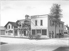 | Deal, J.J., and Son Carriage Factory | building | 2012 | 12000456 |
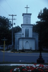 | Grace Episcopal Church | building | 1971 | 71000391 |
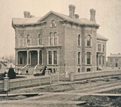 | E. O. Grosvenor House | building | 1977 | 77000713 |
 | Hillsdale County Courthouse | building | 1982 | 82002835 |
 | Hillsdale Downtown Historic District | district | 1995 | 95000075 |
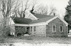 | William R. Kirby Sr. House | building | 1982 | 82002836 |
 | W. H. L. McCourtie Estate | site | 1992 | 91001984 |
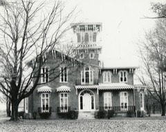 | William Treadwell House | building | 1974 | 74000984 |
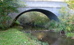 | Trunk Line Bridge No. 237 | structure | 2000 | 99001672 |
Every wildfire the federal occurrence database records inside this county: 67 of them, burning about 108 acres. 8 started naturally and none was recorded as arson. Each settlement page carries the fires within five miles of it.
| Reported cause | Fires |
|---|---|
| Missing data/not specified/undetermined | 42 |
| Equipment and vehicle use | 14 |
| Natural | 8 |
| Debris and open burning | 3 |
The five largest, by the area the report gives. None of them was recorded as arson.
| Date | Cause | Size | Reported by | Name on the report |
|---|---|---|---|---|
| 19 July 2019 | Equipment and vehicle use | 15 acres | Michigan Department of Natural Resources | PITTSFORD-JEFFERSON FIRE/RESCUE 19056 - 2019 |
| 7 April 2019 | Equipment and vehicle use | 10 acres | Michigan Department of Natural Resources | WRIGHT-WALDRON FIRE & AMBULANCE 0000128 - 2019 |
| 28 July 2019 | Missing data/not specified/undetermined | 5.0 acres | Michigan Department of Natural Resources | WRIGHT-WALDRON FIRE & AMBULANCE 0000224 - 2019 |
| 5 August 2018 | Natural | 5.0 acres | Michigan Department of Natural Resources | HILLSDALE CITY FD 0000796 - 2018 |
| 26 July 2019 | Missing data/not specified/undetermined | 4.0 acres | Michigan Department of Natural Resources | WRIGHT-WALDRON FIRE & AMBULANCE 0000223 - 2019 |
| 18 March 2018 | Equipment and vehicle use | 3.0 acres | Michigan Department of Natural Resources | WRIGHT-WALDRON FIRE & AMBULANCE 0000066 - 2018 |
| 18 April 1996 | Debris and open burning | 3.0 acres | Michigan Department of Natural Resources | not named |
| 3 April 2019 | Missing data/not specified/undetermined | 2.0 acres | Michigan Department of Natural Resources | WRIGHT-WALDRON FIRE & AMBULANCE 0000120 - 2019 |
Every settlement page carries the fires within five miles of it - see the settlement index below.
The NOAA Storm Events Database holds 328 reports for this county, causing 9 deaths, 138 injuries and about $57,171,030 in recorded property damage. Each settlement page carries the reports that name it.
| Kind of event | Reports |
|---|---|
| Thunderstorm Wind | 233 |
| Hail | 62 |
| Tornado | 26 |
| Flash Flood | 6 |
| Lightning | 1 |
The most serious of them, by death, then injury, then recorded damage. The accounts are quoted exactly as the forecast office filed them.
| When | Event | Place named | Harm | What the report says |
|---|---|---|---|---|
| April 1965 | Tornado (F4) | not stated | 3 killed, 47 hurt, $25,000,000 | no account filed |
| April 1965 | Tornado (F4) | not stated | 3 killed, 47 hurt | no account filed |
| April 1974 | Tornado (F2) | not stated | 2 killed, 31 hurt, $2,500,000 | no account filed |
| July 2001 | Lightning | Hillsdale | 1 killed | Man went outside to check possible lightning damage to barn. While standing outside of barn was hitby lightning and died shortly after at Hillsdale Community Health Center. |
| April 1974 | Tornado (F2) | not stated | 5 hurt | no account filed |
| September 1984 | Tornado (F2) | not stated | 2 hurt, $250,000 | no account filed |
| April 1974 | Tornado (F2) | not stated | 2 hurt, $25,000 | no account filed |
| April 1968 | Tornado (F1) | not stated | 1 hurt, $250,000 | no account filed |
| May 1997 | Thunderstorm Wind | Hillsdale | 1 hurt, $50,000 | Hillsdale County officials reported trees and power lines were downed by straight-line thunderstorm winds across Allen, Adams, and Wheatland townships. Four barns were destroyed at 3120 East Bacon Road in Hillsdale and damage was done to the home at the same address. One woman sustained minor injuries when the trailer she was in parked on Meadow Lane tipped over. |
| August 1964 | Tornado (F2) | not stated | 1 hurt, $25,000 | no account filed |
| July 2003 | Thunderstorm Wind | Somerset Center | 1 hurt | Emergency management reported tress down in Somerset Center. One person was injured. |
| March 1991 | Tornado (F3) | not stated | $25,000,000 | no account filed |
| April 1996 | Hail | Reading | $2,000,000 | no account filed |
| October 2001 | Tornado (F1) | Ransom | $350,000 | Tornado with F1 damage mainly on the north side of Ransom. Garages and sheds destroyed and significant roof damage to homes with twisting of signs and trees. |
| March 1976 | Tornado (F2) | not stated | $250,000 | no account filed |
| March 1976 | Tornado (F2) | not stated | $250,000 | no account filed |
| July 1969 | Tornado (F2) | not stated | $250,000 | no account filed |
| June 1996 | Flash Flood | Southwest | $150,000 | no account filed |
| September 2024 | Tornado (EF0) | Austin | $100,000 | Minor damage occurred to 2 barns on Austin Road, between S Edon Rd and Gilmore Road. The circulation was only briefly on the ground with estimated wind speeds of around 65 mph. |
| August 1998 | Thunderstorm Wind | Hillsdale | $100,000 | SEVERAL TREES DOWN ACROSS THE SOUTHERN THIRD OF THE COUNTY INCLUDING ONE WHOLE LINE OF POWER POLES WHICH WERE FLATTENED TO THE GROUND. |
| April 2015 | Thunderstorm Wind | Moscow | $75,000 | A two mile long swath of straight line wind damage was noted from roughly one half mile northwest of Moscow to 2 miles northeast of Moscow. The majority of the damage occurred to groves of trees that were snapped or uprooted. A century old barn was severely damaged after being impacted by the high winds and pushed off its elevated foundation. Additional evidence was found of a weak tornado within this swath that is noted separately. Maximum wind speeds are estimated to have reached at least 90 mph. |
| November 1998 | Thunderstorm Wind | Countywide | $60,000 | WIDESPREAD TREES AND POWER LINES WERE BLOWN DOWN. AEP HAD 66 REPORTS OF POWER LINES DOWN ACROSS THE COUNTY. IN JONESVILLE... DAMAGE WAS EXTENSIVE TO TREES...SIGNS AND POWER LINES. |
| August 1998 | Thunderstorm Wind | Hillsdale | $50,000 | WIDESPREAD TREE DAMAGE AND POWER LINES DOWN ACROSS THE COUNTY. |
| July 1999 | Thunderstorm Wind | Jonesville | $25,000 | Several tree limbs...power lines...and traffic lights were blown down. |
| July 1977 | Tornado (F2) | not stated | $25,000 | no account filed |
| July 1968 | Tornado (F1) | not stated | $25,000 | no account filed |
| March 2025 | Thunderstorm Wind | Hillsdale | $20,000 | Trees and power lines down throughout the county. |
| March 2025 | Thunderstorm Wind | Osseo | $20,000 | Partial barn collapse. Barn looks old and in poor condition. |
| June 2005 | Thunderstorm Wind | Hillsdale | $20,000 | A pole barn was destroyed west of Hillsdale. |
| August 2021 | Thunderstorm Wind | Moscow | $15,000 | Three foot diameter tree snapped. Large 1-2 ft diameter limb down. Power pole snapped and leaning on a house. Damage along Mosherville Rd at 2 separate residences. |
| June 2005 | Thunderstorm Wind | Hillsdale | $15,000 | A pole barn was destroyed in the area. |
| May 2024 | Hail | Hillsdale | $12,000 | no account filed |
| June 2025 | Thunderstorm Wind | Litchfield | $10,000 | Report of powerlines down on Mosherville Rd. |
| August 2024 | Thunderstorm Wind | Hillsdale | $10,000 | Dispatch reports a few trees and powerlines down across the county. |
| July 2023 | Thunderstorm Wind | Somerset Center | $10,000 | Numerous large trees uprooted or down at the mobile home park in Somerset Center. Photos on Twitter. |
| August 2022 | Thunderstorm Wind | Hillsdale | $10,000 | Several reports of trees and wires down within the county. |
| June 2008 | Thunderstorm Wind | Waldron | $10,000 | Law enforcement reported trees and power lines down in and around the Waldron area. |
| June 2007 | Thunderstorm Wind | Hillsdale | $10,000 | Scattered reports of trees down in and around the Hillsdale area as well as western parts of the county. |
| June 2007 | Thunderstorm Wind | Litchfield | $10,000 | Large trees were reported blown down in Litchfield. |
| August 2007 | Thunderstorm Wind | Hillsdale | $10,000 | A tree was blown down on car. Damage is estimated at $10,000. |
| June 2005 | Thunderstorm Wind | Litchfield | $10,000 | Power lines reported down in the area. |
| June 2005 | Thunderstorm Wind | Pittsford | $10,000 | Power lines were blown down in the city limits. |
| June 2005 | Thunderstorm Wind | Hillsdale | $10,000 | Power lines reported down in the area. |
| October 2001 | Thunderstorm Wind | Camden | $10,000 | Law enforcement reported trees and power lines down near Camden. 3 houses also had roof damage and a shed and a barn were destroyed. |
| May 2000 | Thunderstorm Wind | Hillsdale | $10,000 | Barn blown down. Numerous trees down. |
| June 1999 | Thunderstorm Wind | Hillsdale | $10,000 | Trees and power lines down in northeast part of Hillsdale County. |
| August 1998 | Thunderstorm Wind | Reading | $10,000 | TREE FELL ON A HOME WHICH SUSTAINED JUST MINOR DAMAGE. |
| July 1997 | Thunderstorm Wind | Osseo | $10,000 | Hillsdale County Emergency Operations reported trees and electrical wires downed 3 miles southeast of Hillsdale near Osseo and Pleasant Lake, in Jefferson Township. Power was cut for approximately 400 Consumers Energy customers. |
| October 1996 | Thunderstorm Wind | Jonesville | $8,000 | no account filed |
| October 1996 | Thunderstorm Wind | Hillsdale | $8,000 | no account filed |
| March 2025 | Thunderstorm Wind | Osseo | $5,000 | The public reports that trees are down. |
| July 2023 | Thunderstorm Wind | Somerset Center | $5,000 | Several trees down or uprooted around McCourite park. Photos on Twitter. |
| July 2023 | Thunderstorm Wind | Jerome | $5,000 | Several trees snapped on Jerome road. |
| July 2023 | Thunderstorm Wind | Jerome | $5,000 | Several large tree branches and a few trees down. |
| June 2006 | Thunderstorm Wind | Hillsdale | $5,000 | Windows were blown out of homes and businesses. |
| June 2005 | Thunderstorm Wind | Osseo | $5,000 | Trees and power lines reported blown down near Osseo. |
| October 2001 | Thunderstorm Wind | Camden | $5,000 | Law enforcement reported several large grain bins and barns damaged near Camden. |
| May 1997 | Thunderstorm Wind | Camden | $5,000 | Hillsdale County Central Dispatch reported a residence at 13080 South Edon Road was damaged by severe thunderstorm winds. A machine shop, another out-building, and the home received minor damage. |
| August 1997 | Thunderstorm Wind | Litchfield | $5,000 | Hillsdale County Central Dispatch reported trees downed in Litchfield. |
| August 1997 | Thunderstorm Wind | Moscow | $5,000 | Scattered reports of trees and power lines downed across Moscow Township. |
The Survey's mineral resources record lists 12 workings inside this county. 7 still produce and 5 are closed or unrecorded. Each settlement page carries the workings within five miles of it.
| Commodity | Workings |
|---|---|
| Sand and Gravel, Construction | 7 |
| Clay | 4 |
| Calcium | 1 |
The least common of them first, because a county's hundredth gravel pit says nothing its first ten did not.
| Where | Site | Commodity | Status | Recorded |
|---|---|---|---|---|
| John Hess Marl Pit | Calcium | Past Producer | ||
| J B Keiser and Son Clay Pit | Clay | Past Producer | ||
| Jerome Brick and Tile Co Clay Pit | Clay | Past Producer | ||
| Parks Farm Clay Prospect | Clay | Prospect | ||
| Unnamed Clay Pit | Clay | Past Producer | ||
| Hillsdale County Pit | Sand and Gravel, Construction | Producer | ||
| Hillsdale Sand & Gravel Pit | Sand and Gravel, Construction | Producer | ||
| Jerome Pit | Sand and Gravel, Construction | Producer | ||
| Jerome Pit & Mill | Sand and Gravel, Construction | Producer | ||
| Mil-Co Pit and Mill | Sand and Gravel, Construction | Producer | ||
| Osseo Sand Pit | Sand and Gravel, Construction | Producer | ||
| Waldron Pit | Sand and Gravel, Construction | Producer |
Named settlements recorded in the Geographic Names Information System, each with the topographic sheets covering it. Villages, hamlets and abandoned places alike. Each is shown with the nearest named watercourse or landform and the survey quadrangle it falls on.
Wright township · 49247 · On Prattville Drain · Pittsford quadrangle
9 sheets, 1953 to 1990