Block
From the record
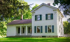
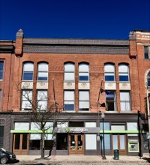
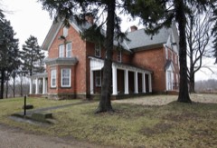
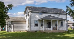
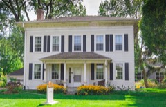
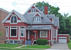
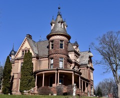
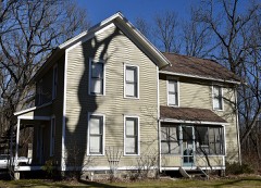
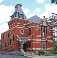
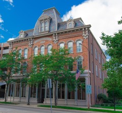
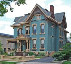
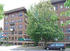
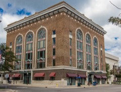
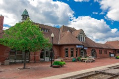
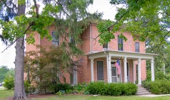
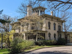
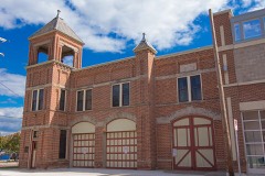
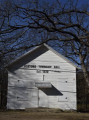
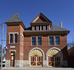
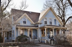
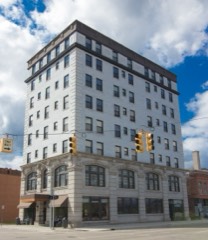
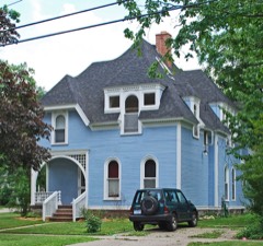
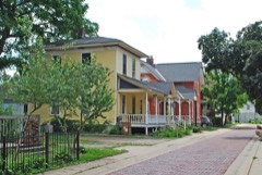
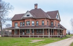
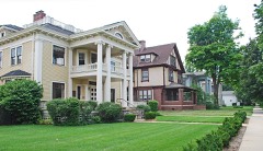
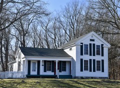
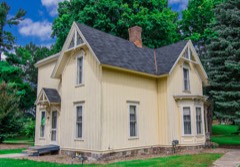
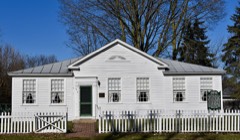
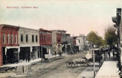
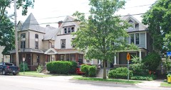
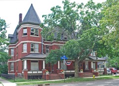
60 National Register listings published here.
Sources: the National Register database, National Park Service
85 topographic sheets cover 43 settlements here, and 60 properties are on the National Register of Historic Places.
60 National Register listings published here.
Sources: the National Register database, National Park Service
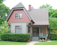
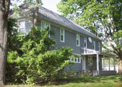
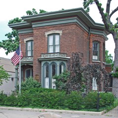
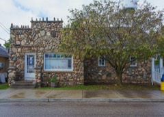
Every property in this county listed on the National Register of Historic Places, with the year it was listed and the federal nomination document.
Every wildfire the federal occurrence database records inside this county: 169 of them, burning about 241 acres. 13 started naturally and 2 were recorded as arson. Each settlement page carries the fires within five miles of it.
| Reported cause | Fires |
|---|---|
| Missing data/not specified/undetermined | 94 |
| Equipment and vehicle use | 48 |
| Natural | 13 |
| Debris and open burning | 5 |
| Recreation and ceremony | 4 |
| Smoking | 2 |
| Arson/incendiarism | 2 |
| Fireworks | 1 |
The five largest, by the area the report gives. Two of them were set deliberately.
| Date | Cause | Size | Reported by | Name on the report |
|---|---|---|---|---|
| 12 May 2018 | Fireworks | 40 acres | Michigan Department of Natural Resources | KALAMAZOO 01 - FAD FIRE |
| 22 April 2018 | Natural | 7.0 acres | Michigan Department of Natural Resources | CLIMAX TOWNSHIP FD 0000037 - 2018 |
| 20 April 2014 | Recreation and ceremony | 5.4 acres | Michigan Department of Natural Resources | KALAMAZOO 0001 |
| 25 June 2003 | Equipment and vehicle use | 5.4 acres | Michigan Department of Natural Resources | not named |
| 15 April 2004 | Arson/incendiarism | 4.8 acres | Michigan Department of Natural Resources | not named |
| 15 April 2004 | Arson/incendiarism | 4.0 acres | Michigan Department of Natural Resources | not named |
| 22 April 2018 | Equipment and vehicle use | 3.0 acres | Michigan Department of Natural Resources | CLIMAX TOWNSHIP FD 0000038 - 2018 |
| 24 March 2019 | Missing data/not specified/undetermined | 3.0 acres | Michigan Department of Natural Resources | GALESBURG-CHARLESTON FD 125 - 2019 |
Every settlement page carries the fires within five miles of it - see the settlement index below.
The NOAA Storm Events Database holds 367 reports for this county, causing 6 deaths, 131 injuries and about $238,293,000 in recorded property damage. Each settlement page carries the reports that name it.
| Kind of event | Reports |
|---|---|
| Thunderstorm Wind | 225 |
| Hail | 100 |
| Tornado | 27 |
| Flash Flood | 7 |
| Lightning | 3 |
| Flood | 3 |
| Funnel Cloud | 2 |
The most serious of them, by death, then injury, then recorded damage. The accounts are quoted exactly as the forecast office filed them.
| When | Event | Place named | Harm | What the report says |
|---|---|---|---|---|
| May 1980 | Tornado (F3) | not stated | 5 killed, 79 hurt, $25,000,000 | no account filed |
| July 1987 | Thunderstorm Wind | not stated | 1 killed | no account filed |
| April 1965 | Tornado (F3) | not stated | 17 hurt, $250,000 | no account filed |
| May 2024 | Tornado (EF2) | Texas Corners | 12 hurt, $50,000,000 | An EF-2 tornado touched down near the intersection of South 10th Street and West R Avenue and traveled east northeast for around 11 miles until it lifted north of East N Avenue just west of 31st street. Many homes, including two mobile home parks, were severely damaged. Over 500 homes were impacted, 305 of which were in Portage. Twenty three of those homes were destroyed. A number of businesses had significant damage. Thousands of trees were either snapped or uprooted. A large section of the roof of an industrial warehouse also collapsed near the Kalamazoo/Battle Creek international airport. Twelve people were injured. There were no fatalities. |
| April 1977 | Tornado (F4) | not stated | 10 hurt, $2,500,000 | no account filed |
| April 2011 | Lightning | Oakwood | 9 hurt | Nine people were injured when lightning struck a soccer field in Portage at Westfield Park. The injured were a mix of adults and students who ranged in age from 12 to 41. Seven people were transported to area hospitals and two sought treatment on their own. One man who was injured most seriously went into cardiac arrest before being treated and released from Bronson hospital in Kalamazoo. |
| May 1997 | Thunderstorm Wind | Kalamazoo | 1 hurt, $500,000 | At 1020 PM EDT Sunday, May 18, a wet microburst hit the Americana Estates mobile home park in western Kalamazoo, Michigan. The mobile home park is located one mile northeast of the U.S. Highway 131/Stadium Street (Business I-94) interchange. One injury (a broken wrist) was caused when a microburst approximately 150 yards long and 50 yards wide struck the park. The first damage was noted on Stadium Street at the Burger King and Lee's Restaurant. Two light poles were downed at a Burger King restaurant. The Lee's Restaurant sign was broken with large fragments of 1 to 2 feet driven into the front siding of the restaurant. Some shingles and siding were also blown off. To the northeast, about a dozen mobile homes were pushed off foundations or received major roof damage. Two homes were completely destroyed, one of which was tied down. In the tied down mobile home, the wind ripped off the upper portions of the home, leaving only debris and the flooring. Five people were in the home at the time of the incident, one of whom was a teenage male injured with a broken wrist. The second destroyed trailer was not tied down and the back half of the trailer was broken and twisted onto its side. Debris was blown over 1/4 mile away, where a 2X4 was embedded at a downward angle into the side of a home. |
| August 1978 | Tornado | not stated | 1 hurt, $250,000 | no account filed |
| July 1973 | Tornado (F0) | not stated | 1 hurt, $250,000 | no account filed |
| June 1997 | Lightning | Oshtemo | 1 hurt | A Friday afternoon lightning strike sent Tom Williams, a 15 year-old male, to the hospital and sparked a fire that did minimal damage to his family's home on Stadium Drive in Oshtemo Township. The teen was in his basement playing his video game console when he was shocked during an electrical storm. He was treated and released from Borgess Medical Center later the same day. |
| April 2010 | Hail | Schoolcraft | $125,000,000 | Severe thunderstorm winds in excess of 80 mph and hail up to golf ball size impacted far southwestern and south central Kalamazoo county as a bow echo moved into Schoolcraft east to Vicksburg. ||The most significant damage occurred across west southwest portions of the town of Schoolcraft, where the siding of the western sides of many homes was shredded by the wind driven large hail. About a dozen irrigation pivots were destroyed and several trees were blown down. ||A local RV dealership had several of it's vehicles rolled over and damaged. Power lines were blown down and a semi truck was tipped over 1 mile south of downtown Schoolcraft. A wind gust to 79 mph was measured one mile northeast of Vicksburg by a co-op observer with a home weather station a minute before midnight. |
| September 2008 | Flood | Blownell | $11,000,000 | A wave of low pressure moving along a slow moving front and the remnants of Hurricane Ike brought heavy rain to Southwest Lower Michigan. The rain started on the twelfth and persisted through the thirteenth and fourteenth. ||Rainfall totals were impressive and in excess of ten inches across portions of Kalamazoo county, including a report of 10.5 inches at Augusta. The heaviest rain occurred along and just north of the Interstate 94 corridor across northern and central Kalamazoo county.||A local state of emergency was declared for Kalamazoo county and moderate river flooding occurred on the Kalamazoo river at Comstock. Damage to public infrastructure (mostly road and bridge washouts) and to homes from flooding was estimated to exceed 11 million dollars. ||The worst flooding occurred near Comstock, where the river rose to 10.43 feet, the third highest crest on record. Many homes and businesses downstream were flooded. Many roads in the city of Kalamazoo were closed for several days due to high water. ||In fact, in the city of Kalamazoo, ten businesses were flooded, 466 homes were flooded, and ten major street intersections in downtown Kalamazoo were flooded. |
| April 2013 | Flood | Alamo | $5,000,000 | Heavy rainfall caused significant flooding on rivers and streams across Kalamazoo county. |
| April 2011 | Hail | Miller Corner | $4,000,000 | Trained spotters reported that large hail fell from a thunderstorm that tracked from just southwest of Oshtemo east northeast across northern Kalamazoo to Richland. The hail size reached 1.25 inches in diameter two miles west of Richland. The hail swath was up to one mile wide based on the correlation of spotter reports with WSR-88D radar products. |
| June 2022 | Thunderstorm Wind | Texas Corners | $2,000,000 | Wind gusts up to 75 mph brought down numerous trees, tree limbs and power lines in Texas township and to the southeast near Schoolcraft and Vicksburg. |
| May 2011 | Thunderstorm Wind | Adams Park | $1,200,000 | The areas most impacted by the bowing segment of the line echo wave pattern fell within Brady and Wakeshma Townships along and south of E W Avenue between 33rd and 47th Streets. Hundreds of trees were either uprooted or snapped, with some snapped 15-20 feet above the ground. Additionally, some structures were damaged with this storm. A grain silo on the corner of E W Avenue and S 40th Street collapsed, and nearly a dozen farm buildings sustained significant roof damage. The damage path was approximately 8 miles long and 3 miles wide. |
| September 2014 | Thunderstorm Wind | Parchment | $1,000,000 | Trained spotters reported that numerous large trees and power lines were blown down across portions of Kalamazoo county, including in the city of Kalamazoo, where thousands of people lost power for several days. |
| July 2014 | Thunderstorm Wind | Schoolcraft | $1,000,000 | Numerous trees and power lines were blown down mainly across southern Kalamazoo county from around Schoolcraft east to Vicksburg. Winds of up to 70 to 75 mph were estimated. Some trees fell on area homes and cars. |
| July 2011 | Thunderstorm Wind | Texas Corners | $1,000,000 | A bow echo raced east across Kalamazoo county during the late morning hours, bringing down numerous trees and power lines. A trained spotter reported a measured wind gust of 71 mph in Schoolcraft. The public report lots of tree damage in and near Portage. Radar data suggests that downed trees were likely countywide. |
| October 2001 | Thunderstorm Wind | Schoolcraft | $1,000,000 | no account filed |
| May 2024 | Hail | Oakwood | $500,000 | Hail up to two inches in diameter was reported in and near Oakwood. |
| June 2024 | Thunderstorm Wind | Kalamazoo | $500,000 | Kalamazoo county emergency management reported scattered trees and power lines were blown down countywide. |
| April 2020 | Hail | Howlandsburg | $500,000 | Very large hail up to two inches in diameter was reported near Gull Lake and a few other locations in Kalamazoo county. |
| May 2001 | Tornado (F2) | Richland | $500,000 | A F2 tornado produced maximum estimated wind speeds of 120 to 130 m.p.h. and caused extensive damage 4 miles west of Richland, in Kalamazoo county.The initial damage occurred approximately one third of a mile south of the intersection of C Avenue and 24th street, extending north for about a mile. Extensive tree damage occurred along the tornado's path, and there was structural damage to several homes. One home along the tornado's path was completely destroyed, while several others sustained significant roof and shingle damage. The home that was destroyed lost it's roof, which was carried roughly 75 yards north of the home, and it also lost most of it's interior and exterior walls. The tornado's path length was one mile long with a width of 150 yards. |
| June 2024 | Thunderstorm Wind | Comstock | $250,000 | There were numerous reports of downed trees and limbs. A peak wind gust to 76 mph was measured at the Kalamazoo airport ASOS. |
| August 2022 | Thunderstorm Wind | Westwood | $250,000 | Numerous trees were blown down across Kalamazoo county. |
| July 2013 | Thunderstorm Wind | Kalamazoo | $250,000 | The public reported that numerous power lines and trees were blown down in Milwood and fairly extensive wind damage was reported across portions of Kalamazoo county. A 59 mph wind gust was measured at Kalamazoo airport. |
| April 1997 | Thunderstorm Wind | Portage | $250,000 | no account filed |
| May 1955 | Tornado (F2) | not stated | $250,000 | no account filed |
| June 2024 | Thunderstorm Wind | Carpenters Corners | $200,000 | Numerous trees and limbs were blown down in southern Kalamazoo and Portage. |
| August 2002 | Flash Flood | Kalamazoo | $200,000 | no account filed |
| May 2007 | Thunderstorm Wind | Schoolcraft | $150,000 | Severe thunderstorms produced very high wind gusts of up to 75 to 85 m.p.h. and also several reports of large hail across southern Kalamazoo county. ||The worst of the damage occurred around 5:52 p.m. in the area south of Portage and north of Vicksburg. A path of damage one mile wide and one and a half miles long started near the Portage Road and U Avenue intersection. The damage continued northeast to just south of the 24th street and S Avenue intersection. ||Highest wind speeds of 75 to 85 m.p.h. were determined by NOAA's National Weather Service Grand Rapids storm survey team. Within this|area a roof on a pole barn was partially blown off. A garage|door was blown in and some roofing and siding material was stripped off of several homes. Many large healthy trees were uprooted or snapped off. Some trees were lying on houses and all damage was lying to the northeast indicating straight line winds. |
| May 2020 | Flood | Vicksburg | $100,000 | Several roads were closed due to flooding. |
| June 2010 | Flash Flood | Oshtemo | $100,000 | Local law enforcement reported significant street flooding in downtown Kalamazoo, which required patrol cars to block off streets to keep people from driving into the flood waters. The Kalamazoo road commission also reported 10 gravel roads washed out in Oshtemo and Texas Townships located in western Kalamazoo County. |
| April 2009 | Thunderstorm Wind | Schoolcraft | $100,000 | Wind damage began 4.5 miles southwest of Vicksburg and continued 8.5 miles to the northeast. The greatest width of the damage was approximately 2.5 miles and was widest towards the end of the damage swath. Primary damage was to trees with scattered large limbs and isolated trees uprooted. The greatest concentration of damage, rated EF-0, occurred just southwest of downtown Vicksburg. In this area an irrigation pivot was blown over and several 25 pound 1 foot by 3 foot plastic packing trays were lofted over a one to two story industrial building and blown up to 200 yards downwind. Several large trees were also uprooted in downtown Vicksburg near the intersection of S. Kalamazoo and Prairie Streets. The trees knocked down several wires on residential streets. |
| August 2007 | Thunderstorm Wind | Texas Corners | $100,000 | A measured 59 mph wind gust was recorded at the Kalamazoo airport and widespread tree damage was reported across the county. |
| May 2004 | Hail | Vicksburg | $100,000 | One inch diameter hail was reported in Vicksburg, in addition to estimated thunderstorm wind gusts to 70 m.p.h. |
| July 2002 | Tornado (F1) | Augusta | $100,000 | no account filed |
| February 2001 | Flash Flood | Countywide | $100,000 | no account filed |
| August 2001 | Flash Flood | Countywide | $100,000 | no account filed |
| May 2000 | Hail | Schoolcraft | $100,000 | no account filed |
| May 2000 | Flash Flood | Countywide | $100,000 | no account filed |
| May 2000 | Hail | Kalamazoo | $75,000 | no account filed |
| August 2000 | Thunderstorm Wind | Schoolcraft | $75,000 | no account filed |
| June 2024 | Thunderstorm Wind | Vicksburg | $50,000 | A few trees were blown down near Vicksburg. |
| June 2020 | Thunderstorm Wind | Schoolcraft | $50,000 | Several trees and large branches were blown down across the county. |
| June 2020 | Thunderstorm Wind | Climax | $50,000 | Numerous power outages were reported and several trees were blown down. |
| July 2018 | Thunderstorm Wind | Kalamazoo | $50,000 | Kalamazoo county emergency management reported that numerous trees were blown down near Eastwood. |
| November 2013 | Thunderstorm Wind | Alamo | $50,000 | A trained spotter estimated wind gusts up to 70 mph in Alamo. Several trees and power lines were blown down in and around Kalamazoo. |
| June 2009 | Tornado (EF1) | Alamo | $50,000 | Several trees and large branches were broken where the tornado touched down. Structural damage was found near the intersection of 1st Street and Ab Avenue. This was the most significant damage. A roof was torn off of a 30x30 square foot outbuilding resulting in the failure of two walls. A nearby house received around 20% shingle loss and soffit damage. Numerous large trees were found across 1st Street. Approximately one-half mile east of the intersection of 1st Street and Ab Avenue, about 35% of trees were snapped or uprooted with numerous branches down in a forested area. Several utility wires were also down. Scattered tree and large branches were torn down near where the tornado lifted off of the ground. |
| July 2008 | Flash Flood | Eastwood | $50,000 | Flash flooding in Kalamazoo caused water to reach the windows and windshields of cars, several of which became submerged underwater beneath the Norfolk Southern Railroad viaduct on East Michigan Avenue. This occurred near the East Michigan Avenue and Riverview Drive intersection. |
| July 2006 | Thunderstorm Wind | Portage | $50,000 | Many trees were blown down in Portage and Kalamazoo. |
| May 1999 | Thunderstorm Wind | Countywide | $50,000 | Numerous trees were downed by strong winds across Kalamazoo. A 60 mile per hour wind gust was recorded in Cooper Township in northwest Kalamazoo County. |
| June 1998 | Thunderstorm Wind | Schoolcraft | $50,000 | A trained weather spotter reported approximately 20 trees snapped off, 12 trees uprooted, power lines downed, and minor structural damage in an area approximately 1.5 miles south of the village of Schoolcraft. Structural damage included: windows blown out of 2 homes and 1 home with siding torn off, one barn with large doors blown off and roof damage and another barn with a roof blown off at 5348 XY Avenue; 1 home with a garage door buckled out and siding damage caused by a fallen tree at 15835 Prairie Rhonde St.; a child's outdoor play set destroyed at 5802 Woodbrook Ln.; and minor structural damage done to Carter Lumber Company (which included a large overhanging storage area blown up and off, 3 large doors blown out, many stacks of lumber toppled, and several fences destroyed). Damage was estimated at $50,000. No injuries were reported. |
| June 1994 | Hail | Vicksburg | $50,000 | Strong thunderstorm winds blew down trees, and roofs were blown off several houses. |
| June 1994 | Thunderstorm Wind | Vicksburg | $50,000 | Strong thunderstorm winds blew down trees, and roofs were blown off several houses. |
| May 2000 | Hail | Vicksburg | $50,000 | no account filed |
| September 2000 | Thunderstorm Wind | Kalamazoo | $50,000 | no account filed |
| July 2000 | Thunderstorm Wind | Kalamazoo | $50,000 | no account filed |
| June 2009 | Tornado (EF2) | Richland Jct | $40,000 | Several trees and large branches were knocked down across North 28th Street near the tornado touchdown. The most extensive damage was located approximately two-miles northwest of Richland south of E C Avenue. The roof was torn off a ranch-style house and completely destroyed with pieces of truss carried one-half mile. Insulation was found over one-mile away from the tornado damaged home. The back deck of the home was destroyed with a large piece of the deck thrown approximately 100 yards. All trees were snapped or uprooted around the house with two uprooted trees carried 30-40 feet. Nearly 1.8 miles northwest of Richland, about 50% of trees were snapped or uprooted with numerous branches down along the tree line. |
The Survey's mineral resources record lists 14 workings inside this county. 11 still produce and 3 are closed or unrecorded. Each settlement page carries the workings within five miles of it.
| Commodity | Workings |
|---|---|
| Sand and Gravel, Construction | 12 |
| Fire Clay (Refractory) | 1 |
| Limestone, General | 1 |
The least common of them first, because a county's hundredth gravel pit says nothing its first ten did not.
| Where | Site | Commodity | Status | Recorded |
|---|---|---|---|---|
| Hayward Dry Marl Pit | Limestone, General | Past Producer | ||
| Shield Brother's Clay Pit | Fire Clay (Refractory) | Past Producer | ||
| American Aggregates Corp. | Sand and Gravel, Construction | Producer | ||
| Balkema Sand Pit | Sand and Gravel, Construction | Producer | ||
| Bill Smith Kalamazoo County Pit | Sand and Gravel, Construction | Producer | ||
| Bynre Pit | Sand and Gravel, Construction | Producer | ||
| Cole Brothers Pit | Sand and Gravel, Construction | Producer | ||
| Consumers Sand & Gravel Co. Pit | Sand and Gravel, Construction | Producer | ||
| Kalamazoo County Pit | Sand and Gravel, Construction | Past Producer | ||
| Kalamazoo County Pit | Sand and Gravel, Construction | Producer | ||
| Peters Construction Co. Pit | Sand and Gravel, Construction | Producer | ||
| Plant Number 1 | Sand and Gravel, Construction | Producer | ||
| Ravine Road Pit | Sand and Gravel, Construction | Producer | ||
| Stoney Lake Pit | Sand and Gravel, Construction | Producer |
Named settlements recorded in the Geographic Names Information System, each with the topographic sheets covering it. Villages, hamlets and abandoned places alike. Each is shown with the nearest named watercourse or landform and the survey quadrangle it falls on.
Brady township · 49097 · On Dorrance Creek · Adams Park quadrangle
14 sheets, 1918 to 1982
Comstock Charter Township · 49048 · On Comstock Creek · Kalamazoo quadrangle
20 sheets, 1916 to 1995
Oshtemo Charter Township · 49009 · Kalamazoo SW quadrangle
18 sheets, 1916 to 1982
Comstock Charter Township · 49048 · On Comstock Creek · Galesburg quadrangle
21 sheets, 1918 to 1982
Cooper Charter Township · 49004 · On Spring Brook · Kalamazoo quadrangle
20 sheets, 1916 to 1995
Kalamazoo Charter Township · 49048 · On Portage Creek · Kalamazoo quadrangle
20 sheets, 1916 to 1995
Kalamazoo Charter Township · 49048 · On Davis Creek · Kalamazoo quadrangle
20 sheets, 1916 to 1995
Comstock Charter Township · 49053 · Near Rowe Island · Galesburg quadrangle
21 sheets, 1918 to 1982
Kalamazoo city · 49001 · On West Fork Portage Creek · Kalamazoo quadrangle
20 sheets, 1916 to 1995
Pavilion township · 49088 · On Dorrance Creek · Adams Park quadrangle
14 sheets, 1918 to 1982